Kilimanjaro Ecological Zones: Vegetation & Altitude Guide

Climb Through Five Kilimanjaro Zones

Kilimanjaro changes from rainforest to alpine desert and arctic summit. We help you choose the right route and prepare for each stage of the mountain.

Explore More Kilimanjaro Planning Guides

Your route, preparation, and strategy will shape your entire climb. Explore these essential guides:

OUR CATEGORIES

Kilimanjaro Ecological Zones: Vegetation & Altitude Guide

Mount Kilimanjaro is not just a climb to Africa’s highest summit. It is a journey through five completely different natural worlds stacked on one mountain.

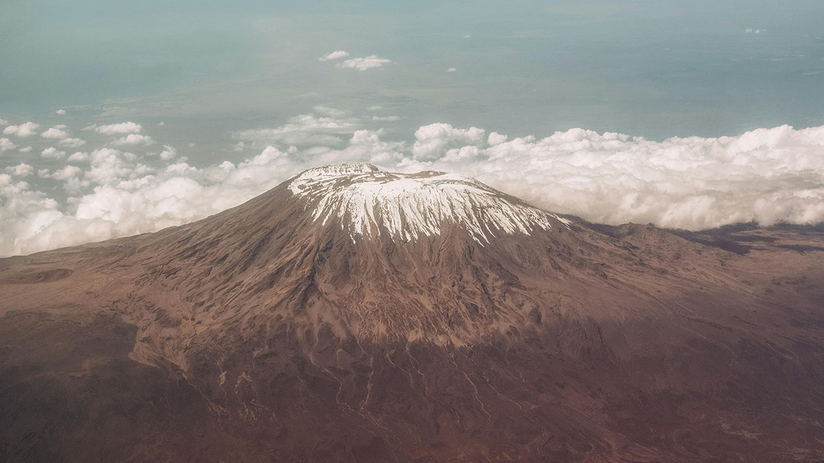
As you ascend from the lower slopes to Uhuru Peak at 5,895 meters, the landscape changes from cultivated farmland to dense rainforest, open moorland, dry alpine desert, and finally the cold arctic summit zone. Few treks in the world offer such a dramatic environmental change in such a short time.

These ecological zones shape what climbers see, feel, and experience each day. The vegetation changes. The air becomes thinner. The terrain becomes more exposed. Wildlife becomes less common. Nights become colder. Even the mood of the mountain changes as you move higher.

This guide explains Kilimanjaro’s five ecological zones, including their altitude ranges, vegetation, wildlife, terrain, and what climbers should expect in each section of the mountain.

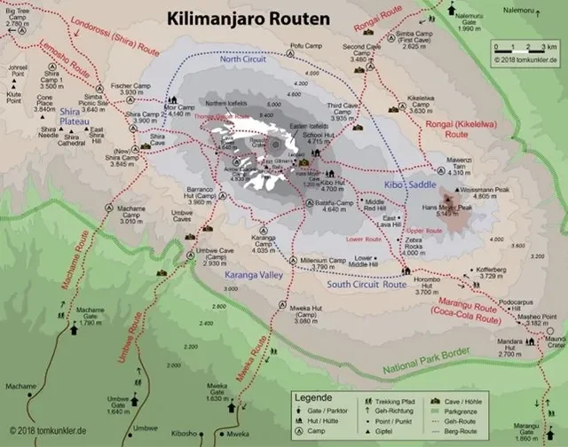
Before choosing your route, it also helps to compare Kilimanjaro routes because different trails pass through these zones in different ways.

Quick Answer: What Are Kilimanjaro’s Ecological Zones?

Mount Kilimanjaro has five main ecological zones: the cultivation zone, montane forest zone, heath and moorland zone, alpine desert zone, and arctic summit zone.
 
As climbers gain altitude, the mountain changes dramatically. The lower slopes are warmer, greener, and more humid. Higher up, the landscape becomes cooler, drier, rockier, and more exposed. Near the summit, vegetation almost disappears, and climbers enter a cold, arctic-like environment with ice, scree, and thin air.
 
These zones are one reason Kilimanjaro feels so unique. In one climb, you move from farms and rainforest to giant groundsels, volcanic desert, and the icy summit area near Uhuru Peak. Understanding these zones helps you prepare for the scenery, terrain, altitude, and changing conditions you will experience during the trek.

The Five Ecological Zones of Mount Kilimanjaro

Kilimanjaro’s ecological zones are created by altitude. As you climb higher, temperature drops, rainfall patterns change, vegetation becomes thinner, and the landscape becomes more exposed. This is why Kilimanjaro feels like several different treks in one journey.
Ecological Zone Altitude Range Landscape & Vegetation What Climbers Experience
Cultivation Zone 800–1,800 m
2,600–6,000 ft
Farms, coffee plantations, banana trees, villages, and fertile volcanic soil. Warm lower slopes and cultural scenery before reaching the main trailheads.
Montane Forest Zone 1,800–2,800 m
6,000–9,200 ft
Dense rainforest, moss-covered trees, ferns, vines, monkeys, and forest birds. Humid air, muddy trails, frequent mist, and rich biodiversity.
Heath & Moorland Zone 2,800–4,000 m
9,200–13,100 ft
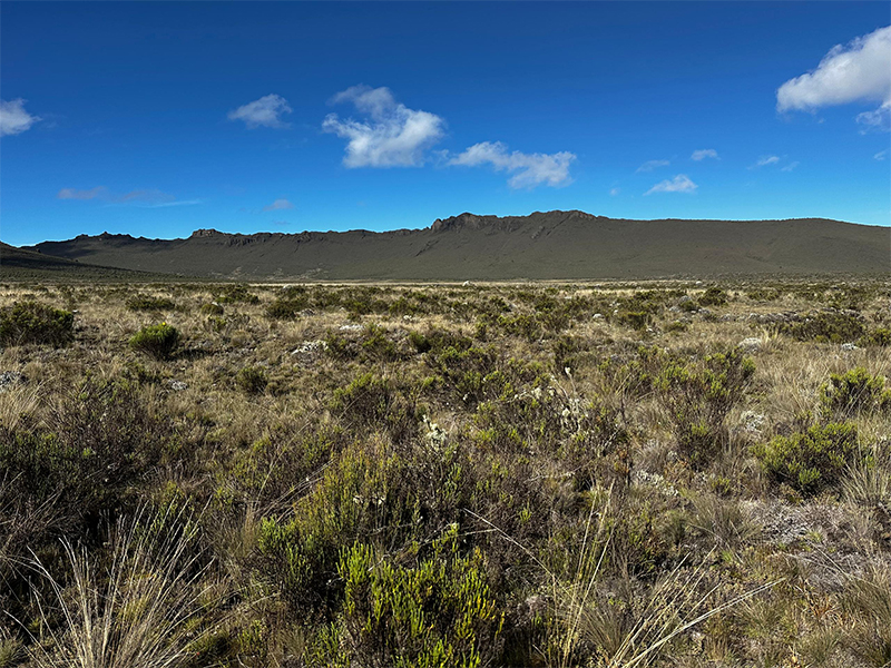
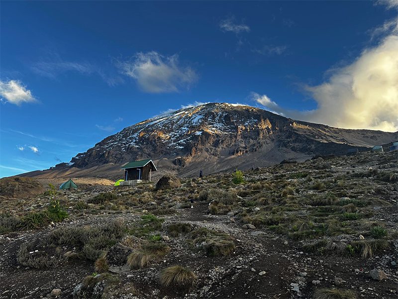
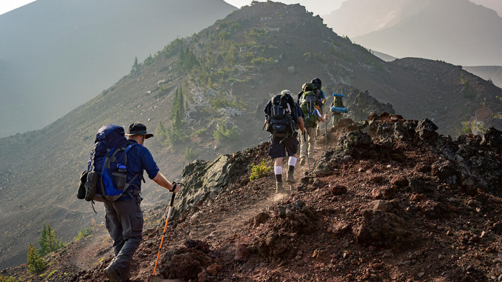
Open hills, giant groundsels, lobelias, heathers, volcanic rock, and wide views. Cooler air, stronger sun, colder nights, and the first noticeable altitude effects.
Alpine Desert Zone 4,000–5,000 m
13,100–16,400 ft
Dry volcanic terrain, gravel, ash, sparse plants, open ridges, and exposed slopes. Stronger wind, colder nights, dry air, slower walking, and more serious altitude pressure.
Arctic Summit Zone 5,000–5,895 m
16,400–19,341 ft
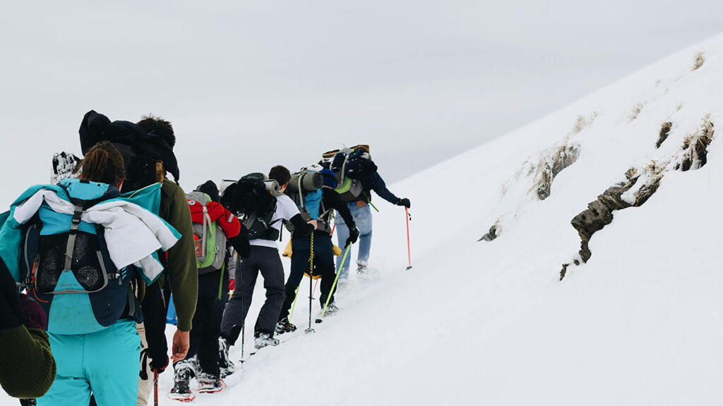
Ice, glaciers, scree, volcanic rock, snowfields, and almost no vegetation. Freezing temperatures, thin air, strong winds, and the final push to Uhuru Peak.
For weather conditions like rain, wind, clouds, and muddy trails, use our Kilimanjaro Weather Conditions guide before your climb.
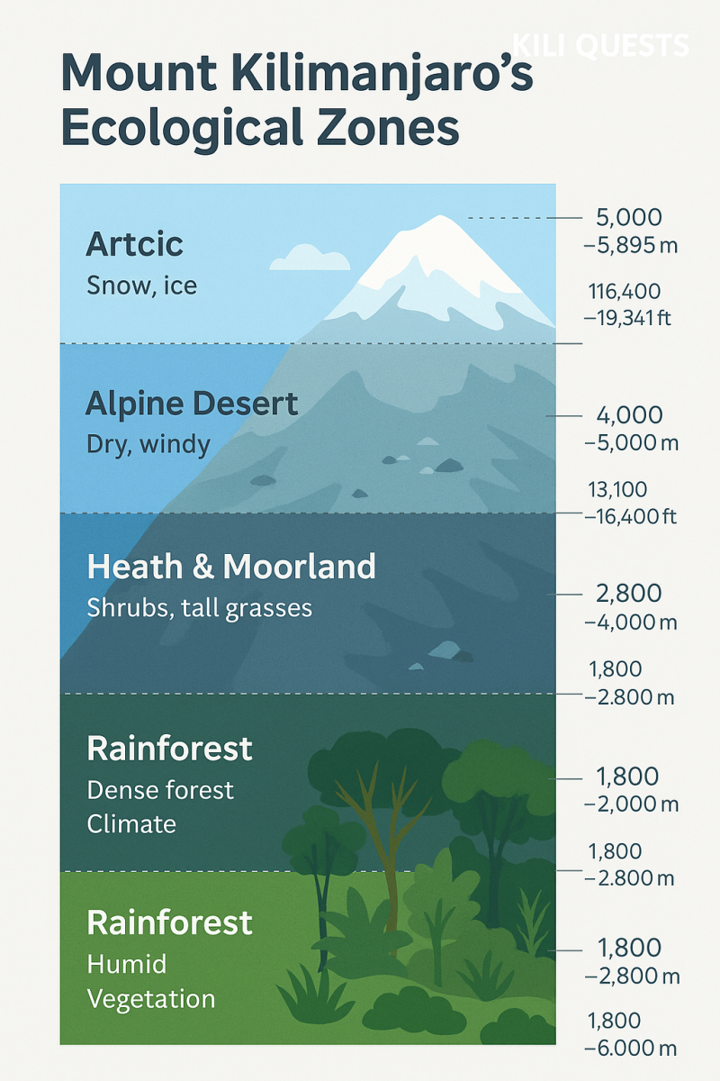
Infographic of Mount Kilimanjaro’s ecological zones showing rainforest, heath, moorland, alpine desert, and arctic summit with altitude labels in meters and feet.
Explore the five ecological zones of Mount Kilimanjaro , from lush rainforest to the icy arctic summit ,each with unique climate, vegetation, and wildlife.

Table of Contents

Cultivation Zone: Kilimanjaro’s Lower Slopes

The cultivation zone is the lowest ecological zone on Mount Kilimanjaro. It sits on the fertile lower slopes where volcanic soil, rainfall, and local farming communities shape the landscape.
 
Most climbers do not spend much trekking time in this zone, but they often pass through it on the way to the trailhead. It gives the first view of how closely Kilimanjaro is connected to local life.

Landscape and Vegetation

This zone is green, warm, and heavily used for farming. You may see banana trees, coffee farms, maize fields, small villages, and cultivated land around the base of the mountain.
 
The fertile soil comes from Kilimanjaro’s volcanic past, making the lower slopes highly productive for agriculture.

Wildlife and Local Life

The cultivation zone is more about people and farming than wild mountain scenery. It is home to local communities, especially the Chagga people, who have lived on the slopes of Kilimanjaro for generations.
 
This zone shows that Kilimanjaro is not only a trekking destination. It is also a living cultural landscape.

What Climbers Experience

For most trekkers, the cultivation zone is part of the approach to the climb rather than a full trekking stage. The air is warmer, the land is greener, and the mountain may appear above farms and villages before you enter the national park.
 
This lower zone helps set the scene before the trail moves into denser forest and higher mountain terrain.

Montane Forest Zone: Rainforest, Mist, and Wildlife

The montane forest zone is one of the richest and most atmospheric parts of Mount Kilimanjaro. After leaving the lower slopes, climbers enter a dense rainforest filled with tall trees, moss, ferns, vines, and mist.
 
This zone feels completely different from the open mountain terrain higher up. It is greener, wetter, more enclosed, and full of life.

Landscape and Vegetation

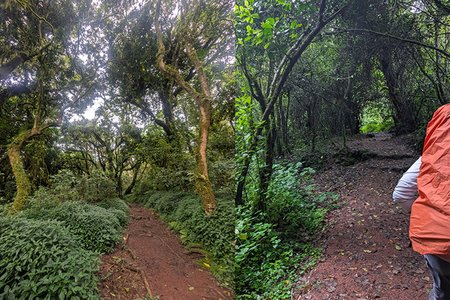
The forest zone is thick, humid, and often damp. Trees grow tall, the canopy blocks direct sunlight, and the trail may pass through moss-covered trunks, tangled roots, and muddy sections.
 
Common vegetation includes ferns, vines, mosses, and broadleaf forest plants. Because this zone receives more moisture than higher elevations, it supports some of the densest plant life on Kilimanjaro.

Wildlife in the Forest Zone

This is one of the best areas on Kilimanjaro for seeing wildlife. Climbers may spot blue monkeys, black-and-white colobus monkeys, forest birds, and other small animals.
 
Wildlife sightings are never guaranteed, but the forest zone gives climbers the best chance to experience Kilimanjaro as a living ecosystem, not just a mountain trail.

What Climbers Experience

The forest zone can be beautiful, but it can also be wet and slippery. Rain, mist, and mud are common, especially during wetter months or after recent rainfall.
 
Climbers should expect humid air, shaded trails, softer ground, and occasional muddy sections. Good waterproof boots and trekking poles can make this part of the climb more comfortable.
 
For more detail on rain, mud, clouds, and trail conditions, read our Kilimanjaro Weather Conditions guide.
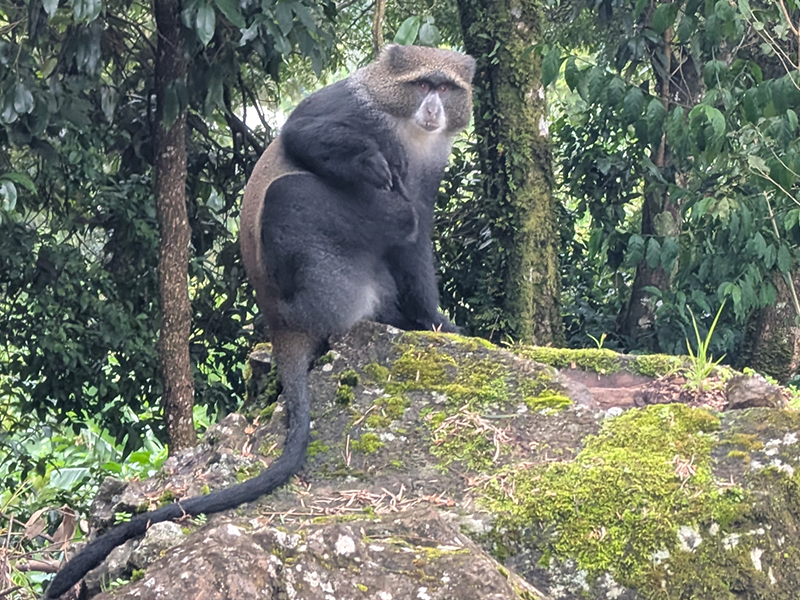
Blue monkey sitting on a moss-covered rock in the rainforest of Mount Kilimanjaro
A blue monkey (Cercopithecus mitis) rests on a mossy rock in Kilimanjaro’s montane rainforest — a common sight in the lower forest zone of the mountain.

Heath and Moorland Zone: Giant Plants and Open Views

The heath and moorland zone is where Kilimanjaro starts to feel more open, wild, and high-altitude. The dense rainforest disappears, the trail becomes more exposed, and climbers begin to see wider views of the mountain landscape.
 
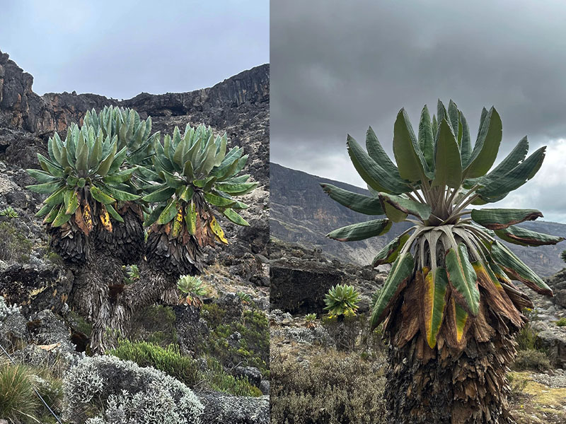
This zone is famous for its unusual high-altitude plants, especially giant groundsels and lobelias. These plants give the moorland a strange, almost prehistoric feeling that many climbers remember long after the trek.

Landscape and Vegetation

The landscape changes from thick forest to open hills, volcanic rock, shrubs, heathers, giant groundsels, and lobelias. The air is cooler, the sun can feel stronger, and the trail often feels more spacious than the forest below.
 
This is one of the most visually interesting zones on Kilimanjaro because the plants are adapted to harsh mountain conditions. They survive cold nights, strong sun, and changing moisture levels.

Wildlife and Plant Life

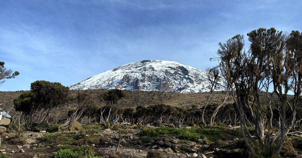
Wildlife becomes less common than in the forest, but the plant life becomes more unique. Giant groundsels, lobelias, heathers, and alpine shrubs dominate the scenery.
 
Birds may still be seen, and small animals may appear, but this zone is more known for its strange vegetation and open mountain views than for large wildlife.

What Climbers Experience

This is where many climbers first feel the altitude more clearly. Breathing may become slower, walking pace becomes more important, and nights begin to feel colder.
 
The heath and moorland zone is also where layering becomes more important. You may feel warm while walking in the sun, then cold quickly when clouds move in or when you stop for a break.
 
If you are preparing for the altitude changes that begin around this stage, read our Acclimatization Tips on Kilimanjaro guide before your climb.
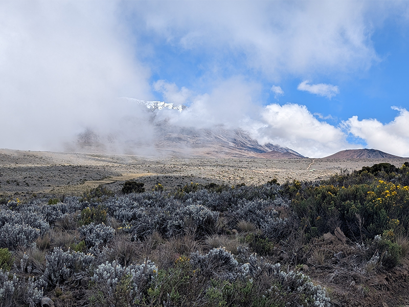
Moorland vegetation on Mount Kilimanjaro with cloud-covered summit and scattered alpine shrubs under a blue sky.
The heath and moorland zone on Mount Kilimanjaro, located between 2,800 and 4,000 meters, is known for its scattered shrubs, giant heathers, and surreal alpine landscape.

Alpine Desert Zone: Dry, Exposed, and Almost Lifeless

The alpine desert zone is one of the harshest parts of Mount Kilimanjaro. By this stage, the mountain feels drier, colder, emptier, and more exposed. Vegetation becomes sparse, the ground turns rocky, and the landscape starts to feel more like another planet than a normal hiking trail.
 
This zone is important because it shows how quickly Kilimanjaro changes with altitude. The rainforest and giant plants are now behind you. Ahead, the mountain becomes more serious.

Landscape and Vegetation

The alpine desert zone has very little plant life. The terrain is mostly volcanic rock, gravel, ash, dust, and open slopes. A few hardy plants may survive in protected areas, but compared with the forest and moorland zones, this section feels almost empty.
 
The lack of vegetation makes the landscape feel wide and exposed. There is less shade, less shelter, and more direct contact with sun, wind, and cold.

Terrain and Mountain Conditions

This zone can feel dry during the day and very cold at night. The sun may be strong when skies are clear, but the air is thin and the temperature can drop quickly after sunset.
Climbers should expect:
  • Rocky and dusty trails
  • Stronger wind exposure
  • Dry air
  • Bigger temperature changes between day and night
  • Fewer plants and less natural shelter
  • More noticeable altitude effects
This is where hydration, pacing, and proper layering become even more important.

What Climbers Experience

The alpine desert zone often feels mentally different from the lower mountain. The scenery is dramatic, but the environment is less forgiving. Walking can feel slower, breathing may feel harder, and the body starts working more seriously against altitude.
 
This is also where many climbers begin to understand why Kilimanjaro is not just a simple hike. The trail may not be technical, but the altitude, dryness, wind, and exposure make this section demanding.
For cold nights and high-camp preparation, read our Kilimanjaro Night Temperature guide before your climb.
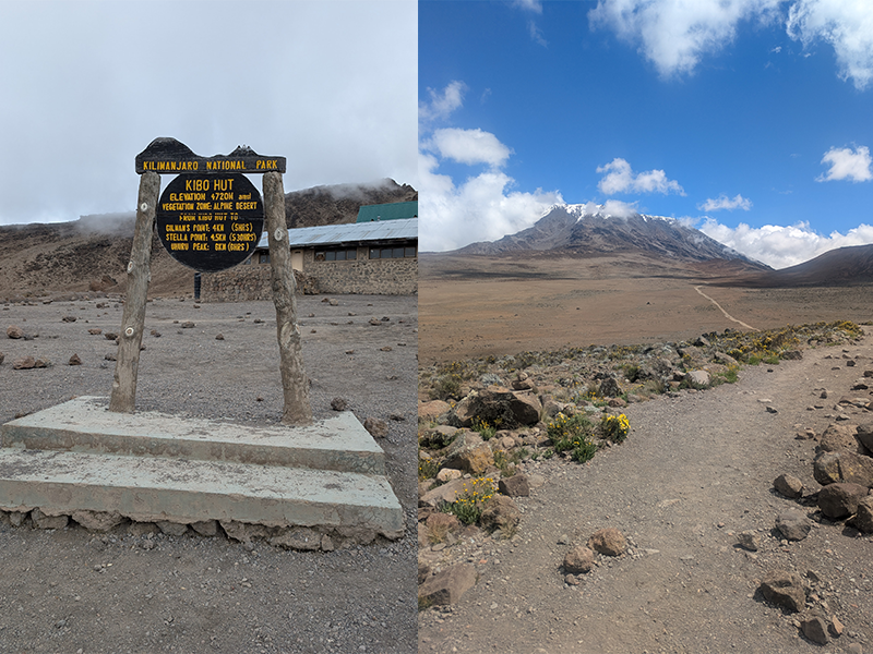
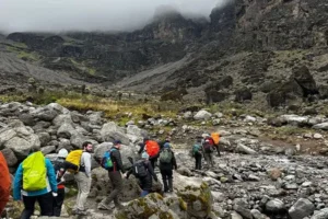
Kibo Hut signpost and view of Mount Kilimanjaro’s alpine desert zone with rocky terrain and sparse vegetation.
Kibo Hut, located at 4,720 meters, marks the start of the alpine desert zone on Mount Kilimanjaro — a dry, wind-swept region just below the summit.

Arctic Summit Zone: Ice, Scree, and Uhuru Peak

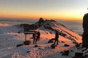
The arctic summit zone is the highest and most extreme ecological zone on Mount Kilimanjaro. Vegetation almost disappears, the air becomes very thin, and the landscape is dominated by volcanic scree, ice, snowfields, glaciers, and exposed rock.
 
This is the final environment climbers enter before reaching Stella Point, Gilman’s Point, or Uhuru Peak. It is beautiful, but it is also the most physically and mentally demanding part of the mountain.

Landscape and Vegetation

There is almost no vegetation in the arctic summit zone. The conditions are too cold, dry, windy, and oxygen-poor for most plant life to survive.
 
Instead, climbers see loose volcanic scree, frozen ground, ice formations, crater views, and the remaining glaciers near the summit. This zone feels completely different from the rainforest, moorland, and alpine desert below.

Terrain and Summit Conditions

The summit zone is harsh because several challenges come together at once:
  • Freezing temperatures
  • Strong wind exposure
  • Loose scree underfoot
  • Very low oxygen levels
  • Darkness during summit night
  • Slow movement because of altitude
  • Mental fatigue near the final push
Most summit attempts begin around midnight, so climbers often enter this zone in darkness and cold. The terrain is not technical climbing, but the combination of altitude, cold, and exhaustion makes it the hardest section of the trek.

What Climbers Experience

This is where Kilimanjaro becomes serious. Every step feels slower, breathing becomes more deliberate, and the climb demands patience.
 
The reward is also powerful. As sunrise begins near the crater rim, the views above the clouds can be unforgettable. Reaching Uhuru Peak means you have crossed every ecological zone on the mountain, from cultivated lower slopes to the arctic summit of Africa.
 
For a full breakdown of summit-night gear, use our Kilimanjaro Summit Day Gear Checklist before your climb.
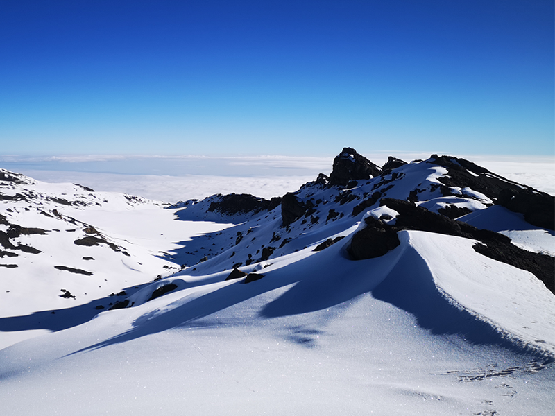
Snow-covered ridges near Stella Point on Mount Kilimanjaro with a clear blue sky above the clouds.
The arctic summit zone of Kilimanjaro near Stella Point is often blanketed in snow, offering breathtaking views above the cloud layer.

Why Kilimanjaro’s Ecological Zones Matter for Climbers

Kilimanjaro’s ecological zones are not just interesting scenery. They affect how the climb feels, how your body responds, what gear you need, and how mentally prepared you feel each day.
 
A climber who understands the zones is less likely to be surprised when the trail changes from humid forest to cold moorland, dry alpine desert, and freezing summit terrain.

They Help You Understand the Journey

Kilimanjaro does not feel the same from bottom to top. Each zone has its own terrain, vegetation, weather feel, and physical challenge.
 
The forest may feel wet and enclosed. The moorland feels open and strange. The alpine desert feels dry and exposed. The summit zone feels cold, thin, and demanding.
 
Understanding this progression helps you see the climb as a full mountain journey, not just a race to Uhuru Peak.

They Help You Pack Smarter

Different zones require different gear decisions. The forest may demand waterproof boots and rain protection. The moorland may require sun protection and flexible layers. The alpine desert and summit zones demand warmer clothing and stronger cold protection.
 
This is why a Kilimanjaro packing list should prepare you for several environments, not one simple climate.
For a complete gear breakdown, use our Kilimanjaro Packing List before your climb.

They Help You Respect Altitude

As you climb through the zones, altitude becomes more important. The higher you go, the thinner the air becomes and the more carefully you need to manage pace, hydration, and rest.
 
The ecological zones make this change visible. Vegetation becomes smaller, the landscape becomes harsher, and your body starts to work harder.
 
If you are new to high-altitude trekking, read our Altitude Sickness on Kilimanjaro guide before your trip.

They Make the Climb More Meaningful

Kilimanjaro is not only about reaching the summit. The mountain is special because the journey changes so dramatically along the way.
 
When you understand the zones, you notice more: the farms on the lower slopes, the monkeys in the forest, the giant groundsels in the moorland, the silence of the alpine desert, and the icy summit landscape near Uhuru Peak.

Kilimanjaro Is a Journey Through Five Natural Worlds

Climbing Kilimanjaro is not only about reaching Uhuru Peak. The mountain is powerful because every stage feels different. You begin near farms and villages, enter dense rainforest, walk through strange giant plants, cross dry volcanic desert, and finish in an arctic summit environment.
 
That variety is what makes Kilimanjaro one of the most unique trekking mountains in the world. Few climbs allow you to move through so many ecosystems without technical climbing.

Why the Route You Choose Matters

Not every route gives the same ecological-zone experience. Some routes spend more time in scenic moorland. Some feel drier and more remote. Some offer better views of Kibo, Mawenzi, or the Shira Plateau.
 
This is why route choice matters if you care about scenery, photography, solitude, and acclimatization. Before choosing your itinerary, compare Kilimanjaro routes so you understand how each trail changes the mountain experience.

What Makes Kilimanjaro’s Zones Special

The zones make the climb feel like a natural story. The lower mountain shows local life and fertile land. The forest shows biodiversity. The moorland shows strange high-altitude plants. The alpine desert shows exposure and altitude. The summit zone shows the extreme final environment near the Roof of Africa.
 
When climbers understand this progression, they enjoy the journey more. They know what they are seeing, why the landscape changes, and why each stage demands different preparation.

The Summit Is Only One Part of the Experience

Reaching Uhuru Peak is the goal, but the zones are part of the reward. If you only focus on the summit, you miss much of what makes Kilimanjaro special.
 
The mountain gives you a full environmental transition in just a few days. That is why Kilimanjaro is not just a high-altitude trek. It is a complete journey from rainforest to arctic summit.

Frequently Asked Questions About Mount Kilimanjaro’s Ecological Zones

How many ecological zones are on Mount Kilimanjaro?

Mount Kilimanjaro has five main ecological zones: the cultivation zone, montane forest zone, heath and moorland zone, alpine desert zone, and arctic summit zone.
 
These zones change as altitude increases. The lower mountain is warmer, greener, and more humid, while the upper mountain becomes colder, drier, rockier, and more exposed.

What are the five ecological zones of Kilimanjaro?

The five ecological zones of Kilimanjaro are:
  • Cultivation zone
  • Montane forest zone
  • Heath and moorland zone
  • Alpine desert zone
  • Arctic summit zone
Each zone has different vegetation, terrain, wildlife, and climbing conditions. This is one reason Kilimanjaro feels like several different treks in one climb.

Which Kilimanjaro zone has the most wildlife?

The montane forest zone has the most wildlife. This lower forest section has dense vegetation, more moisture, and better habitat for animals and birds.
 
Climbers may see blue monkeys, black-and-white colobus monkeys, forest birds, and other small wildlife. Sightings are never guaranteed, but the rainforest zone gives the best chance of seeing animals on Kilimanjaro.

Which ecological zone has giant groundsels and lobelias?

Giant groundsels and lobelias are found mainly in the heath and moorland zone. This zone sits above the rainforest and has cooler air, open views, shrubs, heathers, and unusual high-altitude plants.
 
For many climbers, this is one of the most memorable parts of Kilimanjaro because the plants look strange, ancient, and very different from normal forest vegetation.

At what altitude does the alpine desert zone begin on Kilimanjaro?

The alpine desert zone begins around 4,000 meters and continues up to about 5,000 meters. This section is dry, rocky, windy, and exposed, with very little vegetation.
 
Climbers often feel the altitude more strongly in this zone. The air is thinner, the trail feels more demanding, and nights become much colder.

What is the coldest ecological zone on Kilimanjaro?

The coldest ecological zone is the arctic summit zone. This zone begins around 5,000 meters and continues to Uhuru Peak at 5,895 meters.
 
The summit zone has freezing temperatures, strong winds, very thin air, scree, ice, and almost no vegetation. Most climbers enter this zone during summit night, which is usually the hardest stage of the climb.

Why does Kilimanjaro have different ecological zones?

Kilimanjaro has different ecological zones because altitude changes the mountain environment. As elevation increases, temperatures drop, rainfall patterns change, oxygen becomes thinner, and vegetation becomes more limited.
 
This creates a dramatic transition from cultivated lower slopes and rainforest to moorland, alpine desert, and the arctic summit zone.

Experience Kilimanjaro’s Ecological Zones With Kili Quests

Kilimanjaro is not just a summit climb. It is a journey through farms, rainforest, giant plants, volcanic desert, and the icy summit zone near Uhuru Peak. Each stage has its own scenery, terrain, altitude challenge, and preparation needs.
 
At Kili Quests, our local mountain guides help you understand what to expect as the landscape changes each day. We guide your pace, help you prepare for each altitude zone, and make sure you experience the mountain as more than just a climb to the top.
 
We can help you plan:
  • The best route for scenery and ecological variety
  • What to expect in each Kilimanjaro zone
  • How to prepare for rainforest mud, moorland sun, alpine desert exposure, and summit cold
  • What gear to carry for changing terrain and altitude
  • How to pace your climb through each stage of the mountain
Contact Kili Quests today and tell us your preferred route, travel month, and trekking experience. We will help you plan a Kilimanjaro climb that lets you experience the full journey from rainforest to arctic summit.

Related Articles
Stella Point Kilimanjaro: Why It’s Named That & History

Plan Your Kilimanjaro Climb

Reach Stella Point , and go beyond to Uhuru Peak with expert local guides.

Prepare for Your Summit

Your success depends on preparation , explore these essential guides:

OUR CATEGORIES

Stella Point Kilimanjaro: Why It’s Named That and Why It Matters

On the final push to the summit of Mount Kilimanjaro, many climbers reach a wooden sign on the crater rim that marks Stella Point. For trekkers coming from routes such as Machame, Lemosho, Shira, and Umbwe, this is one of the most emotional moments of summit night.
 
Stella Point is not the true summit of Kilimanjaro, but it is a major milestone. It sits on the rim of Kibo crater, close to Uhuru Peak, and marks the point where climbers finally reach the crater edge after hours of steep night climbing.
 
The name Stella Point is widely linked to Estella Latham, one of the early recorded women to reach this high point on Kilimanjaro in 1925. Because of that history, Stella Point is more than a checkpoint. It is part of Kilimanjaro’s climbing legacy.
 
In this guide, you will learn where Stella Point is, why it is called Stella Point, how it differs from Uhuru Peak, which routes pass through it, and why reaching this point matters on summit night.
 
Before your summit push, it also helps to understand how difficult Kilimanjaro really is and what makes summit night so demanding.

Quick Answer: Why Is It Called Stella Point?

Stella Point on Mount Kilimanjaro is named after Estella Latham, who is widely recognized as one of the early recorded women to reach this high point on Kilimanjaro in 1925.
 
Stella Point is located on the crater rim of Kibo, close to Uhuru Peak, the true summit of Mount Kilimanjaro. Climbers on routes such as Machame, Lemosho, Shira, and Umbwe often reach Stella Point first before continuing toward Uhuru Peak.
 
Although Stella Point is not the highest point on Kilimanjaro, it is an important summit milestone. Climbers who reach Stella Point may receive a Kilimanjaro summit certificate, and many continue for about 45–60 minutes to reach Uhuru Peak.
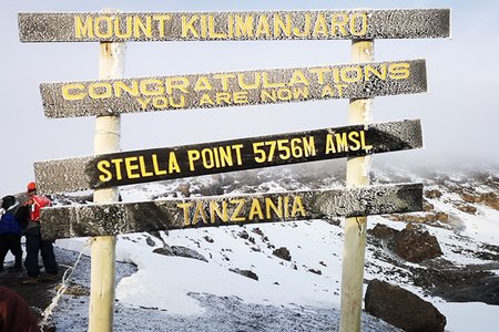
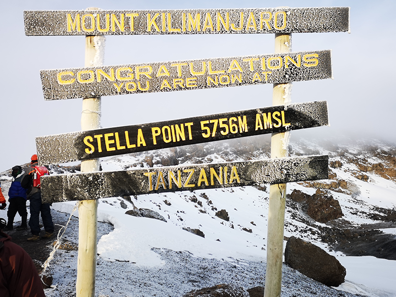
Stella Point signpost on Mount Kilimanjaro’s crater rim, frosted with snow and showing an elevation of 5,756 meters above sea level.
Stella Point, located at 5,756 meters on Mount Kilimanjaro’s crater rim, offers trekkers a dramatic first view into the summit zone. It was named after Estella Latham, one of the first recorded women to reach this altitude in 1925, making it a historic and emotional milestone on the Machame and Lemosho routes.

Table of Contents

Where Is Stella Point?

Stella Point sits on the crater rim of Kibo, one of Kilimanjaro’s three volcanic cones. It is a major landmark on the Machame, Lemosho, Shira, and Umbwe routes, located before the final walk toward Uhuru Peak.
 
Stella Point is commonly listed between 5,739 meters and 5,756 meters above sea level, depending on the source or sign reference used. The important point for climbers is that Stella Point sits on Kilimanjaro’s crater rim, below Uhuru Peak at 5,895 meters.
 
When trekkers reach Stella Point, they are usually less than an hour from Uhuru Peak. This final stretch is part of the most demanding stage of the climb, especially because it comes after hours of steep night hiking.
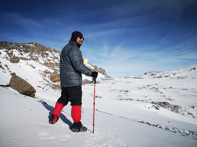
A climber stands on snow-covered terrain near Stella Point on Mount Kilimanjaro, holding a cup and trekking pole while overlooking the crater rim.
A trekker pauses to take in the spectacular view near Stella Point, where Kilimanjaro’s crater rim opens up into a vast, icy alpine landscape.

Who or What Is Stella Point Named After?

Stella Point is named in honor of Estella Latham,Her achievement came decades after the first successful ascent of the mountain , you can read the full story of who first climbed Mount Kilimanjaro.one of the earliest recorded women to reach this altitude on Mount Kilimanjaro in 1925. Unlike earlier assumptions linking the name to Hans Meyer’s family, historical accounts now attribute it to Latham’s notable achievement during a time when few women attempted such climbs. Hans Meyer, the first documented European to reach the summit in 1889, did name several features on the mountain  such as Gilman’s Point  but Stella Point was named later, reflecting a shift toward recognizing climbers beyond colonial figures or sponsors.

Curious who first reached the summit of Kilimanjaro? Read the full story of Hans Meyer, Yohani Kinyala Lauwo, and the first recorded Kilimanjaro summit in 1889.
Stella Point summit sign on Kilimanjaro at 5,756 meters, named after Estella Latham who reached this point in 1925.
Estella Latham became one of the first recorded women to reach Stella Point on Mount Kilimanjaro in 1925. The point was later named in her honor, marking a milestone in early female mountaineering history

What Happens at Stella Point Today?

Today, Stella Point is the first place where most climbers reach the rim of Kibo’s crater. When you arrive, you’ll see the iconic wooden sign, usually in the early morning cold, with views of the surrounding glaciers and crater floor.While it’s not the final summit, reaching Stella Point is a major achievement, especially due to the steep, exhausting climb just before it , often done at night in freezing conditions.Proper preparation is key , make sure you have the right equipment with this complete Kilimanjaro packing list.
 
Temperatures here can drop far below freezing ,especially at night ,so it’s important to understand Kilimanjaro night temperatures and how to prepare.
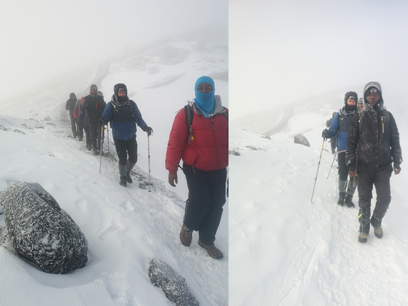
Trekkers and guides hiking through snow near Stella Point on Mount Kilimanjaro during the final summit approach.
Trekkers and KILI QUESTS guides push through snow and fog near Stella Point, one of the final checkpoints before reaching Kilimanjaro’s summit at Uhuru Peak.

Stella Point vs. Uhuru Peak: What's the Difference?

Feature Stella Point Uhuru Peak
Location Crater rim of Kibo Highest point on Mount Kilimanjaro
Altitude Commonly listed around 5,739–5,756 meters 5,895 meters
Summit status Major summit milestone and certificate point True summit of Kilimanjaro and highest point in Africa
Walking time between them Usually about 45–60 minutes to Uhuru Peak Final summit destination
Main meaning Emotional turning point after the steep summit-night climb Official goal for climbers aiming to stand on the roof of Africa
This final push depends heavily on acclimatization , learn how to avoid altitude sickness on Kilimanjaro.

Stella Point earns you aKilimanjaro Summit Certificate”, but if you want to stand at the true roof of Africa, you’ll need to continue to Uhuru Peak.

 
Not sure if reaching the summit is realistic for you? Here’s a detailed guide on how hard it is to climb Kilimanjaro.

Did You Know?

Climbers on the Machame, Lemosho, Shira, and Umbwe routes usually reach Stella Point first on summit night before continuing to Uhuru Peak. Climbers on the Marangu and Rongai routes usually reach Gilman’s Point first, then continue along the crater rim toward Stella Point and Uhuru Peak.
 
Each route approaches the summit differently, so it is important to compare Kilimanjaro routes before choosing your climb.
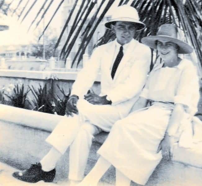
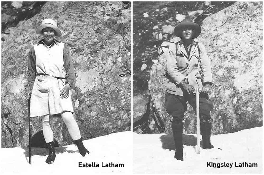
Historical photo of Estella Latham and Kingsley Latham during their 1925 Mount Kilimanjaro expedition.
Estella Latham (left) and Kingsley Latham (right) during their 1925 expedition on Mount Kilimanjaro. Estella became one of the first recorded women to reach 5,756 meters, and Stella Point was later named in her honor.

Frequently Asked Questions About Stella Point

What is Stella Point on Mount Kilimanjaro?

Stella Point is a famous landmark on the crater rim of Kibo, close to the summit of Mount Kilimanjaro. It is one of the final major checkpoints climbers reach before continuing toward Uhuru Peak.

Why is it called Stella Point?

Stella Point is widely linked to Estella Latham, one of the early recorded women to reach this high point on Mount Kilimanjaro in 1925. The name honors her connection to Kilimanjaro’s early climbing history.

Is Stella Point the summit of Kilimanjaro?

No, Stella Point is not the true summit of Kilimanjaro. The true summit is Uhuru Peak, which stands at 5,895 meters. Stella Point is a major crater-rim milestone before the final walk to Uhuru Peak.

How high is Stella Point?

Stella Point is commonly listed between about 5,739 meters and 5,756 meters above sea level, depending on the source or sign reference. It sits below Uhuru Peak on the crater rim of Kibo.

How long does it take to walk from Stella Point to Uhuru Peak?

The walk from Stella Point to Uhuru Peak usually takes about 45–60 minutes, depending on altitude conditions, weather, fatigue, and the climber’s pace.

Which Kilimanjaro routes pass through Stella Point?

Machame, Lemosho, Shira, and Umbwe usually reach Stella Point first on summit night. Marangu and Rongai usually reach Gilman’s Point first, then continue toward Stella Point and Uhuru Peak.

Do you get a certificate for reaching Stella Point?

Yes, climbers who reach Stella Point may receive a Kilimanjaro summit certificate. However, Uhuru Peak is the true summit and the main goal for climbers who want to reach the highest point in Africa.

Reaching Stella Point: The Turning Point of Your Summit

Stella Point is more than just a marker near the summit  it’s a landmark rooted in Kilimanjaro’s climbing history. Named in honor of Estella Latham, one of the first recorded women to reach this altitude in 1925, Stella Point represents both personal achievement and historical significance. Whether you pause here to witness the sunrise or continue your final push to Uhuru Peak, arriving at Stella Point is a powerful reminder of how far you’ve come  and how close you are to standing on the roof of Africa.
 
Not many people know that Kilimanjaro’s first recorded summit was not only a European achievement. Read the story of Yohani Kinyala Lauwo and the first ascent of Mount Kilimanjaro to understand the local history behind this climb.

Plan Your Kilimanjaro Summit Journey

Reaching Stella Point is one of the most powerful moments on Kilimanjaro. It means you have climbed through the hardest part of summit night and reached the crater rim, with Uhuru Peak now within reach.

At Kili Quests, our local mountain guides help climbers prepare for summit night with proper pacing, route advice, acclimatization support, and safe guidance from the lower slopes to Stella Point and Uhuru Peak.

Contact us to plan your Kilimanjaro climb with experienced local guides who understand the mountain, the routes, and the final push to the summit.

Related Articles

Gilman’s Point Kilimanjaro: Name, History & Location

Reach the Summit

Climb to Gilman’s Point and continue to Uhuru Peak with expert local guides.

Plan Your Climb

Prepare for your Kilimanjaro adventure:

OUR CATEGORIES

Why Is It Called Gilman’s Point? The Story Behind the Name | Kili Quests

Climbers taking the Marangu Route or Rongai Route to the top of Mount Kilimanjaro reach an important milestone before Uhuru Peak: Gilman’s Point. Located on the rim of Kibo crater, Gilman’s Point is one of Kilimanjaro’s recognized summit markers and a major achievement during the final summit push.
 
But why is it called Gilman’s Point, and who was Gilman?
 
In this article, Kili Quests explains the story behind the name, where Gilman’s Point is located, why it matters, and how it differs from Uhuru Peak and Stella Point.
 
To understand the mountain’s volcanic structure, read our guide to Kilimanjaro’s volcanic cones: Kibo, Mawenzi, and Shira.
 

Quick Answer: Why Is It Called Gilman’s Point?

Gilman’s Point is named after Clement Gillman, a British geographer, civil engineer, and surveyor connected with early mapping and geographic study in East Africa. The summit marker on Mount Kilimanjaro is widely spelled Gilman’s Point, although the historical surname is often written as Gillman with two “l” letters.
 
On Kilimanjaro, Gilman’s Point marks a recognized crater-rim summit point reached most commonly by climbers using the Marangu Route or Rongai Route. It is a major achievement, but it is not the highest point on the mountain. The true summit of Kilimanjaro is Uhuru Peak.
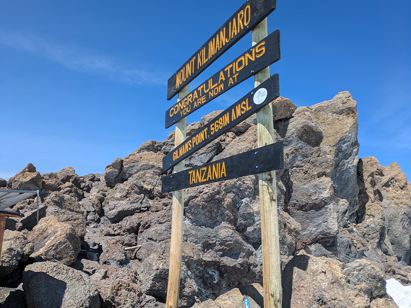
Gilman’s Point summit sign on Mount Kilimanjaro crater rim
Gilman’s Point marks one of Kilimanjaro’s recognized summit points on the rim of Kibo crater.

Table of Contents

Where Is Gilman’s Point on Kilimanjaro?

Gilman’s Point lies on the eastern rim of Kilimanjaro’s Kibo crater. It is the first major crater-rim marker reached by many climbers ascending via the Marangu Route or Rongai Route.
 
Reaching Gilman’s Point is a huge accomplishment because it means you have reached the crater rim after the steep overnight summit climb. From here, climbers who still have enough energy and safe conditions can continue toward Uhuru Peak, the highest point on Mount Kilimanjaro.
 
The walk from Gilman’s Point to Uhuru Peak usually takes around 1.5 to 2 hours, depending on pace, weather, trail conditions, and how well your body is handling the altitude.
 
These routes approach the summit differently, so if you are still choosing your trail, compare them in our Kilimanjaro Routes Guide.

Who Was Gilman?

Gilman’s Point is named after Clement Gillman, a British geographer, civil engineer, and surveyor who carried out mapping and survey work in East Africa during the early 20th century.
 
His work helped document the physical geography, routes, and terrain of the region, including areas around Mount Kilimanjaro. Although he was not the first person to climb Kilimanjaro, his name became connected with one of the mountain’s important crater-rim landmarks.
 
One detail often confuses climbers: the place is commonly spelled Gilman’s Point, while the historical surname is often written Gillman. For the Kilimanjaro location, use Gilman’s Point.
 
For more Kilimanjaro history, read the story of Hans Meyer and the first Kilimanjaro ascent in 1889.
 
Historical names on Kilimanjaro can be confusing because many landmarks were recorded during the colonial mapping period, and spellings were not always used consistently across maps, guidebooks, and local references.
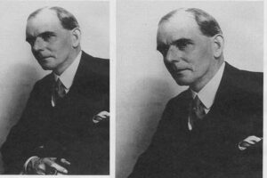
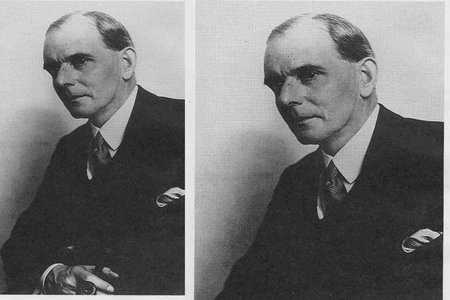
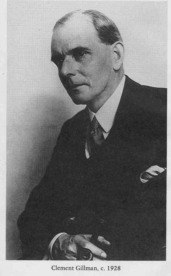
Portrait of Clement Gillman British geographer and surveyor
Clement Gillman was connected with early mapping and geographic study in East Africa.

Why Does Gilman’s Point Matter?

Gilman’s Point matters because it is one of Kilimanjaro’s recognized crater-rim summit points. For climbers on the Marangu or Rongai Route, reaching this point means they have completed the steepest and most exhausting part of summit night.
 
Gilman’s Point is not a separate mountain peak. It is a named point on the crater rim of Kibo, Kilimanjaro’s highest volcanic cone.
 
For many climbers, Gilman’s Point represents:
  • The first major crater-rim milestone before Uhuru Peak
  • A major psychological victory after hours of climbing in darkness
  • A recognized Kilimanjaro summit point
  • A place where climbers may receive a summit certificate
  • A decision point before continuing toward Uhuru Peak
This is also where guides carefully assess each climber’s condition. If someone is too exhausted, showing altitude symptoms, or moving too slowly, stopping at Gilman’s Point may be the safer decision.

Gilman’s Point vs. Uhuru Peak

Feature Gilman’s Point Uhuru Peak
Elevation 5,681 m / 18,638 ft 5,895 m / 19,341 ft
Location Eastern rim of Kibo crater Highest point on Kilimanjaro
Common routes Marangu Route and Rongai Route Final goal for most Kilimanjaro routes
Meaning Recognized crater-rim summit point True highest summit of Mount Kilimanjaro
Certificate Summit certificate usually awarded Full summit certificate awarded
Time from Gilman’s Point Starting point on the crater rim Usually 1.5 to 2 hours farther

Gilman’s Point vs Stella Point

Gilman’s Point and Stella Point are both important crater-rim landmarks on Mount Kilimanjaro, but they are reached from different summit approaches.
 
Gilman’s Point is most commonly reached by climbers using the Marangu Route or Rongai Route. Stella Point is more commonly reached by climbers coming from routes such as Machame, Lemosho, and Umbwe.
 
Both points are major achievements, but neither is the highest point on Kilimanjaro. Uhuru Peak remains the true summit of the mountain.
 
To understand the other major crater-rim landmark, read our guide to Stella Point on Kilimanjaro.
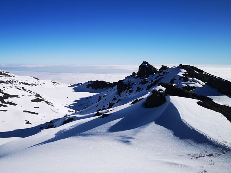
Snow-covered crater rim view from Gilman’s Point on Mount Kilimanjaro
From Gilman’s Point, climbers continue along Kilimanjaro’s crater rim toward Uhuru Peak.

Did You Know?

The final push to Gilman’s Point is often done at night. Summit attempts usually begin around midnight so climbers can reach the crater rim near sunrise.

This section is one of the toughest parts of the Marangu Route because climbers move slowly through cold temperatures, thin air, and loose volcanic scree.

At sunrise, Gilman’s Point can offer dramatic views across the crater rim, the clouds below, and the distant landscape toward Kenya. It is one of three famous summit markers on Kilimanjaro, along with Stella Point and Uhuru Peak.

If you want to understand why summit night feels so demanding, read How Hard Is Kilimanjaro?

Frequently Asked Questions About Gilman’s Point

What is Gilman’s Point on Mount Kilimanjaro?

Gilman’s Point is one of Mount Kilimanjaro’s recognized summit markers. It is located on the eastern rim of Kibo crater at about 5,681 meters, or 18,638 feet. Climbers who reach this point have reached the crater rim and are close to the final summit route toward Uhuru Peak.

Is Gilman’s Point the summit of Mount Kilimanjaro?

Gilman’s Point is a recognized crater-rim summit point, but it is not the highest point on Mount Kilimanjaro. The true summit is Uhuru Peak, which stands at 5,895 meters, or 19,341 feet. From Gilman’s Point, it usually takes 1.5 to 2 hours to reach Uhuru Peak.

Which Kilimanjaro routes reach Gilman’s Point?

Gilman’s Point is most commonly reached by climbers using the Marangu Route and Rongai Route. These routes approach the crater rim from the eastern side before climbers continue toward Uhuru Peak.

How difficult is the climb to Gilman’s Point?

The climb to Gilman’s Point is difficult because it usually happens during summit night in cold, dark, high-altitude conditions. Climbers ascend steep volcanic scree from Kibo Hut while dealing with fatigue, thin air, and freezing temperatures.

Do you get a summit certificate at Gilman’s Point?

Yes. Climbers who reach Gilman’s Point usually receive an official Kilimanjaro summit certificate. However, Uhuru Peak is the highest point on the mountain and is considered the main summit goal for most climbers.

Reaching Gilman’s Point: What It Means for Your Summit

Reaching Gilman’s PoGilman’s Point may not be the highest point on Kilimanjaro, but it is still a powerful achievement. After hours of climbing through darkness, cold, and thin air, reaching the crater rim is a major physical and emotional milestone.

For some climbers, Gilman’s Point is the safest stopping point. For others, it becomes the final push before continuing along the crater rim toward Uhuru Peak. Either way, standing at Gilman’s Point means you have reached one of Kilimanjaro’s most important historic summit landmarks.

To understand the meaning of Kilimanjaro’s highest summit, read how Uhuru Peak got its name after Tanzania’s independence.

Plan Your Kilimanjaro Climb with Kili Quests

If you are planning to climb via the Marangu Route or Rongai Route, Gilman’s Point will be one of the most important landmarks on your summit journey.
 
With Kili Quests, you climb with experienced local guides who understand the route, the altitude, the summit pace, and the stories behind Kilimanjaro’s famous landmarks.
 
Contact us today to start planning your Kilimanjaro climb.

Related Articles

First Ascent of Mount Kilimanjaro: Hans Meyer in 1889

Climb Kilimanjaro with Experts

Follow the path of the first explorers ,and reach the summit with a trusted local team.

Plan Your Climb

Prepare the right way before your Kilimanjaro adventure:

OUR CATEGORIES

Who Was Hans Meyer? The First Ascent of Kilimanjaro | Kili Quests

In 1889, German geographer Hans Meyer became one of the central figures in the first recorded successful ascent of Mount Kilimanjaro. Together with Austrian mountaineer Ludwig Purtscheller and support from local guides and porters, Meyer reached the summit of Kibo, the highest volcanic cone of Kilimanjaro.

Today, this summit is known as Uhuru Peak, the highest point in Africa at 5,895 meters / 19,341 feet.

This article explains who Hans Meyer was, how the 1889 ascent happened, why the climb became important in Kilimanjaro history, and why the story should also recognize the local support behind the expedition.

For the local guide story, read our full article about Yohani Kinyala Lauwo and Kilimanjaro’s first ascent.

Quick Answer: Who Was Hans Meyer?

Hans Meyer was a German geographer, explorer, and professor who became famous for his role in the first recorded successful ascent of Mount Kilimanjaro in 1889. He reached the summit with Austrian mountaineer Ludwig Purtscheller, supported by local guides, porters, and expedition crew.
 
His climb helped document Kilimanjaro’s geography, summit area, and volcanic structure for later explorers and climbers. However, the full story of the ascent should not ignore the local knowledge and support that made the expedition possible.
Year Event Why It Matters
1887 Hans Meyer made an earlier unsuccessful attempt on Kilimanjaro. This showed the difficulty of climbing Kibo before modern gear and support.
1889 Hans Meyer and Ludwig Purtscheller reached Kilimanjaro’s summit area. This became the first recorded successful ascent of Mount Kilimanjaro.
1961 The summit became associated with the name Uhuru Peak after Tanzania’s independence. The name reflects freedom and Tanzania’s national identity.
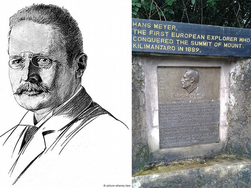
Hans Meyer Kilimanjaro first ascent plaque at Marangu Gate
Hans Meyer was the first European to reach the summit of Kilimanjaro in 1889. This historical plaque at the Marangu Gate Information Center honors his achievement and marks his contribution to the mountain’s climbing history.

Table of Contents

Who Was Hans Meyer?

Hans Meyer was a German geographer, mountaineer, and professor at the University of Leipzig. He became interested in Kilimanjaro during a period when European explorers were trying to study and document major mountains in East Africa.
 
Meyer made more than one attempt to climb Kilimanjaro before finally reaching the summit in October 1889. His success came through better planning, stronger expedition support, and help from Austrian mountaineer Ludwig Purtscheller and local mountain guides.
 
Meyer’s role is important because his expedition helped place Kilimanjaro into the written history of modern mountaineering. But Kilimanjaro was not “discovered” by Meyer. The mountain was already known, named, lived around, and understood by local communities long before European expeditions arrived.
 
To understand the mountain itself, read our guide to what Mount Kilimanjaro is and how it formed.
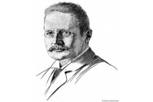
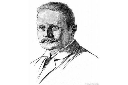
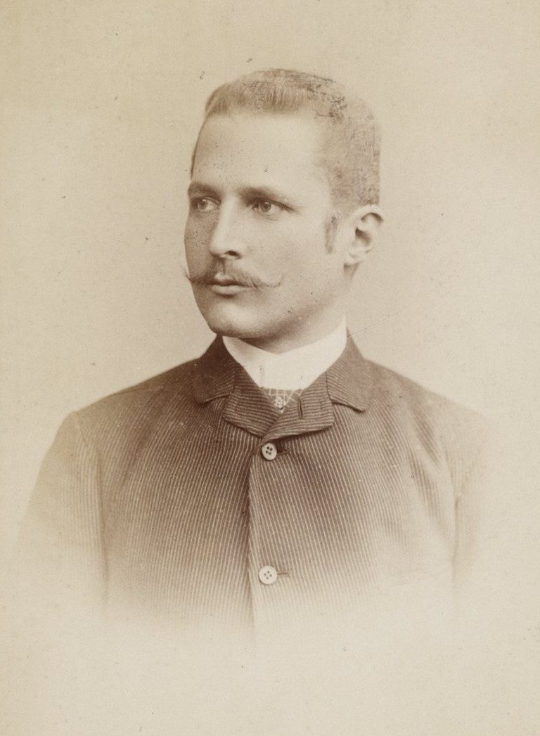
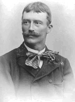
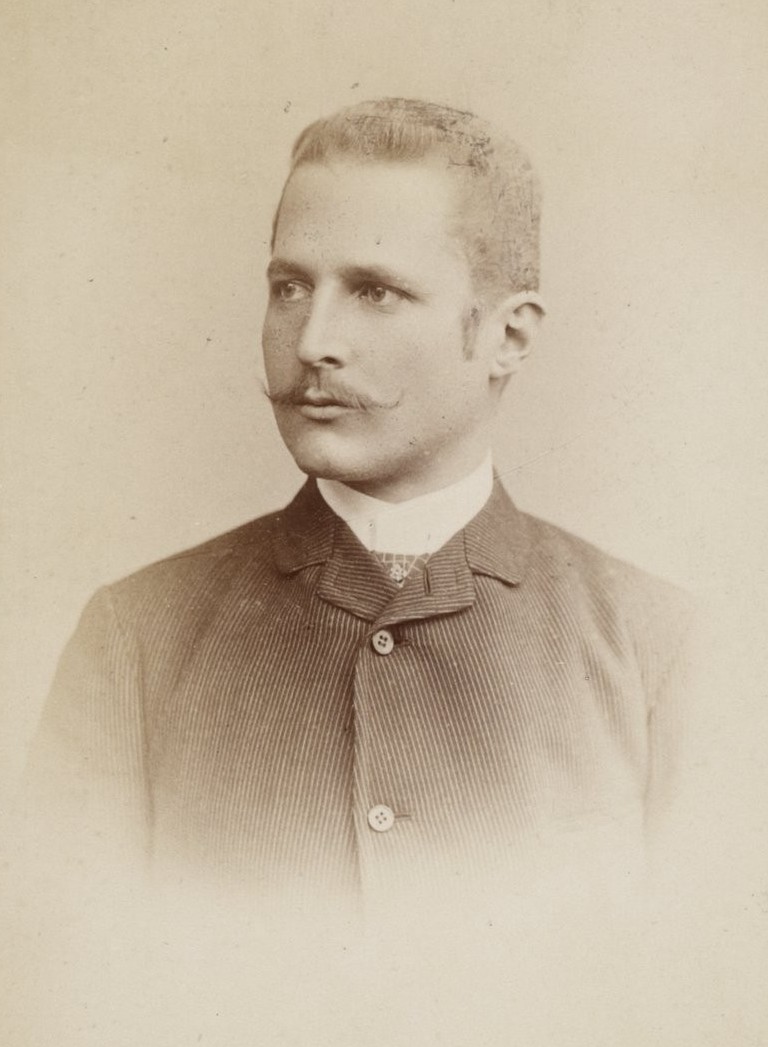
Portrait of Hans Meyer German geographer linked to Kilimanjaro first ascent
Hans Meyer, a German geographer, became the first documented person to reach Uhuru Peak on Mount Kilimanjaro in 1889, accompanied by Austrian climber Ludwig Purtscheller and a Chagga guide named Lauwo.
Portrait of Ludwig Purtscheller Austrian mountaineer Kilimanjaro 1889 ascent
Ludwig Purtscheller, an experienced Austrian mountaineer, reached the summit of Kilimanjaro with Hans Meyer and local guide Lauwo in 1889.

The First Successful Ascent of Kilimanjaro

Hans Meyer’s successful 1889 expedition included Austrian mountaineer Ludwig Purtscheller, local guides, porters, and support crew. Historical accounts commonly connect Yohani Kinyala Lauwo, a Chagga guide from the Kilimanjaro region, with the expedition’s local support.
 
On October 6, 1889, Meyer and Purtscheller reached the summit area of Kibo, Kilimanjaro’s highest volcanic cone. This became known as the first recorded successful ascent of Mount Kilimanjaro.
 
The climb was difficult because the team faced altitude, cold, ice, limited equipment, and the logistical challenge of moving supplies on a high mountain before modern trekking support existed.
 
For the full local guide story, read our dedicated article about Yohani Kinyala Lauwo and Kilimanjaro’s first ascent.
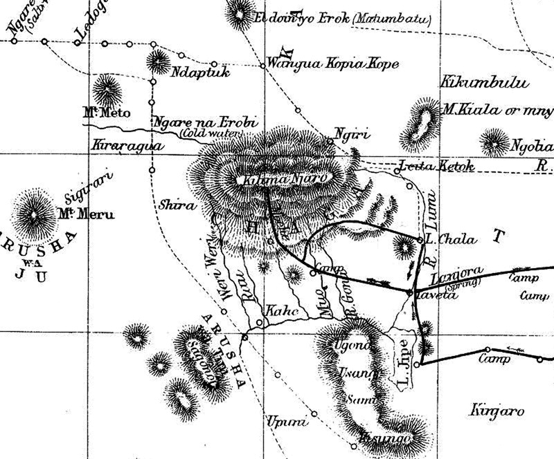
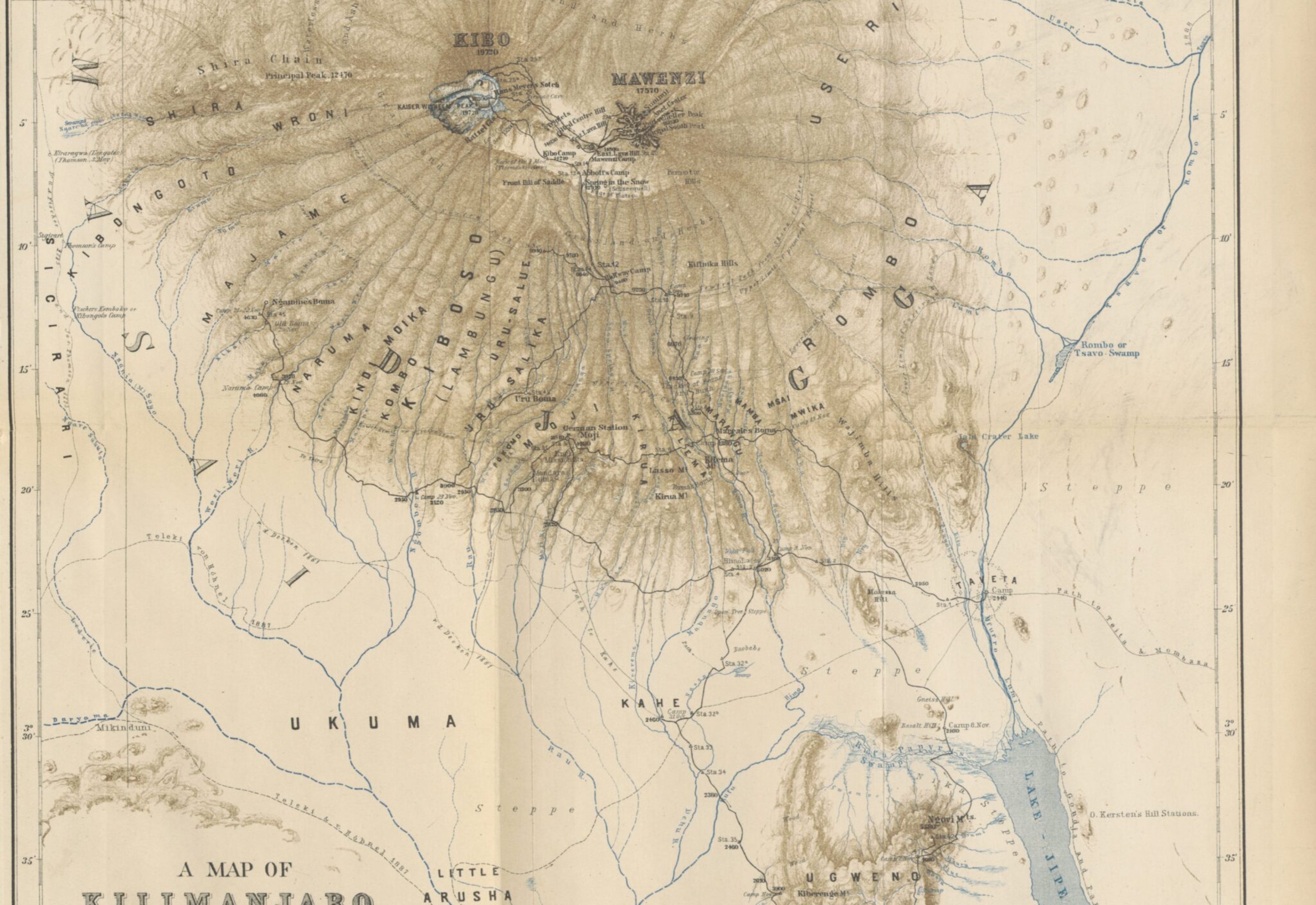
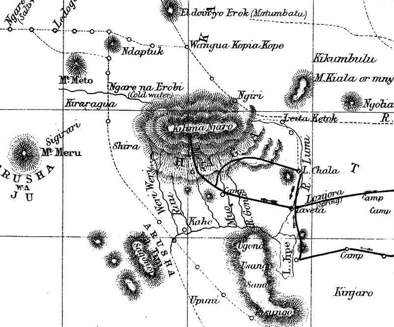
Hans Meyer 1889 map of Mount Kilimanjaro summit area
A look back in time — this 1990s Kilimanjaro map reflects how the mountain was explored, traveled, and understood decades ago.

What Made the Expedition Historic?

Meyer’s 1889 ascent was historic because it became the first recorded successful climb to Kilimanjaro’s highest summit. The expedition also helped document the mountain’s geography, crater area, ice, and summit landscape for later climbers and researchers.

The climb mattered because:
  • It confirmed a recorded route to Kilimanjaro’s highest summit
  • It helped document Kibo, the highest of Kilimanjaro’s volcanic cones
  • It showed the challenge of altitude, ice, and logistics on the mountain
  • It became a major event in East African exploration history
  • It helped shape Kilimanjaro’s later identity as a major climbing destination
Modern climbers have better equipment, trained guides, and safer logistics, but Kilimanjaro is still demanding. Read How Hard Is Kilimanjaro? to understand the challenge today.
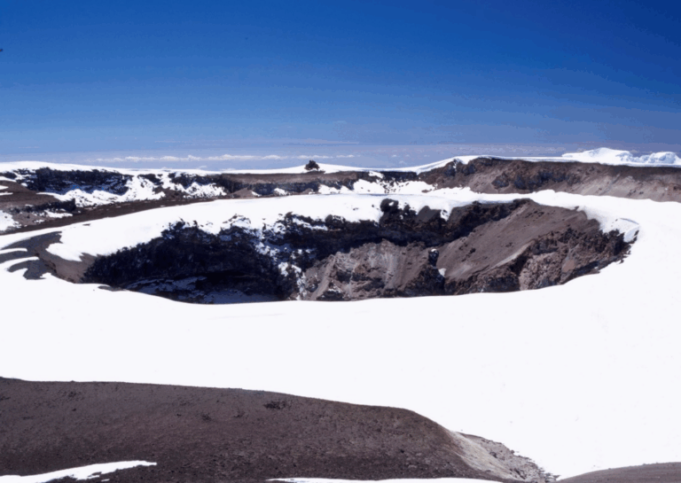
Glacial snow and ice covering the crater rim of Mount Kilimanjaro during dry season ascent | Kili Quests
Kilimanjaro’s crater rim wrapped in snow and ancient ice — a glimpse into the mountain’s glacial past.
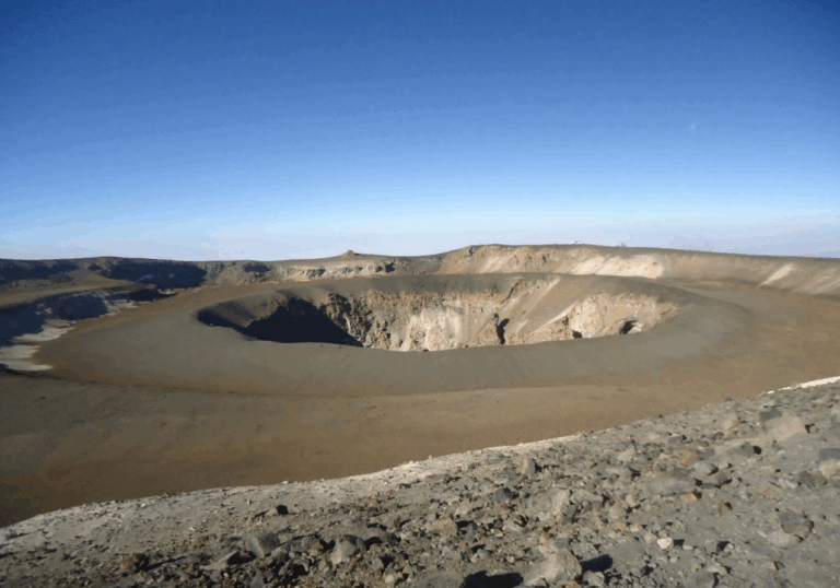
Dry, snowless crater rim of Mount Kilimanjaro showing volcanic rock and summit trail | Kili Quests
The exposed crater rim reveals Kilimanjaro’s raw volcanic structure — dramatic, vast, and wind-carved by time.

Naming the Summit Points

Kilimanjaro’s summit area has several famous names, including Gilman’s Point, Stella Point, and Uhuru Peak. These names reflect different periods of exploration, mapping, climbing history, and Tanzania’s national identity.
 
During the German colonial period, the highest summit was known as Kaiser-Wilhelm-Spitze. After Tanzania’s independence, the summit became known as Uhuru Peak, with “Uhuru” meaning freedom in Swahili.
 
Gilman’s Point is another historic crater-rim landmark, while Stella Point is one of the key summit markers reached by climbers from routes such as Machame, Lemosho, and Umbwe.
 
For more detail, read our guides to Gilman’s Point, Stella Point on Kilimanjaro, and Why Uhuru Peak Is Called Uhuru.

Meyer’s Legacy on Kilimanjaro

Hans Meyer’s legacy is tied to Kilimanjaro’s written climbing history, early geographic documentation, and the first recorded ascent of the mountain’s highest summit.

His expedition helped make Kilimanjaro known internationally as a major mountain objective. His maps, writings, and observations also contributed to how later climbers and researchers understood the mountain.

But Meyer’s legacy should be explained honestly. The 1889 ascent was not only the story of one European explorer. It also depended on Ludwig Purtscheller, local guides, porters, and mountain knowledge from the Kilimanjaro region.
1889 exploration map of Mount Kilimanjaro drawn by Hans Meyer, highlighting the early summit path and crater area | Kili Quests
A legacy etched in ink — Hans Meyer’s 1889 map captured Kilimanjaro’s summit long before modern routes existed.

Frequently Asked Questions About Hans Meyer and Kilimanjaro

Who was Hans Meyer?

Hans Meyer was a German geographer, mountaineer, and professor who became famous for his role in the first recorded successful ascent of Mount Kilimanjaro in 1889.

When was Mount Kilimanjaro first climbed?

The first recorded successful ascent of Mount Kilimanjaro took place in October 1889, when Hans Meyer and Ludwig Purtscheller reached the summit area of Kibo.

Did Hans Meyer climb Kilimanjaro alone?

No. Hans Meyer did not climb Kilimanjaro alone. He climbed with Austrian mountaineer Ludwig Purtscheller and relied on local guides, porters, and expedition support.

What was the original name of Uhuru Peak?

During the German colonial period, Kilimanjaro’s highest summit was known as Kaiser-Wilhelm-Spitze. Today, it is called Uhuru Peak, a name associated with Tanzania’s independence and freedom.

Why is Hans Meyer important in Kilimanjaro history?

Hans Meyer is important because his 1889 expedition became the first recorded successful ascent of Mount Kilimanjaro and helped document the mountain’s geography, summit area, and climbing history.

Who was the local guide in the first Kilimanjaro expedition?

The local guide who assisted Hans Meyer’s expedition was Yohani Kinyala Lauwo, a Chagga man from Marangu. His role in the climb is now widely recognized as an important part of Kilimanjaro’s history.
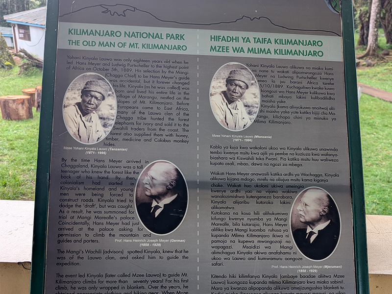
Interpretive sign at Kilimanjaro National Park showing historical profiles of Yohani Kinyala Lauwo, the first local guide of Mount Kilimanjaro, and Hans Meyer, the first recorded European to summit Kilimanjaro in 1889.
Informational sign at Kilimanjaro National Park honoring Yohani Kinyala Lauwo, the first local Kilimanjaro guide, and Hans Meyer, the first European summiteer in 1889. Their partnership marked the beginning of Kilimanjaro’s climbing history.

The Legacy of Kilimanjaro’s First Ascent

Hans Meyer’s first recorded successful climb of Mount Kilimanjaro was more than a mountaineering achievement. It became part of the mountain’s written history and helped shape how later generations understood Kibo, the crater rim, and the summit area.

But the story is stronger when it is told honestly. Meyer’s success depended not only on his ambition, but also on Ludwig Purtscheller, local guides, porters, and the mountain knowledge of people from the Kilimanjaro region.

Today, climbers follow safer routes with better equipment and experienced local guides, but the journey still carries the same sense of challenge, history, and achievement.

Plan Your Kilimanjaro Climb with Kili Quests

Kilimanjaro’s history gives the mountain deeper meaning, but reaching the summit today still requires preparation, pacing, acclimatization, and experienced support.
 
At Kili Quests, we guide climbers with local mountain knowledge, careful planning, and respect for the history behind Africa’s highest peak.
 
Contact us today to start planning your Kilimanjaro climb.

Related Articles

Yohani Kinyala Lauwo: Kilimanjaro’s First Local Guide

Climb with Local Experts

Follow in Lauwo’s footsteps with experienced Tanzanian guides.

Plan Your Climb

Start preparing for your Kilimanjaro adventure: 

OUR CATEGORIES

Who Was Yohani Kinyala Lauwo? Kilimanjaro’s Local Guide

When people talk about the first recorded ascent of Mount Kilimanjaro, they often mention Hans Meyer and Ludwig Purtscheller. But the story is not complete without Yohani Kinyala Lauwo, the local Chagga guide from Marangu who is remembered for his connection to the 1889 expedition.
 
Lauwo’s story matters because Kilimanjaro history is not only about European explorers. It is also about the local guides, porters, and mountain communities whose knowledge made early expeditions possible.
 
In this article, Kili Quests shares who Lauwo was, what role he played in Kilimanjaro’s first recorded ascent story, why his contribution was overlooked, and how his legacy continues through Tanzanian mountain guides today.
 
For the European expedition side of the story, read our guide to Hans Meyer and the first Kilimanjaro ascent in 1889.

Quick Answer: Who Was Yohani Kinyala Lauwo?

Yohani Kinyala Lauwo was a Chagga guide from the Marangu area of Mount Kilimanjaro. He is remembered for his connection to the first recorded successful ascent of Kilimanjaro in 1889, when Hans Meyer and Ludwig Purtscheller reached the summit with support from local guides, porters, and expedition crew.
 
Lauwo’s story highlights the local knowledge behind Kilimanjaro’s early climbing history. While European expedition leaders received most of the written recognition, local guides helped make mountain travel possible through route knowledge, strength, endurance, and familiarity with the land

A Note on Lauwo’s Historical Record

Lauwo is widely remembered in Kilimanjaro guiding history, but some details about his exact role, age, and participation are not recorded as clearly as the European expedition accounts.
 
A later centenary review of Kilimanjaro’s first ascent connected Yohani Kinyala Lauwo with Meyer and Purtscheller’s 1889 expedition, but the historical record also shows that some details were uncertain. That uncertainty is important to mention because local guides and porters were often under-recorded in colonial-era expedition history.
 
This does not make Lauwo’s story less important. It makes it more important to tell carefully, honestly, and with respect for the local people who helped shape Kilimanjaro guiding history.
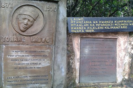
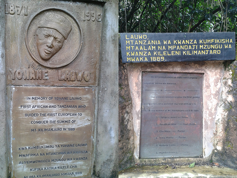
Memorial plaques honoring Yohane Lauwo, the first Tanzanian to guide a European to Kilimanjaro’s summit in 1889.
Yohane Lauwo is remembered as the first African and Tanzanian guide to summit Mount Kilimanjaro, assisting Hans Meyer in the historic 1889 expedition.

Table of Contents

Who Was Yohani Kinyala Lauwo?

Yohani Kinyala Lauwo was a local guide from Marangu, one of the historic gateway areas on the southeastern slopes of Mount Kilimanjaro.
 
He is commonly remembered as a Chagga guide connected to the 1889 first recorded ascent of Kilimanjaro. That expedition involved Hans Meyer, a German geographer, and Ludwig Purtscheller, an Austrian mountaineer, along with local guides, porters, and support crew.
 
Lauwo’s importance goes beyond one expedition. His story represents the local mountain knowledge, endurance, and guiding tradition that existed around Kilimanjaro long before the mountain became a global trekking destination.
 
Marangu remains one of Kilimanjaro’s most historic gateways, and today the Marangu Route is still one of the main trails to the summit.
 
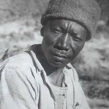
Portrait of Yohani Kinyala Lauwo, the first local Kilimanjaro guide and early Tanzanian mountain pioneer
Yohani Kinyala Lauwo – The legendary Chagga guide who led Hans Meyer to the summit of Kilimanjaro in 1889.
Historic 1889 Kilimanjaro expedition team with Hans Meyer and local guides including Yohani Kinyala Lauwo
1889 Kilimanjaro Expedition Team – Hans Meyer with Chagga porters and guides, including Yohani Lauwo, before the first summit of Uhuru Peak.
Portrait of Ludwig Purtscheller Austrian mountaineer Kilimanjaro 1889 ascent
Ludwig Purtscheller, an experienced Austrian mountaineer, reached the summit of Kilimanjaro with Hans Meyer and local guide Lauwo in 1889.
Portrait of Hans Meyer German geographer linked to Kilimanjaro first ascent
Hans Meyer led the first successful recorded expedition to the summit of Mount Kilimanjaro in 1889, marking a historic moment in mountaineering.

What Role Did Lauwo Play in the 1889 Ascent Story?

Lauwo is remembered for his connection to the expedition that reached Kilimanjaro’s summit in 1889. That climb is most commonly associated with Hans Meyer and Ludwig Purtscheller, but it also depended on local support.
 
Local guides and porters helped with:
  • Route knowledge through the lower mountain zones
  • Carrying supplies and expedition equipment
  • Moving through unfamiliar terrain
  • Supporting camp logistics
  • Helping the expedition continue in difficult mountain conditions
This is why Lauwo matters. The first recorded ascent was not only the achievement of European explorers. It was also made possible by local people who knew the mountain environment and supported the climb.
 
For the full European expedition story, read Hans Meyer and the first ascent of Kilimanjaro.
Person or Group Role in the 1889 Ascent Story Why It Matters
Yohani Kinyala Lauwo Local Chagga guide remembered for his connection to the expedition Represents local mountain knowledge and Tanzania’s guiding legacy.
Hans Meyer German geographer linked to the first recorded ascent Helped bring Kilimanjaro into written mountaineering history.
Ludwig Purtscheller Austrian mountaineer who climbed with Meyer Brought mountaineering experience to the expedition.
Local porters and support crew Carried supplies and supported mountain logistics Shows that the climb depended on more than the named expedition leaders.

Why Was Lauwo’s Story Often Overlooked?

For many years, Kilimanjaro’s first ascent story was told mainly through European expedition records. Hans Meyer and Ludwig Purtscheller became the most widely known names because they were the figures most clearly documented in written accounts.
 
Local guides and porters were often treated as background support, even when their work was essential. Lauwo’s story helps correct that imbalance by showing that Kilimanjaro’s climbing history also belongs to the people who lived near the mountain and understood its slopes, forests, weather, and routes.
 
This does not mean the Hans Meyer story should be erased. It means Kilimanjaro history should be told more completely.
Hans Meyer 1889 map of Mount Kilimanjaro summit area
A look back in time — this 1990s Kilimanjaro map reflects how the mountain was explored, traveled, and understood decades ago.

Lauwo’s Legacy on Kilimanjaro

Lauwo’s legacy lives in Tanzania’s mountain guiding tradition. Today, Kilimanjaro guides continue a local profession built on endurance, responsibility, route knowledge, safety awareness, and respect for the mountain.
 
His story also reminds climbers that Kilimanjaro is not just a summit. It is a living landscape connected to local communities, culture, history, and generations of mountain workers.
 
For a deeper look at the wider cultural background around the mountain, read our guide to Chagga culture and history around Kilimanjaro.

Why Lauwo’s Story Still Matters Today

Lauwo’s story matters because it brings local people back into Kilimanjaro’s climbing history. The mountain was not simply conquered by outsiders. It was guided, supported, understood, and lived around by local communities long before international climbers arrived.

When climbers stand on Uhuru Peak today, they are following a mountain history shaped by many people: explorers, guides, porters, cooks, route builders, local communities, and generations of Tanzanian mountain workers.

Lauwo represents that local legacy. His story reminds us that Kilimanjaro guiding is not just a job; it is part of the mountain’s living history.

Frequently Asked Questions About Yohani Kinyala Lauwo

Who was Yohani Kinyala Lauwo?

Yohani Kinyala Lauwo was a local Chagga guide from Marangu, remembered for his connection to Kilimanjaro’s 1889 first recorded ascent and Tanzania’s early mountain guiding history.

Did Lauwo climb with Hans Meyer?

Lauwo is commonly connected with the 1889 expedition involving Hans Meyer and Ludwig Purtscheller. The expedition also relied on local guides, porters, and support crew from the Kilimanjaro region.

Why is Lauwo important in Kilimanjaro history?

Lauwo is important because his story highlights the local knowledge behind Kilimanjaro’s early climbing history. It reminds climbers that the mountain’s history includes Tanzanian guides and communities, not only European expedition leaders.

Where was Lauwo from?

Yohani Kinyala Lauwo was from the Marangu area on the slopes of Mount Kilimanjaro. Marangu remains one of the mountain’s historic gateway communities and is closely connected with Kilimanjaro guiding history.

Why was Lauwo overlooked in early Kilimanjaro history?

Lauwo was overlooked because colonial-era expedition accounts focused mainly on European explorers such as Hans Meyer and Ludwig Purtscheller. Local guides, porters, and support crews were often under-recorded, even though their work was essential.
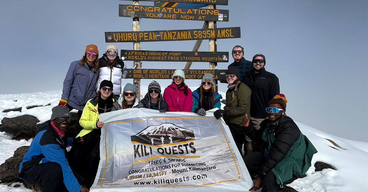
Group of trekkers celebrating together at Uhuru Peak, the summit of Mount Kilimanjaro
Tourists celebrate their successful summit at Uhuru Peak alongside our expert KILI QUESTS guides, proudly raising the flag at Africa’s highest point.

Climb Kilimanjaro with Local Mountain Experts

Lauwo’s story reminds us that Kilimanjaro guiding has deep local roots. Long before the mountain became a global trekking destination, local people understood its slopes, forests, weather, and routes.
 
At Kili Quests, we continue that tradition with experienced Tanzanian guides, careful route planning, strong safety support, and respect for the people and history behind the mountain.
 
Plan your Kilimanjaro climb with Kili Quests today.

Related Articles

Uhuru Peak Meaning: Kilimanjaro Summit & Independence

Reach Uhuru Peak

Stand on the highest point in Africa with expert local guides.

Plan Your Summit

Prepare the right way before your Kilimanjaro climb:

OUR CATEGORIES

From Kaiser Wilhelm Spitze to Uhuru Peak: Kilimanjaro and Tanzania’s Independence | Kili Quests

Mount Kilimanjaro’s summit is known today as Uhuru Peak ,Learn more about what Uhuru Peak is and why it’s the true summit of Africa,a symbol of freedom and pride for the people of Tanzania. But before independence, this same summit carried a very different name: Kaiser Wilhelm Spitze, a colonial-era label honoring the German emperor.
 
In this article, Kili Quests explores how Kilimanjaro’s highest point was renamed, what “Uhuru” truly means, and how the summit came to represent a new chapter in Tanzania’s history.Reaching this point is the goal of every climber , but it requires preparation and proper acclimatization.
 
Discover the full story behind Uhuru Peak and its historical meaning.
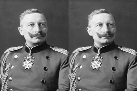
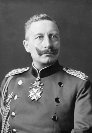
Portrait of Kaiser Wilhelm II, the German emperor after whom Kilimanjaro’s summit was named during colonial rule.
Kaiser Wilhelm II was the namesake of Kilimanjaro’s summit during the German colonial era — formerly called Kaiser Wilhelm Spitze until Tanzania gained independence.

Table of Contents

The Colonial Name: Kaiser Wilhelm Spitze

Historic wooden sign at Uhuru Peak on Mount Kilimanjaro displaying the highest point in Africa at 5,895 meters above sea level.
An early sign at Uhuru Peak, renamed in the 1960s after Tanzanian independence. Before this, Europeans knew the summit as Kaiser Wilhelm Spitze during the colonial era.
In 1889, German explorer Hans Meyer,
Read more about Hans Meyer and the first Kilimanjaro ascent in 1889.became the first recorded person to reach the summit of Mount Kilimanjaro. As part of his achievement, he named the peak Kaiser Wilhelm Spitze, or “Emperor William Peak,” in honor of Kaiser Wilhelm II, the ruler of the German Empire.
At the time, Tanzania (then German East Africa) was a colony under German control, and naming major geographical landmarks after European royalty was a common colonial practice.
Uhuru Peak sign at the summit of Mount Kilimanjaro showing elevation and independence-related messages.
Since 1964, the summit of Kilimanjaro has been officially known as Uhuru Peak — a name symbolizing Tanzanian freedom. During colonial times, it was called Kaiser Wilhelm Spitze by Europeans.

A Mountain Under Many Flags

Throughout the early 20th century, Kilimanjaro , like much of East Africa , changed hands between colonial powers:
  • German control (late 1800s to WWI)
  • British control (after World War I, renamed Tanganyika Territory)
  • Independence movement grows in the 1950s
Despite these political changes, the mountain remained a cultural and geographic icon for local communities , especially the Chagga people, who lived on its slopes.
 

Tanzania Independence and the Renaming of the Summit

On December 9, 1961, Tanganyika gained independence from British colonial rule and became a sovereign nation.As part of celebrating this historic milestone, the government officially renamed Kilimanjaro’s summit from Kaiser Wilhelm Spitze to “Uhuru Peak.”
The word “Uhuru” means “freedom” in Swahili ,The summit name reflects both national pride and identity , making it one of the most meaningful mountain summits in the world.
 
Tanzania’s national language.
This change was more than symbolic. It marked:
  • A rejection of colonial naming and legacy.
  • A celebration of African identity and independence.
  • A reminder that Tanzania’s highest point belongs to its people.

Uhuru Peak Today

Trekkers posing at the Uhuru Peak summit sign on Mount Kilimanjaro, marking Africa’s highest point at 5,895 meters.
Ones of Kili Quests Member celebrate reaching Uhuru Peak, the highest point in Africa. The sign marks 5,895 meters above sea level — a powerful moment for every Kilimanjaro climber.
Uhuru Peak stands as:
  • The highest point in Africa (5,895 m / 19,341 ft)Before attempting the summit, it’s important to understand how difficult Kilimanjaro really is.
  • A place where independence meets elevation
  • A globally recognized name that reflects Tanzania’s values
Today, climbers from all over the world take photos beneath the summit sign, Most climbers reach Uhuru Peak after passing Stella Point on the crater rim that proudly reads
 
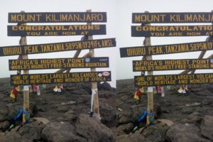
“Congratulations! You are now at Uhuru Peak, Tanzania, 5,895 m. Africa’s Highest Point. World’s Highest Free-Standing Mountain.”

Did You Know?

The renaming was part of a wider movement in post-colonial Africa to reclaim names, borders, and identities.Uhuru Peak was officially named within months of independence, showing how deeply the name was tied to national pride.Other peaks on Kilimanjaro , such as Stella Point and Gilman’s Point , still retain their explorer-era names
 
Portrait of Hans Meyer German geographer linked to Kilimanjaro first ascent
Hans Meyer led the first successful recorded expedition to the summit of Mount Kilimanjaro in 1889, marking a historic moment in mountaineering.
Portrait of Ludwig Purtscheller Austrian mountaineer Kilimanjaro 1889 ascent
Ludwig Purtscheller, an experienced Austrian mountaineer, reached the summit of Kilimanjaro with Hans Meyer and local guide Lauwo in 1889.

Final Thoughts

Mountains carry meaning ,and for Tanzania, Uhuru Peak stands not only as a geographical high point but as a symbol of national freedom.From a colonial name tied to European empire, to a Swahili name that honors independence, the summit of Kilimanjaro tells a powerful story. Every climber who reaches it stands on more than volcanic rock , they stand on the spirit of Uhuru.Every climber who reaches this summit follows a journey shaped by history, culture, and determination.
 
Hans Meyer 1889 map of Mount Kilimanjaro summit area
A look back in time — this 1990s Kilimanjaro map reflects how the mountain was explored, traveled, and understood decades ago.

Frequently Asked Questions About Uhuru Peak and Kilimanjaro’s Name

What was the original name of Uhuru Peak?

Before Tanzania gained independence, the summit of Mount Kilimanjaro was called Kaiser Wilhelm Spitze. The name was given by German explorer Hans Meyer in 1889 to honor Kaiser Wilhelm II of Germany.

Why was Kilimanjaro’s summit renamed Uhuru Peak?

After Tanganyika gained independence in 1961, the summit was renamed Uhuru Peak to symbolize national freedom. The word “Uhuru” means freedom in Swahili, reflecting the country’s independence and cultural identity.

What does the word “Uhuru” mean?

The Swahili word “Uhuru” means freedom or independence. Naming the summit Uhuru Peak was meant to celebrate Tanzania’s liberation from colonial rule.

When was Uhuru Peak officially named?

The summit of Mount Kilimanjaro was renamed Uhuru Peak shortly after Tanganyika gained independence on December 9, 1961. The new name reflected the pride and identity of the newly independent nation.

Is Uhuru Peak the highest point in Africa?

Yes. Uhuru Peak stands at 5,895 meters (19,341 feet) above sea level and is the highest point in Africa and the summit of Mount Kilimanjaro.

How long does it take to reach Uhuru Peak from Stella Point?

From Stella Point, it usually takes about 45 minutes to one hour to reach Uhuru Peak, depending on altitude conditions and the climber’s pace.

Climb to Uhuru Peak with Kili Quests

At Kili Quests, we guide you to more than just a summit , we guide you through a journey of culture, history, and self-discovery.Whether it’s your first trek or your return to the mountain, we’ll help you reach Uhuru Peak with expert guidance, preparation, and respect for the land and its story.
 

Related Articles

Mount Kilimanjaro: Africa’s Highest and Most Famous Mountain

Plan Your Kilimanjaro Climb

Turn your goal of climbing Africa’s highest peak into a real experience

Start Planning Your Kilimanjaro Adventure

 The right preparation makes the difference between reaching the summit and turning back.

OUR CATEGORIES

Why Kilimanjaro Is Africa’s Most Iconic Landmark | Kili Quests

Mount Kilimanjaro is one of the most recognized and revered natural features in the world. Towering at 5,895 meters (19,341 ft), it is not just the highest mountain in Africa — it’s a symbol of achievement, resilience, and natural beauty. But what exactly makes Kilimanjaro so iconic?

Whether you’re drawn to it for the adventure, the scenery, or its cultural importance, here’s why Kilimanjaro earns its legendary status among global travelers.

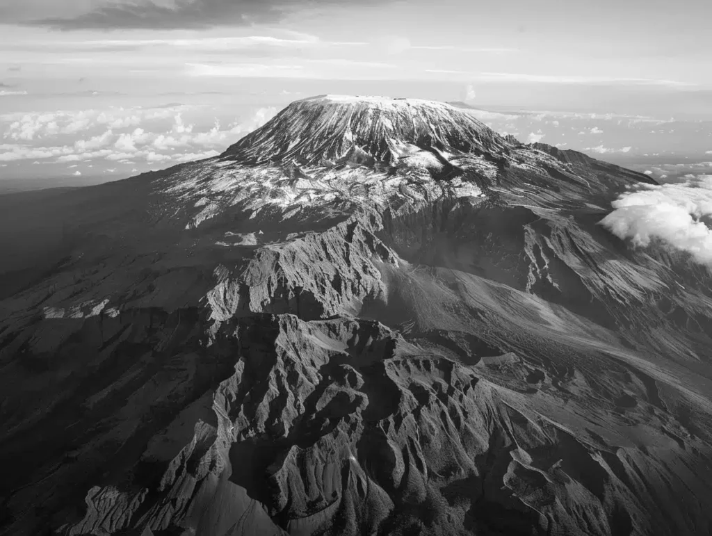
Mount Kilimanjaro rising above the African plains with acacia trees in the foreground
Kilimanjaro’s snowcapped summit and free-standing presence make it one of Africa’s most iconic and photographed landmarks

Table of Contents

It’s the Highest Free-Standing Mountain in the World

Unlike most major peaks that are part of mountain ranges, Kilimanjaro stands alone. Its dramatic rise from the surrounding savanna makes it visible from miles away , a breathtaking spectacle, especially at sunrise or sunset. It’s the tallest free-standing mountain on Earth, making it geologically and visually unique.
 
To understand how this massive mountain formed, explore Kilimanjaro’s volcanic cones and geological history.

Snow at the Equator — A Surprising Natural Wonder

Located just south of the equator, Kilimanjaro’s summit is capped with permanent glaciers and snow , a rare sight in tropical Africa. This surreal contrast between hot plains and icy summit is part of the mountain’s magic and mystery.
 
These extreme differences also affect trekking conditions , learn the best time to climb Kilimanjaro for clearer skies and better summit chances.

It Has Five Distinct Ecological Zones

Climbing Kilimanjaro takes you through five ecological zones, each with unique landscapes, flora, and fauna:
  • Cultivation Zone – farmland and villages
  • Rainforest Zone – home to monkeys and exotic birds
  • Heather and Moorland Zone – surreal plant life and rolling fog
  • Alpine Desert Zone – dry, rocky terrain with wide views
  • Arctic Summit Zone – glaciers, ice, and thin air
You can explore all zones in detail in this guide to Kilimanjaro’s ecological zones.
 
Local Chagga farmer working in the fields with Mount Kilimanjaro in the background
Kilimanjaro is not just a landmark — it’s a source of life, culture, and pride for the communities around it

It’s the Most Accessible of the Seven Summits

Kilimanjaro is part of the Seven Summits , the tallest mountains on each continent , but it’s the most accessible to non-technical climbers. No ropes or climbing gear are needed. With good fitness and altitude preparation, anyone can attempt the climb.
 
Prepare for your summit with this plan:
 

It Attracts Trekkers from All Over the World

Each year, over 35,000 climbers attempt to summit Kilimanjaro. From solo hikers to charity groups and family expeditions, the mountain draws people from every continent. It’s not just a climb , it’s a global pilgrimage of determination, teamwork, and personal triumph.
 
Wide view of the Shira Plateau with its flat landscape and Shira Peak rising in the background
The Shira Plateau offers a rare flat expanse on Kilimanjaro — once the crater floor of an ancient volcano, with Shira Peak visible on the horizon

It’s a Cultural and Spiritual Symbol

To local communities like the Chagga, Maasai, and Pare, Kilimanjaro is sacred. It plays a central role in oral stories, rituals, and traditional beliefs. It is believed to house spirits, ancestors, and divine energy , and locals treat it with profound respect.
 
Discover the deeper cultural meaning through Kilimanjaro myths, spirits, and local tribes
Members of the Pare tribe from the southeastern Kilimanjaro region, dressed in traditional clothing
The Pare people, known for their rituals and herbal knowledge, view Kilimanjaro as a sacred force and conduct spiritual ceremonies in its presence
Chagga people performing a traditional dance during the 1990s in Kilimanjaro region | Kili Quests
Cultural pride in motion — this 1990s Chagga dance reflects deep-rooted heritage passed through generations.

It’s One of the Most Photographed Natural Landmarks

From National Geographic covers to adventure films and global brand campaigns, Kilimanjaro’s silhouette is iconic. With its towering form above the plains and its snowy peak contrasting against blue skies or golden savannas, it’s a dream scene for photographers and travelers alike.
 
Reaching the summit is the ultimate goal , learn what it takes to reach Uhuru Peak successfully.
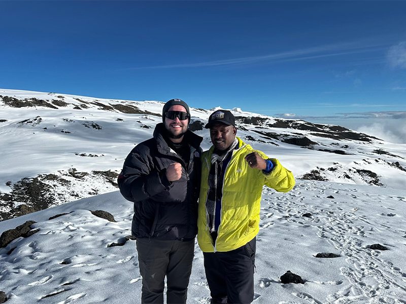
Kilimanjaro guide and climber standing together at Stella Point, sharing a moment in fresh snow
A powerful moment between guide and climber at Stella Point — a key milestone on the way to the summit of Kilimanjaro
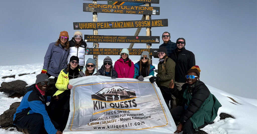
Group of trekkers celebrating together at Uhuru Peak, the summit of Mount Kilimanjaro
Reaching Uhuru Peak is a shared triumph — this final photo marks the ultimate goal of every Kilimanjaro climber

It Borders Rich Wildlife Ecosystems

Kilimanjaro National Park is home to elephants, monkeys, antelope, and countless birds. Nearby destinations like Amboseli (Kenya) and Arusha National Park (Tanzania) allow trekkers to combine summit adventure with safari.
 
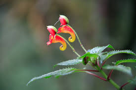
Impatien kilimanjarica flower blooming on Mount Kilimanjaro | Kili Quests
Impatien kilimanjarica- endemic flower of KilimanjaroDelicate beauty — this bright flower grows only on Kilimanjaro.
Giant groundsels in the alpine desert zone of Mount Kilimanjaro | Kili Quests
Strange and beautiful giant groundsels are among Kilimanjaro’s most iconic high-altitude plants.

 Why It All Matters

Kilimanjaro is not just a mountain — it’s a symbol of Africa’s beauty, challenge, and spirit. It represents hope, resilience, and nature’s grandeur. Whether you summit it or simply admire it from below, you are engaging with one of the greatest landmarks on Earth.
 
At Kili Quests, we help you connect with this wonder — responsibly, respectfully, and with expert guidance.
Mount Kilimanjaro rising above the African savanna with snow on the summit
Kilimanjaro’s unmatched height, freestanding shape, and snowcapped peak make it one of Africa’s most iconic natural landmarks

Frequently Asked Questions About Why Kilimanjaro Is Africa’s Most Iconic Landmark

Why is Mount Kilimanjaro considered Africa’s most iconic landmark?

Mount Kilimanjaro is widely considered Africa’s most iconic landmark because it is the highest mountain on the continent and the tallest free-standing mountain in the world. Its snow-covered summit rising above tropical plains creates one of the most recognizable natural landscapes on Earth.

What makes Mount Kilimanjaro unique compared to other mountains?

Unlike most famous mountains that are part of large ranges, Kilimanjaro stands alone. Its dramatic rise from the surrounding savanna, combined with glaciers near the equator and diverse ecosystems along its slopes, makes it geologically and visually unique.

Why do so many travelers want to climb Mount Kilimanjaro?

Kilimanjaro attracts tens of thousands of climbers each year because it offers a rare opportunity to reach a very high summit without technical climbing skills. Trekkers can walk to the summit while passing through multiple ecological zones, making the journey both accessible and diverse.

Is Mount Kilimanjaro part of the Seven Summits?

Yes. Kilimanjaro is the highest mountain in Africa and represents the African continent in the famous Seven Summits challenge, which includes the tallest peaks on each continent.

Why is Kilimanjaro culturally important to local communities?

For many local communities, including the Chagga people, the Maasai people, and the Pare people, Kilimanjaro holds spiritual and cultural significance. Stories, traditions, and ancestral beliefs connected to the mountain have been passed down for generations.

Why is Mount Kilimanjaro famous around the world?

Kilimanjaro is globally famous for its height, dramatic landscape, and reputation as one of the world’s great trekking destinations. Its distinctive silhouette, glaciers near the equator, and cultural importance have made it one of the most recognizable mountains in the world.

Ready to Experience Kilimanjaro for Yourself?

Whether you’re planning your first trek or returning for a new route, Mount Kilimanjaro is calling , and we’re here to guide you every step of the way.
At Kili Quests, we offer:
  • 98% summit success rate on popular routes like Lemosho and Machame
  • Certified local guides with years of experience
  • Full cultural immersion with a Chagga-owned team
  • Private, customizable itineraries based on your goals and pace
 
 Book a free consultation or ask us your questions:Contact Us

Related Articles

Climb Mount Kilimanjaro with Local Trekking Experts

Plan Your Kilimanjaro Climb

Turn your goal into a successful summit experience.

Start Planning Your Climb

The right route, timing, and preparation make all the difference.

OUR CATEGORIES

Ready for the Challenge? Book Your Kilimanjaro Climb with Kili Quests Today and Choose Your Ideal Route

Mount Kilimanjaro, Africa’s highest peak at 5,895 meters, offers one of the most incredible trekking experiences on Earth. But reaching the summit takes preparation, expert support, and the right route.At Kili Quests, we help you choose the perfect Kilimanjaro route, tailor your trek to your goals, and guide you to the summit with experienced staff, safe practices, and unforgettable service.
 
Before booking, it’s important to understand how much it costs to climb Kilimanjaro so you can plan your trip with confidence
Group of trekkers celebrating together at Uhuru Peak, the summit of Mount Kilimanjaro
A dream fulfilled at 5,895m — our climber reaches the highest point in Africa

Table of Contents

Why Climb with Kili Quests?

Expert Guidance

Our guides have decades of experience on Kilimanjaro and are WFR-certified, offering personal attention, motivation, and altitude safety expertise throughout the climb.
 
Your safety depends on proper altitude management , learn how to acclimatize on Kilimanjaro to increase your summit success

Custom Packages

We tailor every trek to your:
  • Preferred route and pace
  • Gear needs (rentals available)
  • Accommodation and timing preference

Safety First

 
We provide:
  • Emergency oxygen and health checks
  • Direct access to evacuation services
  • High-quality gear and daily support

 A True Tanzanian Welcome

Beyond the summit, we offer a genuine cultural experience, combining the spirit of Chagga hospitality with international trekking standards.
Topographic map showing all major climbing routes on Mount Kilimanjaro, including Machame, Lemosho, Marangu, Rongai, Umbwe, Shira, and Northern Circuit.
This detailed map shows all main Kilimanjaro climbing routes, including Machame, Marangu, Lemosho, Rongai, Umbwe, Shira, and the Northern Circuit, with campsites, elevation points, and park boundaries.

Choosing the Right Kilimanjaro Route

Here’s a quick overview of the top routes we offer , each with its own character and challenge:

Lemosho Route (8 Days)

 Difficulty: Moderate to Challenging
Why Choose It:
  • Most scenic route on the mountain
  • Excellent acclimatization and success rate
  • Fewer crowds = more solitude
Ideal for photographers and first-timers who want the best balance of challenge and success.
 

Machame Route (7 Days)

Difficulty: Challenging
Why Choose It:
  • Diverse terrain including the famous Barranco Wall
  • High success rate with a steady ascent
  • Great for trekkers seeking adventure and views

One of the most popular routes for good reason.
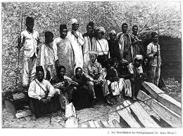
 

Marangu Route (6 Days)

Difficulty: Moderate
Why Choose It:
  • Only route with hut accommodations
  • Straightforward trail and shorter duration
  • Great for beginners or travelers with limited time
Also called the “Coca-Cola Route” for its comfort and accessibility.
 

Rongai Route (7 Days)

Difficulty: Moderate
Why Choose It:
  • Northern approach = fewer climbers
  • Drier climate and remote trail
  • Offers unique views of Mawenzi Peak
A peaceful option with beautiful scenery and low crowds.
 
Discover why Rongai is ideal during certain seasons.

Umbwe Route (6 Days)

Difficulty: Very Challenging
Why Choose It:
  • Steep, direct, and fast-paced
  • For fit and experienced climbers only
  • More rugged and isolated than other routes
If you want intensity and minimal traffic, this is your route.

Understand why Umbwe is considered one of the toughest routes on Kilimanjaro.

Selfie at Stella Point — 5,756 meters above sea level, just steps from the summit.

How to Book Your Kilimanjaro Climb with Kili Quests

Step 1: Contact Us

Send us a message with:
  • Your preferred route
  • Group size and travel dates
  • Any special requirements

Our team will walk you through every detail.

Step 2: Choose Your Dates

Best time to climb Kilimanjaro:
  • June to October (dry season)
  • December to February (warmer but clear)

Book early — especially during peak months.

Weather plays a major role in your experience , learn the best time to climb Kilimanjaro before choosing your dates.

Step 3: Prepare for the Trek

We’ll send you:
  • A complete packing list
  • Rental gear options
  • Training tips and acclimatization advice
Beginner’s Guide to Climbing Kilimanjaro
 

Step 4: Arrive and Begin the Journey

We’ll greet you at the airport, help you settle in Moshi or Arusha, inspect your gear, and ensure you’re 100% ready before your trek begins.

Why Kili Quests?

  •  Trusted by climbers from around the world
  •  Experienced, licensed, and locally owned
  •  Committed to fair porter treatment and sustainability
  •  Proven high success rates on every route
From the first step to Uhuru Peak, we’re with you every step of the way

Frequently Asked Questions About Booking a Kilimanjaro Climb

How do I book a Mount Kilimanjaro climb?

Most travelers book their trek through a licensed tour operator that arranges permits, guides, porters, and accommodation. Because independent climbing is not allowed, visitors must organize their expedition through an authorized company operating in Mount Kilimanjaro.

Which Kilimanjaro route is best for beginners?

The Lemosho Route is often recommended for beginners because it offers gradual acclimatization, beautiful scenery, and a high summit success rate. The Marangu Route is another beginner-friendly option because it provides hut accommodations instead of camping.

How long does it take to climb Mount Kilimanjaro?

Most Kilimanjaro climbs take 6 to 9 days, depending on the chosen route and acclimatization schedule. Longer itineraries allow trekkers to adjust to the altitude more gradually, which improves the chances of successfully reaching the summit.

What is the best time of year to climb Kilimanjaro?

The best times to climb Kilimanjaro are during the dry seasons from June to October and December to February. These months usually offer clearer skies, better trail conditions, and more stable weather for trekking.

Do I need climbing experience to climb Kilimanjaro?

No technical climbing experience is required. Kilimanjaro is a trekking peak, meaning climbers walk to the summit without ropes or mountaineering equipment. However, good physical fitness and proper altitude preparation are important for a successful climb.

What support team is included on a Kilimanjaro trek?

A typical Kilimanjaro expedition includes a professional mountain guide, assistant guides, cooks, and porters who carry equipment and set up camps. These team members help ensure safety, provide meals, and support trekkers throughout the journey to the summit.

Start Your Kilimanjaro Adventure Today

Are you ready to conquer the Roof of Africa?
Book your Kilimanjaro trek with Kili Quests and let our expert team guide you to the top , safely, successfully, and with memories to last a lifetime.
 
Contact us now to reserve your climb and choose the ideal route for your Kilimanjaro challenge.

Related Articles

Mount Kilimanjaro Guide: Facts & Overview

Plan Your Kilimanjaro Climb

Not sure where to start? We help you choose the right route, season, itinerary length, and preparation plan for your Kilimanjaro climb.

Essential Kilimanjaro Guides

Use these guides to plan your climb step by step.

OUR CATEGORIES

Mount Kilimanjaro Guide: Location, Height, Facts & Trek Overview

Mount Kilimanjaro is Africa’s highest mountain and one of the most famous trekking destinations in the world. Rising to 5,895 meters / 19,341 feet, it stands in northern Tanzania near the border with Kenya and attracts climbers from around the world.
 
What makes Kilimanjaro special is not only its height. It is the world’s tallest free-standing mountain, a dormant volcano, a UNESCO World Heritage Site, and a non-technical trek that takes climbers through changing landscapes from forest to alpine terrain and the arctic summit.
 
For many travelers, Kilimanjaro is their first major high-altitude adventure. You do not need ropes or advanced mountaineering skills, but you do need proper preparation, the right route, good pacing, and experienced guides.
 
This guide gives you a clear overview of Mount Kilimanjaro, including its location, height, volcanic features, history, trekking routes, challenges, preparation, safety, and why it remains one of Africa’s most iconic climbs.
For a deeper planning decision, you can also compare Kilimanjaro routes before choosing your itinerary.

Quick Answer: What Is Mount Kilimanjaro?

Mount Kilimanjaro is the highest mountain in Africa, standing at 5,895 meters / 19,341 feet above sea level. It is located in northern Tanzania, near the border with Kenya, and its highest point is Uhuru Peak.
 
Kilimanjaro is a dormant volcano made up of three volcanic cones: Kibo, Mawenzi, and Shira. Kibo is the highest cone and contains Uhuru Peak, while Mawenzi and Shira are older volcanic formations.
 
The mountain is famous because it is the tallest free-standing mountain in the world and one of the most accessible major high-altitude treks. Climbers do not need technical mountaineering skills, but they do need fitness, acclimatization, proper gear, and experienced guides.
 
For most trekkers, Kilimanjaro is not just a summit climb. It is a journey through changing landscapes, local culture, volcanic terrain, altitude challenges, and the final push to the Roof of Africa.
Mount Kilimanjaro—Africa’s tallest and most iconic peak

Table of Contents

Geography and Volcanic Features of Mount Kilimanjaro

Mount Kilimanjaro is located in northern Tanzania, close to the Kenya border and near the town of Moshi. Unlike mountains that form part of a long range, Kilimanjaro rises alone from the surrounding plains, which is one reason it looks so dramatic from a distance.
 
Kilimanjaro is a dormant volcano made up of three main volcanic cones: Kibo, Mawenzi, and Shira. Kibo is the highest cone and contains Uhuru Peak, the summit of Kilimanjaro. Mawenzi is rugged and jagged, while Shira is the oldest cone and now forms a wide plateau.
 
This volcanic structure shaped much of the mountain’s terrain, including its crater area, ridges, scree slopes, lava formations, and high-altitude landscapes.
 
For a deeper explanation of how the mountain formed and how Kibo, Mawenzi, and Shira developed, read our Kilimanjaro Formation and Volcanic Cones guide.

Why Kilimanjaro’s Geography Matters for Climbers
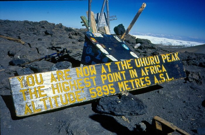
Kilimanjaro’s volcanic structure affects the trekking experience. Climbers pass through changing terrain, from forest trails and open moorland to volcanic rock, scree, and summit ridges.
 
The mountain’s height also creates major altitude changes, which is why route choice and acclimatization matter. Before booking, it helps to compare Kilimanjaro routes so you choose an itinerary that fits your fitness, scenery preferences, and acclimatization needs.

History and Cultural Significance of Mount Kilimanjaro

Mount Kilimanjaro has deep cultural and historical importance, especially for communities living around its lower slopes. For the Chagga people and other nearby communities, the mountain is part of local identity, farming life, stories, and heritage.
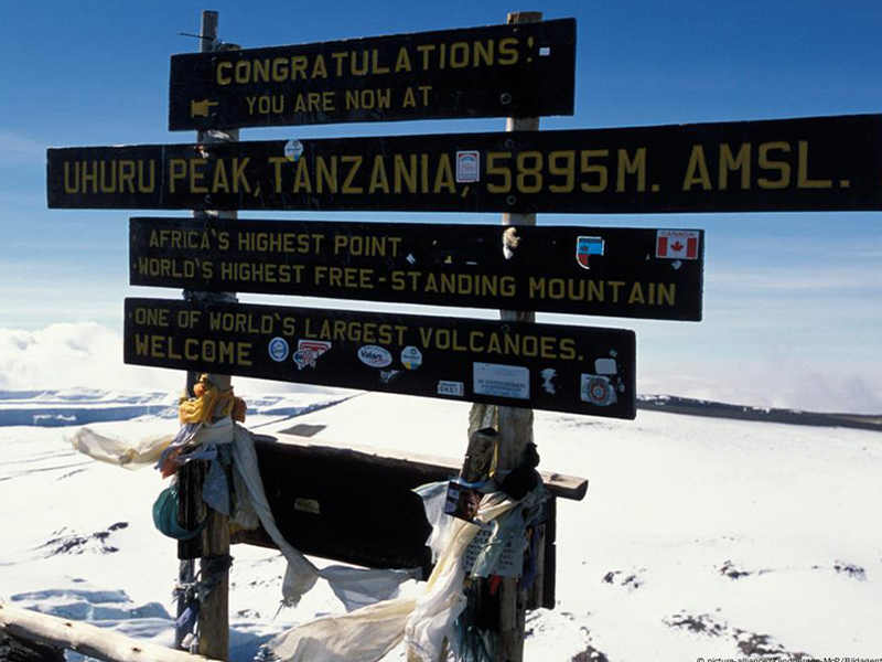
Kilimanjaro also became internationally famous through early exploration, recorded summit attempts, and its status as Africa’s highest mountain. Today, it is both a natural landmark and a symbol of adventure for climbers from around the world.
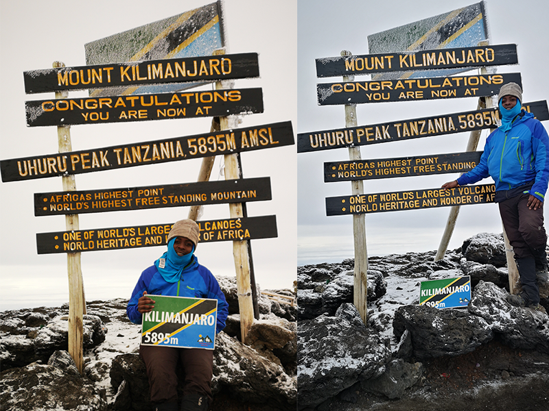
This guide gives only a brief overview. For deeper background, read our Kilimanjaro History and Chagga Culture guide and our Kilimanjaro First Ascent article.
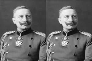
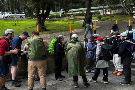
The final push—climbing toward the Roof of Africa

Trekking Routes to the Summit

Mount Kilimanjaro has several official trekking routes to Uhuru Peak, including Machame, Marangu, Lemosho, Rongai, Northern Circuit, Shira, and Umbwe.
 
Each route gives climbers a different experience. Some are more scenic, some are quieter, some allow more time for acclimatization, and some are shorter but more demanding. Route choice affects your daily walking rhythm, camp experience, crowd level, and how your body adjusts to altitude.
 
This overview guide will not explain every route in detail because each route deserves its own full breakdown. Before choosing, read our Kilimanjaro Routes Comparison guide to compare scenery, difficulty, route length, acclimatization profile, and who each route is best for.
 
Heading toward greatness—Mount Kilimanjaro awaits.

Challenges of Climbing Mount Kilimanjaro

Mount Kilimanjaro is a non-technical trek, but that does not mean it is easy. The main challenges are altitude, long trekking days, cold summit conditions, fatigue, and the need to keep a slow, steady pace for several days.

Most climbers do not struggle because the trail requires climbing skills. They struggle because the mountain is high, the air gets thinner, and the summit push is physically and mentally demanding.

The biggest challenges include:

  • High altitude above 5,000 meters
  • Cold temperatures near the summit
  • Long walking days
  • Summit night fatigue
  • Changing trail and weather conditions
  • Poor acclimatization on short itineraries
For a deeper breakdown of altitude risks, read our Altitude Sickness on Kilimanjaro guide. If you want to understand what makes the climb difficult overall, read our How Hard Is It to Climb Kilimanjaro? guide.

How to Prepare for a Kilimanjaro Climb

Preparing for Kilimanjaro means getting your body, gear, route choice, and mindset ready before you arrive in Tanzania. You do not need technical climbing skills, but you do need enough fitness for multi-day trekking, patience for altitude, and the right equipment for changing mountain conditions.

The most important preparation areas are:

  • Building hiking fitness and leg endurance
  • Choosing a route with enough acclimatization time
  • Packing proper layers for rain, wind, sun, and summit cold
  • Understanding altitude sickness symptoms
  • Breaking in your hiking boots before the trip
  • Preparing mentally for slow pacing and summit night

Do not treat Kilimanjaro like a normal day hike. The climb takes several days, and your body needs time to adjust as you gain altitude.

For detailed preparation, use our Kilimanjaro Training Guide, Kilimanjaro Packing List, and Acclimatization Tips on Kilimanjaro before your trek.

 
Morning views from Millennium Camp—Kilimanjaro standing proud.

Wildlife and Ecosystems on Mount Kilimanjaro

Mount Kilimanjaro is famous for its changing landscapes. As climbers move higher, the mountain shifts from cultivated lower slopes and rainforest to moorland, alpine desert, and the arctic summit zone.
 
The lower forest areas are the best places to see wildlife. Climbers may spot blue monkeys, black-and-white colobus monkeys, forest birds, and other small animals, although sightings are never guaranteed.
 
Higher on the mountain, wildlife becomes less common, but the landscape becomes more dramatic. Giant groundsels, open moorland, volcanic rock, dry alpine terrain, and icy summit views are all part of Kilimanjaro’s natural journey.
 
For a deeper breakdown of the mountain’s vegetation, altitude ranges, wildlife, and landscapes, read our Kilimanjaro Ecological Zones guide.

Safety and Support on Mount Kilimanjaro

Safety on Kilimanjaro depends on preparation, pacing, altitude awareness, guide experience, and the ability to respond quickly when conditions change.
 
Kilimanjaro is not a technical climb, but it is still a serious high-altitude trek. Climbers may face altitude symptoms, cold summit conditions, fatigue, dehydration, changing weather, and long trekking days. This is why choosing an experienced guide team matters.
 
At Kili Quests, safety support includes:


  • Experienced local mountain guides
  • Daily health checks during the climb
  • Pulse oximeter monitoring
  • Emergency oxygen support
  • Careful pacing for acclimatization
  • Clear communication with climbers
  • Emergency response planning when needed

Why Guide Experience Matters

A strong guide team does more than lead the trail. Guides monitor pace, watch for altitude symptoms, help climbers manage energy, and make practical decisions when weather, fatigue, or health concerns appear.

On Kilimanjaro, pushing too fast is not strength. Smart pacing, honest communication, and proper acclimatization are what protect the climb.

Travel Insurance for Kilimanjaro

Travel insurance is also important for Kilimanjaro because the climb takes place in a remote, high-altitude environment.
 
Climbers should choose insurance that covers high-altitude trekking, emergency evacuation, medical treatment, trip interruption, and lost or delayed baggage.
 
Do not buy a cheap policy without checking the altitude limit. Some policies exclude trekking above certain elevations, which can make them useless for Kilimanjaro.
 
For more detail, read our Kilimanjaro Travel Insurance guide before booking your climb
 
For altitude-specific safety, read our Altitude Sickness on Kilimanjaro guide and Acclimatization Tips on Kilimanjaro before your trek.

Why Climb Kilimanjaro With Kili Quests?

Choosing the right Kilimanjaro company matters because the climb is not just about reaching the trailhead. It is about route planning, acclimatization, safety, pacing, crew support, gear advice, and honest preparation before the trek begins.
 
At Kili Quests, we are a local Tanzania mountain team that helps climbers prepare properly and move steadily from the first trail day to the summit.
 
We support climbers with:
  • Local Kilimanjaro route advice
  • Private and small-group climb planning
  • Experienced mountain guides
  • Daily health checks during the trek
  • Emergency oxygen and pulse oximeter monitoring
  • Porter and crew support
  • Pre-climb preparation guidance
  • Clear communication before and during the climb

Local Knowledge From the Mountain

Kilimanjaro is our home mountain. Our guides understand how the routes feel, how weather changes, where climbers usually struggle, and why pacing matters from the first day.
 
That local knowledge helps climbers make better decisions before and during the trek.

Support Before You Arrive in Tanzania

 Good Kilimanjaro preparation starts before the climb. We help you understand route choice, packing, training, insurance, weather, and what to expect on the mountain.
 
This matters because many problems on Kilimanjaro begin before the trek starts: wrong route choice, poor gear, weak pacing expectations, or underestimating altitude.

A Climb Plan Built Around You

Every climber is different. Some need more time for acclimatization. Some want the most scenic route. Some want fewer crowds. Some are climbing for the first time and need more guidance.
 
Tell us your travel dates, fitness level, experience, and preferred route. We will help you choose a Kilimanjaro climb plan that fits your goals instead of forcing you into a one-size-fits-all itinerary.
 

Frequently Asked Questions About Mount Kilimanjaro

Where is Mount Kilimanjaro located?

Mount Kilimanjaro is located in northern Tanzania, near the border with Kenya. The mountain is close to the town of Moshi and is one of the most famous landmarks in East Africa.

How high is Mount Kilimanjaro?

Mount Kilimanjaro is 5,895 meters / 19,341 feet high. Its highest point is Uhuru Peak, located on the Kibo volcanic cone.

Is Mount Kilimanjaro a volcano?

Yes. Mount Kilimanjaro is a dormant volcano made up of three main cones: Kibo, Mawenzi, and Shira. Kibo is the highest cone and contains the summit, Uhuru Peak.
 
For a deeper explanation of the mountain’s volcanic history, read our Kilimanjaro Formation and Volcanic Cones guide.

Can beginners climb Mount Kilimanjaro?

Yes, beginners can climb Mount Kilimanjaro because it is a non-technical trek. You do not need ropes, ice axes, or advanced mountaineering skills.

But beginners should not underestimate the climb. Kilimanjaro still requires fitness, proper gear, slow pacing, acclimatization, and experienced guides.

For a full first-timer breakdown, read our Beginner’s Guide to Climbing Kilimanjaro.

How long does it take to climb Kilimanjaro?

Most Kilimanjaro climbs take 5 to 9 days, depending on the route and itinerary. Shorter climbs may look easier, but they give your body less time to adjust to altitude.

For most climbers, choosing the right number of days is a serious planning decision, not just a schedule choice.

For a full breakdown by route and itinerary length, read our How Many Days Does It Take to Climb Kilimanjaro? guide.

What is the best time to climb Mount Kilimanjaro?

The best time to climb Kilimanjaro is usually during the drier months from January to early March and June to October. These periods often offer better trail conditions and clearer views.
 
For a full month-by-month breakdown, read our Best Time to Climb Kilimanjaro guide.

Is Kilimanjaro dangerous?

Kilimanjaro is not a technical climb, but it is still a serious high-altitude trek. The main risks are altitude sickness, fatigue, dehydration, cold summit conditions, and changing weather.

Most risks can be reduced with good preparation, slow pacing, proper acclimatization, experienced guides, and honest communication during the climb.

For a full safety breakdown, read our Is Climbing Kilimanjaro Dangerous? guide.

Start Planning Your Kilimanjaro Climb With Kili Quests

Mount Kilimanjaro is more than Africa’s highest mountain. It is a journey through volcanic landscapes, changing ecosystems, local culture, altitude challenges, and the final push to Uhuru Peak.
 
The best climb starts with the right plan. Before you book, you need to understand your route options, how many days you need, what season fits your travel dates, what gear to bring, and how to prepare for altitude.
 
At Kili Quests, our local mountain team helps you plan your Kilimanjaro climb with clear advice, experienced guides, and honest preparation from the beginning.
We can help you:
  • Choose the right Kilimanjaro route
  • Decide how many days you need for your climb
  • Prepare for altitude and summit night
  • Understand weather, gear, and safety
  • Build a climb plan that fits your fitness, dates, and goals
Contact Kili Quests today and tell us your preferred travel month, fitness level, and route interest. We will help you plan a Kilimanjaro climb that is safe, realistic, and built around your goals.

Related Articles