Gilman’s Point Kilimanjaro: Name, History & Location

Reach the Summit

Climb to Gilman’s Point and continue to Uhuru Peak with expert local guides.

Plan Your Climb

Prepare for your Kilimanjaro adventure:

OUR CATEGORIES

Why Is It Called Gilman’s Point? The Story Behind the Name | Kili Quests

Climbers taking the Marangu Route or Rongai Route to the top of Mount Kilimanjaro reach an important milestone before Uhuru Peak: Gilman’s Point. Located on the rim of Kibo crater, Gilman’s Point is one of Kilimanjaro’s recognized summit markers and a major achievement during the final summit push.
 
But why is it called Gilman’s Point, and who was Gilman?
 
In this article, Kili Quests explains the story behind the name, where Gilman’s Point is located, why it matters, and how it differs from Uhuru Peak and Stella Point.
 
To understand the mountain’s volcanic structure, read our guide to Kilimanjaro’s volcanic cones: Kibo, Mawenzi, and Shira.
 

Quick Answer: Why Is It Called Gilman’s Point?

Gilman’s Point is named after Clement Gillman, a British geographer, civil engineer, and surveyor connected with early mapping and geographic study in East Africa. The summit marker on Mount Kilimanjaro is widely spelled Gilman’s Point, although the historical surname is often written as Gillman with two “l” letters.
 
On Kilimanjaro, Gilman’s Point marks a recognized crater-rim summit point reached most commonly by climbers using the Marangu Route or Rongai Route. It is a major achievement, but it is not the highest point on the mountain. The true summit of Kilimanjaro is Uhuru Peak.
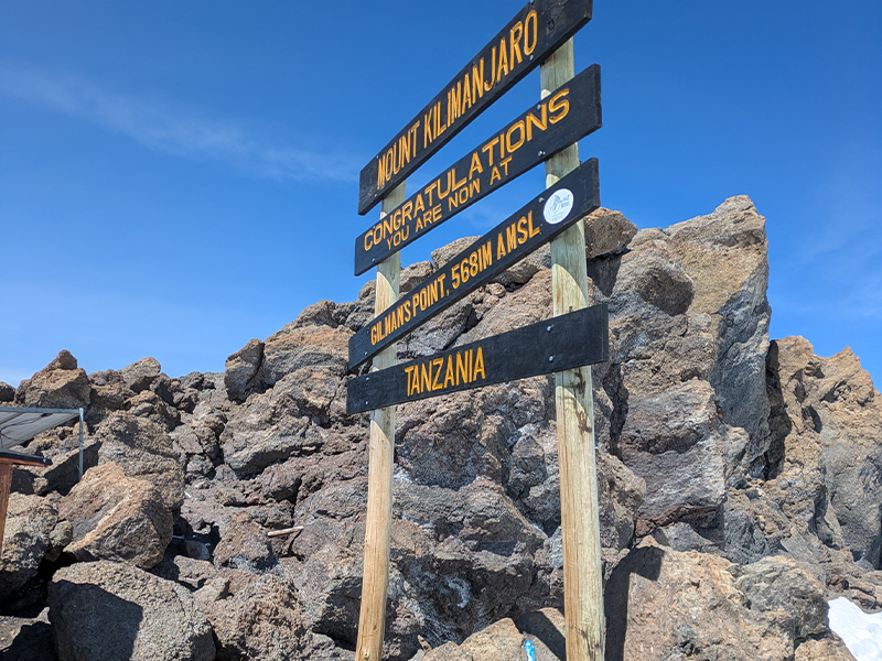
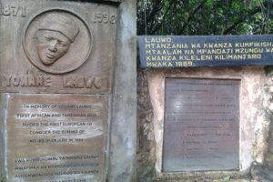
Gilman’s Point summit sign on Mount Kilimanjaro crater rim
Gilman’s Point marks one of Kilimanjaro’s recognized summit points on the rim of Kibo crater.

Table of Contents

Where Is Gilman’s Point on Kilimanjaro?

Gilman’s Point lies on the eastern rim of Kilimanjaro’s Kibo crater. It is the first major crater-rim marker reached by many climbers ascending via the Marangu Route or Rongai Route.
 
Reaching Gilman’s Point is a huge accomplishment because it means you have reached the crater rim after the steep overnight summit climb. From here, climbers who still have enough energy and safe conditions can continue toward Uhuru Peak, the highest point on Mount Kilimanjaro.
 
The walk from Gilman’s Point to Uhuru Peak usually takes around 1.5 to 2 hours, depending on pace, weather, trail conditions, and how well your body is handling the altitude.
 
These routes approach the summit differently, so if you are still choosing your trail, compare them in our Kilimanjaro Routes Guide.

Who Was Gilman?

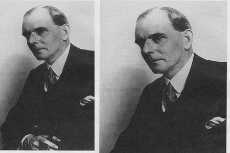
Gilman’s Point is named after Clement Gillman, a British geographer, civil engineer, and surveyor who carried out mapping and survey work in East Africa during the early 20th century.
 
His work helped document the physical geography, routes, and terrain of the region, including areas around Mount Kilimanjaro. Although he was not the first person to climb Kilimanjaro, his name became connected with one of the mountain’s important crater-rim landmarks.
 
One detail often confuses climbers: the place is commonly spelled Gilman’s Point, while the historical surname is often written Gillman. For the Kilimanjaro location, use Gilman’s Point.
 
For more Kilimanjaro history, read the story of Hans Meyer and the first Kilimanjaro ascent in 1889.
 
Historical names on Kilimanjaro can be confusing because many landmarks were recorded during the colonial mapping period, and spellings were not always used consistently across maps, guidebooks, and local references.

Portrait of Clement Gillman British geographer and surveyor
Clement Gillman was connected with early mapping and geographic study in East Africa.

Why Does Gilman’s Point Matter?

Gilman’s Point matters because it is one of Kilimanjaro’s recognized crater-rim summit points. For climbers on the Marangu or Rongai Route, reaching this point means they have completed the steepest and most exhausting part of summit night.
 
Gilman’s Point is not a separate mountain peak. It is a named point on the crater rim of Kibo, Kilimanjaro’s highest volcanic cone.
 
For many climbers, Gilman’s Point represents:
  • The first major crater-rim milestone before Uhuru Peak
  • A major psychological victory after hours of climbing in darkness
  • A recognized Kilimanjaro summit point
  • A place where climbers may receive a summit certificate
  • A decision point before continuing toward Uhuru Peak
This is also where guides carefully assess each climber’s condition. If someone is too exhausted, showing altitude symptoms, or moving too slowly, stopping at Gilman’s Point may be the safer decision.

Gilman’s Point vs. Uhuru Peak

Feature Gilman’s Point Uhuru Peak
Elevation 5,681 m / 18,638 ft 5,895 m / 19,341 ft
Location Eastern rim of Kibo crater Highest point on Kilimanjaro
Common routes Marangu Route and Rongai Route Final goal for most Kilimanjaro routes
Meaning Recognized crater-rim summit point True highest summit of Mount Kilimanjaro
Certificate Summit certificate usually awarded Full summit certificate awarded
Time from Gilman’s Point Starting point on the crater rim Usually 1.5 to 2 hours farther

Gilman’s Point vs Stella Point

Gilman’s Point and Stella Point are both important crater-rim landmarks on Mount Kilimanjaro, but they are reached from different summit approaches.
 
Gilman’s Point is most commonly reached by climbers using the Marangu Route or Rongai Route. Stella Point is more commonly reached by climbers coming from routes such as Machame, Lemosho, and Umbwe.
 
Both points are major achievements, but neither is the highest point on Kilimanjaro. Uhuru Peak remains the true summit of the mountain.
 
To understand the other major crater-rim landmark, read our guide to Stella Point on Kilimanjaro.
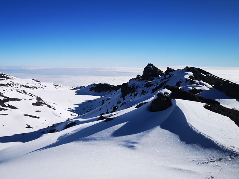
Snow-covered crater rim view from Gilman’s Point on Mount Kilimanjaro
From Gilman’s Point, climbers continue along Kilimanjaro’s crater rim toward Uhuru Peak.

Did You Know?

The final push to Gilman’s Point is often done at night. Summit attempts usually begin around midnight so climbers can reach the crater rim near sunrise.

This section is one of the toughest parts of the Marangu Route because climbers move slowly through cold temperatures, thin air, and loose volcanic scree.

At sunrise, Gilman’s Point can offer dramatic views across the crater rim, the clouds below, and the distant landscape toward Kenya. It is one of three famous summit markers on Kilimanjaro, along with Stella Point and Uhuru Peak.

If you want to understand why summit night feels so demanding, read How Hard Is Kilimanjaro?

Frequently Asked Questions About Gilman’s Point

What is Gilman’s Point on Mount Kilimanjaro?

Gilman’s Point is one of Mount Kilimanjaro’s recognized summit markers. It is located on the eastern rim of Kibo crater at about 5,681 meters, or 18,638 feet. Climbers who reach this point have reached the crater rim and are close to the final summit route toward Uhuru Peak.

Is Gilman’s Point the summit of Mount Kilimanjaro?

Gilman’s Point is a recognized crater-rim summit point, but it is not the highest point on Mount Kilimanjaro. The true summit is Uhuru Peak, which stands at 5,895 meters, or 19,341 feet. From Gilman’s Point, it usually takes 1.5 to 2 hours to reach Uhuru Peak.

Which Kilimanjaro routes reach Gilman’s Point?

Gilman’s Point is most commonly reached by climbers using the Marangu Route and Rongai Route. These routes approach the crater rim from the eastern side before climbers continue toward Uhuru Peak.

How difficult is the climb to Gilman’s Point?

The climb to Gilman’s Point is difficult because it usually happens during summit night in cold, dark, high-altitude conditions. Climbers ascend steep volcanic scree from Kibo Hut while dealing with fatigue, thin air, and freezing temperatures.

Do you get a summit certificate at Gilman’s Point?

Yes. Climbers who reach Gilman’s Point usually receive an official Kilimanjaro summit certificate. However, Uhuru Peak is the highest point on the mountain and is considered the main summit goal for most climbers.

Reaching Gilman’s Point: What It Means for Your Summit

Reaching Gilman’s PoGilman’s Point may not be the highest point on Kilimanjaro, but it is still a powerful achievement. After hours of climbing through darkness, cold, and thin air, reaching the crater rim is a major physical and emotional milestone.

For some climbers, Gilman’s Point is the safest stopping point. For others, it becomes the final push before continuing along the crater rim toward Uhuru Peak. Either way, standing at Gilman’s Point means you have reached one of Kilimanjaro’s most important historic summit landmarks.

To understand the meaning of Kilimanjaro’s highest summit, read how Uhuru Peak got its name after Tanzania’s independence.

Plan Your Kilimanjaro Climb with Kili Quests

If you are planning to climb via the Marangu Route or Rongai Route, Gilman’s Point will be one of the most important landmarks on your summit journey.
 
With Kili Quests, you climb with experienced local guides who understand the route, the altitude, the summit pace, and the stories behind Kilimanjaro’s famous landmarks.
 
Contact us today to start planning your Kilimanjaro climb.

Related Articles

Rongai Route Kilimanjaro: 6–7 Day Itinerary, Difficulty & Cost

Plan Your Rongai Route Climb

The Rongai Route offers a quiet, steady path to the summit.
Get expert advice and a personalized quote for your climb.

Kilimanjaro Planning Guides

Choosing the right route is just the start. Explore these key guides:

OUR CATEGORIES

Rongai Route Kilimanjaro: 6–7 Day Itinerary, Difficulty & Cost

Rongai Route Kilimanjaro: Quiet Northern Trail from the North

 The Rongai Route is the only Kilimanjaro trail that approaches the mountain from the north, near the Kenya–Tanzania border. It is known for being quieter and drier than the southern routes, making it a strong choice for climbers who want a more peaceful trekking experience.

Rongai offers a steady ascent, remote wilderness, wide views, and dramatic scenery around Mawenzi Peak. It is not as lush or varied as Lemosho or Machame, but it gives climbers a quieter side of Kilimanjaro that many people never see.
The route is usually climbed in 6 or 7 days, with the 7-day itinerary offering a better acclimatization profile. If you want a less crowded trail with a gradual approach and a different Kilimanjaro experience, Rongai is worth considering.
 
For a full route comparison, see our Kilimanjaro Routes Comparison guide.

Quick Answer: Is the Rongai Route a Good Kilimanjaro Route?

Yes, the Rongai Route is a good Kilimanjaro route for climbers who want a quieter, drier, and more gradual trail from the northern side of the mountain. It is usually climbed in 6 or 7 days, with the 7-day version recommended for better acclimatization.
 
Rongai is best for climbers who prefer fewer crowds, remote scenery, and a steady approach. It is less dramatic than Lemosho or Machame in terms of scenery, but it offers excellent views of Mawenzi Peak and a peaceful wilderness feel.
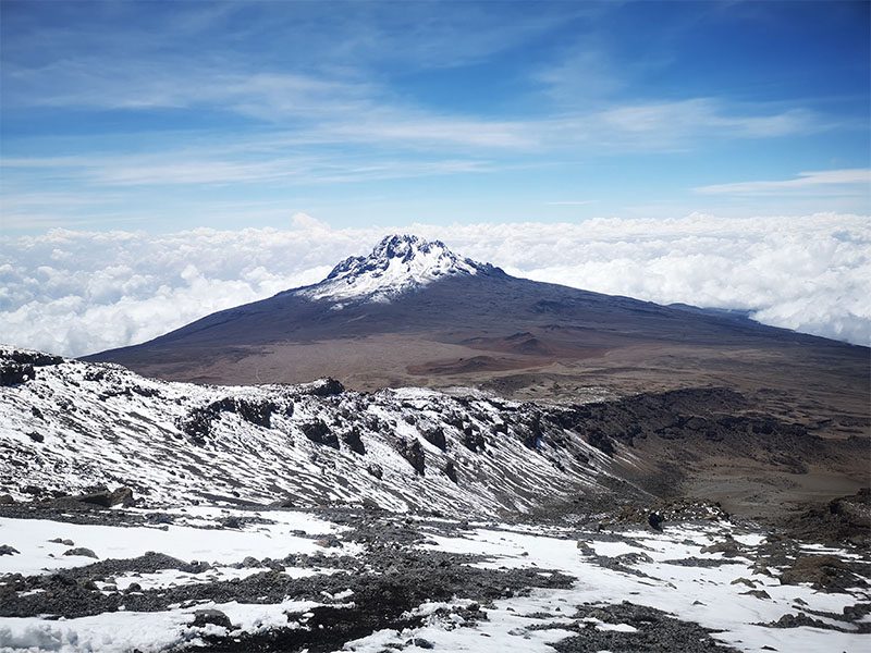
View of Mawenzi Peak from Stella Point on Mount Kilimanjaro
Mawenzi Peak views are one of the highlights of the Rongai Route near the summit zone.

Table of Contents

Why the Rongai Route Is Unique on Kilimanjaro

The Rongai Route is unique because it is the only official Kilimanjaro route that starts from the northern side of the mountain. Most other routes begin from the south or west, where rainfall is higher and trails are busier.
 
Because Rongai approaches from the drier northern side, it can be a strong option during wetter months. The trail also feels quieter and more remote, especially in the early stages near Simba Camp, Second Cave, and Kikelewa.
 
Another unique feature is the descent. Climbers ascend from the north but usually descend through the Marangu Route, giving them two different sides of Kilimanjaro in one trek.

Rongai Route Overview

Feature Rongai Route Details
Typical duration 6 to 7 days
Distance About 73 km / 45 miles
Starting point Rongai Gate, northern Kilimanjaro
Exit point Marangu Gate
Highest point Uhuru Peak, 5,895 m / 19,341 ft
Difficulty Moderate, with altitude still the main challenge
Best for Quiet trails, dry conditions, remote scenery, and steady ascent
Recommended option 7-day Rongai for better acclimatization
Not sure if Rongai is the right route for you? Compare all options in our Kilimanjaro Routes Comparison guide.

Rongai Route Days and Elevation Profile

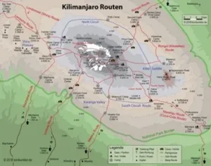
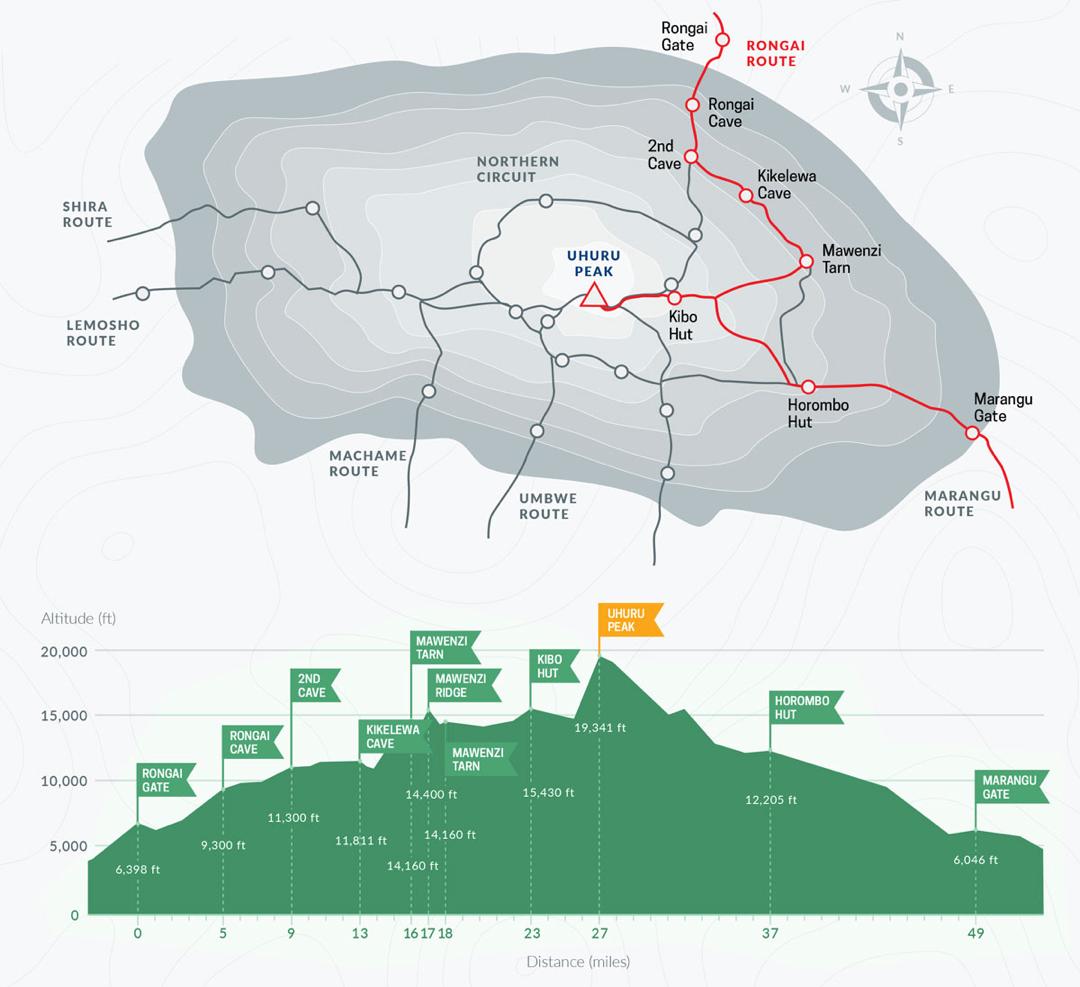
Rongai Route map showing camps and elevation profile on Kilimanjaro
The Rongai Route approaches Kilimanjaro from the quieter northern side before descending through Marangu.

Who Is the Rongai Route Best For?

The Rongai Route is best for climbers who want a quieter Kilimanjaro experience with fewer crowds, a drier northern approach, and a steady trail profile.
 
It is a good choice for:
  • First-time climbers who want a less crowded route
  • Trekkers climbing during wetter months
  • Climbers who prefer remote wilderness over busy camps
  • People who want strong views of Mawenzi Peak
  • Trekkers who are comfortable choosing a 7-day itinerary for better acclimatization
Rongai is not the best choice if you want the most dramatic scenery or the strongest acclimatization profile. In that case, Lemosho or Northern Circuit may be better.

7-Day Rongai Route Itinerary

The 7-day Rongai Route is the better choice for most climbers because it gives more time for acclimatization than the shorter 6-day version. The route starts at Rongai Gate, passes through Simba Camp, Second Cave, Kikelewa, Mawenzi Tarn, and Kibo Hut, then descends through the Marangu Route after summit day.
 
Below is the typical 7-day Rongai itinerary.

Day 1: Rongai Gate to Simba Camp

  • Altitude: 2,000 m to 2,625 m
  • Time: 4–5 hours
  • Gentle hike through forest zone
Your adventure begins on the quiet northern side of Kilimanjaro at Rongai Gate, near the Kenya border. After registration, you’ll start a gentle hike through farmland and pine forest.
This section is relatively easy and allows your body to begin adjusting gradually. Wildlife sightings such as colobus monkeys are sometimes possible.You’ll arrive at Simba Camp in the afternoon, where you’ll enjoy your first night on the mountain.

Day 2: Simba Camp to Second Cave Camp

  • Altitude: 2,625 m to 3,450 m
  • Time: 5–6 hours
  • Beautiful views of Kibo and wilderness trail
The trail leaves the forest behind and enters the moorland zone, offering wide open views of Kibo Peak. The path remains steady and not too steep, making it a comfortable trekking day.As you gain altitude, you’ll begin to feel the effects of thinner air, so it’s important to maintain a slow, steady pace.Second Cave Camp provides a scenic and less crowded overnight stop.

Day 3: Second Cave to Kikelewa Camp

  • Altitude: 3,450 m to 3,600 m
  • Time: 4 hours
  • Scenic moorland terrain with fewer climbers
This is a shorter trekking day designed to support acclimatization. The trail becomes quieter and more remote, with fewer climbers compared to southern routes.You’ll hike across rolling moorland terrain with beautiful views of Mawenzi Peak, one of Kilimanjaro’s three volcanic cones.Kikelewa Camp is set in a sheltered valley, offering a peaceful atmosphere for rest and recovery.

Day 4: Kikelewa to Mawenzi Tarn Camp

  • Altitude: 3,600 m to 4,330 m
  • Time: 4–5 hours
  • Camp beneath rugged Mawenzi Peak
Today’s trek is steeper but rewarding, as you climb toward Mawenzi Tarn, one of the most scenic camps on Kilimanjaro.The camp sits beneath the dramatic spires of Mawenzi Peak, providing incredible views and a true high-altitude environment.This is an important acclimatization day, allowing your body to adjust before moving higher.

Day 5: Mawenzi Tarn to Kibo Hut

  • Altitude: 4,330 m to 4,700 m
  • Time: 4–5 hours
  • Final staging point before summit night
The landscape changes dramatically as you enter the alpine desert zone. Vegetation disappears, and the terrain becomes dry and rugged.The hike is steady but feels more demanding due to the altitude. You’ll arrive at Kibo Hut, the final base camp before your summit attempt.After an early dinner, you’ll rest for a few hours before beginning the summit push around midnight.

Day 6: Kibo Hut to Uhuru Peak, descend to Horombo Hut

  • Altitude: 4,700 m to 5,895 m (summit), then down to 3,720 m
  • Time: 12–14 hours
  • Overnight climb, summit at sunrise, long descent
This is the most challenging and rewarding day of the climb. You’ll start your summit attempt in the early hours of the morning, trekking slowly in the dark toward Gillman’s Point and Stella Point.From there, it’s a final push to Uhuru Peak — the highest point in Africa. Reaching the summit at sunrise is an unforgettable experience.After celebrating, you’ll descend back to Kibo Hut briefly, then continue down to Horombo Hut for rest.

Day 7: Horombo Hut to Marangu Gate

  • Altitude: 3,720 m to 1,870 m
  • Time: 5–6 hours
  • Final descent through forest and receive certificate
Your final day is a long but steady descent through moorland and forest zones. As you reach lower altitudes, the air becomes richer in oxygen, making the hike feel easier.At Marangu Gate, you’ll receive your summit certificate and celebrate the successful completion of your Kilimanjaro climb.
 
Choosing a longer itinerary like this significantly improves your chances of reaching the summit. Learn more about Kilimanjaro success rates and why Kilimanjaro climb duration plays a key role in summit success.

6-Day vs 7-Day Rongai Route: Which Is Better?

The Rongai Route can be climbed in either 6 or 7 days, but the 7-day itinerary is usually the better choice for acclimatization and comfort.
 
The 6-day version is shorter and may cost less, but it gives your body less time to adjust to altitude. The 7-day version adds more breathing room and creates a steadier climb profile, especially for first-time Kilimanjaro climbers.
Option Best For Main Consideration
6-Day Rongai Route Climbers with limited time and strong fitness Faster ascent with less acclimatization time
7-Day Rongai Route Most climbers, especially first-time Kilimanjaro trekkers Better acclimatization and a more comfortable pace
For most climbers, we recommend the 7-day Rongai Route because the extra day supports a safer and more comfortable climb.

Rongai Route Difficulty and Acclimatization

The Rongai Route is considered moderately difficult. The trail is not technical, and it is generally less steep than routes such as Machame, but it still reaches the same summit: Uhuru Peak at 5,895 meters.
 
The main challenge is altitude. Even though Rongai has a steady ascent profile, climbers still need enough time for the body to adjust. The 7-day itinerary is better than the 6-day version because it gives more time for acclimatization before summit night.
 
Rongai can be a good option for first-time climbers who want a quieter trail and a more gradual approach. However, it does not offer as many natural “climb high, sleep low” opportunities as some other routes, so pacing and guide support are very important.
 
For a deeper explanation of the challenge, read How Difficult Is Kilimanjaro? You can also read our guide on How to Acclimatize on Kilimanjaro before choosing your route.

Rongai Route Cost: What Affects the Price?

The cost of the Rongai Route depends on the number of days, group size, service level, park fees, crew support, transport, meals, camping equipment, and safety arrangements.
 
A 7-day Rongai climb usually costs more than a 6-day option because it requires an extra day of park fees, food, guide support, porter support, and camp logistics. However, the extra day can be worth it because it gives climbers more time to acclimatize.
 
Do not choose Rongai only by the cheapest price. Very low prices can mean weaker safety support, rushed itineraries, poor crew treatment, or missing services. A responsible Kilimanjaro climb should include experienced guides, proper meals, fair porter support, emergency planning, and clear inclusions.
 
For a full price breakdown, read our main guide to Kilimanjaro Climb Cost.

Best Time to Climb the Rongai Route

The Rongai Route is one of the better Kilimanjaro routes during wetter months because it approaches the mountain from the drier northern side. This does not mean it never rains, but conditions are often less wet than on the southern slopes.

The best times to climb Rongai are usually:

  • January to early March: warmer conditions and good visibility
  • June to October: drier weather and popular trekking months
  • November or wetter shoulder periods: Rongai can be a better option than some southern routes because of its drier northern approach

If you want the most stable weather, choose the main dry seasons. If you want fewer crowds and are comfortable with possible rain, Rongai can still be considered outside peak months.

For a full seasonal breakdown, read Best Time to Climb Kilimanjaro.
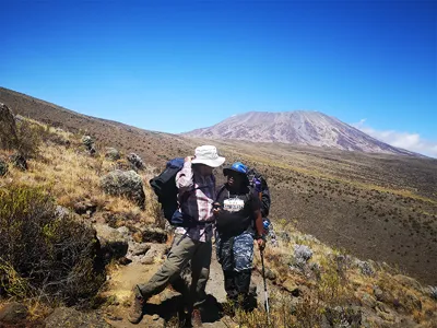
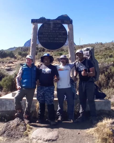
Trekkers at Kikelewa Camp on the Rongai Route with Mawenzi Peak in the distance
Kikelewa Camp offers peaceful moorland scenery and strong views toward Mawenzi Peak.

What Makes the Rongai Route Different?

Rongai is different from other Kilimanjaro routes because it gives climbers a quieter northern approach and a descent through the Marangu Route. This creates a different experience from routes that start and finish on the southern side.
 
Main differences include:
  • It is the only route that starts from northern Kilimanjaro
  • It is usually quieter than Machame and Marangu
  • It has a drier trail profile than southern routes
  • It offers strong views of Mawenzi Peak
  • It can be useful during wetter seasons
  • It descends through Marangu, giving climbers a different exit route
The trade-off is scenery. Rongai is beautiful, but it is generally less varied than Lemosho or Machame, especially in the early stages.

Is the Rongai Route Right for You?

The Rongai Route is a good choice if you want a quieter Kilimanjaro climb with fewer trekkers, drier conditions, and a gradual approach from the north.

Rongai may be right for you if:
  • You want a peaceful trail with fewer crowds
  • You are climbing during a wetter season
  • You prefer a steady ascent profile
  • You like remote wilderness and open landscapes
  • You want strong views of Mawenzi Peak
  • You are considering a 7-day itinerary for better acclimatization
Rongai may not be the best choice if you want the most dramatic scenery, the strongest acclimatization profile, or a very social trail experience. In that case, Lemosho, Machame, or Northern Circuit may be better options.
 

Rongai Route Pros and Cons

Pros Cons
Quieter than many popular Kilimanjaro routes Less scenic variety than Lemosho or Machame
Drier northern approach, useful in wetter periods Fewer natural climb-high, sleep-low features than some routes
Gradual trail profile, especially comfortable on 7 days Long travel to the starting gate from Moshi or Arusha
Excellent Mawenzi Peak views Summit night is still demanding and should not be underestimated
Descends through Marangu, giving two route experiences Not ideal for climbers who want the most varied scenery
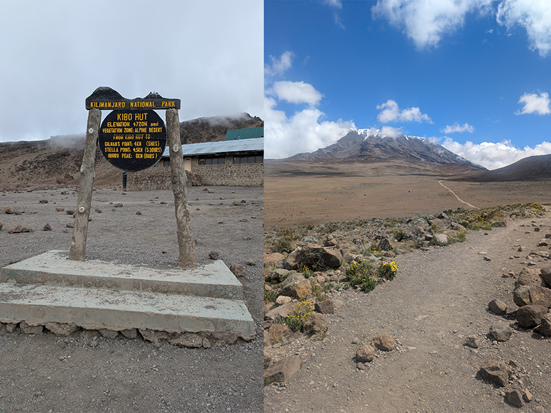
Kilimanjaro trekker walking through alpine desert near Kibo Hut on Rongai Route
The alpine desert near Kibo Hut marks the final stage before Rongai’s summit night.

Rongai vs Other Kilimanjaro Routes

Rongai is best understood by comparing it with the more popular Kilimanjaro routes.
 
  • Rongai vs Marangu: Rongai is quieter and starts from the north, while Marangu has hut accommodation and is often busier.
  • Rongai vs Machame: Machame is more scenic and social, while Rongai is quieter and drier.
  • Rongai vs Lemosho: Lemosho has more varied scenery and a stronger acclimatization profile, while Rongai offers solitude and a remote northern approach.
  • Rongai vs Northern Circuit: Northern Circuit is longer and has excellent acclimatization, while Rongai is shorter, quieter, and simpler.
If you are still unsure, compare all routes in our Kilimanjaro Routes Comparison guide.

What to Pack for the Rongai Route

Packing for Rongai is similar to other Kilimanjaro routes, but you should pay attention to dry, windy, and cold conditions as you move higher toward Mawenzi Tarn and Kibo Hut.
 
Important items include:
  • Warm layers for cold nights and summit day
  • Waterproof jacket and trousers
  • Broken-in hiking boots
  • Trekking poles for the descent
  • Sun protection for exposed sections
  • Warm gloves, hat, and neck gaiter
  • A good sleeping bag rated for cold conditions
  • A comfortable daypack for water, snacks, and extra layers
For the full gear checklist, read our Kilimanjaro Packing List.

Frequently Asked Questions About the Rongai Route

Is the Rongai Route difficult?

The Rongai Route is moderately difficult. It has a steady trail profile and is not technical, but altitude is still the main challenge. The 7-day itinerary is better for most climbers because it gives the body more time to adjust before summit night.

How many days does the Rongai Route take?

The Rongai Route usually takes 6 or 7 days. The 7-day itinerary is recommended for most climbers because it offers better acclimatization, a more comfortable pace, and a stronger summit profile than the shorter 6-day option.

Why choose the Rongai Route on Kilimanjaro?

Choose the Rongai Route if you want a quieter Kilimanjaro climb, a drier northern approach, remote scenery, strong Mawenzi Peak views, and fewer crowds than the busier southern routes.

Is the Rongai Route good during the rainy season?

Yes, Rongai can be a good option during wetter months because it approaches Kilimanjaro from the drier northern side. Rain is still possible, but the route is often less wet than southern approaches such as Machame, Umbwe, or Marangu.

Is Rongai better than Machame or Lemosho?

Rongai is better if you want a quieter and drier route with fewer trekkers. Machame and Lemosho are usually better if you want more scenic variety and stronger acclimatization features. For most climbers, the best choice depends on your travel dates, fitness, scenery preference, and how many days you can spend on the mountain.
 

Climb the Rongai Route With Kili Quests

The Rongai Route is a strong choice for climbers who want a quieter Kilimanjaro trail, a drier northern approach, and a steady 6–7 day route to the summit.
 
At Kili Quests, we recommend the 7-day Rongai itinerary for better acclimatization and a more comfortable pace. Our local guides help you plan the right route, prepare properly, and climb with safe support from the first day to the final descent.
 
Contact us today to plan your Rongai Route climb with Kili Quests.

Related Articles