Kilimanjaro Altitude Sickness: Symptoms & Causes

Climb Kilimanjaro Safely

Altitude is the biggest challenge on Kilimanjaro , but with the right preparation and expert guidance, you can reach the summit safely and confidently.

Choose Your Route

OUR CATEGORIES

Altitude Sickness on Kilimanjaro: What You Need to Know

Mount Kilimanjaro rises to 5,895 meters / 19,341 feet, where oxygen levels are much lower than at sea level. The climb does not require ropes or technical mountaineering skills, but altitude sickness is the biggest safety challenge most trekkers need to understand before climbing.

Altitude sickness can affect anyone. It does not matter if you are young, fit, experienced, or mentally strong. As you climb higher, your body must adjust to thinner air. If it does not adapt well enough, symptoms can appear and may become serious if ignored.

This guide explains altitude sickness on Kilimanjaro, including what causes it, early symptoms, serious danger signs, when descent may be needed, and how professional guides monitor climbers on the mountain. For a deeper prevention-focused guide, read How to Acclimatize on Kilimanjaro.

Quick Answer: How Serious Is Altitude Sickness on Kilimanjaro?
Altitude sickness is common on Kilimanjaro because climbers gain elevation quickly over several days. Mild symptoms such as headache, nausea, tiredness, poor sleep, or loss of appetite can happen as the body adjusts to altitude.
 
Mild symptoms do not always mean the climb is over, but they must be reported to your guide immediately. Serious symptoms such as confusion, loss of coordination, difficulty breathing at rest, or a worsening headache are dangerous and may require immediate descent.
 
The most important rule is simple: do not hide symptoms. Altitude sickness becomes more dangerous when climbers ignore early warning signs and continue climbing without telling their guide.
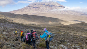
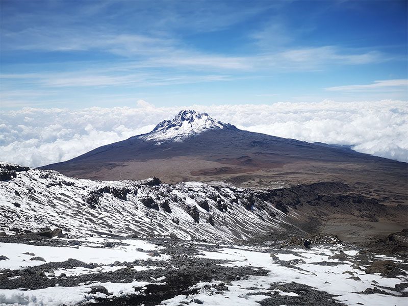
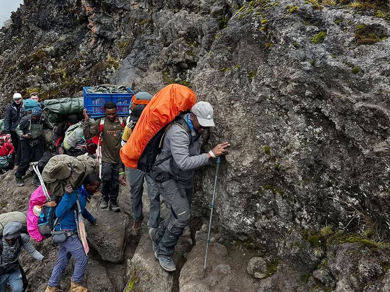
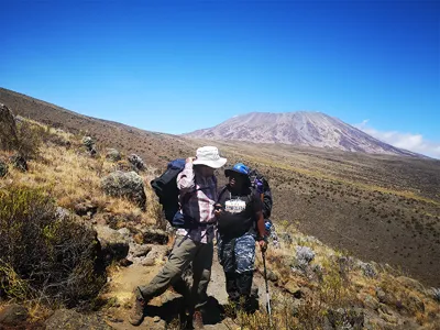
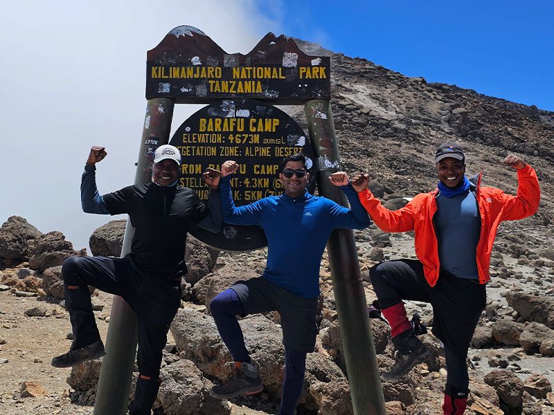
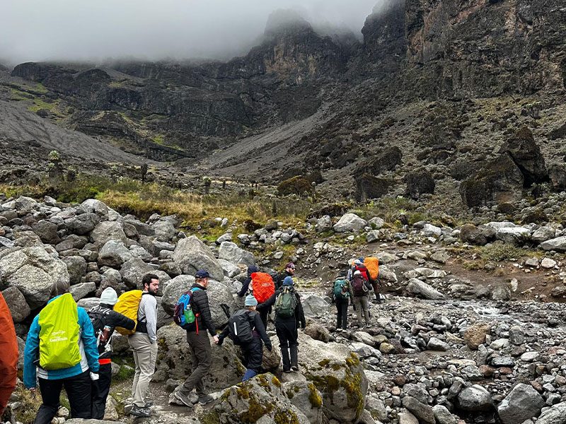
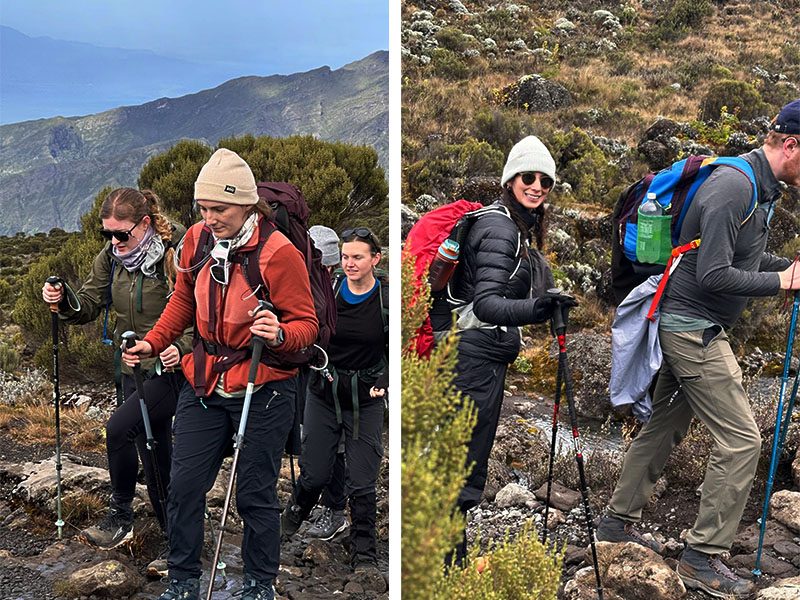
Tourists trekking on Mount Kilimanjaro at high altitude with guides | Kili Quests
Step by step — staying hydrated, steady, and supported helps you adapt as altitude increases.

Table of Contents

What Is Altitude Sickness?

Altitude sickness, also called Acute Mountain Sickness, happens when your body struggles to adjust to lower oxygen levels at high altitude. On Kilimanjaro, this risk increases as you climb through higher camps and approach the summit zone.

The condition can begin with mild symptoms, but it can become dangerous if symptoms worsen and the climber continues ascending. This is why altitude sickness should never be treated as normal tiredness. It is a safety issue that requires attention, monitoring, and honest communication with your guide.Altitude sickness exists in three main forms, each with increasing severity:
 
Proper acclimatization is the key to prevention, and you can learn more in our detailed guide on Kilimanjaro acclimatization strategies.

Types of Altitude Sickness on Kilimanjaro

Type of Altitude Sickness Severity Common Symptoms What It Means
Acute Mountain Sickness (AMS) Mild to moderate Headache, nausea, fatigue, dizziness, loss of appetite, and difficulty sleeping. The most common form of altitude sickness and an early warning sign that the body needs more time to adjust.
High Altitude Pulmonary Edema (HAPE) Serious Shortness of breath at rest, persistent cough, chest tightness, and extreme fatigue. A dangerous condition caused by fluid buildup in the lungs. Immediate descent and medical attention are required.
High Altitude Cerebral Edema (HACE) Medical emergency Severe headache, confusion, difficulty walking straight, slurred speech, and loss of coordination. The most severe form of altitude sickness, involving brain swelling due to lack of oxygen. Immediate descent is critical.

Acute Mountain Sickness (AMS)

This is the most common and mildest form of altitude sickness. Many climbers experience some level of AMS during their trek.
Typical symptoms include:
  • Headache
  • Nausea or vomiting
  • Fatigue or weakness
  • Dizziness
  • Loss of appetite
  • Difficulty sleeping
While AMS is usually manageable, it should never be ignored. Early symptoms are your body’s warning signs that you need to slow down and allow more time to adjust.
 

High Altitude Pulmonary Edema (HAPE)

HAPE is a serious and potentially life-threatening condition caused by fluid buildup in the lungs. It can develop if altitude sickness is not properly managed.
Symptoms may include:
  • Shortness of breath, even at rest
  • Persistent cough (sometimes with fluid)
  • Tightness in the chest
  • Extreme fatigue
HAPE requires immediate descent and medical attention. It is one of the most dangerous altitude-related conditions on the mountain.

High Altitude Cerebral Edema (HACE)

HACE is the most severe form of altitude sickness and involves swelling of the brain due to lack of oxygen.
Symptoms may include:
  • Severe headache
  • Confusion or disorientation
  • Difficulty walking in a straight line (ataxia)
  • Slurred speech
  • Loss of coordination
HACE is a medical emergency. Immediate descent is critical, and delays can be life-threatening.

Why Does Altitude Sickness Happen on Kilimanjaro?

One of the main reasons altitude sickness is common on Kilimanjaro is the speed of the ascent.Within just a few days, climbers go from below 2,000 meters to nearly 6,000 meters. This rapid gain in elevation does not give the body enough time to adapt naturally to lower oxygen levels.At high altitude, your body must work harder to function. Your breathing rate increases, your heart works harder, and your body begins adjusting its oxygen use. Without enough time to adapt, symptoms of altitude sickness can develop.
Several factors can increase your risk:
  • Climbing too quickly without proper acclimatization
  • Not drinking enough water
  • Skipping rest or acclimatization days
  • Ignoring early warning signs
  • Poor pacing during the climb

Understanding these factors helps you make better decisions and reduce your risk.

Choosing the right itinerary plays a major role, as explained in our Kilimanjaro routes comparison guide, where different routes offer different acclimatization profiles.

Common Symptoms to Watch For

Recognizing symptoms early is one of the most important parts of staying safe on Kilimanjaro.

Early Symptoms of AMS

Early symptoms are usually mild but should be taken seriously. These include:
  • Headache
  • Nausea or vomiting
  • Loss of appetite
  • Dizziness
  • Fatigue or unusual weakness
  • Poor or disturbed sleep
These symptoms often appear as you gain altitude and may improve with rest, hydration, and proper pacing.

Severe Symptoms (HAPE and HACE)

More serious symptoms indicate a dangerous level of altitude sickness and require immediate action.
These may include:
  • Shortness of breath even while resting
  • Persistent cough or chest tightness
  • Difficulty walking in a straight line (ataxia)
  • Confusion or unusual behavior
  • Slurred speech
If these symptoms appear or worsen, the only safe and effective treatment is immediate descent to a lower altitude.

How Common Is Altitude Sickness on Kilimanjaro

Altitude sickness is one of the most common challenges on Kilimanjaro because the summit is very high and the ascent happens within a limited number of days. Many climbers experience mild symptoms such as headache, tiredness, poor sleep, or reduced appetite at some point during the trek.

Mild symptoms are not unusual, but they must be watched carefully. The danger comes when symptoms get worse, when a climber hides how they feel, or when the group continues ascending despite warning signs.
 
Severe altitude sickness is less common, but it is serious. Conditions such as HAPE and HACE can become life-threatening if descent is delayed. This is why experienced guides monitor climbers daily and make safety decisions based on symptoms, oxygen levels, walking condition, and overall behavior.
 
The risk depends on several factors, including route length, ascent speed, pacing, hydration, previous altitude exposure, and how quickly symptoms are reported.

When Should a Climber Descend on Kilimanjaro?

Descent may be necessary when altitude sickness symptoms become severe or continue to worsen despite rest and support. On Kilimanjaro, the safest response to serious altitude illness is to go lower, because lower altitude gives the body more oxygen and can prevent the condition from becoming life-threatening.
 
You should alert your guide immediately if you experience:
  • Severe headache that does not improve
  • Confusion or unusual behavior
  • Difficulty walking in a straight line
  • Loss of coordination
  • Shortness of breath while resting
  • Persistent cough or chest tightness
  • Worsening nausea or vomiting
  • Extreme weakness that makes walking difficult
Immediate descent is the most important treatment for serious altitude sickness. Medication, oxygen, or rest may help in some situations, but they should not be used to delay descent when danger signs are present.
 
This is why climbers should never hide symptoms to “push through.” Summit success is not more important than safety.

Who Is Most at Risk of Altitude Sickness?

Altitude sickness does not discriminate. It can affect anyone, including experienced hikers and physically fit individuals.However, certain factors can increase your risk:
  • Having no previous experience above 3,000 meters
  • Ascending too quickly without enough acclimatization
  • Poor hydration during the climb
  • Ignoring early symptoms and continuing to ascend
It is important to understand that fitness alone does not protect you from altitude sickness. The key to prevention is proper pacing, acclimatization, and listening to your body.

What to Do If You Experience Altitude Sickness Symptoms

Even with good preparation, some climbers may experience mild symptoms of altitude sickness. The key is to respond quickly and appropriately.
 
The first step is always to tell your guide honestly how you feel. Do not wait until symptoms become severe, and do not pretend you are fine because you want to continue climbing.
 
If symptoms are mild, your guide may recommend:
  • Slowing the pace
  • Resting and monitoring symptoms
  • Drinking water regularly
  • Eating even if appetite is low
  • Avoiding further unnecessary exertion
  • Checking oxygen levels and general condition
  • Adjusting the next stage if needed
Medication should only be used under proper medical advice or guide protocol.

If Symptoms Are Mild

Mild symptoms may include headaches, slight dizziness, or fatigue. These are common and do not necessarily mean you need to stop your climb.
In this situation, you should:
  • Inform your guide immediately
  • Rest and allow your body to recover
  • Drink more water
  • Take medication if recommended
  • Adjust your pace or shorten the next day’s hike

Early communication with your guide is critical, as they can monitor your condition and decide the best course of action.

If Symptoms Become Severe
If symptoms worsen  such as intense headaches, nausea, confusion, or difficulty breathing  immediate action is required.The only effective treatment for serious altitude sickness is descent.Descending to a lower altitude allows your body to recover and prevents the condition from becoming life-threatening. This is why experienced guides closely monitor climbers and make safety decisions when necessary.
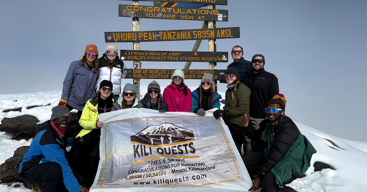
Happy tourist walking along a high-altitude trail on Kilimanjaro with a smile and trekking gear | Kili Quests
High spirits at high altitude — staying positive, prepared, and well-guided makes all the difference.

The Role of Professional Guides in Altitude Safety
Climbing Kilimanjaro with experienced guides is one of the most important safety decisions you can make. A good guide does more than lead the trail. They monitor your pace, observe your symptoms, check your condition, and make decisions when altitude becomes a concern.
 
At Kili Quests, safety is treated seriously throughout the climb. Our guides monitor climbers daily, including oxygen saturation, pulse, walking condition, appetite, sleep quality, and visible symptoms. This helps the team identify problems early instead of waiting until symptoms become dangerous.
 
If a climber shows signs of serious altitude sickness, the guide’s priority is safety, not summit pressure. This may mean slowing the pace, stopping further ascent, using emergency oxygen if needed, or arranging descent to a lower altitude.
 
They are trained to recognize early signs of altitude sickness and take action before the situation becomes serious.This may include adjusting your pace, recommending rest, or organizing a descent if necessary. Having a knowledgeable and experienced team around you makes a significant difference in both safety and success.
 
Choosing a professional operator is just as important as preparation, which is why many climbers explore our Kilimanjaro climbing packages for a complete guided experience.
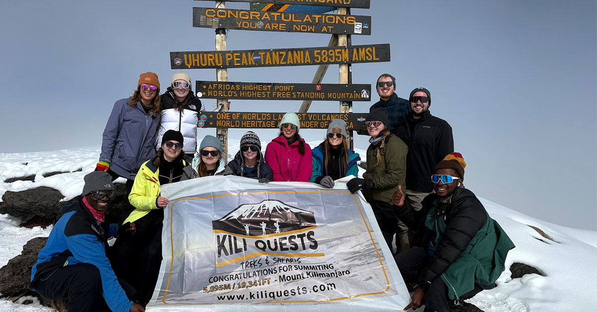
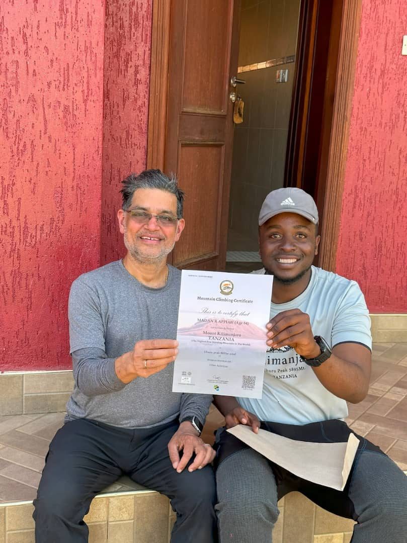
Group of trekkers celebrating together at Uhuru Peak, the summit of Mount Kilimanjaro
With the right pace and preparation, reaching the summit is not just possible — it’s unforgettable.

How to Reduce the Risk of Altitude Sickness

You cannot fully guarantee that altitude sickness will not happen, but you can reduce the risk by making smart choices before and during the climb.
The most important steps are:
  • Choose a route with enough acclimatization time
  • Walk slowly from the first day
  • Drink water regularly
  • Eat enough food, even when appetite drops
  • Avoid rushing to camp
  • Tell your guide immediately when symptoms appear
  • Do not ignore headaches, nausea, dizziness, or unusual fatigue
This article focuses on symptoms and safety response. For a full prevention guide covering pacing, route choice, climb-high-sleep-low strategy, and acclimatization days, read How to  Acclimatize on Mount Kilimanjaro.

Do You Need Oxygen for Kilimanjaro Altitude Sickness?

Most climbers do not use supplemental oxygen as part of a normal Kilimanjaro climb. Kilimanjaro is usually climbed through gradual acclimatization, slow pacing, and proper guide monitoring.
 
However, emergency oxygen is important for safety. It may be used if a climber develops serious altitude symptoms and needs support during descent or emergency response. Oxygen can help stabilize a climber temporarily, but it is not a replacement for descent when symptoms are severe.
 
If breathing difficulty, confusion, loss of coordination, or severe weakness appears, the priority is to go lower as quickly and safely as possible under guide supervision.

Should You Take Diamox for Kilimanjaro?

Some climbers use Diamox to help with altitude adjustment, but it should only be taken after speaking with a doctor before the trip. It is not a guarantee against altitude sickness, and it does not replace proper acclimatization, slow pacing, hydration, or guide monitoring.
 
If you plan to use Diamox, discuss it with a qualified medical professional before traveling to Tanzania. You should understand the dosage, timing, possible side effects, and whether it is safe for your personal health situation.
 
Do not start medication on the mountain without proper advice unless it is part of an agreed medical plan or emergency protocol.

Frequently Asked Questions About Altitude Sickness on Kilimanjaro

How can you reduce the risk of altitude sickness on Kilimanjaro?

You can reduce the risk by choosing a route with enough days, walking slowly, staying hydrated, eating properly, and reporting symptoms early. However, altitude sickness cannot be fully guaranteed away because every body reacts differently to high altitude.
 
The best approach is to climb with enough acclimatization time, follow your guide’s pace, and avoid rushing the mountain. For a full prevention strategy, read How to Acclimatize on Kilimanjaro.

Can physically fit people still get altitude sickness?

Yes, physical fitness does not protect you from altitude sickness. This is one of the most misunderstood aspects of climbing Kilimanjaro.Altitude sickness is caused by reduced oxygen levels at high elevation, not by a lack of strength or endurance. Even highly trained athletes can develop symptoms if they ascend too quickly or do not acclimatize properly.In some cases, very fit individuals are actually at higher risk because they may walk faster than recommended, pushing their bodies too quickly to higher altitudes. On Kilimanjaro, success is not about speed  it is about pacing, patience, and allowing your body time to adjust.

How can you effectively prevent altitude sickness on Kilimanjaro?

Preventing altitude sickness requires a combination of preparation, smart decision-making, and discipline during the climb.The most effective strategies include choosing a longer route that allows for proper acclimatization, walking slowly at a steady pace, and staying well hydrated throughout the trek. Drinking enough water helps your body function efficiently at altitude and reduces the severity of symptoms.It is also important to eat regularly, even when your appetite decreases, as your body needs energy to adapt. Listening to your guide is equally critical, as experienced guides monitor your condition and can adjust your pace or schedule when needed.Preventing altitude sickness is not about one single action  it is about consistently following the right habits throughout the entire climb.

Which Kilimanjaro routes are best for avoiding altitude sickness?

Routes that allow more time for acclimatization are the best options for reducing the risk of altitude sickness.The Lemosho Route and Northern Circuit are widely considered the most effective because they include more days on the mountain and a gradual ascent profile. This gives your body the time it needs to adjust to decreasing oxygen levels.The Machame Route, when done over 7 days, is also a strong option, offering a good balance between duration and acclimatization.Shorter routes, such as the 5-day Marangu itinerary, are generally less effective because they involve a faster ascent and provide less time for the body to adapt.

What should you do if altitude sickness symptoms get worse?

If altitude sickness symptoms begin to worsen, it is essential to act quickly and take the situation seriously. Ignoring symptoms or continuing to climb can lead to more severe and potentially dangerous conditions.The most important step is to inform your guide immediately. Guides are trained to assess your condition and determine the best course of action. This may include resting, adjusting your pace, or stopping further ascent.If symptoms become severe  such as difficulty breathing, confusion, or loss of coordination  immediate descent to a lower altitude is necessary. Descent is the only effective treatment for serious altitude sickness and can quickly improve your condition.Taking early action is the key to staying safe on the mountain.

Climb Kilimanjaro With Safety-Focused Local Guides

Altitude sickness is the biggest safety concern on Kilimanjaro, but the right route, pace, monitoring, and guide team make a major difference. The goal is not only to reach the summit. The goal is to climb with a plan that respects altitude and protects your health.

At Kili Quests, our local guides support climbers with steady pacing, daily health checks, oxygen monitoring, emergency oxygen, proper mountain meals, and clear safety decisions when symptoms appear.

If you are worried about altitude, we can help you choose a route and itinerary that gives your body a better chance to adjust.

Contact Kili Quests today to plan a safer Kilimanjaro climb with experienced local guides.

Related Articles

First Ascent of Mount Kilimanjaro: Hans Meyer in 1889

Climb Kilimanjaro with Experts

Follow the path of the first explorers ,and reach the summit with a trusted local team.

Plan Your Climb

Prepare the right way before your Kilimanjaro adventure:

OUR CATEGORIES

Who Was Hans Meyer? The First Ascent of Kilimanjaro | Kili Quests

In 1889, German geographer Hans Meyer became one of the central figures in the first recorded successful ascent of Mount Kilimanjaro. Together with Austrian mountaineer Ludwig Purtscheller and support from local guides and porters, Meyer reached the summit of Kibo, the highest volcanic cone of Kilimanjaro.

Today, this summit is known as Uhuru Peak, the highest point in Africa at 5,895 meters / 19,341 feet.

This article explains who Hans Meyer was, how the 1889 ascent happened, why the climb became important in Kilimanjaro history, and why the story should also recognize the local support behind the expedition.

For the local guide story, read our full article about Yohani Kinyala Lauwo and Kilimanjaro’s first ascent.

Quick Answer: Who Was Hans Meyer?

Hans Meyer was a German geographer, explorer, and professor who became famous for his role in the first recorded successful ascent of Mount Kilimanjaro in 1889. He reached the summit with Austrian mountaineer Ludwig Purtscheller, supported by local guides, porters, and expedition crew.
 
His climb helped document Kilimanjaro’s geography, summit area, and volcanic structure for later explorers and climbers. However, the full story of the ascent should not ignore the local knowledge and support that made the expedition possible.
Year Event Why It Matters
1887 Hans Meyer made an earlier unsuccessful attempt on Kilimanjaro. This showed the difficulty of climbing Kibo before modern gear and support.
1889 Hans Meyer and Ludwig Purtscheller reached Kilimanjaro’s summit area. This became the first recorded successful ascent of Mount Kilimanjaro.
1961 The summit became associated with the name Uhuru Peak after Tanzania’s independence. The name reflects freedom and Tanzania’s national identity.
Hans Meyer Kilimanjaro first ascent plaque at Marangu Gate
Hans Meyer was the first European to reach the summit of Kilimanjaro in 1889. This historical plaque at the Marangu Gate Information Center honors his achievement and marks his contribution to the mountain’s climbing history.

Table of Contents

Who Was Hans Meyer?

Hans Meyer was a German geographer, mountaineer, and professor at the University of Leipzig. He became interested in Kilimanjaro during a period when European explorers were trying to study and document major mountains in East Africa.
 
Meyer made more than one attempt to climb Kilimanjaro before finally reaching the summit in October 1889. His success came through better planning, stronger expedition support, and help from Austrian mountaineer Ludwig Purtscheller and local mountain guides.
 
Meyer’s role is important because his expedition helped place Kilimanjaro into the written history of modern mountaineering. But Kilimanjaro was not “discovered” by Meyer. The mountain was already known, named, lived around, and understood by local communities long before European expeditions arrived.
 
To understand the mountain itself, read our guide to what Mount Kilimanjaro is and how it formed.
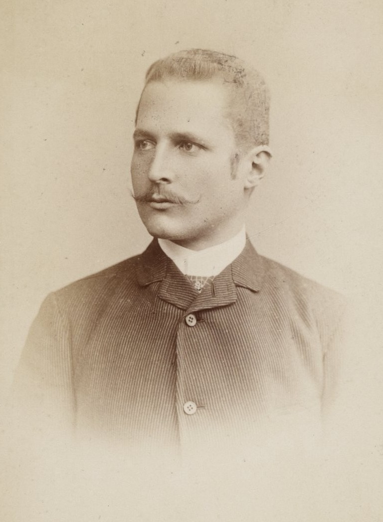
Portrait of Hans Meyer German geographer linked to Kilimanjaro first ascent
Hans Meyer, a German geographer, became the first documented person to reach Uhuru Peak on Mount Kilimanjaro in 1889, accompanied by Austrian climber Ludwig Purtscheller and a Chagga guide named Lauwo.
Portrait of Ludwig Purtscheller Austrian mountaineer Kilimanjaro 1889 ascent
Ludwig Purtscheller, an experienced Austrian mountaineer, reached the summit of Kilimanjaro with Hans Meyer and local guide Lauwo in 1889.

The First Successful Ascent of Kilimanjaro

Hans Meyer’s successful 1889 expedition included Austrian mountaineer Ludwig Purtscheller, local guides, porters, and support crew. Historical accounts commonly connect Yohani Kinyala Lauwo, a Chagga guide from the Kilimanjaro region, with the expedition’s local support.
 
On October 6, 1889, Meyer and Purtscheller reached the summit area of Kibo, Kilimanjaro’s highest volcanic cone. This became known as the first recorded successful ascent of Mount Kilimanjaro.
 
The climb was difficult because the team faced altitude, cold, ice, limited equipment, and the logistical challenge of moving supplies on a high mountain before modern trekking support existed.
 
For the full local guide story, read our dedicated article about Yohani Kinyala Lauwo and Kilimanjaro’s first ascent.
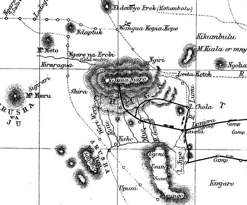
Hans Meyer 1889 map of Mount Kilimanjaro summit area
A look back in time — this 1990s Kilimanjaro map reflects how the mountain was explored, traveled, and understood decades ago.

What Made the Expedition Historic?

Meyer’s 1889 ascent was historic because it became the first recorded successful climb to Kilimanjaro’s highest summit. The expedition also helped document the mountain’s geography, crater area, ice, and summit landscape for later climbers and researchers.

The climb mattered because:
  • It confirmed a recorded route to Kilimanjaro’s highest summit
  • It helped document Kibo, the highest of Kilimanjaro’s volcanic cones
  • It showed the challenge of altitude, ice, and logistics on the mountain
  • It became a major event in East African exploration history
  • It helped shape Kilimanjaro’s later identity as a major climbing destination
Modern climbers have better equipment, trained guides, and safer logistics, but Kilimanjaro is still demanding. Read How Hard Is Kilimanjaro? to understand the challenge today.
Glacial snow and ice covering the crater rim of Mount Kilimanjaro during dry season ascent | Kili Quests
Kilimanjaro’s crater rim wrapped in snow and ancient ice — a glimpse into the mountain’s glacial past.
Dry, snowless crater rim of Mount Kilimanjaro showing volcanic rock and summit trail | Kili Quests
The exposed crater rim reveals Kilimanjaro’s raw volcanic structure — dramatic, vast, and wind-carved by time.

Naming the Summit Points

Kilimanjaro’s summit area has several famous names, including Gilman’s Point, Stella Point, and Uhuru Peak. These names reflect different periods of exploration, mapping, climbing history, and Tanzania’s national identity.
 
During the German colonial period, the highest summit was known as Kaiser-Wilhelm-Spitze. After Tanzania’s independence, the summit became known as Uhuru Peak, with “Uhuru” meaning freedom in Swahili.
 
Gilman’s Point is another historic crater-rim landmark, while Stella Point is one of the key summit markers reached by climbers from routes such as Machame, Lemosho, and Umbwe.
 
For more detail, read our guides to Gilman’s Point, Stella Point on Kilimanjaro, and Why Uhuru Peak Is Called Uhuru.

Meyer’s Legacy on Kilimanjaro

Hans Meyer’s legacy is tied to Kilimanjaro’s written climbing history, early geographic documentation, and the first recorded ascent of the mountain’s highest summit.

His expedition helped make Kilimanjaro known internationally as a major mountain objective. His maps, writings, and observations also contributed to how later climbers and researchers understood the mountain.

But Meyer’s legacy should be explained honestly. The 1889 ascent was not only the story of one European explorer. It also depended on Ludwig Purtscheller, local guides, porters, and mountain knowledge from the Kilimanjaro region.
1889 exploration map of Mount Kilimanjaro drawn by Hans Meyer, highlighting the early summit path and crater area | Kili Quests
A legacy etched in ink — Hans Meyer’s 1889 map captured Kilimanjaro’s summit long before modern routes existed.

Frequently Asked Questions About Hans Meyer and Kilimanjaro

Who was Hans Meyer?

Hans Meyer was a German geographer, mountaineer, and professor who became famous for his role in the first recorded successful ascent of Mount Kilimanjaro in 1889.

When was Mount Kilimanjaro first climbed?

The first recorded successful ascent of Mount Kilimanjaro took place in October 1889, when Hans Meyer and Ludwig Purtscheller reached the summit area of Kibo.

Did Hans Meyer climb Kilimanjaro alone?

No. Hans Meyer did not climb Kilimanjaro alone. He climbed with Austrian mountaineer Ludwig Purtscheller and relied on local guides, porters, and expedition support.

What was the original name of Uhuru Peak?

During the German colonial period, Kilimanjaro’s highest summit was known as Kaiser-Wilhelm-Spitze. Today, it is called Uhuru Peak, a name associated with Tanzania’s independence and freedom.

Why is Hans Meyer important in Kilimanjaro history?

Hans Meyer is important because his 1889 expedition became the first recorded successful ascent of Mount Kilimanjaro and helped document the mountain’s geography, summit area, and climbing history.

Who was the local guide in the first Kilimanjaro expedition?

The local guide who assisted Hans Meyer’s expedition was Yohani Kinyala Lauwo, a Chagga man from Marangu. His role in the climb is now widely recognized as an important part of Kilimanjaro’s history.
Interpretive sign at Kilimanjaro National Park showing historical profiles of Yohani Kinyala Lauwo, the first local guide of Mount Kilimanjaro, and Hans Meyer, the first recorded European to summit Kilimanjaro in 1889.
Informational sign at Kilimanjaro National Park honoring Yohani Kinyala Lauwo, the first local Kilimanjaro guide, and Hans Meyer, the first European summiteer in 1889. Their partnership marked the beginning of Kilimanjaro’s climbing history.

The Legacy of Kilimanjaro’s First Ascent

Hans Meyer’s first recorded successful climb of Mount Kilimanjaro was more than a mountaineering achievement. It became part of the mountain’s written history and helped shape how later generations understood Kibo, the crater rim, and the summit area.

But the story is stronger when it is told honestly. Meyer’s success depended not only on his ambition, but also on Ludwig Purtscheller, local guides, porters, and the mountain knowledge of people from the Kilimanjaro region.

Today, climbers follow safer routes with better equipment and experienced local guides, but the journey still carries the same sense of challenge, history, and achievement.

Plan Your Kilimanjaro Climb with Kili Quests

Kilimanjaro’s history gives the mountain deeper meaning, but reaching the summit today still requires preparation, pacing, acclimatization, and experienced support.
 
At Kili Quests, we guide climbers with local mountain knowledge, careful planning, and respect for the history behind Africa’s highest peak.
 
Contact us today to start planning your Kilimanjaro climb.

Related Articles

Yohani Kinyala Lauwo: Kilimanjaro’s First Local Guide

Climb with Local Experts

Follow in Lauwo’s footsteps with experienced Tanzanian guides.

Plan Your Climb

Start preparing for your Kilimanjaro adventure: 

OUR CATEGORIES

Who Was Yohani Kinyala Lauwo? Kilimanjaro’s Local Guide

When people talk about the first recorded ascent of Mount Kilimanjaro, they often mention Hans Meyer and Ludwig Purtscheller. But the story is not complete without Yohani Kinyala Lauwo, the local Chagga guide from Marangu who is remembered for his connection to the 1889 expedition.
 
Lauwo’s story matters because Kilimanjaro history is not only about European explorers. It is also about the local guides, porters, and mountain communities whose knowledge made early expeditions possible.
 
In this article, Kili Quests shares who Lauwo was, what role he played in Kilimanjaro’s first recorded ascent story, why his contribution was overlooked, and how his legacy continues through Tanzanian mountain guides today.
 
For the European expedition side of the story, read our guide to Hans Meyer and the first Kilimanjaro ascent in 1889.

Quick Answer: Who Was Yohani Kinyala Lauwo?

Yohani Kinyala Lauwo was a Chagga guide from the Marangu area of Mount Kilimanjaro. He is remembered for his connection to the first recorded successful ascent of Kilimanjaro in 1889, when Hans Meyer and Ludwig Purtscheller reached the summit with support from local guides, porters, and expedition crew.
 
Lauwo’s story highlights the local knowledge behind Kilimanjaro’s early climbing history. While European expedition leaders received most of the written recognition, local guides helped make mountain travel possible through route knowledge, strength, endurance, and familiarity with the land

A Note on Lauwo’s Historical Record

Lauwo is widely remembered in Kilimanjaro guiding history, but some details about his exact role, age, and participation are not recorded as clearly as the European expedition accounts.
 
A later centenary review of Kilimanjaro’s first ascent connected Yohani Kinyala Lauwo with Meyer and Purtscheller’s 1889 expedition, but the historical record also shows that some details were uncertain. That uncertainty is important to mention because local guides and porters were often under-recorded in colonial-era expedition history.
 
This does not make Lauwo’s story less important. It makes it more important to tell carefully, honestly, and with respect for the local people who helped shape Kilimanjaro guiding history.
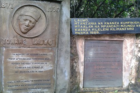
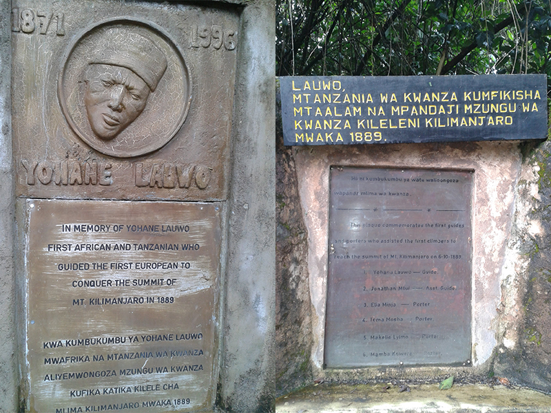
Memorial plaques honoring Yohane Lauwo, the first Tanzanian to guide a European to Kilimanjaro’s summit in 1889.
Yohane Lauwo is remembered as the first African and Tanzanian guide to summit Mount Kilimanjaro, assisting Hans Meyer in the historic 1889 expedition.

Table of Contents

Who Was Yohani Kinyala Lauwo?

Yohani Kinyala Lauwo was a local guide from Marangu, one of the historic gateway areas on the southeastern slopes of Mount Kilimanjaro.
 
He is commonly remembered as a Chagga guide connected to the 1889 first recorded ascent of Kilimanjaro. That expedition involved Hans Meyer, a German geographer, and Ludwig Purtscheller, an Austrian mountaineer, along with local guides, porters, and support crew.
 
Lauwo’s importance goes beyond one expedition. His story represents the local mountain knowledge, endurance, and guiding tradition that existed around Kilimanjaro long before the mountain became a global trekking destination.
 
Marangu remains one of Kilimanjaro’s most historic gateways, and today the Marangu Route is still one of the main trails to the summit.
 
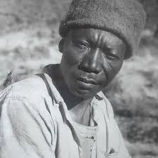
Portrait of Yohani Kinyala Lauwo, the first local Kilimanjaro guide and early Tanzanian mountain pioneer
Yohani Kinyala Lauwo – The legendary Chagga guide who led Hans Meyer to the summit of Kilimanjaro in 1889.
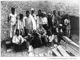
Historic 1889 Kilimanjaro expedition team with Hans Meyer and local guides including Yohani Kinyala Lauwo
1889 Kilimanjaro Expedition Team – Hans Meyer with Chagga porters and guides, including Yohani Lauwo, before the first summit of Uhuru Peak.
Portrait of Ludwig Purtscheller Austrian mountaineer Kilimanjaro 1889 ascent
Ludwig Purtscheller, an experienced Austrian mountaineer, reached the summit of Kilimanjaro with Hans Meyer and local guide Lauwo in 1889.
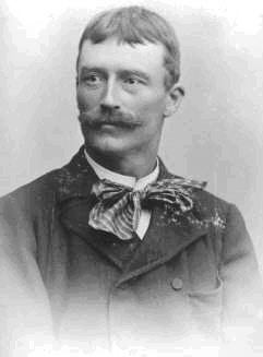
Portrait of Hans Meyer German geographer linked to Kilimanjaro first ascent
Hans Meyer led the first successful recorded expedition to the summit of Mount Kilimanjaro in 1889, marking a historic moment in mountaineering.

What Role Did Lauwo Play in the 1889 Ascent Story?

Lauwo is remembered for his connection to the expedition that reached Kilimanjaro’s summit in 1889. That climb is most commonly associated with Hans Meyer and Ludwig Purtscheller, but it also depended on local support.
 
Local guides and porters helped with:
  • Route knowledge through the lower mountain zones
  • Carrying supplies and expedition equipment
  • Moving through unfamiliar terrain
  • Supporting camp logistics
  • Helping the expedition continue in difficult mountain conditions
This is why Lauwo matters. The first recorded ascent was not only the achievement of European explorers. It was also made possible by local people who knew the mountain environment and supported the climb.
 
For the full European expedition story, read Hans Meyer and the first ascent of Kilimanjaro.
Person or Group Role in the 1889 Ascent Story Why It Matters
Yohani Kinyala Lauwo Local Chagga guide remembered for his connection to the expedition Represents local mountain knowledge and Tanzania’s guiding legacy.
Hans Meyer German geographer linked to the first recorded ascent Helped bring Kilimanjaro into written mountaineering history.
Ludwig Purtscheller Austrian mountaineer who climbed with Meyer Brought mountaineering experience to the expedition.
Local porters and support crew Carried supplies and supported mountain logistics Shows that the climb depended on more than the named expedition leaders.

Why Was Lauwo’s Story Often Overlooked?

For many years, Kilimanjaro’s first ascent story was told mainly through European expedition records. Hans Meyer and Ludwig Purtscheller became the most widely known names because they were the figures most clearly documented in written accounts.
 
Local guides and porters were often treated as background support, even when their work was essential. Lauwo’s story helps correct that imbalance by showing that Kilimanjaro’s climbing history also belongs to the people who lived near the mountain and understood its slopes, forests, weather, and routes.
 
This does not mean the Hans Meyer story should be erased. It means Kilimanjaro history should be told more completely.
Hans Meyer 1889 map of Mount Kilimanjaro summit area
A look back in time — this 1990s Kilimanjaro map reflects how the mountain was explored, traveled, and understood decades ago.

Lauwo’s Legacy on Kilimanjaro

Lauwo’s legacy lives in Tanzania’s mountain guiding tradition. Today, Kilimanjaro guides continue a local profession built on endurance, responsibility, route knowledge, safety awareness, and respect for the mountain.
 
His story also reminds climbers that Kilimanjaro is not just a summit. It is a living landscape connected to local communities, culture, history, and generations of mountain workers.
 
For a deeper look at the wider cultural background around the mountain, read our guide to Chagga culture and history around Kilimanjaro.

Why Lauwo’s Story Still Matters Today

Lauwo’s story matters because it brings local people back into Kilimanjaro’s climbing history. The mountain was not simply conquered by outsiders. It was guided, supported, understood, and lived around by local communities long before international climbers arrived.

When climbers stand on Uhuru Peak today, they are following a mountain history shaped by many people: explorers, guides, porters, cooks, route builders, local communities, and generations of Tanzanian mountain workers.

Lauwo represents that local legacy. His story reminds us that Kilimanjaro guiding is not just a job; it is part of the mountain’s living history.

Frequently Asked Questions About Yohani Kinyala Lauwo

Who was Yohani Kinyala Lauwo?

Yohani Kinyala Lauwo was a local Chagga guide from Marangu, remembered for his connection to Kilimanjaro’s 1889 first recorded ascent and Tanzania’s early mountain guiding history.

Did Lauwo climb with Hans Meyer?

Lauwo is commonly connected with the 1889 expedition involving Hans Meyer and Ludwig Purtscheller. The expedition also relied on local guides, porters, and support crew from the Kilimanjaro region.

Why is Lauwo important in Kilimanjaro history?

Lauwo is important because his story highlights the local knowledge behind Kilimanjaro’s early climbing history. It reminds climbers that the mountain’s history includes Tanzanian guides and communities, not only European expedition leaders.

Where was Lauwo from?

Yohani Kinyala Lauwo was from the Marangu area on the slopes of Mount Kilimanjaro. Marangu remains one of the mountain’s historic gateway communities and is closely connected with Kilimanjaro guiding history.

Why was Lauwo overlooked in early Kilimanjaro history?

Lauwo was overlooked because colonial-era expedition accounts focused mainly on European explorers such as Hans Meyer and Ludwig Purtscheller. Local guides, porters, and support crews were often under-recorded, even though their work was essential.
Group of trekkers celebrating together at Uhuru Peak, the summit of Mount Kilimanjaro
Tourists celebrate their successful summit at Uhuru Peak alongside our expert KILI QUESTS guides, proudly raising the flag at Africa’s highest point.

Climb Kilimanjaro with Local Mountain Experts

Lauwo’s story reminds us that Kilimanjaro guiding has deep local roots. Long before the mountain became a global trekking destination, local people understood its slopes, forests, weather, and routes.
 
At Kili Quests, we continue that tradition with experienced Tanzanian guides, careful route planning, strong safety support, and respect for the people and history behind the mountain.
 
Plan your Kilimanjaro climb with Kili Quests today.

Related Articles

Uhuru Peak Meaning: Kilimanjaro Summit & Independence

Reach Uhuru Peak

Stand on the highest point in Africa with expert local guides.

Plan Your Summit

Prepare the right way before your Kilimanjaro climb:

OUR CATEGORIES

From Kaiser Wilhelm Spitze to Uhuru Peak: Kilimanjaro and Tanzania’s Independence | Kili Quests

Mount Kilimanjaro’s summit is known today as Uhuru Peak ,Learn more about what Uhuru Peak is and why it’s the true summit of Africa,a symbol of freedom and pride for the people of Tanzania. But before independence, this same summit carried a very different name: Kaiser Wilhelm Spitze, a colonial-era label honoring the German emperor.
 
In this article, Kili Quests explores how Kilimanjaro’s highest point was renamed, what “Uhuru” truly means, and how the summit came to represent a new chapter in Tanzania’s history.Reaching this point is the goal of every climber , but it requires preparation and proper acclimatization.
 
Discover the full story behind Uhuru Peak and its historical meaning.
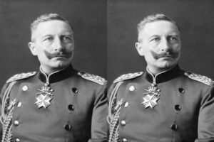
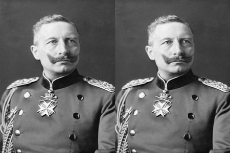
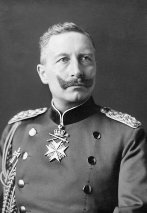
Portrait of Kaiser Wilhelm II, the German emperor after whom Kilimanjaro’s summit was named during colonial rule.
Kaiser Wilhelm II was the namesake of Kilimanjaro’s summit during the German colonial era — formerly called Kaiser Wilhelm Spitze until Tanzania gained independence.

Table of Contents

The Colonial Name: Kaiser Wilhelm Spitze

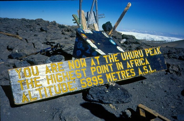
Historic wooden sign at Uhuru Peak on Mount Kilimanjaro displaying the highest point in Africa at 5,895 meters above sea level.
An early sign at Uhuru Peak, renamed in the 1960s after Tanzanian independence. Before this, Europeans knew the summit as Kaiser Wilhelm Spitze during the colonial era.
In 1889, German explorer Hans Meyer,
Read more about Hans Meyer and the first Kilimanjaro ascent in 1889.became the first recorded person to reach the summit of Mount Kilimanjaro. As part of his achievement, he named the peak Kaiser Wilhelm Spitze, or “Emperor William Peak,” in honor of Kaiser Wilhelm II, the ruler of the German Empire.
At the time, Tanzania (then German East Africa) was a colony under German control, and naming major geographical landmarks after European royalty was a common colonial practice.
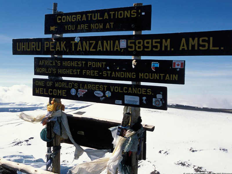
Uhuru Peak sign at the summit of Mount Kilimanjaro showing elevation and independence-related messages.
Since 1964, the summit of Kilimanjaro has been officially known as Uhuru Peak — a name symbolizing Tanzanian freedom. During colonial times, it was called Kaiser Wilhelm Spitze by Europeans.

A Mountain Under Many Flags

Throughout the early 20th century, Kilimanjaro , like much of East Africa , changed hands between colonial powers:
  • German control (late 1800s to WWI)
  • British control (after World War I, renamed Tanganyika Territory)
  • Independence movement grows in the 1950s
Despite these political changes, the mountain remained a cultural and geographic icon for local communities , especially the Chagga people, who lived on its slopes.
 

Tanzania Independence and the Renaming of the Summit

On December 9, 1961, Tanganyika gained independence from British colonial rule and became a sovereign nation.As part of celebrating this historic milestone, the government officially renamed Kilimanjaro’s summit from Kaiser Wilhelm Spitze to “Uhuru Peak.”
The word “Uhuru” means “freedom” in Swahili ,The summit name reflects both national pride and identity , making it one of the most meaningful mountain summits in the world.
 
Tanzania’s national language.
This change was more than symbolic. It marked:
  • A rejection of colonial naming and legacy.
  • A celebration of African identity and independence.
  • A reminder that Tanzania’s highest point belongs to its people.

Uhuru Peak Today

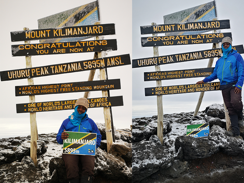
Trekkers posing at the Uhuru Peak summit sign on Mount Kilimanjaro, marking Africa’s highest point at 5,895 meters.
Ones of Kili Quests Member celebrate reaching Uhuru Peak, the highest point in Africa. The sign marks 5,895 meters above sea level — a powerful moment for every Kilimanjaro climber.
Uhuru Peak stands as:
  • The highest point in Africa (5,895 m / 19,341 ft)Before attempting the summit, it’s important to understand how difficult Kilimanjaro really is.
  • A place where independence meets elevation
  • A globally recognized name that reflects Tanzania’s values
Today, climbers from all over the world take photos beneath the summit sign, Most climbers reach Uhuru Peak after passing Stella Point on the crater rim that proudly reads
 
“Congratulations! You are now at Uhuru Peak, Tanzania, 5,895 m. Africa’s Highest Point. World’s Highest Free-Standing Mountain.”

Did You Know?

The renaming was part of a wider movement in post-colonial Africa to reclaim names, borders, and identities.Uhuru Peak was officially named within months of independence, showing how deeply the name was tied to national pride.Other peaks on Kilimanjaro , such as Stella Point and Gilman’s Point , still retain their explorer-era names
 
Portrait of Hans Meyer German geographer linked to Kilimanjaro first ascent
Hans Meyer led the first successful recorded expedition to the summit of Mount Kilimanjaro in 1889, marking a historic moment in mountaineering.
Portrait of Ludwig Purtscheller Austrian mountaineer Kilimanjaro 1889 ascent
Ludwig Purtscheller, an experienced Austrian mountaineer, reached the summit of Kilimanjaro with Hans Meyer and local guide Lauwo in 1889.

Final Thoughts

Mountains carry meaning ,and for Tanzania, Uhuru Peak stands not only as a geographical high point but as a symbol of national freedom.From a colonial name tied to European empire, to a Swahili name that honors independence, the summit of Kilimanjaro tells a powerful story. Every climber who reaches it stands on more than volcanic rock , they stand on the spirit of Uhuru.Every climber who reaches this summit follows a journey shaped by history, culture, and determination.
 
Hans Meyer 1889 map of Mount Kilimanjaro summit area
A look back in time — this 1990s Kilimanjaro map reflects how the mountain was explored, traveled, and understood decades ago.

Frequently Asked Questions About Uhuru Peak and Kilimanjaro’s Name

What was the original name of Uhuru Peak?

Before Tanzania gained independence, the summit of Mount Kilimanjaro was called Kaiser Wilhelm Spitze. The name was given by German explorer Hans Meyer in 1889 to honor Kaiser Wilhelm II of Germany.

Why was Kilimanjaro’s summit renamed Uhuru Peak?

After Tanganyika gained independence in 1961, the summit was renamed Uhuru Peak to symbolize national freedom. The word “Uhuru” means freedom in Swahili, reflecting the country’s independence and cultural identity.

What does the word “Uhuru” mean?

The Swahili word “Uhuru” means freedom or independence. Naming the summit Uhuru Peak was meant to celebrate Tanzania’s liberation from colonial rule.

When was Uhuru Peak officially named?

The summit of Mount Kilimanjaro was renamed Uhuru Peak shortly after Tanganyika gained independence on December 9, 1961. The new name reflected the pride and identity of the newly independent nation.

Is Uhuru Peak the highest point in Africa?

Yes. Uhuru Peak stands at 5,895 meters (19,341 feet) above sea level and is the highest point in Africa and the summit of Mount Kilimanjaro.

How long does it take to reach Uhuru Peak from Stella Point?

From Stella Point, it usually takes about 45 minutes to one hour to reach Uhuru Peak, depending on altitude conditions and the climber’s pace.

Climb to Uhuru Peak with Kili Quests

At Kili Quests, we guide you to more than just a summit , we guide you through a journey of culture, history, and self-discovery.Whether it’s your first trek or your return to the mountain, we’ll help you reach Uhuru Peak with expert guidance, preparation, and respect for the land and its story.
 

Related Articles

Lemosho Route Kilimanjaro: 8-Day Itinerary, Difficulty & Cost

Reach the Summit with Confidence

Your success depends on the right route, acclimatization, and expert guidance.
We plan every climb for a safe summit.

Plan Your Kilimanjaro Climb the Right Way

Kilimanjaro success depends on preparation and acclimatization.Explore these essential guides:

OUR CATEGORIES

Lemosho Route Kilimanjaro: 8-Day Itinerary, Difficulty & Cost

Why Choose the Lemosho Route?

The Lemosho Route is one of the best Kilimanjaro routes for climbers who want strong acclimatization, beautiful scenery, and a quieter start on the mountain. It begins on the remote western side of Mount Kilimanjaro, crosses the wide Shira Plateau, joins the southern circuit near Lava Tower, and reaches the summit from Barafu Camp.

This route is not the easiest way up Kilimanjaro, but it is one of the smartest choices for climbers who want enough time to adjust to altitude. The longer 8-day Lemosho itinerary gives your body more time to adapt, which can improve your summit chances compared with shorter, faster routes.

Lemosho is especially good for first-time Kilimanjaro climbers who want a scenic route without rushing the ascent. If you are still comparing routes, read our Kilimanjaro Routes Comparison: Which Route Is Best? to see how Lemosho compares with Machame, Marangu, Rongai, and the Northern Circuit.

Quick Answer: Is the Lemosho Route Worth It?

Yes, the Lemosho Route is worth it for most climbers who want a scenic, well-paced Kilimanjaro climb with better acclimatization. The 8-day version is the best choice for most travelers because it gives your body more time to adjust before summit night.
 
The route is especially strong for first-time climbers, photographers, and trekkers who want more than a rushed climb. It starts quietly on the western side of Kilimanjaro, crosses the Shira Plateau, passes Lava Tower and Barranco Wall, then joins the summit approach from Barafu Camp.
Best For Why Lemosho Works Well
First-time climbers The 8-day itinerary gives more time for altitude adjustment.
Scenery lovers The route crosses rainforest, Shira Plateau, Lava Tower, Barranco Wall, and alpine desert.
Climbers wanting fewer crowds early Lemosho starts on the quieter western side before joining the busier southern circuit.
Better acclimatization The route follows a gradual profile and includes the Lava Tower climb-high, sleep-low day.
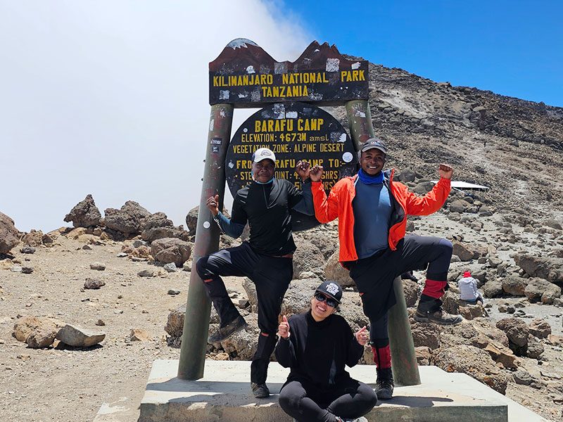
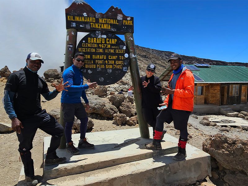
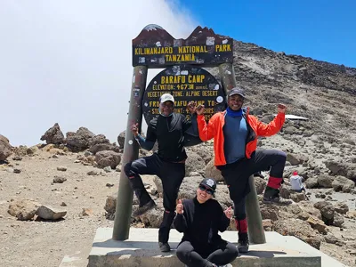
Climbers posing at Barafu Camp on the Lemosho Route before summit night on Mount Kilimanjaro
Climbers at Barafu Camp, the final staging point before summit night on the Lemosho Route.

Table of Contents

What Is the Lemosho Route on Kilimanjaro?

The Lemosho Route is a western approach route on Mount Kilimanjaro. It starts at Londorossi Gate, passes through rainforest, climbs onto the Shira Plateau, and then joins the southern circuit used by the Machame Route. From there, climbers continue toward Lava Tower, Barranco Camp, Karanga Camp, Barafu Camp, and finally Uhuru Peak.
 
The route is popular because it gives climbers a strong balance of scenery, acclimatization, and summit success. Compared with shorter routes, Lemosho gives your body more time to adapt to altitude, especially when done over 8 days.

Where Does the Lemosho Route Start?

The Lemosho Route begins at Londorossi Gate on the western side of Mount Kilimanjaro. After registration, climbers continue to the trailhead and begin walking through the rainforest toward Mti Mkubwa Camp. This western start is one reason Lemosho feels quieter and more remote during the first part of the climb.

How Long Is the Lemosho Route?

The Lemosho Route is usually completed in 7 or 8 days and covers about 70 kilometers / 43 miles. The 8-day version is strongly recommended for most climbers because it gives better acclimatization and reduces the pressure of gaining altitude too quickly.
 
If you are still deciding how many days you need, read our How Many Days to Climb Kilimanjaro guide before choosing your itinerary.

Lemosho Route Overview

Feature Details
Route Length 7 to 8 days
Distance ~70 km / 43 miles
Start Point Londorossi Gate, Western Kilimanjaro
Highest Point Uhuru Peak, 5,895 m / 19,341 ft
Difficulty Moderate to challenging
Best For Scenic views, high success rate, and fewer crowds
Success Rate ~98% on the 8-day itinerary

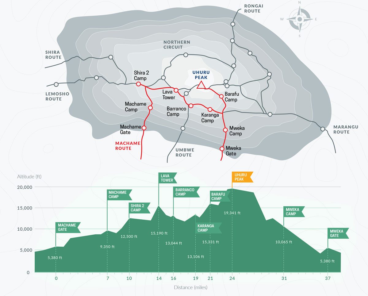
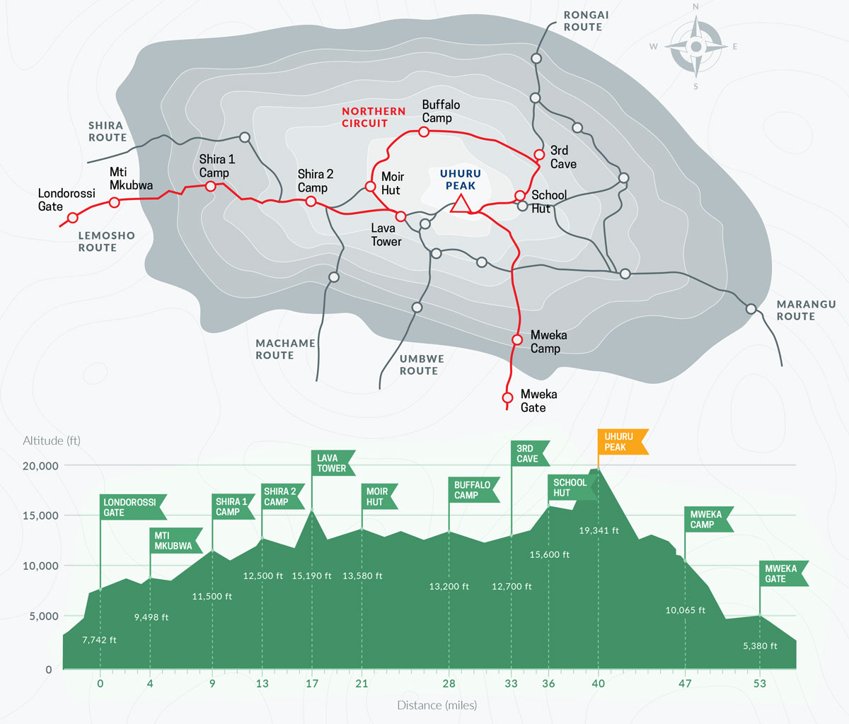
Lemosho Day Map and Elevation Profile

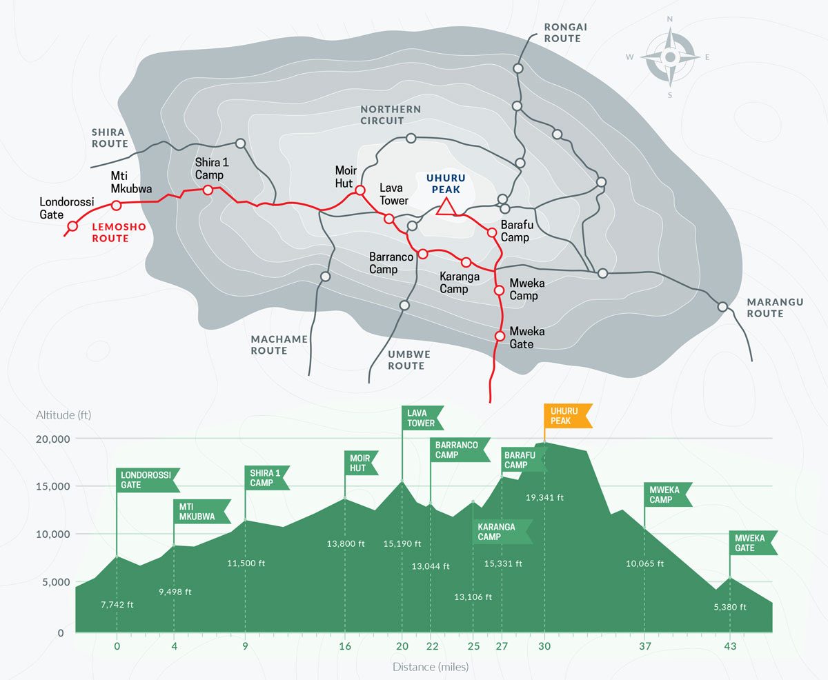
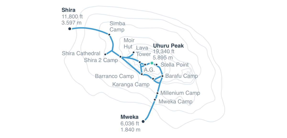
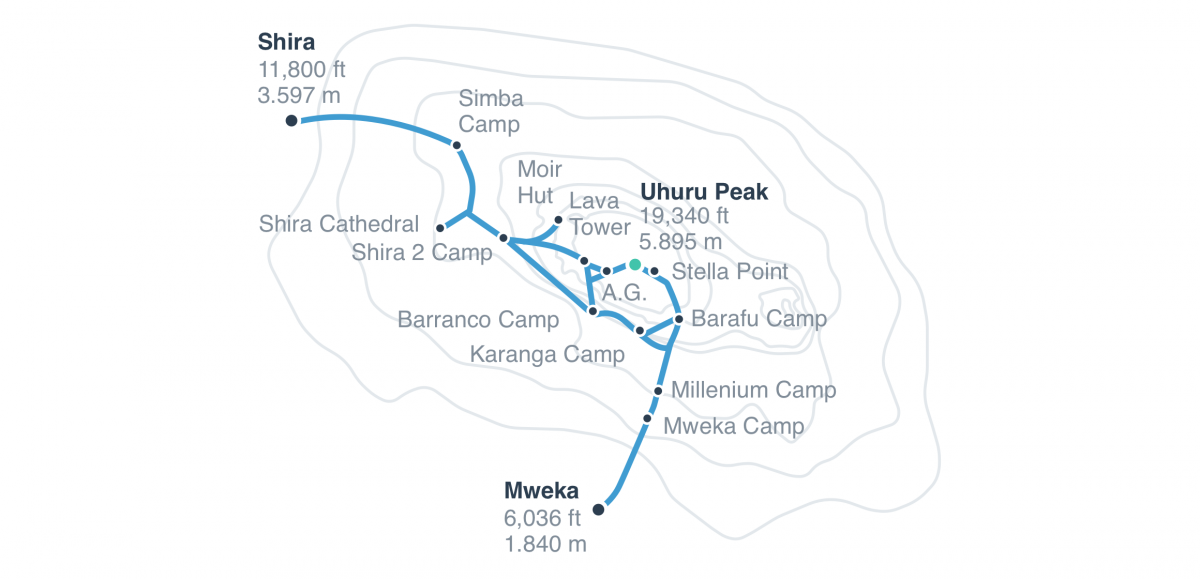
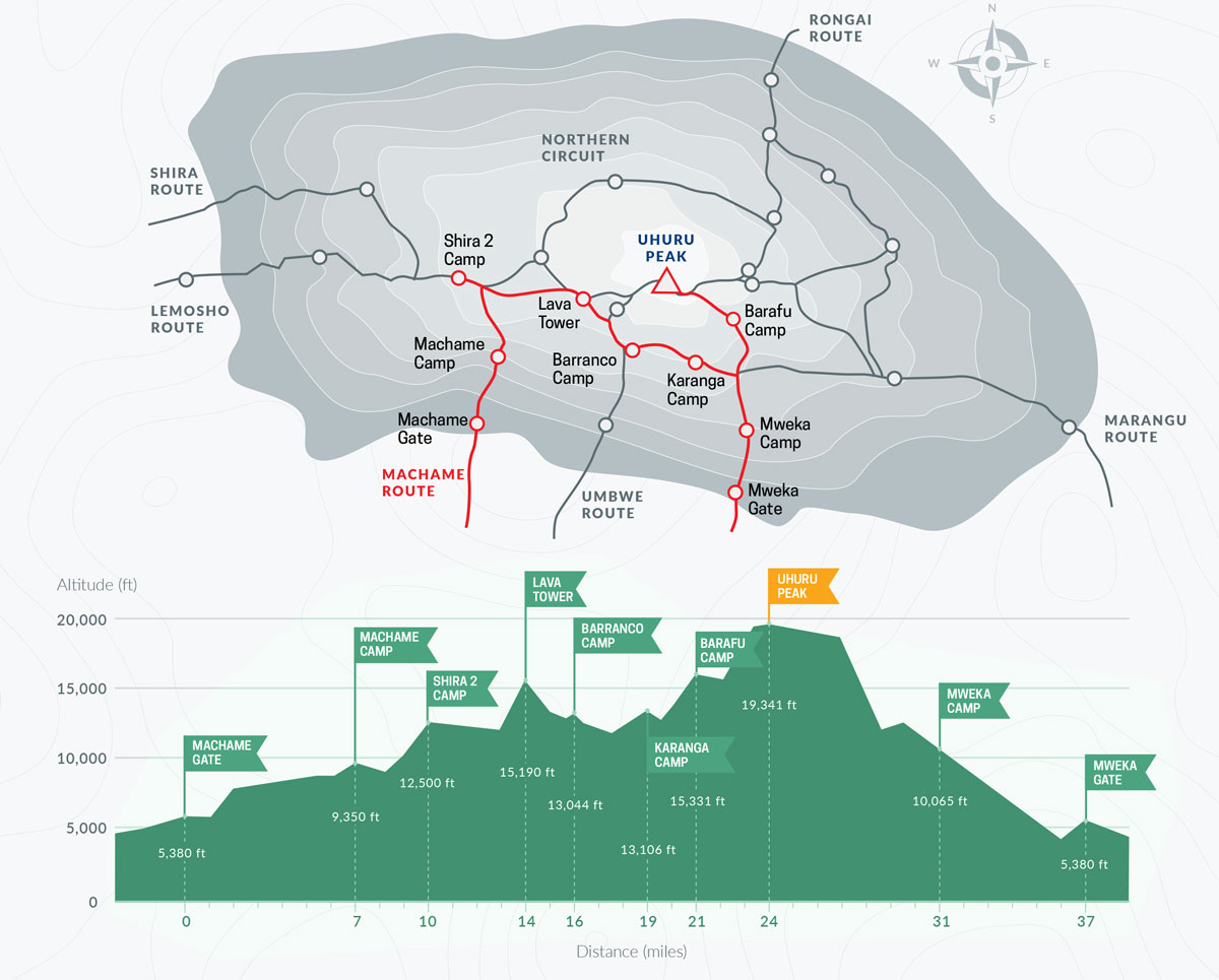
Lemosho Route map on Mount Kilimanjaro with full trail, elevation profile, and camp locations to Uhuru Peak
A scenic and well-acclimatized trail starting from Londorossi Gate and joining the Machame Route via Lava Tower.

8-Day Lemosho Route Itinerary

The 8-day Lemosho itinerary is the best version for most climbers because it gives more time for acclimatization before summit night. The route starts slowly, gains altitude gradually, and uses the important Lava Tower acclimatization day before sleeping lower at Barranco Camp.

Day 1 – Londorossi Gate to Mti Mkubwa Camp

The first day starts with registration at Londorossi Gate before entering the rainforest zone. The walk is usually short and gentle, which helps climbers begin slowly instead of rushing into altitude too fast.
  • Altitude: 2,100 m to 2,650 m
  • Hiking time: 3–4 hours
  • Zone: Rainforest
  • Camp: Mti Mkubwa Camp

Day 2: Mti Mkubwa Camp to Shira 1 Camp

Day 2 leaves the forest and climbs into the moorland zone. The trail becomes more open, and you begin to see the wide Shira Plateau. This is one of the first days where climbers start feeling the altitude, so pacing matters.
  • Altitude: 2,650 m to 3,610 m
  • Hiking time: 5–6 hours
  • Zone: Rainforest to moorland
  • Camp: Shira 1 Camp

Day 3: Shira 1 Camp to Shira 2 Camp

This is a gentler day across the Shira Plateau. The walk is not extremely steep, but it is important for acclimatization because you are now sleeping above 3,800 meters. Clear weather can give excellent views across the plateau.
  • Altitude: 3,610 m to 3,850 m
  • Hiking time: 4–5 hours
  • Zone: Moorland
  • Camp: Shira 2 Camp

Day 4: Shira 2 Camp to Barranco Camp via Lava Tower

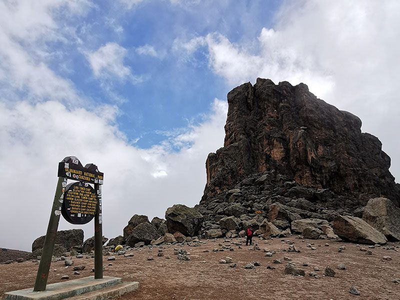
This is one of the most important acclimatization days on the Lemosho Route. Climbers ascend to Lava Tower at about 4,640 meters, then descend to sleep at Barranco Camp. This follows the climb high, sleep-low principle, which helps the body adjust before going higher.
  • Altitude: 3,850 m to 4,640 m, then down to 3,960 m
  • Hiking time: 6–7 hours
  • Zone: Alpine desert
  • Camp: Barranco Camp
This is also the day when some climbers may start noticing altitude symptoms. Read our Altitude Sickness on Kilimanjaro guide so you understand what symptoms are normal and which signs should not be ignored.

Day 5: Barranco Camp to Karanga Camp

Day 5 begins with the Barranco Wall, one of the most famous parts of the Lemosho Route. It looks intimidating from camp, but most climbers find it manageable with slow movement and guide support. After the wall, the trail continues through valleys and ridges toward Karanga Camp.
  • Altitude: 3,960 m to 4,035 m
  • Hiking time: 4–5 hours
  • Highlight: Barranco Wall
  • Camp: Karanga Camp

Day 6: Karanga Camp to Barafu Camp

This is a shorter but important day because Barafu Camp is the base camp for summit night. Climbers arrive, rest, eat early, prepare summit gear, and try to sleep before the midnight summit push.
  • Altitude: 4,035 m to 4,673 m
  • Hiking time: 3–4 hours
  • Zone: Alpine desert
  • Camp: Barafu Camp

Day 7: Barafu Camp to Uhuru Peak, then down to Mweka Camp

Summit day is the hardest part of the Lemosho Route. The climb begins around midnight in cold, thin air. The trail climbs slowly toward Stella Point before continuing along the crater rim to Uhuru Peak, the highest point in Africa.
 
After reaching the summit, climbers descend back to Barafu Camp for a short rest, then continue down to Mweka Camp. This is a long day and requires mental strength, warm summit gear, and steady pacing.
  • Altitude: 4,673 m to 5,895 m, then down to 3,100 m
  • Hiking time: 12–14 hours total
  • Summit: Uhuru Peak
  • Camp: Mweka Camp
If you are worried about summit night, read our How Hard Is Mount Kilimanjaro? guide for a realistic look at the physical and mental challenge.

Day 8: Mweka Camp to Mweka Gate

The final day is a descent through the rainforest to Mweka Gate. After signing out, successful climbers receive their Kilimanjaro summit certificate before returning to Moshi or Arusha.
    • Altitude: 3,100 m to 1,640 m
    • Hiking time: 3–4 hours
    • Zone: Rainforest
    • Finish: Mweka Gate

7-Day vs 8-Day Lemosho Route: Which Is Better?

The Lemosho Route can be climbed in 7 or 8 days, but the 8-day itinerary is the better choice for most climbers. The extra day gives your body more time to adapt to altitude and makes the overall climb feel less rushed.
Option Best For Main Risk
7-Day Lemosho Fit climbers with some trekking experience Less time for acclimatization
8-Day Lemosho Most first-time climbers and travelers who want better acclimatization Higher cost because of the extra day
For most climbers, the extra day is worth it. Kilimanjaro is not a mountain where speed should be the goal. A slower itinerary gives you a better chance of reaching the summit safely and enjoying the climb.

Lemosho Route Difficulty and Acclimatization

How Difficult Is the Lemosho Route?

The Lemosho Route is moderately difficult. The trail is not technical, and you do not need climbing equipment, but the altitude, long trekking days, cold summit night, and mental fatigue make it a serious challenge.
 
The hardest part is usually summit night from Barafu Camp to Uhuru Peak. Climbers start in darkness, move slowly in freezing temperatures, and continue for several hours at high altitude. Good preparation, warm gear, and steady pacing are essential.

Why Lemosho Has Strong Acclimatization

Lemosho is one of the better Kilimanjaro routes for acclimatization because it gains altitude gradually and includes the important Lava Tower day. This gives the body exposure to higher altitude before descending to sleep lower at Barranco Camp.
 
The 8-day version is especially strong because it reduces the pressure of climbing too high too quickly. This is why Lemosho is often recommended for climbers who want a safer and more comfortable summit attempt.

Who Should Choose the Lemosho Route?

Choose the Lemosho Route if you are:
  • A first-time Kilimanjaro climber who wants better acclimatization
  • A trekker with average to good fitness
  • A traveler who wants one of Kilimanjaro’s most scenic routes
  • A climber who prefers a quieter start before joining the southern circuit
  • Someone who wants a strong balance of scenery, pacing, safety, and summit preparation
Training still matters. Even with a good route, weak preparation can make the climb harder than it needs to be. Read our Kilimanjaro Training Plan before your trek so you know how to prepare your legs, lungs, and endurance.

How Much Does the Lemosho Route Cost?

The Lemosho Route usually costs more than shorter Kilimanjaro routes because it takes more days on the mountain. More days mean more park fees, guide and porter support, meals, camping equipment, and mountain logistics.
 
The 8-day Lemosho Route is not normally the cheapest Kilimanjaro option, but it gives better acclimatization and a more complete mountain experience. Choosing only by price is a mistake if it forces you into a rushed itinerary with less time to adjust to altitude.
 
Your final cost depends on the number of climbers, route length, service level, season, and what is included in the package. Before comparing prices, read our Kilimanjaro Climb Cost so you understand park fees, crew support, equipment, food, transport, and other important costs.
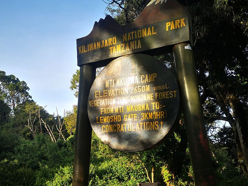
Mti Mkubwa Camp sign on Lemosho Route, Kilimanjaro National Park, showing elevation and distance to Lemosho Gate | Kili Quests
Mti Mkubwa Camp Sign (2,650m) – The first overnight stop on the Lemosho Route, located in the lush montane forest of Kilimanjaro.

Best Time to Climb the Lemosho Route

The best time to climb the Lemosho Route is during the drier months, especially from January to early March and from June to October. These months usually offer better trail conditions, clearer views, and more stable weather.
Season What to Expect Best For
January to early March Warmer conditions, good visibility, and fewer crowds than peak season Climbers who want a good balance of weather and quieter trails
June to October Drier weather, clear skies, colder nights, and busier trails Climbers who want the most reliable weather window
April to May Long rains, muddy trails, lower visibility, and wetter camps Usually not recommended
November Short rains and more unpredictable conditions Possible, but not ideal for most climbers
For a full month-by-month breakdown, read our Best Time to Climb Kilimanjaro guide before choosing your travel dates.

What Makes Lemosho Unique?

The Lemosho Route is unique because it combines a quieter western approach with some of Kilimanjaro’s most dramatic landscapes. The early days feel more remote than the busier southern routes, especially before Lemosho joins the main trail near Lava Tower and Barranco.

The route gives climbers a full mountain experience. You begin in rainforest, cross the Shira Plateau, pass through moorland and alpine desert, climb near Lava Tower, face the Barranco Wall, and finish with the summit push from Barafu Camp to Uhuru Peak.

Lemosho is not only scenic. Its real strength is pacing. The longer 8-day itinerary gives your body more time to adjust, which is why many climbers choose Lemosho when safety, acclimatization, and summit preparation matter more than speed.

Lemosho Route vs Machame Route

Lemosho and Machame are two of the most popular Kilimanjaro routes, and many climbers compare them before booking. Both routes use the southern circuit, both pass Lava Tower and Barranco Wall, and both usually summit from Barafu Camp. The main difference is the beginning of the route and the pacing.
Category Lemosho Route Machame Route
Starting Side Western Kilimanjaro Southern Kilimanjaro
Best Duration 8 days 7 days
Scenery Excellent, especially Shira Plateau and western approach Excellent, with varied landscapes and dramatic southern circuit views
Crowds Quieter at the start, busier after joining the southern circuit Busier from the beginning
Acclimatization Very strong on the 8-day itinerary Good on the 7-day itinerary
Best For Climbers who want scenery, better pacing, and a quieter start Climbers who want a popular, scenic, slightly shorter route
Choose Lemosho if you want more time, a quieter beginning, and one of the most scenic Kilimanjaro approaches. Choose Machame if you want a shorter scenic route and are comfortable with a busier trail. You can also read our Machame Route Kilimanjaro Guide for a deeper comparison.
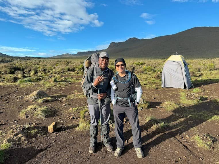
Two trekkers standing at Shira One Camp on the Lemosho Route, Kilimanjaro, with scenic moorland and tent in the background | Kili Quests
Shira One Camp (3,610m) – Trekkers enjoying a clear morning at Shira Plateau, the first high-altitude campsite on the Lemosho Route.

Is the Lemosho Route Right for You?

The Lemosho Route is right for you if you want a scenic Kilimanjaro climb with strong acclimatization and enough time to enjoy the mountain. It is especially good for climbers who do not want to rush the ascent and who understand that altitude, not technical climbing, is the biggest challenge on Kilimanjaro.

Choose Lemosho If You Want:

  • A scenic Kilimanjaro route with rainforest, Shira Plateau, Lava Tower, Barranco Wall, and summit views
  • A quieter start on the western side of the mountain
  • Better acclimatization on an 8-day itinerary
  • A strong route for first-time Kilimanjaro climbers
  • A route that balances scenery, pacing, and summit potential

Lemosho May Not Be Ideal If:

  • You only have 5 or 6 days for the climb
  • You are looking for the cheapest Kilimanjaro route
  • You prefer a shorter itinerary even if it gives less acclimatization time
  • You want the quietest route all the way to the summit, because Lemosho joins the southern circuit after Shira
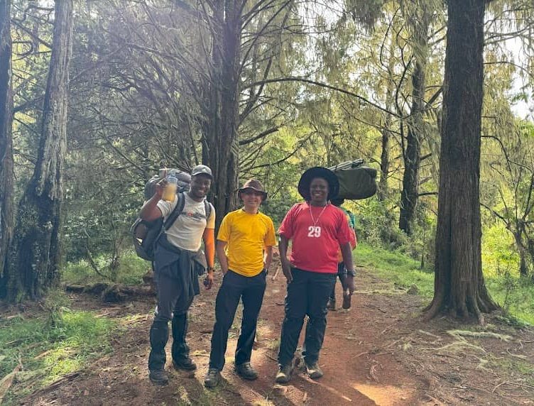
Trekkers and porters hiking through the forest into the moorland zone on the Lemosho Route, Mount Kilimanjaro | Kili Quests
Forest to Moorland Transition – Climbers and porters passing through the lush forest as they ascend toward the moorland zone on Day 2 of the Lemosho Route.

What to Pack for the Lemosho Route

The Lemosho Route crosses several climate zones, so you need to pack for rainforest, moorland, alpine desert, and freezing summit conditions. The most important items are warm layers, a waterproof jacket, strong hiking boots, gloves, a headlamp, a sleeping bag, and comfortable daypack essentials.
 
Do not underestimate summit night. Temperatures can feel extremely cold near Stella Point and Uhuru Peak, especially when wind and fatigue are added. Pack properly and test your gear before arrival.
 
Use our Kilimanjaro Packing List to prepare your clothing, boots, sleeping bag, summit gear, toiletries, and daypack items before your climb

Frequently Asked Questions About the Lemosho Route

How difficult is the Lemosho Route on Mount Kilimanjaro?

The Lemosho Route is moderately difficult. It is not technical, but the altitude, long trekking days, cold summit night, and mental fatigue make it challenging. The 8-day version is easier to manage than shorter routes because it gives more time for acclimatization.

How many days does the Lemosho Route take?

The Lemosho Route usually takes 7 or 8 days. The 8-day itinerary is better for most climbers because it provides more time to adjust to altitude before summit night.

Is the Lemosho Route good for beginners?

Yes, Lemosho is a strong choice for many first-time Kilimanjaro climbers. It gives better acclimatization than shorter routes and has a gradual profile, especially when climbed over 8 days. Beginners still need proper training and realistic preparation.

What is the success rate of the Lemosho Route?

The Lemosho Route has one of the stronger summit success profiles on Kilimanjaro, especially on the 8-day itinerary. Success depends on acclimatization, fitness, guide pacing, weather, health, and how well the climb is managed.

Is Lemosho better than Machame?

Lemosho is usually better if you want a quieter start, more scenery, and stronger acclimatization on an 8-day itinerary. Machame is also scenic and popular, but it is busier and usually done in fewer days.

How much does the Lemosho Route cost?

The Lemosho Route usually costs more than shorter routes because it includes more days on the mountain. More days mean more park fees, crew support, food, camping logistics, and guide services. The extra cost can be worth it if it improves acclimatization and summit preparation.

Climb Kilimanjaro via the Lemosho Route with Kili Quests

The Lemosho Route is one of the best choices if you want a scenic, well-paced Kilimanjaro climb with strong acclimatization. At Kili Quests, we plan Lemosho climbs with experienced local guides, proper pacing, safety checks, good mountain meals, fair porter care, and realistic summit preparation.

Our 8-day Lemosho itinerary is designed for climbers who want more than a rushed climb. You get time to adjust, time to enjoy the mountain, and a better chance of reaching Uhuru Peak safely.
 
Ready to climb Kilimanjaro on the Lemosho Route? Contact Kili Quests today and let our local team help you plan the right itinerary, dates, gear, and preparation for your climb.

Related Articles

Kilimanjaro Routes Comparison: Which Route Is Best?

Plan Your Kilimanjaro Climb

Climbing Kilimanjaro is a once-in-a-lifetime adventure choosing the right route and preparation makes all the difference.

Kilimanjaro Guides

OUR CATEGORIES

Kilimanjaro Routes Comparison: Which Route Is Best?

Choosing the right route is one of the most important decisions you will make when planning to climb Mount Kilimanjaro. Every route leads to Uhuru Peak, but the journey to the summit can feel completely different depending on the trail you choose. Some routes are longer and give your body more time to adjust to altitude. Others are shorter, steeper, and more physically demanding. Some are known for dramatic scenery, while others are chosen for comfort, quiet trails, or the highest chance of summit success.
 
Because of this, there is no single route that is perfect for everyone. The best route depends on your fitness level, trekking experience, available time, comfort preference, and how important summit success is to you. A first-time climber with enough time will usually benefit from a longer route with better acclimatization, while an experienced trekker may be comfortable with a steeper and faster option.This guide compares all seven official Kilimanjaro routes in detail so you can understand how each one works and decide which route is the best fit for your climb.
 
Before choosing your route, it helps to understand how to acclimatize on Kilimanjaro, compare the full Kilimanjaro  climb Cost , and review how many days you need to climb Kilimanjaro so your decision is based on safety, budget, and realistic summit preparation.

Quick Answer: What Is the Best Kilimanjaro Route?

For most climbers, the Lemosho Route is the best overall Kilimanjaro route because it offers a strong balance of scenery, acclimatization, route experience, and summit preparation time. It is especially good for first-time climbers who want a safer, more gradual approach without choosing the longest itinerary.
 
The Northern Circuit Route is best for climbers who want the strongest acclimatization profile and a quieter trail. The Machame Route is best for climbers who want a scenic, popular, and more affordable route when done over 7 days. The Marangu Route is best for hut accommodation, but it is not automatically the easiest because shorter itineraries can make altitude harder.
 
The smartest choice is not always the shortest or cheapest route. Choose based on acclimatization first, then fitness, scenery, budget, and comfort.
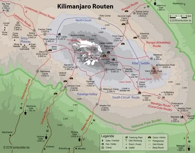
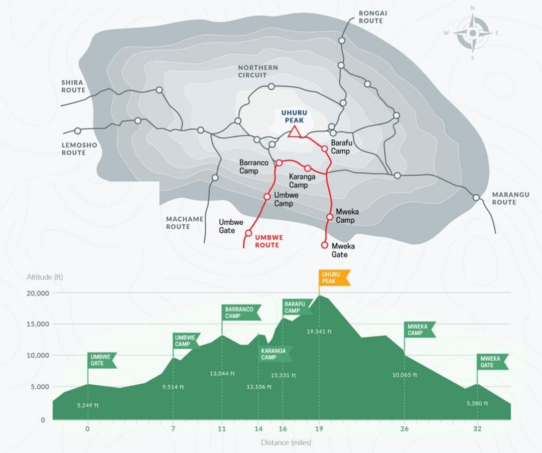
Topographic map showing all major climbing routes on Mount Kilimanjaro, including Machame, Lemosho, Marangu, Rongai, Umbwe, Shira, and Northern Circuit.
This detailed map shows all main Kilimanjaro climbing routes, including Machame, Marangu, Lemosho, Rongai, Umbwe, Shira, and the Northern Circuit, with campsites, elevation points, and park boundaries.

Table of Contents

Best Kilimanjaro Route Overall

For most climbers, the Lemosho Route is the best overall Kilimanjaro route because it gives a strong balance of scenery, acclimatization, summit success, and route experience. It is not the cheapest route, but it gives most climbers a better chance to enjoy the mountain and reach Uhuru Peak safely.
 
The Northern Circuit Route is the best choice for acclimatization and a quieter experience, while the Machame Route is best for climbers who want a scenic and popular route with a slightly shorter itinerary. The Marangu Route is best for hut accommodation, but it is not always the easiest route because the shorter itinerary can make acclimatization harder.
 
From our guiding experience on Kilimanjaro, most climbers make a better decision when they choose a route based on acclimatization first, then scenery, then budget. Choosing only the cheapest or shortest route is one of the most common mistakes.
Route Recommended Days Distance Difficulty Acclimatization Scenery Crowds Best For
Lemosho Route 7–8 days About 70 km Moderate Excellent Excellent Moderate Best overall route for most climbers
Machame Route 6–7 days About 62 km Moderate to challenging Good Excellent High Scenic route with strong popularity
Marangu Route 5–6 days About 72 km Moderate, but often rushed Fair Good Moderate Climbers who prefer hut accommodation
Rongai Route 6–7 days About 73 km Moderate Good Good Low Quiet northern approach and rainy-season climbs
Northern Circuit Route 8–9+ days About 88–90 km Moderate Excellent Excellent Low Best acclimatization and quieter experience
Umbwe Route 5–6 days About 53 km Very challenging Poor to fair Good Low Experienced trekkers only
Shira Route 7–8 days About 56–60 km Challenging start Fair to good Excellent Low Climbers with prior altitude experience

Best Kilimanjaro Route by Climber Type

Climber Goal Best Route Why It Works
Best overall route Lemosho Route Best balance of scenery, acclimatization, route experience, and summit preparation time.
Best for beginners Lemosho Route or 7-day Machame Route Both work well for first-time climbers when paced properly and not rushed.
Best acclimatization Northern Circuit Route The longer itinerary gives the body more time to adjust before summit night.
Best scenery Lemosho, Shira, or Northern Circuit These routes offer wide views, varied landscapes, and a stronger wilderness feel.
Best for fewer crowds Rongai Route or Northern Circuit These routes are quieter than Machame and Marangu, especially in the early sections.
Best budget option Machame Route or Marangu Route Shorter itineraries usually cost less, but you should not sacrifice acclimatization just to save money.
Best hut route Marangu Route Marangu is the only main Kilimanjaro route with hut accommodation instead of tents.
Toughest route Umbwe Route Umbwe is steep, direct, physically demanding, and gives less time for altitude adjustment.
Best rainy-season route Rongai Route Rongai approaches from the drier northern side of Kilimanjaro.
The best route is not the same for every climber. If you want the strongest all-around choice, Lemosho is usually the safest recommendation. If you want maximum acclimatization and have more time, Northern Circuit is stronger. If you want a popular scenic route with good value, Machame is a solid choice when done over 7 days. If you want hut accommodation, Marangu is the clear option, but it should not be chosen only because it looks easier.

Why Choosing the Right Kilimanjaro Route Matters

On Kilimanjaro, route choice is not just about scenery or duration. It directly affects how well your body adapts to altitude and how likely you are to reach the summit. The mountain is not technical, but altitude makes it serious. That means the route you choose can either support your success or make the climb much harder than it needs to be.
 
Longer routes usually give climbers a better chance of reaching Uhuru Peak because they allow more time for acclimatization. That extra time can make a major difference, especially for first-time climbers. Shorter routes may look attractive because they cost less and require fewer days, but they often come with a lower summit success rate because the body has less time to adapt.Route choice also shapes the overall experience. Some trails feel busy and social, while others feel remote and peaceful. Some begin in dense rainforest and open gradually into moorland and alpine desert, while others start high and immediately expose you to altitude. That is why comparing routes carefully before booking is one of the smartest things a climber can do.
 
Understanding altitude sickness on Kilimanjaro is key to improving your chances of reaching the summit.

How Many Routes Are There on Kilimanjaro?

Route Main Strength Best For Main Drawback
Lemosho Route Beautiful scenery, strong acclimatization, and high summit success rate. First-time climbers who want a safer, scenic, and less rushed route. Usually costs more because it takes 7 to 8 days.
Machame Route Classic Kilimanjaro scenery, good acclimatization, and strong overall value. Reasonably fit climbers who want a popular and proven route. Can be busy during peak climbing seasons.
Marangu Route Only Kilimanjaro route with hut accommodation. Climbers who strongly prefer sleeping in huts instead of tents. Shorter ascent gives less time for acclimatization.
Rongai Route Quiet northern approach with drier conditions and fewer crowds. Climbers who want a peaceful route or are trekking during wetter months. Early scenery is less dramatic than Lemosho or Machame.
Northern Circuit Route Best acclimatization profile and one of the highest success rates. Climbers who want maximum summit success and a quieter trail. Requires more time and a higher budget.
Umbwe Route Steep, direct, quiet, and physically demanding. Experienced climbers who want a tougher and more aggressive climb. Not recommended for most first-time climbers because of rapid altitude gain.
Shira Route High-altitude start with wide views across the Shira Plateau. Trekkers with previous altitude experience or prior acclimatization. Starts high, which can make the first days harder for unacclimatized climbers.
There are seven official trekking routes on Mount Kilimanjaro: Lemosho, Machame, Marangu, Rongai, Northern Circuit, Umbwe, and Shira. Each has its own style, pace, scenery, and acclimatization profile.Some routes share sections of trail higher up on the mountain, but their starting points, first days, and overall experience are still different. For example, Lemosho and Shira eventually join parts of the same path, but their starts are not the same. Likewise, Machame and Lemosho share later sections, yet they attract climbers for different reasons.Understanding these differences makes it easier to match the route to the kind of experience you want rather than just choosing the most popular name.
 
Your budget also plays a role, so it’s important to understand the cost to climb Kilimanjaro before making a decision.

How to Choose the Right Kilimanjaro Route

Choosing the best Kilimanjaro route is not only about popularity. The right route depends on your fitness, available days, budget, comfort level, scenery preference, and how well your body adjusts to altitude.

Choose by acclimatization first

Acclimatization should be your first priority. A longer route usually gives your body more time to adjust as you climb higher. This is why routes such as Lemosho and Northern Circuit are often better choices for climbers who want a safer, more gradual ascent.

Choose by number of days

Shorter routes may look cheaper, but they can be harder on the body. A 5-day climb gives less time to adjust to altitude, while a 7-day or 8-day route usually gives a better chance of reaching the summit comfortably.
 
You can also read How Many Days Does It Take to Climb Kilimanjaro? before choosing your route.

Choose by scenery and crowd level

If scenery matters most, Lemosho, Machame, Shira, and Northern Circuit are strong choices. If you want fewer crowds, Rongai and Northern Circuit are better options. If you want hut accommodation, Marangu is the main choice.

Choose by budget, but do not let price decide everything

Budget matters, but the cheapest Kilimanjaro route is not always the smartest choice. A shorter route may cost less because it uses fewer days, but it can also give your body less time to acclimatize.

Longer routes such as Lemosho or the Northern Circuit usually cost more because they include more park-fee days, crew support, meals, and mountain logistics. But for many climbers, the extra time can be better value because it supports better acclimatization and a more realistic summit plan.

Before choosing a route only by price, read Kilimanjaro Climb Cost so you understand how route length, park fees, tips, gear, insurance, and package inclusions affect your full budget.

Lemosho Route – The Best All-Around Choice

The Lemosho Route is widely considered the best overall route on Kilimanjaro because it combines beautiful scenery, strong acclimatization, and a high summit success rate. It starts on the western side of the mountain and gives climbers a gradual approach, which is one of the main reasons it is so highly recommended.
 
Physical preparation matters, which is why many climbers follow a structured training plan for Kilimanjaro before their trip.

What the Lemosho Route Is Like

The route begins in rainforest and then opens into the wide scenery of the Shira Plateau. From there, climbers continue through moorland, alpine desert, and higher camps before making the final summit push. It is one of the most visually rewarding routes because it offers variety almost from the beginning to the end.Another advantage is that Lemosho starts with fewer crowds than some of the more popular routes. That gives the first few days a quieter and more remote feel, which many trekkers enjoy.

Who the Lemosho Route Is Best For

Lemosho is ideal for first-time climbers who want a strong chance of reaching the summit without choosing an overly aggressive itinerary. It is also excellent for trekkers who care a lot about scenery and want a route that feels more complete and less rushed.
Because it is usually done over 7 to 8 days, it gives the body more time to adjust to altitude. That makes it one of the safest and smartest choices for many climbers.
Lemosho Route map on Mount Kilimanjaro with full trail, elevation profile, and camp locations to Uhuru Peak
A scenic and well-acclimatized trail starting from Londorossi Gate and joining the Machame Route via Lava Tower.

Machame Route – The Most Popular Route

The Machame Route is often called the “Whiskey Route” and is the most popular climbing route on Kilimanjaro. It is known for its dramatic scenery, active trekking days, and strong acclimatization profile when done over enough days.

What the Machame Route Is Like

Machame takes climbers through rainforest, moorland, alpine desert, and the high summit zone, offering a varied and classic Kilimanjaro experience. It includes famous landmarks such as Lava Tower and the Barranco Wall, both of which are highlights for many trekkers.Compared with Marangu, Machame provides a better acclimatization profile because the route allows for more gradual altitude gain. The trail itself is a bit steeper and more physically active, but many climbers see that as part of its appeal.

Who the Machame Route Is Best For

Machame is best for climbers who want a balance between challenge, scenery, and summit success. It suits first-time trekkers who are reasonably fit and want a popular, proven route with strong overall value.
The main downside is that it can be busy, especially during peak climbing seasons. Still, for many people, the scenery and route design make it worth it.
Machame Route map on Mount Kilimanjaro showing trail path, elevation profile, and major camps to Uhuru Peak
A scenic Kilimanjaro trail via Lava Tower and Barafu Camp, descending through Mweka Gate.

Marangu Route – The Hut Route

The Marangu Route is the only Kilimanjaro route with hut accommodation. For some climbers, that makes it immediately attractive, especially if they prefer not to sleep in tents for several nights.

What the Marangu Route Is Like

Marangu follows the same path up and down the mountain, which makes it different from most other routes. The huts provide a more sheltered sleeping arrangement, and the trail is often seen as more straightforward in terms of logistics.However, the shorter itinerary is its biggest weakness. Because many Marangu climbs are done in 5 to 6 days, climbers often do not get enough time to acclimatize properly. That is one reason why its summit success rate is usually lower than longer routes.

Who the Marangu Route Is Best For

Marangu is best for climbers who strongly prefer hut accommodation and want a simpler, shorter itinerary. It can work well for some trekkers, but it is not automatically the best route for beginners just because it has huts. In fact, the shorter profile can make it a harder climb from an altitude perspective.
For climbers who care most about summit success, longer routes are generally a better choice.
Marangu Route map on Mount Kilimanjaro showing elevation, trail path, and major camps to Uhuru Peak
Marangu Route Map – The only Kilimanjaro route with huts, following the same trail up and down via Horombo and Kibo Huts.

Rongai Route – The Quiet Northern Trail

The Rongai Route approaches Kilimanjaro from the north, near the Kenyan side of the mountain. This gives it a quieter and often drier character than the southern routes.

What the Rongai Route Is Like

Rongai is known for its peaceful feel. It usually has fewer climbers, which makes it a good option for people who want a less crowded experience. The northern side of Kilimanjaro also tends to be drier, so this route can be especially appealing during wetter months.The scenery is different from the western and southern routes. While some people find it less dramatic at the beginning, the route offers a unique perspective of the mountain and beautiful views near Mawenzi.

Who the Rongai Route Is Best For

Rongai is a good choice for climbers who want a quieter trail, a gradual ascent, and a different side of Kilimanjaro. It is also a smart option for people climbing during the rainy season when drier conditions can make a big difference.It may not have the same reputation for scenery as Lemosho, but it offers peace, space, and a solid acclimatization profile.
View of Mawenzi Peak from Stella Point on Mount Kilimanjaro
The Rongai Route’s final summit approach offers this dramatic view of Mawenzi Peak from Stella Point. A snowy, unforgettable moment near the crater rim.
Rongai Route map showing camps and elevation profile on Kilimanjaro
A remote trail from the north side of Kilimanjaro, passing Mawenzi Tarn and Kibo Hut before summiting.

Northern Circuit – The Best Route for Acclimatization

The Northern Circuit is the longest route on Kilimanjaro and is often considered the best route for acclimatization. It circles around the mountain’s northern slopes, creating a longer and more gradual approach to the summit.

What the Northern Circuit Is Like

This route offers one of the most complete mountain experiences because it covers more ground and gives trekkers long, scenic days with fewer crowds. It provides broad views from multiple angles and avoids the busier traffic found on some other routes.Its greatest strength is time. Because the route is usually done over 9 or more days, climbers have an excellent chance to adjust to altitude before summit night.

Who the Northern Circuit Is Best For

The Northern Circuit is best for climbers whose main goal is to maximize summit success. It is also ideal for those who want a quieter route and are willing to spend more time on the mountain.For travelers with enough days and budget, it is one of the strongest choices available. The extra time often turns into extra safety, better recovery, and a more enjoyable climb.
Northern Circuit Route map on Mount Kilimanjaro showing full circuit trail, elevation profile, and key camps to Uhuru Peak
The longest Kilimanjaro route, offering excellent acclimatization and 360° views around the mountain.

Umbwe Route – The Steepest and Toughest Option

Umbwe is known as the steepest and most direct route on Kilimanjaro. It is intense, demanding, and not usually recommended for beginners.

What the Umbwe Route Is Like

The route climbs quickly and gives the body less time to adapt to altitude. It is physically demanding from early on and is often chosen by trekkers who want a more aggressive and remote climb.Because it is less popular, Umbwe can feel quiet and wild. That gives it a certain appeal for experienced trekkers who do not mind a tougher route.

Who the Umbwe Route Is Best For

Umbwe is best for experienced climbers who are confident in their fitness and understand the challenge of rapid altitude gain. It is not a route chosen for comfort or ease. It is chosen for intensity.For most first-time Kilimanjaro trekkers, other routes are a safer and smarter choice.
Trekkers and porters ascending the Kissing Rock section on Barranco Wall along the Machame Route, Kilimanjaro
The Kissing Rock – Barranco Wall – Climbers squeeze through one of the most iconic and narrow points on the Umbwe Route: the "Kissing Rock" on Barranco Wall.
Umbwe Route map on Mount Kilimanjaro showing trail path, elevation chart, and key camps to Uhuru Peak
Kilimanjaro’s steepest and most direct route, ascending via Barranco and Karanga Camps.

Shira Route – A High-Altitude Start

The Shira Route begins at a higher elevation than most other routes, which makes it unique but also more demanding at the beginning.

What the Shira Route Is Like

Because the route starts high on the Shira Plateau, climbers skip much of the rainforest zone and enter a higher-altitude environment very early. That can make the first days harder for people who have not acclimatized already.After the opening section, Shira joins the Lemosho path, so much of the later scenery and route experience becomes similar. The landscapes are dramatic and open, with wide views that many climbers love.

Who the Shira Route Is Best For

Shira is best for trekkers who already have some altitude experience or have acclimatized before starting the climb. It is not usually the first recommendation for people completely new to high-altitude trekking.For the right climber, it offers striking scenery and a less typical start, but it requires more care than routes with a lower beginning.
Two trekkers standing at Shira One Camp on the Lemosho Route, Kilimanjaro, with scenic moorland and tent in the background | Kili Quests
Shira One Camp (3,610m) – Trekkers enjoying a clear morning at Shira Plateau, the first high-altitude campsite on the Lemosho Route.
Shira Route map on Mount Kilimanjaro showing trail path from Shira Plateau to Uhuru Peak via Barranco and Barafu Camps
Begins at high altitude on the Shira Plateau and joins the Lemosho-Machame trail to the summit.

Kilimanjaro Route Mistakes to Avoid

Many climbers choose the wrong route because they focus on the wrong thing. Here are the most common mistakes to avoid.

Choosing the shortest route only because it is cheaper

A shorter route can reduce cost, but it also reduces acclimatization time. That can make the climb harder, especially for first-time high-altitude trekkers.

Thinking Marangu is always the easiest route

Marangu is often called the “Coca-Cola Route,” but that does not mean it is always the easiest. The hut accommodation is more comfortable for some climbers, but the shorter itinerary can make altitude more difficult.

Ignoring acclimatization profile

The route profile matters more than the name of the route. A route that climbs gradually and allows your body to adjust is usually better than a route that gains altitude too quickly.

Choosing a route only because it is popular

Machame is popular for good reason, but popularity does not automatically make it the best route for every climber. Some people are better suited to Lemosho, Rongai, or Northern Circuit depending on their goals.

Not matching the route to your fitness level

Umbwe and Shira are not ideal for most beginners. They can be rewarding routes, but they require stronger fitness, altitude awareness, and realistic expectations.

Popular Kilimanjaro Route Comparisons

Many climbers narrow their choice down to two or three routes after reading the full Kilimanjaro routes comparison. The most common decisions are usually between Lemosho, Machame, and Marangu because these routes are popular, well-known, and often recommended for first-time climbers.
 
If you are comparing Lemosho vs Machame, the main difference is usually acclimatization, scenery, crowd level, and itinerary length. Lemosho gives a quieter and more gradual start, while Machame is a scenic and popular route with strong value for many climbers. For a full breakdown, read Lemosho vs Machame Route: Which Kilimanjaro Route Is Better?
 
If you are comparing Machame vs Marangu, the biggest difference is camping versus hut accommodation, scenery, and acclimatization profile. Marangu has huts, but that does not automatically make it easier. Machame usually gives better scenery and a stronger climb-high, sleep-low profile. For the full comparison, read Machame vs Marangu Route: Which Kilimanjaro Route Should You Choose?
 
For most climbers, this main Kilimanjaro routes comparison should help you narrow the decision. The route-to-route comparison guides are useful when you already have two options in mind and need a final decision.
A climber proudly holding a Mount Kilimanjaro summit certificate with their Kili Quests guide after completing the trek to Uhuru Peak | Kili Quests
Every route leads to this moment — celebrating your Kilimanjaro summit with a certificate in hand and memories for a lifetime.

Final Advice: Which Kilimanjaro Route Should You Choose?

If you are still unsure, start with your main priority. For most climbers, the best route is the one that gives enough time for acclimatization while still matching your budget, fitness, and travel schedule.
 
Choose the Lemosho Route if you want the best all-around balance of scenery, acclimatization, and route experience. Choose the Northern Circuit Route if you have more time and want the strongest acclimatization profile with fewer crowds. Choose the Machame Route if you want a scenic, popular, and proven route with good value, especially on a 7-day itinerary.
 
Choose the Marangu Route if hut accommodation matters more to you than scenery or route variety. Choose the Rongai Route if you want a quieter trail or are climbing during wetter months. Choose Umbwe only if you are experienced, fit, and comfortable with a steeper, more demanding route.


The route should match your body, not your ego. Choosing a route because it is cheap, short, or famous is a weak decision. Choosing a route based on acclimatization, fitness, time, and safety is the smart decision.
 
For most first-time climbers, start by comparing Lemosho Route vs Machame Route, and Northern Circuit Route before looking at the shorter or steeper options.

Frequently Asked Questions About Kilimanjaro Routes

What is the best route to climb Kilimanjaro?

The best route for most climbers is the Lemosho Route because it offers excellent scenery, good acclimatization, and a high summit success rate. However, the best route still depends on your priorities. If you want maximum acclimatization time, the Northern Circuit may be an even better fit.

Which Kilimanjaro route is easiest?

The Northern Circuit is often considered the easiest in terms of altitude adaptation because it gives the body the most time to acclimatize. It is longer, but that extra time usually makes the climb feel more manageable than shorter and steeper routes.

Which route is best for first-time climbers?

Lemosho and Machame are usually the best choices for first-time climbers. Both offer strong acclimatization and a well-rounded mountain experience. The Northern Circuit is also excellent for beginners who have enough time for a longer trek.

Which Kilimanjaro route has the highest success rate?

The Northern Circuit and Lemosho routes are often considered among the strongest choices for summit success because they allow more time for acclimatization. A longer route does not guarantee the summit, but it usually gives the body a better chance to adjust to altitude.

Which route has huts?

Marangu is the only Kilimanjaro route with hut accommodation. All other main routes involve camping in tents.

Which Kilimanjaro route has the best scenery?

Many climbers say the Lemosho Route, Shira Route, and Northern Circuit Route offer the most scenic landscapes on Mount Kilimanjaro.

Plan the Right Kilimanjaro Route With Kili Quests

Choosing the right route is one of the most important decisions you will make before climbing Kilimanjaro. The best route is not always the cheapest, shortest, or most famous. It is the route that matches your fitness, time, budget, acclimatization needs, and summit goal.
 
At Kili Quests, we help climbers choose a route based on realistic mountain experience, not guesswork. Whether you are deciding between Lemosho, Machame, Marangu, Rongai, Northern Circuit, Umbwe, or Shira, our team can help you plan a safer and better-supported climb.
 
Request a custom Kilimanjaro climb plan and we will help you choose the route that fits your goals.

Related Articles

Machame Route Kilimanjaro: 7-Day Itinerary, Difficulty & Cost

Reach the Summit with Confidence

Success on Kilimanjaro depends on the right route, acclimatization, and team.We plan every Machame climb for a safe summit.

Plan Your Machame Route the Right Way

The right route, acclimatization, and team make the difference.We plan your Machame climb for a safe summit

OUR CATEGORIES

Machame Route Kilimanjaro: 7-Day Itinerary, Difficulty & Cost

Why Choose the Machame Route?

The Machame Route is one of the most popular ways to climb Mount Kilimanjaro because it offers strong scenery, a varied trail, good acclimatization, and a classic Kilimanjaro adventure. It begins at Machame Gate on the southwestern side of the mountain, climbs through rainforest, crosses moorland and alpine desert, passes Lava Tower and Barranco Wall, and reaches the summit from Barafu Camp.

Machame is often called the “Whiskey Route” because it is more demanding than the Marangu Route, which is sometimes called the “Coca-Cola Route.” That does not mean Machame is only for expert climbers. Many first-time Kilimanjaro climbers choose Machame, but they should choose the 7-day version, train properly, and respect the altitude.

The Machame Route is best for climbers who want a scenic and active Kilimanjaro climb without choosing one of the longest routes. If you are still comparing your options, read our Kilimanjaro Routes Comparison: Which Route Is Best? to see how Machame compares with Lemosho, Marangu, Rongai, and the Northern Circuit.

Quick Answer: Is the Machame Route Worth It?

Yes, the Machame Route is worth it if you want a scenic, active, and popular Kilimanjaro climb with good acclimatization. The 7-day version is the best choice for most climbers because it gives more time to adjust to altitude before summit night.
 
Machame is not the easiest Kilimanjaro route, but it gives a strong balance of scenery, challenge, and summit preparation. It is best for climbers with average to good fitness who want a more adventurous route than Marangu but do not want the longer schedule of Lemosho or the Northern Circuit.
Best For Why Machame Works Well
Active trekkers The route has steeper sections, varied terrain, and a more adventurous feel.
First-time climbers with good fitness The 7-day itinerary gives better acclimatization than the shorter 6-day version.
Scenery lovers Machame crosses rainforest, moorland, Lava Tower, Barranco Wall, alpine desert, and summit terrain.
Climbers comparing popular routes Machame gives a strong balance of scenery, challenge, and route popularity.
Trekkers and porters ascending the Kissing Rock section on Barranco Wall along the Machame Route, Kilimanjaro
The Kissing Rock on Barranco Wall, one of the most famous sections of the Machame Route on Mount Kilimanjaro.

Table of Contents

What Is the Machame Route on Kilimanjaro?

The Machame Route is a southern approach route on Mount Kilimanjaro. It starts at Machame Gate, climbs through rainforest, continues to Shira Cave Camp, crosses toward Lava Tower, descends to Barranco Camp, and then follows the southern circuit toward Karanga, Barafu, and Uhuru Peak.

Machame is popular because it gives climbers a full Kilimanjaro experience in 6 or 7 days. The route has varied scenery, good acclimatization when done over 7 days, and several memorable sections, including Lava Tower, Barranco Wall, and the summit climb from Barafu Camp.

  Where Does the Machame Route Start?

The Machame Route begins at Machame Gate on the southwestern side of Mount Kilimanjaro. The first hiking day enters the rainforest zone, where the trail can be humid, muddy, and slippery depending on weather conditions.

How Long Is the Machame Route?

The Machame Route is usually climbed in 6 or 7 days and covers about 62 kilometers / 37 miles. The 7-day version is strongly recommended for most climbers because it gives more time for acclimatization and makes the climb less rushed.
 
If you are deciding how many days you need, read our How Many Days to Climb Kilimanjaro guide before choosing your route.

Machame Route Overview

Feature Details
Route Length 6 or 7 days
Distance ~62 km / 37 miles
Start Point Machame Gate, southwest side
Highest Point Uhuru Peak, 5,895 m / 19,341 ft
Difficulty Moderate to challenging
Best For Hikers wanting adventure and scenery
Success Rate ~95% on the 7-day itinerary

Machame Route Days and Elevation Profile

Machame Route map on Mount Kilimanjaro showing trail path, elevation profile, and major camps to Uhuru Peak
A scenic Kilimanjaro trail via Lava Tower and Barafu Camp, descending through Mweka Gate.

7-Day Machame Route Itinerary

The 7-day Machame itinerary is the best version for most climbers because it gives more time for acclimatization than the 6-day option. The route still feels active and challenging, but the extra day helps reduce the pressure of gaining altitude too quickly.

Day 1 – Machame Gate to Machame Camp

The climb begins at Machame Gate, where your team completes park registration before entering the rainforest. The trail climbs steadily through thick forest, and conditions can be muddy or slippery after rain. This first day is not technically difficult, but the steady uphill walking can feel demanding.
  • Altitude: 1,800 m to 2,835 m
  • Hiking time: 5–6 hours
  • Zone: Rainforest
  • Camp: Machame Camp

Day 2: Machame Camp to Shira Cave Camp

Day 2 leaves the rainforest and enters the moorland zone. The trail becomes more open, with better views of Kilimanjaro and the surrounding landscape. The climb is steady, and you begin sleeping at a higher altitude, so slow pacing becomes important.
  • Altitude: 2,835 m to 3,750 m
  • Hiking time: 5–6 hours
  • Zone: Moorland
  • Camp: Shira Cave Camp

Day 3: Shira Cave Camp to Barranco Camp via Lava Tower

This is one of the most important acclimatization days on the Machame Route. Climbers ascend toward Lava Tower at about 4,630 meters, then descend to sleep lower at Barranco Camp. This follows the climb-high, sleep-low principle, which helps the body adapt before going higher.
  • Altitude: 3,750 m to 4,630 m, then down to 3,960 m
  • Hiking time: 6–7 hours
  • Zone: Alpine desert
  • Camp: Barranco Camp
This is also where some climbers may begin noticing altitude symptoms. Read our Altitude Sickness on Kilimanjaro guide so you understand what symptoms are common and which warning signs should not be ignored.

Day 4: Barranco Camp to Karanga Camp

Day 4 begins with the Barranco Wall, one of the most famous features on the Machame Route. The wall looks intimidating from camp, but most climbers manage it safely with slow movement and guide support. After the wall, the trail continues across ridges and valleys toward Karanga Camp.

  • Altitude: 3,960 m to 4,035 m
  • Hiking time: 4–5 hours
  • Highlight: Barranco Wall
  • Camp: Karanga Camp

Day 5: Karanga Camp to Barafu Camp

This is a shorter but important day because Barafu Camp is the base camp for summit night. Climbers arrive, rest, eat early, prepare warm summit gear, and try to sleep before the midnight summit attempt.
  • Altitude: 4,035 m to 4,673 m
  • Hiking time: 3–4 hours
  • Zone: Alpine desert
  • Camp: Barafu Camp

Day 6: Barafu Camp to Uhuru Peak, then down to Mweka Camp

Summit day is the hardest part of the Machame Route. The climb begins around midnight in cold, thin air. Climbers move slowly toward Stella Point before continuing along the crater rim to Uhuru Peak, the highest point in Africa.
 
After reaching the summit, climbers descend back to Barafu Camp for a short rest before continuing down to Mweka Camp. This is a long and exhausting day, so mental strength, warm clothing, and steady guide pacing are very important.
  • Altitude: 4,673 m to 5,895 m, then down to 3,100 m
  • Hiking time: 12–14 hours total
  • Summit: Uhuru Peak
  • Camp: Mweka Camp
If you are worried about the challenge, read our How Hard Is Mount Kilimanjaro? guide for a realistic look at summit night, altitude, fitness, and mental preparation.

Day 7: Mweka Camp to Mweka Gate

The final day is a descent through the rainforest to Mweka Gate. After signing out, successful climbers receive their Kilimanjaro certificate before returning to Moshi or Arusha.
  • Altitude: 3,100 m to 1,640 m
  • Hiking time: 3–4 hours
  • Zone: Rainforest
  • Finish: Mweka Gate

6-Day vs 7-Day Machame Route: Which Is Better?

The Machame Route can be climbed in 6 or 7 days, but the 7-day itinerary is the better choice for most climbers. The extra day gives your body more time to adjust to altitude and makes the climb less rushed.
Option Best For Main Risk
6-Day Machame Very fit climbers with previous trekking experience Faster ascent and less time for acclimatization
7-Day Machame Most first-time climbers and travelers who want better acclimatization Slightly higher cost because of the extra day
The 6-day Machame Route may look attractive because it saves time and money, but it gives your body less time to adapt. For most climbers, the 7-day version is the smarter choice because summit success depends more on acclimatization than speed.

Machame Route Difficulty, Acclimatization & Fitness

How Difficult Is the Machame Route?

The Machame Route is moderately difficult to challenging. It is not a technical climb, and you do not need ropes or climbing equipment, but the trail includes steep sections, long trekking days, high altitude, and a cold summit night.
 
The hardest part is usually summit night from Barafu Camp to Uhuru Peak. Climbers start around midnight, move slowly in freezing conditions, and continue for several hours at high altitude before reaching the summit. This is where fitness, mental strength, pacing, and warm gear matter most.

How Acclimatization Works on Machame

Machame has good acclimatization when done over 7 days because it includes the Lava Tower climb-high, sleep-low day. Climbers ascend to a higher altitude during the day, then descend to sleep lower at Barranco Camp. This helps the body adapt before the route continues toward Karanga and Barafu.
 
The 6-day version is more rushed, which can make acclimatization harder. If you want a stronger summit profile and a less pressured climb, choose the 7-day Machame itinerary.
 
Read our Kilimanjaro Success Rate by Route guide to understand how route choice, itinerary length, pacing, and acclimatization affect summit success.

Who Should Choose the Machame Route?

Choose the Machame Route if you are:


  • A first-time climber with average to good fitness
  • A trekker who wants a more active route than Marangu
  • A traveler who wants dramatic scenery in 7 days
  • A climber who wants good acclimatization without choosing a longer route
  • Someone who is comfortable with a popular and sometimes busy trail

Training still matters. Machame is not a route you should treat casually. Read our Kilimanjaro Training Plan before your climb so you know how to prepare your endurance, legs, lungs, and hiking strength.

How Much Does the Machame Route Cost?

The Machame Route usually costs less than longer routes such as Lemosho or the Northern Circuit because it is normally completed in 6 or 7 days. However, the final price still depends on the number of climbers, service level, park fees, guide and porter support, meals, equipment, transport, and what is included in the package.
 
The 7-day Machame Route costs more than the 6-day version because it adds one extra day of park fees, crew wages, food, and mountain logistics. For most climbers, that extra day is worth it because it gives better acclimatization and a stronger summit profile.
 
Do not choose Machame only because it may be cheaper than Lemosho.A lower price may not be a good value if the itinerary is too rushed or the operator cuts corners on safety, food, guides, or porter care.Before comparing packages, read Kilimanjaro Climb Cost so you understand park fees, crew support, route length, tips, gear, insurance, and other expenses before booking.
Trekkers meditating on a rock during a peaceful break on the Machame Route, Mount Kilimanjaro | Kili Quests
Mindful Moment on the Machame Trail – Climbers pause for a short meditation break on the way to Shira Camp, embracing Kilimanjaro’s calm Moorland environment.

Best Time to Climb the Machame Route

The best time to climb the Machame Route is during the drier months, especially from January to early March and from June to October. These months usually offer better trail conditions, clearer views, and more stable weather.
 
Season What to Expect Best For
January to early March Warmer conditions, good visibility, and fewer crowds than peak season Climbers who want a good balance of weather and trail conditions
June to October Drier weather, clear skies, colder nights, and busier trails Climbers who want the most reliable weather window
April to May Long rains, muddy trails, lower visibility, and wetter camps Usually not recommended
November Short rains and more unpredictable conditions Possible, but not ideal for most climbers
For a full month-by-month breakdown, read our Best Time to Climb Kilimanjaro guide before choosing your travel dates.

What Makes the Machame Route Special?

The Machame Route is special because it gives climbers a dramatic and varied Kilimanjaro experience in a 7-day itinerary. The trail starts in rainforest, climbs into moorland, crosses alpine desert, passes Lava Tower, climbs the Barranco Wall, and reaches the summit from Barafu Camp.
 
Machame is also popular because it gives better acclimatization than very short routes when climbed over 7 days. The Lava Tower day is especially important because climbers gain altitude during the day and sleep lower at Barranco Camp.
 
The route is not the quietest option on Kilimanjaro, but it is one of the most rewarding for climbers who want scenery, challenge, and a classic mountain experience.

Machame Route vs Lemosho Route

Machame and Lemosho are two of the best Kilimanjaro routes for scenery and acclimatization. Both routes pass Lava Tower, Barranco Wall, Karanga Camp, and Barafu Camp before summiting from the southern side. The biggest differences are the starting point, route length, crowd levels, and pacing.
Category Machame Route Lemosho Route
Starting Side Southwestern Kilimanjaro Western Kilimanjaro
Best Duration 7 days 8 days
Scenery Excellent, with rainforest, Lava Tower, Barranco Wall, and southern circuit views Excellent, with rainforest, Shira Plateau, western approach, Lava Tower, and Barranco Wall
Crowds Busier from the beginning Quieter at the start, busier after joining the southern circuit
Acclimatization Good on the 7-day itinerary Very strong on the 8-day itinerary
Best For Climbers who want a popular, scenic, active route in 7 days Climbers who want more time, a quieter start, and stronger acclimatization

Choose Machame if you want a scenic and active Kilimanjaro route in 7 days. Choose Lemosho if you want more time, a quieter beginning, and a stronger acclimatization profile. You can also read our Lemosho Route Kilimanjaro Guide for a deeper comparison.

Is the Machame Route Right for You?

The Machame Route is right for you if you want a scenic, active, and popular Kilimanjaro climb with good acclimatization on a 7-day itinerary. It is a strong choice for climbers who want more challenge than Marangu but do not want the longer schedule of Lemosho or the Northern Circuit.

Choose Machame If You Want:

  • A scenic Kilimanjaro route with rainforest, moorland, Lava Tower, Barranco Wall, and summit views
  • A more active and adventurous climb than Marangu
  • A popular route with strong support logistics
  • Good acclimatization on the 7-day itinerary
  • A classic Kilimanjaro trekking experience

Machame May Not Be Ideal If:

  • You want the quietest route on Kilimanjaro
  • You prefer the slowest possible acclimatization profile
  • You only want the easiest route
  • You are uncomfortable with steeper trail sections
  • You want a more remote start, where Lemosho may be a better choice
Trekkers posing with hiking poles at the Shira Cave Camp sign on Day 2 of the Machame Route, Kilimanjaro | Kili Quests
Shira Cave Camp (3,750m) – Climbers celebrate their arrival at this scenic moorland campsite on Day 2 of the Machame Route, Kilimanjaro.

What to Pack for the Machame Route

The Machame Route crosses several climate zones, so you need to pack for rainforest, moorland, alpine desert, and freezing summit conditions. The most important items include warm layers, waterproof clothing, broken-in hiking boots, gloves, a warm hat, a headlamp, a sleeping bag, trekking poles, and a comfortable daypack.
 
Do not underestimate summit night. The climb from Barafu Camp to Uhuru Peak is cold, slow, and physically demanding. Good gear can make a major difference in comfort, safety, and performance.
 
Use our Kilimanjaro Packing List to prepare your clothing, boots, sleeping bag, summit gear, toiletries, and daypack items before your climb.

Frequently Asked Questions About the Machame Route

How difficult is the Machame Route on Mount Kilimanjaro?

The Machame Route is moderately difficult to challenging. It does not require technical climbing skills, but it includes steep sections, long trekking days, high altitude, and a cold summit night. The 7-day version is easier to manage than the 6-day version because it gives more time for acclimatization.

Why is the Machame Route called the Whiskey Route?

The Machame Route is called the “Whiskey Route” because it is more physically demanding than the Marangu Route, which is often called the “Coca-Cola Route.” The nickname reflects the route’s steeper trail, longer camping style, and more adventurous character.

How many days does the Machame Route take?

The Machame Route usually takes 6 or 7 days. The 7-day itinerary is recommended for most climbers because it provides better acclimatization and makes the climb less rushed.

Is the Machame Route good for beginners?

Yes, Machame can be good for beginners who have average to good fitness and choose the 7-day itinerary. Beginners should train properly, walk slowly, use the right gear, and take altitude seriously.

Is Machame better than Lemosho?

Machame is better if you want a scenic, active, and popular route in 7 days. Lemosho is usually better if you want a quieter start, more time, and stronger acclimatization on an 8-day itinerary.

How much does the Machame Route cost?

The Machame Route usually costs less than longer routes because it takes fewer days, but the final price depends on route length, group size, service level, park fees, crew support, food, equipment, and transport. The 7-day version costs more than the 6-day version but gives better acclimatization.

Climb Kilimanjaro via the Machame Route with Kili Quests

The Machame Route is a strong choice if you want a scenic, active, and well-paced Kilimanjaro climb. At Kili Quests, we guide Machame climbs with experienced local guides, proper pacing, safety checks, good mountain meals, fair porter care, and realistic summit preparation.
 
Our 7-day Machame itinerary is designed for climbers who want better acclimatization than the shorter version while still enjoying one of Kilimanjaro’s most famous routes.
 
Ready to climb Kilimanjaro on the Machame Route? Contact Kili Quests today and let our local team help you choose the right dates, itinerary, gear, and preparation plan for your climb.

Related Articles

Marangu Route Kilimanjaro: 6-Day Itinerary, Huts & Cost

Plan Your Marangu Route the Right Way

Preparation, acclimatization, and route choice make the difference.Explore these essential guides:

Climb Kilimanjaro with Comfort

Marangu offers hut comfort, but pacing and acclimatization still matter.
We plan every trek for a safe summit.

OUR CATEGORIES

Marangu Route Kilimanjaro: 6-Day Itinerary, Huts & Cost

Why Choose the Marangu Route?

The Marangu Route is one of the oldest and most established routes on Mount Kilimanjaro. It is best known as the only main Kilimanjaro route with hut accommodation, making it a popular choice for climbers who prefer sleeping in huts instead of tents.
 
Marangu begins at Marangu Gate on the southeastern side of the mountain and follows the same trail up and down. The route passes through rainforest, moorland, alpine desert, and the high summit zone before reaching Gilman’s Point and continuing to Uhuru Peak.
 
Marangu is often called the “Coca-Cola Route,” but that nickname can be misleading. The trail may feel more straightforward than some camping routes, but the shorter itinerary gives climbers less time to acclimatize. For most climbers, the 6-day Marangu itinerary is a smarter choice than the 5-day version because it includes an acclimatization day at Horombo Hut.
 
If you are comparing Marangu with other Kilimanjaro routes, read Kilimanjaro Routes Comparison: Which Route Is Best? before choosing your climb.

Quick Answer: Is the Marangu Route Worth It?

Yes, the Marangu Route is worth it if you want the only Kilimanjaro route with hut accommodation and a more structured trekking experience. It is a good choice for climbers who prefer sleeping in huts, using a clear established trail, and following a shorter itinerary.
 
However, Marangu is not automatically the easiest route. The 5-day version can be difficult because it gives limited time for acclimatization. For most climbers, the 6-day Marangu Route is the better option because it adds an acclimatization day at Horombo Hut.
 
Marangu works best for climbers who value comfort and simplicity, but it may not be the best choice if your main priority is scenery variety, quiet trails, or the strongest acclimatization profile.
Best For Why Marangu Works Well
Climbers who prefer huts Marangu is the only main Kilimanjaro route with permanent hut accommodation.
First-time climbers wanting structure The route follows an established trail with clear camps and a predictable itinerary.
Budget-conscious climbers Marangu is often more affordable than longer camping routes because it usually takes fewer days.
Climbers with limited time The route can be completed in 5 or 6 days, although 6 days is strongly preferred.
Alt Text: Gilman’s Point summit sign at 5,681 meters on Mount Kilimanjaro via the Marangu Route, with rocky terrain and blue sky | Kili Quests
Gilman’s Point (5,681m) marks the crater rim for trekkers ascending via the Marangu Route — a major achievement before reaching Uhuru Peak.

Table of Contents

What Is the Marangu Route on Kilimanjaro?

Where Does the Marangu Route Start?

The Marangu Route begins at Marangu Gate on the southeastern side of Mount Kilimanjaro. The trail passes through rainforest before opening into moorland and alpine desert zones.

How Long Is the Marangu Route?

The route typically takes 5 or 6 days to complete, covering approximately 72 kilometers (45 miles). The 6-day itinerary is strongly recommended to improve acclimatization and increase summit success.

Marangu Route Overview

Feature Details
Route Length 5 or 6 days
Distance About 72 km / 45 miles
Start Point Marangu Gate, southeastern Kilimanjaro
Highest Point Uhuru Peak, 5,895 m / 19,341 ft
Accommodation Permanent huts with shared sleeping rooms and dining areas
Difficulty Moderate, but altitude can be harder on short itineraries
Best For Climbers who want hut accommodation and a structured route
Success Profile Stronger on the 6-day itinerary than the shorter 5-day version
Because shorter routes allow less time for acclimatization, it’s important to understand how route choice affects summit success.Read our article about, Kilimanjaro Success Rate

Marangu Route Days and Elevation Profile

Marangu Route map on Mount Kilimanjaro showing elevation, trail path, and major camps to Uhuru Peak
Marangu Route Map – The only Kilimanjaro route with huts, following the same trail up and down via Horombo and Kibo Huts.

6-Day Marangu Route Itinerary

The 6-day Marangu itinerary is the better choice for most climbers because it includes an acclimatization day at Horombo Hut. The route is shorter than Lemosho or Northern Circuit, so the extra day is important for helping your body adjust before moving higher.

Day 1: Marangu Gate to Mandara Hut

The climb begins at Marangu Gate, where your team completes park registration before entering the rainforest. The trail climbs gradually through dense forest, where you may see blue monkeys, colobus monkeys, and tropical vegetation.
  • Altitude: 1,870 m to 2,700 m
  • Hiking time: 4–5 hours
  • Zone: Rainforest
  • Camp: Mandara Hut

Day 2: Mandara Hut to Horombo Hut

Day 2 leaves the rainforest and enters the moorland zone. The trail becomes more open, with views toward Mawenzi and the higher slopes of Kilimanjaro. This is one of the first days where altitude becomes more noticeable, so a slow pace matters.
  • Altitude: 2,700 m to 3,720 m
  • Hiking time: 6–7 hours
  • Zone: Moorland
  • Camp: Horombo Hut

Day 3 – Acclimatization Day at Horombo Hut

This extra day is one of the most important reasons to choose the 6-day Marangu itinerary instead of the 5-day version. Climbers usually take a short acclimatization hike toward Zebra Rocks, then return to sleep again at Horombo Hut.
 
This day helps your body adjust before moving higher to Kibo Hut. It does not guarantee altitude safety, but it gives your body more time to adapt.
  • Altitude: Around 3,720 m, with optional hike toward 4,000 m
  • Hiking time: 2–4 hours
  • Purpose: Acclimatization
  • Camp: Horombo Hut
For symptoms and warning signs, read Altitude Sickness on Kilimanjaro.

Day 4: Horombo Hut to Kibo Hut

The route continues through alpine desert toward Kibo Hut, the base for summit night. The landscape becomes drier, colder, and more exposed as you move higher. Climbers should walk slowly, drink regularly, and conserve energy for the summit attempt.
  • Altitude: 3,720 m to 4,700 m
  • Hiking time: 5–6 hours
  • Zone: Alpine desert
  • Camp: Kibo Hut

Day 5: Kibo Hut to Uhuru Peak, Then Down to Horombo Hut

Summit day is the hardest part of the Marangu Route. The climb usually begins around midnight and ascends steeply toward Gilman’s Point on the crater rim. From there, climbers continue toward Uhuru Peak, the highest point in Africa.
After reaching the summit, climbers descend back past Kibo Hut and continue down to Horombo Hut. This is a long and demanding day because of altitude, cold, darkness, and total hiking time.
  • Altitude: 4,700 m to 5,895 m, then down to 3,720 m
  • Hiking time: 12–14 hours total
  • Summit: Uhuru Peak
  • Camp: Horombo Hut
For a realistic look at summit night, read How Hard Is Kilimanjaro?

Day 6: Horombo Hut to Marangu Gate

The final day descends through moorland and rainforest back to Marangu Gate. After signing out, successful climbers receive their Kilimanjaro summit certificate before returning to Moshi or Arusha.
  • Altitude: 3,720 m to 1,870 m
  • Hiking time: 5–6 hours
  • Zone: Moorland to rainforest
  • Finish: Marangu Gate

How Much Does the Marangu Route Cost?

The Marangu Route is usually one of the more affordable Kilimanjaro routes because it is shorter than routes such as Lemosho and the Northern Circuit. Most Marangu climbs are completed in 5 or 6 days, which can reduce the total cost of park fees, crew support, food, and mountain logistics.
 
However, the cheapest Marangu climb is not always the best choice. The 5-day itinerary may cost less, but it gives your body less time to acclimatize. For most climbers, the 6-day Marangu Route is the smarter option because it includes an acclimatization day at Horombo Hut.
 
The final cost depends on several factors, including the number of climbers, route length, guide and porter support, hut logistics, meals, transport, park fees, equipment, and service level.
 
Do not choose Marangu only because it is cheaper. A lower price may not be a good value if the itinerary is rushed or the operator cuts corners on safety, food, guides, or porter care.Before comparing packages, read Kilimanjaro Climb Cost so you understand park fees, crew support, route length, tips, gear, insurance, and other expenses before booking.

Marangu Route Difficulty and Acclimatization

Is the Marangu Route Easy?

The Marangu Route is often described as one of the easier Kilimanjaro routes because the trail is more direct and climbers sleep in huts instead of tents. But this can be misleading.

Marangu is not technically difficult, but altitude can make it challenging. The route is usually completed in 5 or 6 days, which gives less time for acclimatization than longer routes such as Lemosho or Northern Circuit.

Why the 6-Day Marangu Route Is Better Than 5 Days

The 6-day Marangu itinerary is better because it adds an acclimatization day at Horombo Hut. This gives your body more time to adjust before going higher to Kibo Hut and attempting the summit.
 
The 5-day version is more rushed. It may cost less, but it gives your body less time to adapt to altitude. For most climbers, the 6-day version is the smarter and safer choice.

Who Should Choose the Marangu Route?

Choose the Marangu Route if you are:
  • A climber who prefers hut accommodation instead of tents
  • A traveler who wants a shorter and more structured Kilimanjaro itinerary
  • A budget-conscious climber who still wants a guided Kilimanjaro climb
  • Someone comfortable with a faster ascent profile
  • A climber who values comfort more than route variety
If your main goal is the strongest acclimatization profile, compare Marangu with Lemosho Route and Northern Circuit Route before deciding.

Best Time to Climb the Marangu Route

The best time to climb the Marangu Route is during the drier months, especially from January to early March and from June to October. These months usually offer better trail conditions, clearer views, and more stable weather.
 
Marangu can also be more comfortable than camping routes during wetter months because climbers sleep in huts. However, rain can still make the lower forest trail muddy and reduce visibility.
Season What to Expect Best For
January to early March Warmer conditions, good visibility, and fewer crowds than peak season. Climbers who want a good balance of weather and trail conditions.
June to October Drier weather, clearer skies, colder nights, and busier trails. Climbers who want the most reliable weather window.
April to May Long rains, muddy trails, lower visibility, and wetter conditions. Usually not recommended for most climbers.
November Short rains and more unpredictable conditions. Possible, but not ideal for most climbers.
For a full month-by-month breakdown, read Best Time to Climb Kilimanjaro before choosing your dates.

What Makes the Marangu Route Unique?

The Marangu Route is unique because it is the only main Kilimanjaro route with hut accommodation. Climbers sleep in shared huts at Mandara, Horombo, and Kibo instead of camping in tents.

It is also one of the most structured Kilimanjaro routes. The trail follows the same path up and down, which makes logistics simpler but gives less route variety than trails such as Lemosho, Machame, or Northern Circuit.

Marangu is often chosen by climbers who want a shorter route, hut accommodation, and a classic Kilimanjaro experience. Its main weakness is acclimatization. Because the route is usually done in 5 or 6 days, climbers need to take pacing seriously and should strongly consider the 6-day itinerary.
Horombo Huts on Mount Kilimanjaro’s Marangu Route with Mawenzi Peak in the background under a clear blue sky | Kili Quests
Horombo Huts (3,720m) on Kilimanjaro’s Marangu Route offer trekkers scenic views of Mawenzi Peak and a vital rest stop before Heading to Kibo Hut | Kili Quests.

Is the Marangu Route Right for You?

The Marangu Route is right for you if you want a hut-based Kilimanjaro climb with a shorter, more structured itinerary. It is especially attractive for climbers who prefer sleeping indoors instead of camping.

Choose Marangu If You Want:

  • Hut accommodation instead of tents
  • A shorter Kilimanjaro itinerary
  • A more structured and predictable route
  • A classic trail with established camps
  • A potentially more budget-friendly climb

Marangu May Not Be Ideal If:

  • You want the strongest acclimatization profile
  • You want the most scenic Kilimanjaro route
  • You prefer a quieter or more remote trail
  • You want a route that uses a different descent path
  • You only plan to choose the 5-day version

If you want stronger acclimatization and more scenery, compare Marangu with Lemosho Route and Machame Route before booking.

A Blue Monkey perched on a mossy rock in the rainforest zone of Mount Kilimanjaro, surrounded by dense green vegetation | Kili Quests
The Blue Monkey is one of the most commonly spotted primates in Kilimanjaro’s rainforest zone. Often seen near the lower trail sections like Marangu and Machame.

What to Pack for the Marangu Route

Even though Marangu uses huts, you still need proper mountain gear. The route crosses rainforest, moorland, alpine desert, and the cold summit zone, so your clothing must handle rain, wind, cold nights, and long trekking days.
 
Important items include warm layers, waterproof clothing, broken-in hiking boots, gloves, a warm hat, a headlamp, trekking poles, a sleeping bag, and daypack essentials.
 
Do not pack casually just because Marangu has huts. Summit night from Kibo Hut to Uhuru Peak can be extremely cold and physically demanding.
 
Use Kilimanjaro Packing List to prepare your clothing, boots, summit gear, toiletries, and daypack items before your climb.

Frequently Asked Questions About the Marangu Route

Why is the Marangu Route called the “Coca-Cola Route”?

The Marangu Route is nicknamed the “Coca-Cola Route” because it is considered one of the easier and more comfortable routes on Mount Kilimanjaro. It also has hut accommodation and historically offered bottled drinks at the camps.

Is the Marangu Route good for beginners?

Yes, many first-time climbers choose the Marangu Route because it has a clear trail and hut accommodation. However, the shorter itinerary means less time for acclimatization, so the 6-day version is strongly recommended.

How many days does the Marangu Route take?

The Marangu Route usually takes 5 or 6 days. The 6-day itinerary includes an acclimatization day at Horombo Hut, which improves the chances of reaching the summit.

Does the Marangu Route have huts?

Yes. The Marangu Route is the only Kilimanjaro route with permanent huts, including Mandara Hut, Horombo Hut, and Kibo Hut.

What summit point do climbers reach from the Marangu Route?

Climbers on the Marangu Route usually reach the crater rim at Gilman’s Point before continuing along the rim to Uhuru Peak, the highest point in Africa.

What wildlife can be seen on the Marangu Route?

The lower rainforest section of Mount Kilimanjaro often includes sightings of animals such as the Blue Monkey, colobus monkeys, and various bird species.

Climb Kilimanjaro via the Marangu Route With Kili Quests

The Marangu Route is a good choice if you want a hut-based Kilimanjaro climb with a shorter and more structured itinerary. But because the route gains altitude quickly, proper pacing and the 6-day itinerary are important.
 
At Kili Quests, we guide Marangu climbs with experienced local guides, steady pacing, daily health checks, good mountain meals, fair porter care, and clear summit preparation.
 
If you want hut accommodation without ignoring altitude risk, our team can help you choose the right Marangu itinerary and prepare properly for the climb.
 
Contact Kili Quests today to plan your Marangu Route Kilimanjaro climb with experienced local guides.

Related Articles

Rongai Route Kilimanjaro: 6–7 Day Itinerary, Difficulty & Cost

Plan Your Rongai Route Climb

The Rongai Route offers a quiet, steady path to the summit.
Get expert advice and a personalized quote for your climb.

Kilimanjaro Planning Guides

Choosing the right route is just the start. Explore these key guides:

OUR CATEGORIES

Rongai Route Kilimanjaro: 6–7 Day Itinerary, Difficulty & Cost

Rongai Route Kilimanjaro: Quiet Northern Trail from the North

 The Rongai Route is the only Kilimanjaro trail that approaches the mountain from the north, near the Kenya–Tanzania border. It is known for being quieter and drier than the southern routes, making it a strong choice for climbers who want a more peaceful trekking experience.

Rongai offers a steady ascent, remote wilderness, wide views, and dramatic scenery around Mawenzi Peak. It is not as lush or varied as Lemosho or Machame, but it gives climbers a quieter side of Kilimanjaro that many people never see.
The route is usually climbed in 6 or 7 days, with the 7-day itinerary offering a better acclimatization profile. If you want a less crowded trail with a gradual approach and a different Kilimanjaro experience, Rongai is worth considering.
 
For a full route comparison, see our Kilimanjaro Routes Comparison guide.

Quick Answer: Is the Rongai Route a Good Kilimanjaro Route?

Yes, the Rongai Route is a good Kilimanjaro route for climbers who want a quieter, drier, and more gradual trail from the northern side of the mountain. It is usually climbed in 6 or 7 days, with the 7-day version recommended for better acclimatization.
 
Rongai is best for climbers who prefer fewer crowds, remote scenery, and a steady approach. It is less dramatic than Lemosho or Machame in terms of scenery, but it offers excellent views of Mawenzi Peak and a peaceful wilderness feel.
View of Mawenzi Peak from Stella Point on Mount Kilimanjaro
Mawenzi Peak views are one of the highlights of the Rongai Route near the summit zone.

Table of Contents

Why the Rongai Route Is Unique on Kilimanjaro

The Rongai Route is unique because it is the only official Kilimanjaro route that starts from the northern side of the mountain. Most other routes begin from the south or west, where rainfall is higher and trails are busier.
 
Because Rongai approaches from the drier northern side, it can be a strong option during wetter months. The trail also feels quieter and more remote, especially in the early stages near Simba Camp, Second Cave, and Kikelewa.
 
Another unique feature is the descent. Climbers ascend from the north but usually descend through the Marangu Route, giving them two different sides of Kilimanjaro in one trek.

Rongai Route Overview

Feature Rongai Route Details
Typical duration 6 to 7 days
Distance About 73 km / 45 miles
Starting point Rongai Gate, northern Kilimanjaro
Exit point Marangu Gate
Highest point Uhuru Peak, 5,895 m / 19,341 ft
Difficulty Moderate, with altitude still the main challenge
Best for Quiet trails, dry conditions, remote scenery, and steady ascent
Recommended option 7-day Rongai for better acclimatization
Not sure if Rongai is the right route for you? Compare all options in our Kilimanjaro Routes Comparison guide.

Rongai Route Days and Elevation Profile

Rongai Route map showing camps and elevation profile on Kilimanjaro
The Rongai Route approaches Kilimanjaro from the quieter northern side before descending through Marangu.

Who Is the Rongai Route Best For?

The Rongai Route is best for climbers who want a quieter Kilimanjaro experience with fewer crowds, a drier northern approach, and a steady trail profile.
 
It is a good choice for:
  • First-time climbers who want a less crowded route
  • Trekkers climbing during wetter months
  • Climbers who prefer remote wilderness over busy camps
  • People who want strong views of Mawenzi Peak
  • Trekkers who are comfortable choosing a 7-day itinerary for better acclimatization
Rongai is not the best choice if you want the most dramatic scenery or the strongest acclimatization profile. In that case, Lemosho or Northern Circuit may be better.

7-Day Rongai Route Itinerary

The 7-day Rongai Route is the better choice for most climbers because it gives more time for acclimatization than the shorter 6-day version. The route starts at Rongai Gate, passes through Simba Camp, Second Cave, Kikelewa, Mawenzi Tarn, and Kibo Hut, then descends through the Marangu Route after summit day.
 
Below is the typical 7-day Rongai itinerary.

Day 1: Rongai Gate to Simba Camp

  • Altitude: 2,000 m to 2,625 m
  • Time: 4–5 hours
  • Gentle hike through forest zone
Your adventure begins on the quiet northern side of Kilimanjaro at Rongai Gate, near the Kenya border. After registration, you’ll start a gentle hike through farmland and pine forest.
This section is relatively easy and allows your body to begin adjusting gradually. Wildlife sightings such as colobus monkeys are sometimes possible.You’ll arrive at Simba Camp in the afternoon, where you’ll enjoy your first night on the mountain.

Day 2: Simba Camp to Second Cave Camp

  • Altitude: 2,625 m to 3,450 m
  • Time: 5–6 hours
  • Beautiful views of Kibo and wilderness trail
The trail leaves the forest behind and enters the moorland zone, offering wide open views of Kibo Peak. The path remains steady and not too steep, making it a comfortable trekking day.As you gain altitude, you’ll begin to feel the effects of thinner air, so it’s important to maintain a slow, steady pace.Second Cave Camp provides a scenic and less crowded overnight stop.

Day 3: Second Cave to Kikelewa Camp

  • Altitude: 3,450 m to 3,600 m
  • Time: 4 hours
  • Scenic moorland terrain with fewer climbers
This is a shorter trekking day designed to support acclimatization. The trail becomes quieter and more remote, with fewer climbers compared to southern routes.You’ll hike across rolling moorland terrain with beautiful views of Mawenzi Peak, one of Kilimanjaro’s three volcanic cones.Kikelewa Camp is set in a sheltered valley, offering a peaceful atmosphere for rest and recovery.

Day 4: Kikelewa to Mawenzi Tarn Camp

  • Altitude: 3,600 m to 4,330 m
  • Time: 4–5 hours
  • Camp beneath rugged Mawenzi Peak
Today’s trek is steeper but rewarding, as you climb toward Mawenzi Tarn, one of the most scenic camps on Kilimanjaro.The camp sits beneath the dramatic spires of Mawenzi Peak, providing incredible views and a true high-altitude environment.This is an important acclimatization day, allowing your body to adjust before moving higher.

Day 5: Mawenzi Tarn to Kibo Hut

  • Altitude: 4,330 m to 4,700 m
  • Time: 4–5 hours
  • Final staging point before summit night
The landscape changes dramatically as you enter the alpine desert zone. Vegetation disappears, and the terrain becomes dry and rugged.The hike is steady but feels more demanding due to the altitude. You’ll arrive at Kibo Hut, the final base camp before your summit attempt.After an early dinner, you’ll rest for a few hours before beginning the summit push around midnight.

Day 6: Kibo Hut to Uhuru Peak, descend to Horombo Hut

  • Altitude: 4,700 m to 5,895 m (summit), then down to 3,720 m
  • Time: 12–14 hours
  • Overnight climb, summit at sunrise, long descent
This is the most challenging and rewarding day of the climb. You’ll start your summit attempt in the early hours of the morning, trekking slowly in the dark toward Gillman’s Point and Stella Point.From there, it’s a final push to Uhuru Peak — the highest point in Africa. Reaching the summit at sunrise is an unforgettable experience.After celebrating, you’ll descend back to Kibo Hut briefly, then continue down to Horombo Hut for rest.

Day 7: Horombo Hut to Marangu Gate

  • Altitude: 3,720 m to 1,870 m
  • Time: 5–6 hours
  • Final descent through forest and receive certificate
Your final day is a long but steady descent through moorland and forest zones. As you reach lower altitudes, the air becomes richer in oxygen, making the hike feel easier.At Marangu Gate, you’ll receive your summit certificate and celebrate the successful completion of your Kilimanjaro climb.
 
Choosing a longer itinerary like this significantly improves your chances of reaching the summit. Learn more about Kilimanjaro success rates and why Kilimanjaro climb duration plays a key role in summit success.

6-Day vs 7-Day Rongai Route: Which Is Better?

The Rongai Route can be climbed in either 6 or 7 days, but the 7-day itinerary is usually the better choice for acclimatization and comfort.
 
The 6-day version is shorter and may cost less, but it gives your body less time to adjust to altitude. The 7-day version adds more breathing room and creates a steadier climb profile, especially for first-time Kilimanjaro climbers.
Option Best For Main Consideration
6-Day Rongai Route Climbers with limited time and strong fitness Faster ascent with less acclimatization time
7-Day Rongai Route Most climbers, especially first-time Kilimanjaro trekkers Better acclimatization and a more comfortable pace
For most climbers, we recommend the 7-day Rongai Route because the extra day supports a safer and more comfortable climb.

Rongai Route Difficulty and Acclimatization

The Rongai Route is considered moderately difficult. The trail is not technical, and it is generally less steep than routes such as Machame, but it still reaches the same summit: Uhuru Peak at 5,895 meters.
 
The main challenge is altitude. Even though Rongai has a steady ascent profile, climbers still need enough time for the body to adjust. The 7-day itinerary is better than the 6-day version because it gives more time for acclimatization before summit night.
 
Rongai can be a good option for first-time climbers who want a quieter trail and a more gradual approach. However, it does not offer as many natural “climb high, sleep low” opportunities as some other routes, so pacing and guide support are very important.
 
For a deeper explanation of the challenge, read How Difficult Is Kilimanjaro? You can also read our guide on How to Acclimatize on Kilimanjaro before choosing your route.

Rongai Route Cost: What Affects the Price?

The cost of the Rongai Route depends on the number of days, group size, service level, park fees, crew support, transport, meals, camping equipment, and safety arrangements.
 
A 7-day Rongai climb usually costs more than a 6-day option because it requires an extra day of park fees, food, guide support, porter support, and camp logistics. However, the extra day can be worth it because it gives climbers more time to acclimatize.
 
Do not choose Rongai only by the cheapest price. Very low prices can mean weaker safety support, rushed itineraries, poor crew treatment, or missing services. A responsible Kilimanjaro climb should include experienced guides, proper meals, fair porter support, emergency planning, and clear inclusions.
 
For a full price breakdown, read our main guide to Kilimanjaro Climb Cost.

Best Time to Climb the Rongai Route

The Rongai Route is one of the better Kilimanjaro routes during wetter months because it approaches the mountain from the drier northern side. This does not mean it never rains, but conditions are often less wet than on the southern slopes.

The best times to climb Rongai are usually:

  • January to early March: warmer conditions and good visibility
  • June to October: drier weather and popular trekking months
  • November or wetter shoulder periods: Rongai can be a better option than some southern routes because of its drier northern approach

If you want the most stable weather, choose the main dry seasons. If you want fewer crowds and are comfortable with possible rain, Rongai can still be considered outside peak months.

For a full seasonal breakdown, read Best Time to Climb Kilimanjaro.
Trekkers at Kikelewa Camp on the Rongai Route with Mawenzi Peak in the distance
Kikelewa Camp offers peaceful moorland scenery and strong views toward Mawenzi Peak.

What Makes the Rongai Route Different?

Rongai is different from other Kilimanjaro routes because it gives climbers a quieter northern approach and a descent through the Marangu Route. This creates a different experience from routes that start and finish on the southern side.
 
Main differences include:
  • It is the only route that starts from northern Kilimanjaro
  • It is usually quieter than Machame and Marangu
  • It has a drier trail profile than southern routes
  • It offers strong views of Mawenzi Peak
  • It can be useful during wetter seasons
  • It descends through Marangu, giving climbers a different exit route
The trade-off is scenery. Rongai is beautiful, but it is generally less varied than Lemosho or Machame, especially in the early stages.

Is the Rongai Route Right for You?

The Rongai Route is a good choice if you want a quieter Kilimanjaro climb with fewer trekkers, drier conditions, and a gradual approach from the north.

Rongai may be right for you if:
  • You want a peaceful trail with fewer crowds
  • You are climbing during a wetter season
  • You prefer a steady ascent profile
  • You like remote wilderness and open landscapes
  • You want strong views of Mawenzi Peak
  • You are considering a 7-day itinerary for better acclimatization
Rongai may not be the best choice if you want the most dramatic scenery, the strongest acclimatization profile, or a very social trail experience. In that case, Lemosho, Machame, or Northern Circuit may be better options.
 

Rongai Route Pros and Cons

Pros Cons
Quieter than many popular Kilimanjaro routes Less scenic variety than Lemosho or Machame
Drier northern approach, useful in wetter periods Fewer natural climb-high, sleep-low features than some routes
Gradual trail profile, especially comfortable on 7 days Long travel to the starting gate from Moshi or Arusha
Excellent Mawenzi Peak views Summit night is still demanding and should not be underestimated
Descends through Marangu, giving two route experiences Not ideal for climbers who want the most varied scenery
Kilimanjaro trekker walking through alpine desert near Kibo Hut on Rongai Route
The alpine desert near Kibo Hut marks the final stage before Rongai’s summit night.

Rongai vs Other Kilimanjaro Routes

Rongai is best understood by comparing it with the more popular Kilimanjaro routes.
 
  • Rongai vs Marangu: Rongai is quieter and starts from the north, while Marangu has hut accommodation and is often busier.
  • Rongai vs Machame: Machame is more scenic and social, while Rongai is quieter and drier.
  • Rongai vs Lemosho: Lemosho has more varied scenery and a stronger acclimatization profile, while Rongai offers solitude and a remote northern approach.
  • Rongai vs Northern Circuit: Northern Circuit is longer and has excellent acclimatization, while Rongai is shorter, quieter, and simpler.
If you are still unsure, compare all routes in our Kilimanjaro Routes Comparison guide.

What to Pack for the Rongai Route

Packing for Rongai is similar to other Kilimanjaro routes, but you should pay attention to dry, windy, and cold conditions as you move higher toward Mawenzi Tarn and Kibo Hut.
 
Important items include:
  • Warm layers for cold nights and summit day
  • Waterproof jacket and trousers
  • Broken-in hiking boots
  • Trekking poles for the descent
  • Sun protection for exposed sections
  • Warm gloves, hat, and neck gaiter
  • A good sleeping bag rated for cold conditions
  • A comfortable daypack for water, snacks, and extra layers
For the full gear checklist, read our Kilimanjaro Packing List.

Frequently Asked Questions About the Rongai Route

Is the Rongai Route difficult?

The Rongai Route is moderately difficult. It has a steady trail profile and is not technical, but altitude is still the main challenge. The 7-day itinerary is better for most climbers because it gives the body more time to adjust before summit night.

How many days does the Rongai Route take?

The Rongai Route usually takes 6 or 7 days. The 7-day itinerary is recommended for most climbers because it offers better acclimatization, a more comfortable pace, and a stronger summit profile than the shorter 6-day option.

Why choose the Rongai Route on Kilimanjaro?

Choose the Rongai Route if you want a quieter Kilimanjaro climb, a drier northern approach, remote scenery, strong Mawenzi Peak views, and fewer crowds than the busier southern routes.

Is the Rongai Route good during the rainy season?

Yes, Rongai can be a good option during wetter months because it approaches Kilimanjaro from the drier northern side. Rain is still possible, but the route is often less wet than southern approaches such as Machame, Umbwe, or Marangu.

Is Rongai better than Machame or Lemosho?

Rongai is better if you want a quieter and drier route with fewer trekkers. Machame and Lemosho are usually better if you want more scenic variety and stronger acclimatization features. For most climbers, the best choice depends on your travel dates, fitness, scenery preference, and how many days you can spend on the mountain.
 

Climb the Rongai Route With Kili Quests

The Rongai Route is a strong choice for climbers who want a quieter Kilimanjaro trail, a drier northern approach, and a steady 6–7 day route to the summit.
 
At Kili Quests, we recommend the 7-day Rongai itinerary for better acclimatization and a more comfortable pace. Our local guides help you plan the right route, prepare properly, and climb with safe support from the first day to the final descent.
 
Contact us today to plan your Rongai Route climb with Kili Quests.

Related Articles

Northern Circuit Kilimanjaro: 9-Day Itinerary, Difficulty & Cost

Climb with the Highest Success Rate

The Northern Circuit offers the best acclimatization — but pacing and guidance still matter.

Plan Your Climb the Right Way

Preparation and acclimatization make the difference.
Explore these guides:

OUR CATEGORIES

Northern Circuit Kilimanjaro: Longest Route With Best Acclimatization

The Northern Circuit Route is the longest Kilimanjaro route and one of the best choices for climbers who want strong acclimatization, quiet trails, and wide panoramic views around the mountain.

Starting from the western side of Kilimanjaro, the route follows the early section of the Lemosho trail before turning north and circling the quieter northern slopes. This gives climbers a longer, more gradual approach before summit night.

The standard 9-day Northern Circuit itinerary gives your body more time to adjust to altitude than shorter routes such as Marangu or 6-day Machame. That makes it one of the strongest Kilimanjaro routes for climbers who want a safer pace and a better summit profile when properly guided.

This guide covers the Northern Circuit itinerary, difficulty, acclimatization, cost, scenery, pros and cons, and who this route is best suited for.
 

Quick Answer: Is the Northern Circuit Route Good for Kilimanjaro?

Yes, the Northern Circuit is one of the best Kilimanjaro routes for acclimatization, scenery, and a quieter trekking experience. It is the longest main route on the mountain, usually completed in 9 days, which gives climbers more time to adapt to altitude.
 
The route starts from the western side, follows part of the Lemosho trail, then circles around the quieter northern slopes before heading to the summit. Because it takes more days and avoids the busiest trail sections for much of the climb, it is ideal for climbers who want a slower pace, fewer crowds, and strong acclimatization.
 
The main drawbacks are time and cost. The Northern Circuit takes longer and usually costs more than shorter routes, but for many climbers, the extra days are worth it.

Why Choose the Northern Circuit Route?

The Northern Circuit Route is best known for three things: excellent acclimatization, low crowds, and a long scenic journey around Kilimanjaro.
 
Unlike shorter routes that reach high altitude quickly, the Northern Circuit gives climbers more days on the mountain. This slower pace helps the body adjust better and reduces the pressure of rushing toward summit night.
 
The route also explores the quieter northern side of Kilimanjaro, where fewer climbers pass compared with the southern circuit, Machame, or Marangu routes. This makes the experience feel more remote and peaceful.
 
Choose the Northern Circuit if you want:


  • A longer 9-day Kilimanjaro itinerary
  • Strong acclimatization profile
  • Quieter trails with fewer crowds
  • Panoramic views around the mountain
  • A premium route with more time to adjust
  • A strong summit profile when properly paced
This is not usually the cheapest Kilimanjaro route, but it is one of the best for climbers who value safety, scenery, and acclimatization.
Climbers at Barafu Camp (4,673m) on Mount Kilimanjaro’s Northern Circuit Route, preparing for the final summit push to Uhuru Peak | Kili Quests
Barafu Camp is the final overnight base camp before summit day on the Northern Circuit. From here, climbers tackle the ascent to Uhuru Peak via Stella Point.

Table of Contents

What Is the Northern Circuit Route on Kilimanjaro?

The Northern Circuit Route is the longest main route on Mount Kilimanjaro. It begins from the western side at Londorossi Gate, follows the early part of the Lemosho Route, then turns north to circle around the quieter northern slopes.

This longer route gives climbers a more complete Kilimanjaro experience. Instead of heading quickly toward the southern circuit, the trail moves around the mountain, offering wide views, remote landscapes, and a quieter atmosphere before joining the final summit approach.

The Northern Circuit is usually completed in 9 days. Its biggest advantage is acclimatization. The extra days allow the body more time to adjust before reaching high camps and attempting Uhuru Peak.

Northern Circuit Route Overview

Feature Northern Circuit Route Details
Route duration Usually 9 days
Distance About 98 km / 61 miles
Starting point Londorossi Gate, western Kilimanjaro
Highest point Uhuru Peak, 5,895 m / 19,341 ft
Difficulty Moderate to challenging because of the length and summit night
Acclimatization One of the strongest profiles on Kilimanjaro due to the longer itinerary
Best for Climbers who want strong acclimatization, quieter trails, scenery, and enough time for a longer trek
Main drawback Takes more time and usually costs more than shorter routes
Because longer routes significantly improve summit success, it’s important to understand how itinerary length affects your chances of reaching the summit.
 
Read our article about, Kilimanjaro Success Rate

Northern Circuit Days and Elevation Profile

Northern Circuit Route map on Mount Kilimanjaro showing full circuit trail, elevation profile, and key camps to Uhuru Peak
The longest Kilimanjaro route, offering excellent acclimatization and 360° views around the mountain.

9-Day Northern Circuit Route Itinerary

Day 1: Londorossi Gate to Mti Mkubwa Camp

Altitude: 2,100 m → 2,650 m
Hiking time: 3–4 hours
 
The trek begins at Londorossi Gate on the western side of Kilimanjaro. After registration, you enter the rainforest zone and walk through a green, shaded trail toward Mti Mkubwa Camp. Wildlife sightings are possible in this lower forest section, especially monkeys and forest birds.

Day 2: Mti Mkubwa Camp to Shira 1 Camp

Altitude: 2,650 m → 3,610 m
Hiking time: 5–6 hours
 
The trail climbs out of the rainforest and into the moorland zone. As the vegetation opens, views across the Shira Plateau begin to appear. This is one of the first major altitude gains of the route, so a slow pace is important.

Day 3: Shira 1 Camp to Shira 2 Camp

Altitude: 3,610 m → 3,850 m
Hiking time: 4–5 hours
 
This day crosses the open Shira Plateau, one of Kilimanjaro’s most scenic high-altitude landscapes. The walking is steadier, with wide views of Kibo and the surrounding wilderness. The gradual profile helps climbers settle into the rhythm of the trek.

Day 4: Shira 2 Camp to Lava Tower to Moir Hut

Altitude: 3,850 m → 4,600 m → 4,200 m
Hiking time: 6–7 hours
 
This is an important acclimatization day. The trail climbs toward Lava Tower, a dramatic volcanic landmark at high altitude, before descending to Moir Hut for the night. This “climb high, sleep low” pattern helps the body adapt before the route moves around the northern slopes.

Day 5: Moir Hut to Buffalo Camp

Altitude: 4,200 m → 4,020 m
Hiking time: 5–6 hours
 
The route now moves into Kilimanjaro’s quieter northern side. This section feels more remote than the busier southern trails, with wide alpine landscapes and views stretching toward Kenya on clear days.
 

Day 6: Buffalo Camp to Third Cave Camp

Altitude: 4,020 m → 3,870 m
Hiking time: Around 5 hours
 
This is one of the quietest parts of the Northern Circuit. The trail crosses remote alpine desert terrain with fewer climbers and open views. The slightly lower sleeping altitude also supports acclimatization before the climb to base camp.

Day 7: Third Cave Camp to School Hut

Altitude: 3,870 m → 4,750 m
Hiking time: 4–5 hours
 
The trail climbs steadily toward School Hut, the base camp used for the summit attempt. This day is shorter but important, because you will rest, hydrate, eat early, and prepare for the midnight summit push.

Day 8: School Hut to Uhuru Peak to Mweka Camp

Altitude: 4,750 m → 5,895 m → 3,100 m
Hiking time: 12–14 hours
 
Summit day is the hardest part of the Northern Circuit Route. The climb usually begins around midnight in cold, dark conditions. You ascend slowly toward the crater rim, continue to Uhuru Peak, then descend to Mweka Camp after a short rest.
This is a long and demanding day, but the extended acclimatization profile of the Northern Circuit helps climbers arrive better prepared than on shorter routes.

Day 9: Mweka Camp to Mweka Gate

Altitude: 3,100 m → 1,640 m
Hiking time: 3–4 hours
 
The final day descends through the rainforest to Mweka Gate. After completing park checkout, successful climbers receive their summit certificate before returning to town.

Why the Northern Circuit Has a Strong Summit Profile

The Northern Circuit has one of the strongest summit profiles on Kilimanjaro because it gives climbers more time to acclimatize before summit night.
 
The 9-day itinerary allows a slower altitude gain, more recovery time, and better adjustment before reaching high camps. This is especially important because altitude is one of the main reasons climbers struggle on Kilimanjaro.

Longer Itinerary Means Better Acclimatization

More days on the mountain give your body more time to adapt to lower oxygen levels. This does not guarantee summit success, but it improves your chances when combined with proper pacing, hydration, nutrition, and guide support.

Lower Pressure Than Shorter Routes

Shorter routes can feel rushed because climbers gain altitude faster with less recovery time. The Northern Circuit spreads the climb over more days, making the experience more gradual.

Good Option for First-Time Climbers With Enough Time

The Northern Circuit can be a strong option for first-time climbers who want a slower pace and have enough time for a 9-day trek. It is still physically demanding, but the route gives the body more opportunity to adjust.
 
For climbers comparing route options, see our Kilimanjaro routes comparison guide

Northern Circuit Route Cost

The Northern Circuit usually costs more than shorter Kilimanjaro routes because it takes 9 days on the mountain. More days mean more park fees, crew wages, food, camping logistics, guide support, and mountain operations.
 
The final price depends on the number of climbers, whether the climb is private or group-based, the level of service, included transfers, hotel nights, equipment, safety support, and route arrangements.
 
The Northern Circuit is not the cheapest route, but it offers strong value for climbers who want better acclimatization, quieter trails, and a more complete Kilimanjaro experience.
 
If your main goal is to reduce cost, a shorter route may look cheaper. But on Kilimanjaro, choosing only by price can be a mistake. A longer route gives your body more time to adjust, which can make the climb safer and more enjoyable.
 
For a full breakdown of park fees, crew costs, inclusions, exclusions, and extra expenses, read our main guide to Kilimanjaro climb cost.

Northern Circuit Route Pros and Cons

Pros Cons
Excellent acclimatization profile due to the 9-day itinerary More expensive than shorter Kilimanjaro routes
Quieter northern slopes with fewer crowds Requires more time on the mountain
Beautiful 360-degree scenery around Kilimanjaro Longer distance can feel tiring for some climbers
Strong option for climbers who want a slower, safer pace Not ideal for travelers with limited vacation days

Best Time to Climb the Northern Circuit

The best time to climb the Northern Circuit is during Kilimanjaro’s drier trekking seasons, when visibility is better and trail conditions are more stable.
 
The best months are usually:
  • January to early March
  • June to October
January to early March can offer warmer conditions and fewer climbers. June to October is one of the most popular climbing seasons because of drier weather and clearer mountain views.
 
The Northern Circuit can be climbed outside these months, but rainier periods such as March to May and parts of November can make the trail wetter, colder, and less comfortable.
 
For a full seasonal breakdown, read our best time to climb Kilimanjaro guide.
 
Read our article about,Best Time to Climb Kilimanjaro 
Trekker climbing and hugging a rock on Kilimanjaro’s Barranco Wall, a fun and scenic segment encountered on the Northern Circuit via Lemosho | Kili Quests
The Barranco Wall, known as the “Breakfast Wall,” is a fun and challenging highlight of the Northern Circuit after it merges with Lemosho.

What Makes the Northern Circuit Unique?

The Northern Circuit is unique because it gives climbers one of the most complete journeys around Mount Kilimanjaro. Instead of following only the busier southern routes, it circles around the quieter northern slopes before heading toward the summit.

This gives the route a different feel from Machame, Marangu, or the standard Lemosho itinerary. You experience open plateau scenery, remote northern landscapes, views toward Kenya, and a longer approach that supports acclimatization.

Its biggest strength is the combination of time, scenery, and solitude. Its biggest drawback is that it requires more days and usually costs more.

Is the Northern Circuit Route Right for You?

The Northern Circuit Route is a strong choice if you want a longer, quieter, and better-acclimatized Kilimanjaro climb.


Choose the Northern Circuit if you:
  • Want one of the best acclimatization profiles on Kilimanjaro
  • Prefer fewer crowds and quieter trails
  • Have enough time for a 9-day climb
  • Want a scenic route with views around the mountain
  • Are willing to pay more for extra days and better pacing
  • Want a strong route option as a first-time climber
This route may not be ideal if you are short on time, looking for the cheapest climb, or prefer a faster itinerary. In that case, routes such as Machame or Marangu may be worth comparing, but they offer less time for acclimatization.

Northern Circuit vs Lemosho Route

The Northern Circuit and Lemosho Route both start from the western side of Kilimanjaro and share the early trail through Londorossi Gate, Mti Mkubwa, and the Shira Plateau.
 
The main difference is what happens after the early section. Lemosho usually continues toward the southern circuit and Barranco, while the Northern Circuit turns north and circles around the quieter side of the mountain.
 
Northern Circuit is usually better for climbers who want more acclimatization time, fewer crowds, and a longer trek. Lemosho is better for climbers who want excellent scenery and acclimatization but prefer a slightly shorter itinerary, usually 7 or 8 days.
 
Both are strong routes. The better choice depends on your time, budget, fitness, and comfort with a longer climb.
Three happy trekkers posing in front of the Barafu Camp sign on Kilimanjaro’s Northern Circuit Route, flexing muscles before summit day | Kili Quests
A light-hearted moment at Barafu Camp (4,673m) on the Northern Circuit Route — trekkers flex their energy and spirit before the final ascent to Uhuru Peak.

Frequently Asked Questions About the Northern Circuit Route

How long does the Northern Circuit Route take?

The Northern Circuit Route usually takes 9 days. This makes it the longest main Kilimanjaro route and gives climbers more time to acclimatize before summit night.

Is the Northern Circuit Route difficult?

The Northern Circuit is moderately challenging. The route is long, and summit night is still demanding, but the gradual 9-day itinerary helps many climbers adjust better than shorter routes.

The challenge is not technical climbing. It is the combination of distance, altitude, cold, and several days of trekking.

Why is the Northern Circuit good for acclimatization?

The Northern Circuit is good for acclimatization because it gives climbers more days on the mountain and follows a slower altitude profile. This allows the body more time to adjust before reaching high camps and attempting the summit.

Is the Northern Circuit good for beginners?

Yes, the Northern Circuit can be a good route for beginners who have enough time and budget for a longer climb. Its slower pace and strong acclimatization profile make it more forgiving than shorter routes.
However, beginners still need proper training, patience, and guide support.

Is the Northern Circuit better than Lemosho?

The Northern Circuit is usually better for acclimatization and solitude because it is longer and quieter. Lemosho is also scenic and well-acclimatized, but it is usually shorter.
 
Choose Northern Circuit if you want the longest, quietest, and most gradual route. Choose Lemosho if you want excellent scenery and acclimatization with fewer days.

Climb the Northern Circuit With Kili Quests

The Northern Circuit is one of the best Kilimanjaro routes for climbers who want more time, better acclimatization, fewer crowds, and a quieter mountain experience.
 
At Kili Quests, we plan Northern Circuit climbs with careful pacing, experienced local guides, proper safety checks, and full mountain support from start to summit. Our team helps you prepare, choose the right itinerary, and climb with a strategy that respects altitude instead of rushing it.
 
If you want a longer Kilimanjaro route with strong acclimatization and panoramic scenery, contact us to plan your Northern Circuit climb.

Related Articles