Choose the Right Safari Style
A private safari gives you more flexibility, privacy, and control.A group safari can reduce cost, but it comes with less freedom.
Plan Your Trip Better
OUR CATEGORIES
Private vs Group Safari Tanzania
Choosing between a private safari and a group safari in Tanzania is one of the most important decisions in the planning process. Get this wrong, and the whole trip can feel off. Get it right, and your safari fits your budget, travel style, expectations, and pace from the start.
Many travelers make the mistake of thinking this decision is only about money. Cost matters, but it is not the only factor. The real difference between private and group safari travel comes down to control, flexibility, privacy, comfort, pace, and the type of experience you want once you are inside the parks.
Some travelers want a custom trip where the schedule, accommodation style, and daily rhythm are shaped around them. Others are happy to share the vehicle, reduce costs, and accept a more fixed structure. Neither option is automatically better. What matters is whether the safari style matches the traveler.
In this guide, we break down the real difference between private and group safari options in Tanzania, who each style is best for, and how to choose without wasting money on the wrong setup.
Quick Answer: Private vs Group Safari in Tanzania
A private safari is usually better if you want flexibility, privacy, comfort, and a more personalized experience. It is the stronger choice for families, couples, honeymooners, photographers, older travelers, and anyone who wants more control over the itinerary and pace.
A group safari is usually better if your main goal is reducing cost. It can work well for solo travelers, budget-conscious visitors, and people who are comfortable sharing the vehicle, guide, schedule, and travel rhythm with other travelers.
The best choice is not simply the cheapest option. The best choice is the safari style that matches your budget, expectations, comfort level, and travel personality.
| Category | Private Safari | Group Safari |
|---|---|---|
| Best for | Families, couples, honeymooners, photographers, private groups, comfort-focused travelers | Solo travelers, budget travelers, flexible and social travelers |
| Cost | Usually higher because the vehicle and guide are dedicated to your party | Usually lower because vehicle and guide costs are shared |
| Flexibility | High flexibility with dates, pace, route, and accommodation choices | Limited flexibility because the itinerary is usually fixed |
| Privacy | More private and personal | Shared with other travelers |
| Pace | Can match your group’s rhythm and interests | Depends on the full group’s timing and preferences |
| Experience feel | More tailored, comfortable, and controlled | More social, shared, and budget-focused |

Table of Contents
What Is a Private Safari in Tanzania?
A private safari is a safari arranged exclusively for you and your travel party. That means the vehicle, guide, and itinerary are not shared with unrelated travelers. If you are traveling as a couple, family, group of friends, or even solo, the safari is organized around your booking alone.
This gives you more control over the experience. Your departure dates are based on your schedule. Your route can usually be customized. Your daily pace can be adjusted more easily. You are also not forced to match the preferences, energy, or timing of strangers.
For many travelers, this is the strongest option because a safari is not a bus ride. It is an expensive, once-in-a-lifetime trip. If the whole thing feels rigid, rushed, or awkward because you are sharing it with people who travel differently from you, that becomes a problem fast.
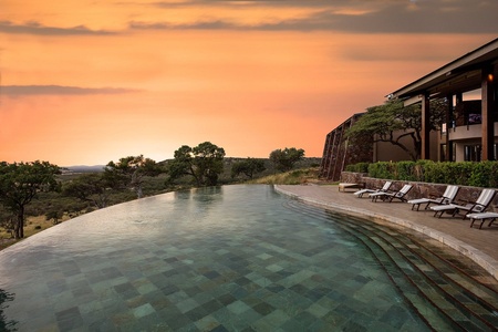
A private safari often works especially well for couples, honeymooners, families with children, photographers, older travelers, and anyone who values comfort, flexibility, or privacy.
What Is a Group Safari in Tanzania?
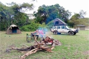
A group safari means you share the safari with other travelers who are not part of your own party. This usually means sharing the vehicle, guide, and fixed itinerary. In many cases, group safaris follow scheduled departure dates and a more structured route.
The main attraction is obvious: lower cost. Because the transport and guide costs are shared across multiple travelers, the price per person is usually lower than on a private safari.
That makes group safari travel attractive for budget-conscious travelers, solo travelers who want to reduce costs, and people who are comfortable with a less personalized experience.But let’s be honest: lower price does not automatically mean better value. If the group is slow, disorganized, noisy, or constantly misaligned on timing, the safari can become frustrating. Shared travel works well when expectations are realistic. It becomes a bad decision when people expect a private-level experience at a group-level price.
Before choosing based only on price, read our full guide to Tanzania Safari Cost so you understand what affects the final safari price.
The Main Difference Between Private and Group Safari Tanzania
The biggest difference is simple: a private safari is built around you, while a group safari requires you to fit into a shared structure.
That single difference affects almost everything else.
Flexibility
Private safaris are far more flexible. You can often adjust departure dates, park order, accommodation style, pace, and even how long you spend at sightings. Group safaris usually follow a set schedule that everyone must accept.
Privacy
Private safaris offer a more personal experience because you are only with your own party. Group safaris mean sharing the vehicle and the daily experience with other travelers.
Cost
Group safaris usually cost less per person because transport and guiding are shared. Private safaris usually cost more, especially for solo travelers or couples, because the fixed costs are spread across fewer people.
Comfort and Pace
Private safaris usually feel smoother because the pace matches your group. In group safaris, the pace depends on the whole vehicle, which can either work fine or become annoying fast.
Personalization
Private safaris allow much more customization. Group safaris are usually more fixed and less adaptable.
This is why treating the decision like a simple budget question is weak planning. You are not just choosing a price point. You are choosing how the safari will actually feel.
Benefits of a Private Safari in Tanzania
A private safari gives travelers more control, more comfort, and a more tailored experience from start to finish.
More Flexible Itinerary
One of the biggest advantages of a private safari is flexibility. If you want to focus more on certain parks, move at a different pace, or shape the route around your priorities, private travel makes that much easier.
For example, some travelers may want more time in Serengeti, while others want to balance the trip with Tarangire, Ngorongoro, and Lake Manyara. A private setup makes those decisions easier to manage.
Safari style also depends on trip length, so review our guide on How Many Days for Tanzania Safari before deciding whether private flexibility is worth it for your route.
Better for Families and Couples
Private safaris are often the best fit for families with children, couples, honeymooners, and close friends traveling together. You avoid the awkwardness of mixing your trip with strangers and you can move at a pace that works for your own group.
This matters more than people realize. Families may need more breaks. Couples may want a quieter, more intimate trip. Older travelers may prefer less rushing. Group travel does not always handle those differences well.
Better Wildlife Experience for Some Travelers
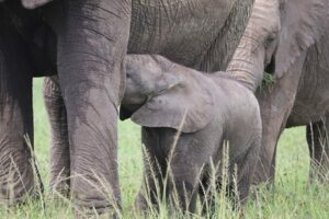
A private safari can improve the wildlife experience because your guide is focused on your party alone. You are not constantly balancing multiple people’s interests, attention spans, or time pressure.If you love photography, birding, or simply prefer not to feel rushed at sightings, private travel usually gives you a stronger experience.
Easier Accommodation Choices
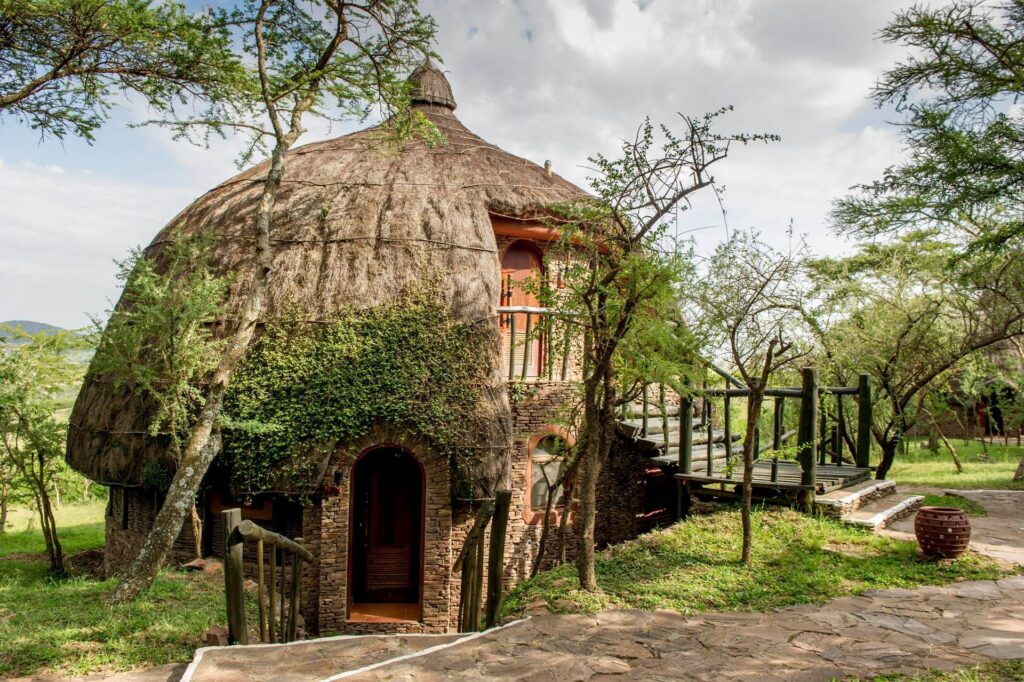
Private safaris make it easier to choose accommodation that fits your comfort level and style. You can usually align the safari more clearly with budget, mid-range, or luxury preferences.That matters because accommodation can shape the whole feeling of the trip. If you have not already done it,Your safari style should also match your accommodation expectations, so compare Luxury vs Mid-Range vs Budget Safari in Tanzania before choosing between private and group travel.
Benefits of a Group Safari in Tanzania
Group safaris have real advantages too, especially for travelers who care more about affordability than personalization.
Lower Cost Per Person
This is the biggest advantage and the reason most travelers consider group safari travel in the first place. Sharing the safari vehicle and guide reduces individual costs, which can make Tanzania more accessible for people with tighter budgets.
For many travelers, that matters. Tanzania is not the cheapest safari destination in Africa, so cost-sharing can make the difference between taking the trip and not taking it at all.
Good Option for Solo Travelers
For solo travelers, a private safari can become expensive quickly. A group safari offers a more affordable way to visit major parks without paying all the fixed transport costs alone.
That does not mean every solo traveler should jump into a group safari blindly. It means they should understand the tradeoff clearly. Lower cost often comes with less flexibility and less privacy.
Social Experience
Some travelers enjoy meeting other people during the safari. If you are outgoing and like shared travel experiences, a group safari can feel lively and fun.But do not romanticize this too much. Sometimes the group is great. Sometimes it is a mess. Shared travel depends heavily on the people, and that part is never fully in your control.
Downsides of a Private Safari in Tanzania
Private safaris are strong, but they are not perfect.
Higher Price
The biggest downside is cost. Because the vehicle and guide are dedicated to your party, the price per person is usually higher than on a shared safari.This is especially noticeable for solo travelers and couples. Larger private groups often get better value per person because the fixed costs are spread across more people.
Less Social Interaction
If part of your motivation is meeting other travelers, a private safari naturally offers less of that shared social environment.That is not a downside for everyone, but for some solo travelers it can matter.
Downsides of a Group Safari in Tanzania
Group safaris save money, but they come with tradeoffs that should not be ignored.
Less Flexibility
You usually have less control over the route, pace, departure date, and how long you spend on activities or sightings. The safari follows the group structure, not your personal preference.
Shared Space and Different Travel Styles
This is where group safari problems usually show up. You may be early and efficient, while someone else is always late. You may want long wildlife viewing, while someone else loses interest quickly. You may want a quiet experience, while someone else talks nonstop.
That mismatch can wear people down over several days.
Less Personal Experience
Because the guide is managing the whole group, the experience is usually less personalized than on a private safari. That does not mean it is bad. It means it is shared, and shared experiences are rarely as tailored.
Which Is Better for First-Time Safari Travelers?
There is no universal answer, but for many first-time travelers, a private safari is often the better choice if the budget allows it.
Why? Because first-time safari travelers usually benefit from a smoother, more flexible, less stressful experience. They may have more questions, stronger excitement around wildlife sightings, and less interest in compromising the trip around strangers.That said, a group safari can still work well for first-time travelers who are budget-focused, easygoing, and comfortable with shared travel conditions.
This is where honesty matters. If someone hates waiting on others, values privacy, or wants more control, pretending group travel will feel the same as private is nonsense. It will not.
Which Is Better for Families?
Private safari wins for most families. It is not even close.
Families often need a safari pace that matches children, rest needs, meal timing, and comfort preferences. Group safari structure usually does not handle that as well because the whole vehicle must move together.
Parents also usually prefer more privacy and less unpredictability when traveling with children. That makes private safari planning the smarter move in most cases.If family logistics, comfort, and trip structure matter,To avoid comparing prices blindly, check What’s Included in a Tanzania Safari Package so you know what is actually covered before booking.
Which Is Better for Couples or Honeymooners?
Private safari is usually the better option for couples and honeymooners because privacy, pace, and atmosphere matter more in that type of trip.
A honeymoon or romantic safari loses something if every day is shared with unrelated travelers on a fixed schedule. That does not mean group travel is impossible for couples. It means it usually is not the best fit if the budget allows better choices.
A private safari gives couples more space, more intimacy, and a trip that feels more personal overall.

Which Is Better for Budget Travelers?
Group safari is usually the better fit for budget travelers, especially solo travelers or travelers who are comfortable sharing transport and working within a fixed schedule.
But budget travelers still need to think clearly. Cheap is not the same as smart. A low-cost safari that feels rushed, uncomfortable, and poorly organized is not value. It is just a cheaper disappointment.The right move is to compare price against experience, not price alone. That is why Tanzania Safari Cost and What’s Included in a Tanzania Safari Package should both be part of the decision.
Which Is Better for Luxury Travelers?
Private safari is the clear winner for luxury travelers. Luxury and shared group structure usually do not belong in the same sentence unless the traveler specifically wants that.
Luxury safari travelers usually care about comfort, exclusivity, service, accommodation quality, and a smoother rhythm throughout the trip. Private safari aligns much better with those expectations.Your safari style should also match your accommodation expectations, so compare Luxury vs Mid-Range vs Budget Safari in Tanzania before choosing between private and group travel.
How to Choose Between Private and Group Safari Tanzania
The right choice depends on five things: budget, travel style, group size, comfort expectations, and how much control you want.
Choose a Private Safari If
- you want flexibility in dates and itinerary
- you value privacy and personal space
- you are traveling as a couple, family, or private group
- you care about comfort and pace
- you want a more personalized safari experience
Choose a Group Safari If
- your main goal is reducing cost
- you are comfortable sharing with other travelers
- you are flexible and easygoing about pace
- you do not mind a more fixed itinerary
- you are a solo traveler looking for a lower-cost safari option
If someone expects a private-level experience on a group-level budget, the expectation is unrealistic. It is better to understand the tradeoff before booking than to feel disappointed during the trip.
Is a Private Safari Worth the Extra Cost?
For many travelers, yes. A private safari is often worth the extra cost because the experience feels more comfortable, more efficient, and more aligned with personal priorities.
That does not mean everyone should spend more. It means the extra money often buys something real: flexibility, privacy, comfort, and better overall flow.The mistake is thinking private safari is just a luxury upgrade with no practical benefit. That is false. For families, couples, photographers, older travelers, and anyone who values pace and personalization, the benefit is very real.
Who Should Choose a Private Safari or Group Safari?
Choose a private safari if you want more control, privacy, comfort, and flexibility. It is usually the better option for families, couples, honeymooners, photographers, older travelers, and anyone who wants the safari to move at their own pace.
Choose a group safari if your main goal is to reduce cost and you are comfortable sharing the vehicle, guide, schedule, and travel experience with other people. It can work well for solo travelers and budget-conscious visitors, but only if expectations are clear from the beginning.
The wrong choice usually happens when travelers focus only on price and ignore how the safari will actually feel day by day.
Should You Choose a Private or Group Safari?
The best safari choice is not the cheapest one or the most expensive one. It is the one that matches the traveler.
Private safari Tanzania is usually better for travelers who want privacy, flexibility, comfort, and a more personalized experience. Group safari Tanzania is usually better for travelers who want to reduce cost and are comfortable sharing the experience with others.
Neither option is automatically right for everyone. What matters is choosing with clear expectations instead of lazy assumptions.A Tanzania safari is too important and too expensive to plan badly. If the style of safari does not match the traveler, the whole trip suffers.
At Kili Quests, we help travelers choose the safari structure that actually fits their budget, expectations, and travel style. If you are deciding between a private safari and a group safari in Tanzania, contact us and we will help you build the right trip from the start.
Frequently Asked Questions About Private vs Group Safari Tanzania
Is a private safari better than a group safari in Tanzania?
A private safari is usually better if you want flexibility, privacy, comfort, and a more personalized experience. You have more control over the itinerary, pace, accommodation style, and how long you spend at wildlife sightings. A group safari is better if your main priority is reducing cost and you are comfortable sharing the vehicle and schedule with other travelers.
Is a group safari cheaper than a private safari in Tanzania?
Yes, a group safari is usually cheaper per person because the vehicle, guide, and transport costs are shared among several travelers. This can make it a good option for solo travelers or visitors with a tighter budget. However, the lower price usually comes with less flexibility, less privacy, and a fixed itinerary.
Is a private safari worth the extra cost?
For many travelers, yes. A private safari is often worth the extra cost because it gives you a smoother, more comfortable, and more controlled experience. This matters especially for families, couples, honeymooners, photographers, older travelers, and anyone who does not want to adjust their trip around strangers.
Which safari is better for families or couples?
A private safari is usually better for families, couples, and honeymooners because it gives more privacy, comfort, and control over the daily pace. Families can manage rest stops and children’s needs more easily, while couples can enjoy a quieter and more personal experience. A group safari can still work for budget-focused travelers, but it is usually less flexible.
How do I choose between a private and group safari in Tanzania?
Choose a private safari if you want privacy, flexibility, comfort, and a trip shaped around your own pace. Choose a group safari if your main goal is lowering cost and you are comfortable with a fixed schedule and shared travel experience. The right choice depends on your budget, travel style, group size, and how much control you want during the safari.
Plan the Right Tanzania Safari for Your Travel Style
Not sure whether a private or group safari fits your trip?
At Kili Quests, we help you choose the safari style that matches your budget, comfort level, travel pace, and expectations. Whether you want a private family safari, a romantic couple’s safari, or a more budget-conscious shared option, we can help you plan it properly from the start.
Contact us today and we will help you build a Tanzania safari that fits the way you actually want to travel.
Related Articles

What’s Included in a Tanzania Safari Package? | Kili Quests
April 9, 2025
No Comments
Understand What Your Safari Includes We help you choose the right Tanzania safari package based on your budget, trip length, and travel style. Request Your

Luxury vs Mid-Range vs Budget Safari Tanzania | Kili Quests
April 23, 2026
No Comments
Choose the Right Safari Style The best safari is not the cheapest one or the most expensive one.It is the one that matches your comfort

Tanzania Safari Cost: Full Price Breakdown | Kili Quests
April 19, 2026
No Comments
Plan Your Tanzania Safari Budget We help you choose the right safari style, trip length, and parks based on your budget and travel goals. Request