Kilimanjaro’s Ecological Zones from Base to Summit

Table of Contents

Mount Kilimanjaro’s Ecological Zones Explained | Kili Quests

Mount Kilimanjaro is not only Africa’s tallest peak — it’s a vertical world of diverse climate zones, changing dramatically from the base to the summit. As you climb higher, you pass through five distinct ecological zones, each with its own temperature, vegetation, and wildlife.
In this article, Kili Quests explains each zone in detail — helping you prepare for what you’ll see, feel, and experience on your trek to Uhuru Peak.
 
This trail also passes through multiple [ecological zones], each with unique vegetation and wildlife(Flora and Fauna).
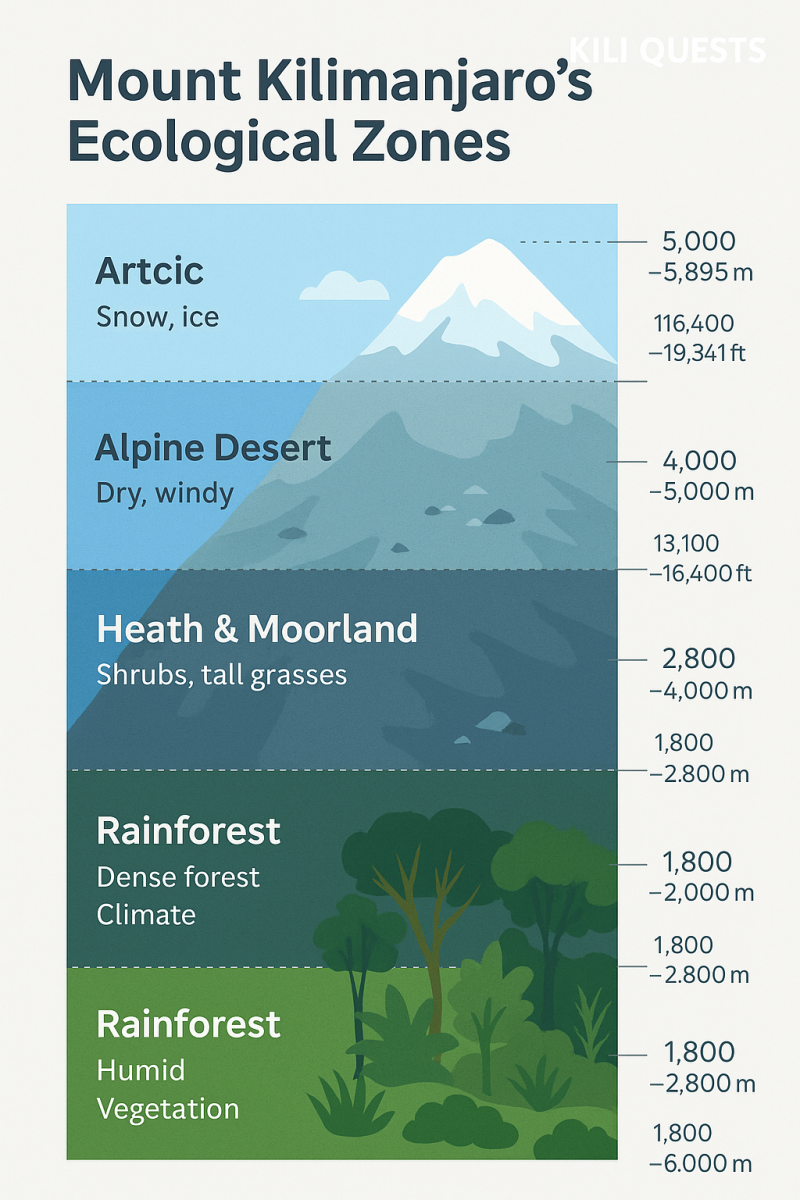
Infographic of Mount Kilimanjaro’s ecological zones showing rainforest, heath, moorland, alpine desert, and arctic summit with altitude labels in meters and feet.
Explore the five ecological zones of Mount Kilimanjaro — from lush rainforest to the icy arctic summit — each with unique climate, vegetation, and wildlife.

Cultivation Zone (800–1,800 m / 2,600–6,000 ft)

This is the lowest zone, covering the fertile foothills of Kilimanjaro.
Climate: Warm, humid, and tropical
Vegetation: Coffee farms, banana trees, maize, and sugarcane
People: Chagga communities live and farm here
Notable towns: Moshi, Marangu, Machame
Your trek usually starts above this zone, but you’ll pass through it while traveling to the trailhead.

Montane Forest Zone (1,800–2,800 m / 6,000–9,200 ft)

This is one of the richest biodiversity zones on Kilimanjaro.
Climate: Moist, foggy, with frequent rainfall
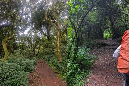
Vegetation: Dense tropical rainforest with ferns, fig trees, and lichens
Wildlife: Blue monkeys, black-and-white colobus monkeys, bushbuck
Experience: Lush scenery, birdsong, muddy trails
This zone is often wet and slippery — good waterproof boots and gaiters are essential.
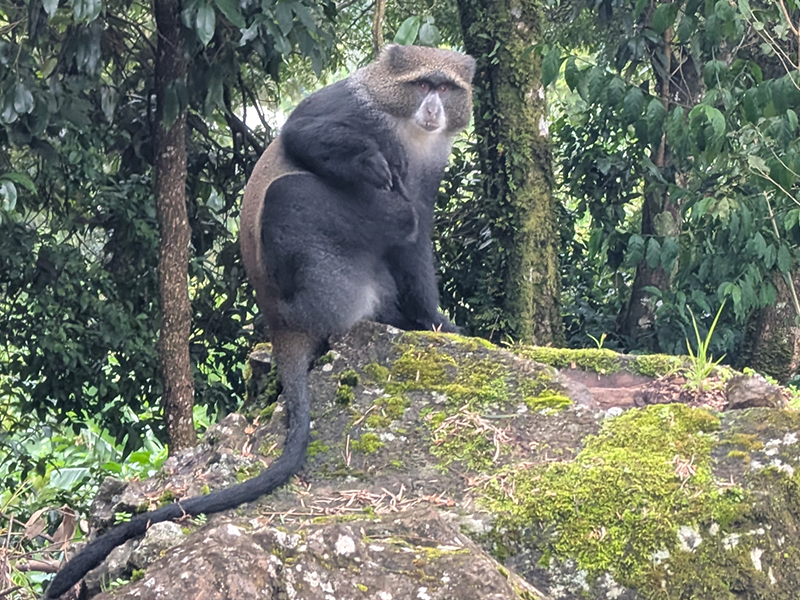
Blue monkey sitting on a moss-covered rock in the rainforest of Mount Kilimanjaro
A blue monkey (Cercopithecus mitis) rests on a mossy rock in Kilimanjaro’s montane rainforest — a common sight in the lower forest zone of the mountain.

Heather & Moorland Zone (2,800–4,000 m / 9,200–13,100 ft)

Here, the forest thins out into a surreal landscape.
Climate: Cooler, with sunny days and cold nights
Vegetation: Heath shrubs, giant groundsels, lobelias, and moss
Scenery: Open hills, valleys, and volcanic boulders
Sunlight: Intense UV during the day; sunscreen needed
You’ll notice a change in oxygen levels here, and altitude symptoms may begin to appear.
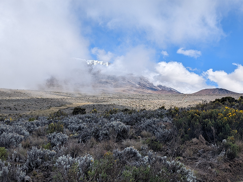
Moorland vegetation on Mount Kilimanjaro with cloud-covered summit and scattered alpine shrubs under a blue sky.
The heath and moorland zone on Mount Kilimanjaro, located between 2,800 and 4,000 meters, is known for its scattered shrubs, giant heathers, and surreal alpine landscape.

Alpine Desert Zone (4,000–5,000 m / 13,100–16,400 ft)

A dry, wind-blasted region with extreme temperature swings.
Climate: Very dry, hot in daytime, freezing at night
Vegetation: Sparse — mostly hardy lichens and small grasses
Terrain: Loose gravel, ash, and volcanic rock
Feel: Isolated, otherworldly, and vast
This is where you begin to feel like you’re walking on another planet.
 
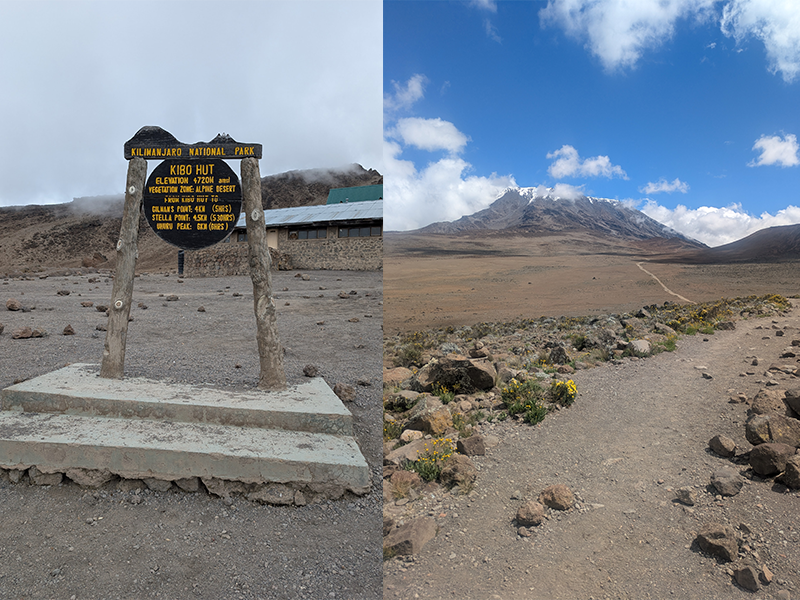
Kibo Hut signpost and view of Mount Kilimanjaro’s alpine desert zone with rocky terrain and sparse vegetation.
Kibo Hut, located at 4,720 meters, marks the start of the alpine desert zone on Mount Kilimanjaro — a dry, wind-swept region just below the summit.

Arctic Zone / Summit (5,000–5,895 m / 16,400–19,341 ft)

The final stretch to Uhuru Peak is harsh and unforgiving.
Climate: Freezing temperatures, high winds, low oxygen
Vegetation: None — this is a polar desert
Terrain: Glaciers, ice fields, volcanic scree
Experience: Physically intense, mentally rewarding
Despite the difficulty, reaching this zone means you’re almost at the summit of Africa.
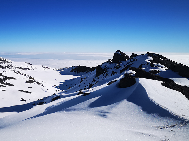
 
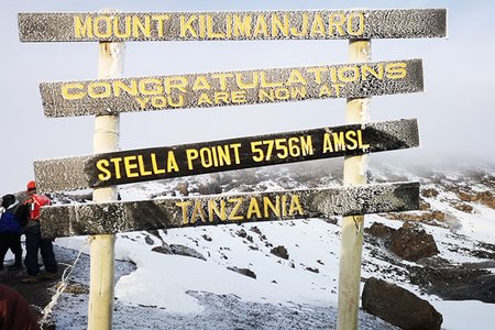
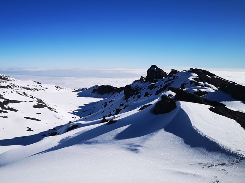
Snow-covered ridges near Stella Point on Mount Kilimanjaro with a clear blue sky above the clouds.
The arctic summit zone of Kilimanjaro near Stella Point is often blanketed in snow, offering breathtaking views above the cloud layer.

Why Understanding the Zones Matters

Gear prep: Knowing the zones helps you pack correctly for temperature and terrain
Mental prep: Each zone presents its own challenges
Appreciation: It’s rare to walk from rainforest to glaciers in a single journey — Kilimanjaro makes it possible

Final Thoughts

Climbing Mount Kilimanjaro is like walking from the equator to the Arctic, all in under a week. Each ecological zone is a chapter in your journey — from warm farmland to icy summit. Understanding these zones helps you prepare better and appreciate the incredible natural transitions along the way.

Climb with Experts Who Know the Zones

At Kili Quests, our guides are trained to navigate every zone — from dense forests to glacial ridges. We help you adjust to each stage of the mountain with expert pacing, acclimatization, and gear advice.Make sure to check our [Essential Kilimanjaro Packing List 2025] to avoid missing anything important.
 
If you’re new to high-altitude trekking, our [Altitude Sickness Tips & Risks] guide can help you stay safe.
 

Related Articles
Why Is It Called Stella Point?

Table of Contents

Why Is It Called Stella Point? The Story Behind the Name | Kili Quests

On your final push to the summit of Mount Kilimanjaro, you’ll likely pass a sign reading “Stella Point – 5,739 m (18,829 ft)” before reaching Uhuru Peak. But what is Stella Point exactly — and why is it named Stella?
In this article, Kili Quests uncovers the historical story behind Stella Point, a place where both the mountain’s history and the modern climb to Africa’s rooftop intersect.
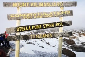
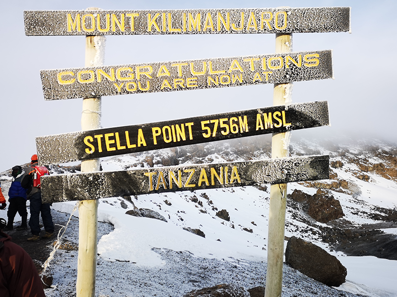
Stella Point signpost on Mount Kilimanjaro’s crater rim, frosted with snow and showing an elevation of 5,756 meters above sea level.
Stella Point, located at 5,756 meters on Mount Kilimanjaro’s crater rim, offers trekkers a dramatic first view into the summit zone. It was named after Estella Latham, one of the first recorded women to reach this altitude in 1925, making it a historic and emotional milestone on the Machame and Lemosho routes.

Where Is Stella Point?

Stella Point sits on the crater rim of Kibo, one of Kilimanjaro’s three volcanic cones. It’s a major landmark on the Machame, Lemosho, and Umbwe Routes, located just before the final ascent to Uhuru Peak.
When trekkers reach Stella Point, they’re less than an hour from the summit. Though not the true top, it’s a significant milestone — and even qualifies as a summit certificate location for some trekkers.
 
Ever wondered why it’s called Gilman,s Point? Here’s the real story.
 
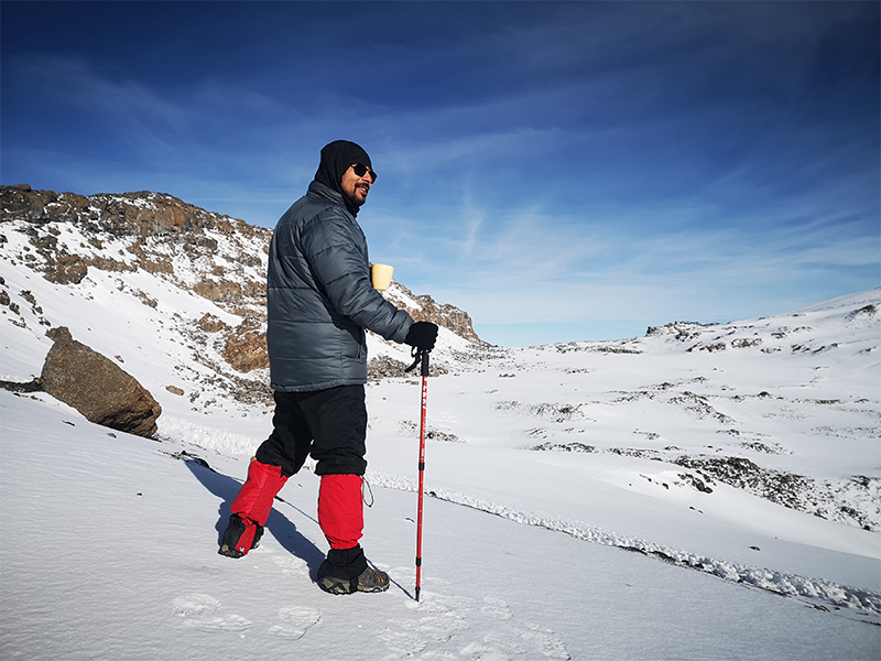
A climber stands on snow-covered terrain near Stella Point on Mount Kilimanjaro, holding a cup and trekking pole while overlooking the crater rim.
A trekker pauses to take in the spectacular view near Stella Point, where Kilimanjaro’s crater rim opens up into a vast, icy alpine landscape.

Who or What Is Stella Point Named After?

Stella Point is named in honor of Estella Latham, one of the earliest recorded women to reach this altitude on Mount Kilimanjaro in 1925. Unlike earlier assumptions linking the name to Hans Meyer’s family, historical accounts now attribute it to Latham’s notable achievement during a time when few women attempted such climbs. Hans Meyer, the first documented European to reach the summit in 1889, did name several features on the mountain — such as Gilman’s Point — but Stella Point was named later, reflecting a shift toward recognizing climbers beyond colonial figures or sponsors.

Curious who first reached the summit of Kilimanjaro? Discover the full story of [Hans Meyer’s historic ascent in 1889]

Stella Point summit sign on Kilimanjaro at 5,756 meters, named after Estella Latham who reached this point in 1925.
Estella Latham became one of the first recorded women to reach Stella Point on Mount Kilimanjaro in 1925. The point was later named in her honor, marking a milestone in early female mountaineering history

What Happens at Stella Point Today?

Today, Stella Point is the first place where most climbers reach the rim of Kibo’s crater. When you arrive, you’ll see the iconic wooden sign, usually in the early morning cold, with views of the surrounding glaciers and crater floor.
While it’s not the final summit, reaching Stella Point is a major achievement, especially due to the steep, exhausting climb just before it — often done at night in freezing conditions.
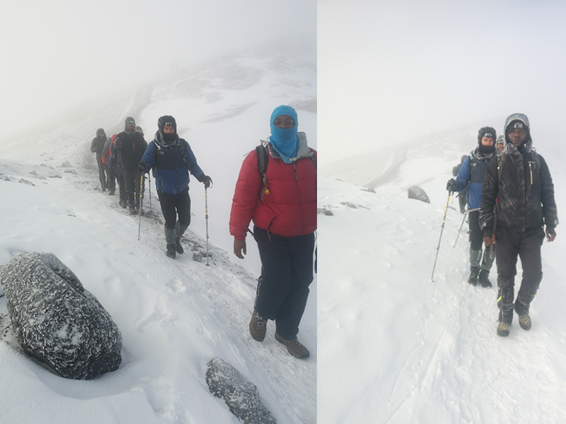
Trekkers and guides hiking through snow near Stella Point on Mount Kilimanjaro during the final summit approach.
Trekkers and KILI QUESTS guides push through snow and fog near Stella Point, one of the final checkpoints before reaching Kilimanjaro’s summit at Uhuru Peak.

Stella Point vs. Uhuru Peak: What's the Difference?

  • Stella Point: 5,739 m (18,829 ft) — crater rim
  • Uhuru Peak: 5,895 m (19,341 ft) — true summit of Africa
  • Distance between the two: ~150 vertical meters, 45–60 min trek
Stella Point earns you a “Kilimanjaro Summit Certificate”, but if you want to stand at the true roof of Africa, you’ll need to continue to Uhuru Peak.

Did You Know?

  • Many climbers stop at Stella Point due to exhaustion or altitude effects, and still receive a partial summit certificate.
  • The sunrise views from Stella Point are breathtaking — some say even more magical than from Uhuru.
  • You’ll likely pass through Stella Point on the way up via  different route including Machame ,Lemosho, Shira ,Umbwe but if you climb via the Marangu Route. and Rongai route you will pass Gilman’s point first then stella point.
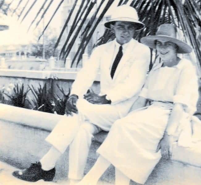
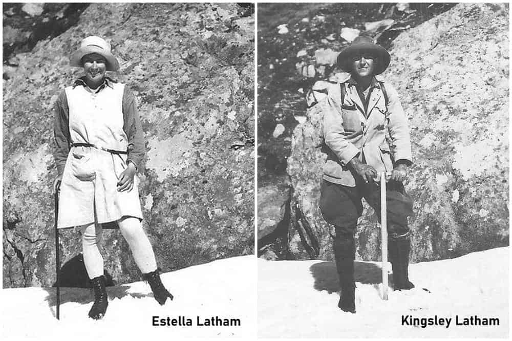
Historical photo of Estella Latham and Kingsley Latham during their 1925 Mount Kilimanjaro expedition.
Estella Latham (left) and Kingsley Latham (right) during their 1925 expedition on Mount Kilimanjaro. Estella became one of the first recorded women to reach 5,756 meters, and Stella Point was later named in her honor.

Final Thoughts

Stella Point is more than just a marker near the summit — it’s a landmark rooted in Kilimanjaro’s climbing history. Named in honor of Estella Latham, one of the first recorded women to reach this altitude in 1925, Stella Point represents both personal achievement and historical significance. Whether you pause here to witness the sunrise or continue your final push to Uhuru Peak, arriving at Stella Point is a powerful reminder of how far you’ve come — and how close you are to standing on the roof of Africa.
 
Not many know that the first Kilimanjaro summit wasn’t just a European feat — Lauwo, a young Chagga man, was the local hero behind it

Plan Your Journey with Kili Quests

At Kili Quests, we guide you beyond just reaching the top — we help you connect with the history, meaning, and magic of Mount Kilimanjaro.
Whether you’re taking the Lemosho, Machame, or Umbwe Route, our experienced team ensures your journey to Stella Point and beyond is safe, supported, and unforgettable.Each route has its pros and cons—see our Kilimanjaro Route Comparison to choose the best fit.
 

Related Articles

Why Is It Called Gilman’s Point?

Table of Contents

Why Is It Called Gilman’s Point? The Story Behind the Name | Kili Quests

Climbers taking the Marangu or Rongai Route to the top of Mount Kilimanjaro will first reach a significant milestone before Uhuru Peak: Gilman’s Point, located at 5,681 meters (18,638 feet) on the rim of Kibo crater.
But what exactly is Gilman’s Point, and who was Gilman? In this article, Kili Quests reveals the historical origins behind this lesser-known but important summit marker.
 
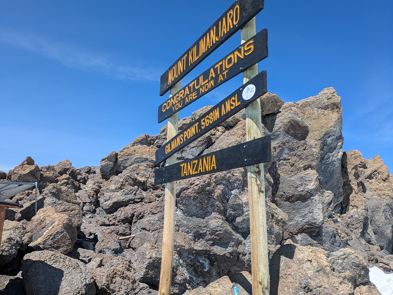
Gilman’s Point summit sign on Mount Kilimanjaro, located at 5,681 meters above sea level, with rocky terrain and clear blue sky.
Gilman’s Point, located at 5,681 meters on the crater rim of Mount Kilimanjaro, marks one of the recognized summit points along the Marangu Route.

Where Is Gilman’s Point on Kilimanjaro?

Gilman’s Point lies on the eastern rim of Kilimanjaro’s Kibo crater and is the first major summit marker reached by climbers ascending via the Marangu or Rongai Route.
Reaching this point is a huge accomplishment — it marks the beginning of the crater rim and earns climbers an official “Kilimanjaro Summit Certificate.” From here, it takes roughly 1.5–2 hours to continue on foot to Uhuru Peak, the true summit of Africa.

Who Was Gilman?

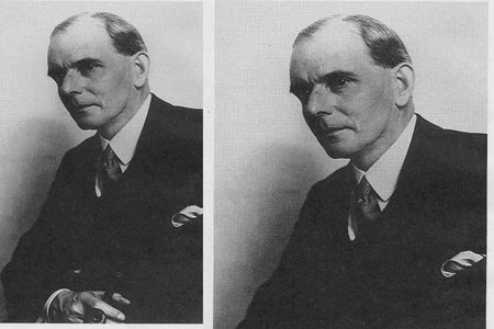
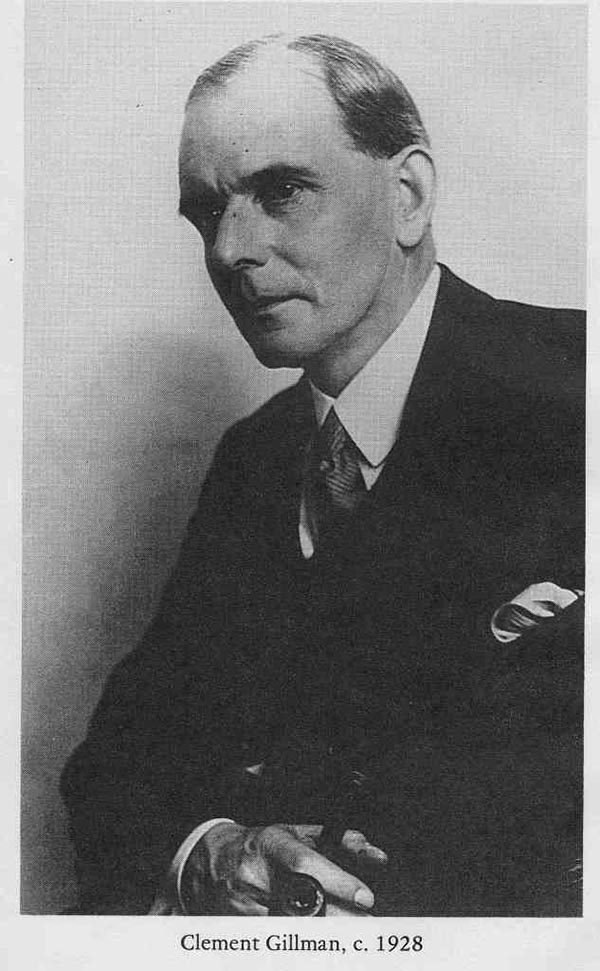
Black and white portrait of Clement Gillman, British surveyor and geographer, circa 1928.
Clement Gillman was a British geographer and colonial surveyor whose name was given to Gilman’s Point on Mount Kilimanjaro’s crater rim.
Gilman’s Point is named after Clement Gillman, a British geographer, civil engineer, and explorer who conducted important mapping and survey work in East Africa during the early 20th century.
  • He helped document Kilimanjaro’s physical geography and elevation
  • His surveys contributed to modern cartography in Tanzania
  • The point was named to honor his contributions to Kilimanjaro’s exploration.
Although he wasn’t the first to climb Kilimanjaro, Clement Gillman’s legacy is closely tied to understanding the mountain’s terrain, geology, and routes.
Note: The name is sometimes misspelled as “Gillman’s Point,” but the correct version is “Gilman’s Point.”
 
Curious who first reached the summit of Kilimanjaro? Discover the full story of Hans Meyer’s historic ascent in 1889

Why Does Gilman’s Point Matter?

For many climbers, Gilman’s Point represents:
  • The beginning of the crater rim, and the hardest part of the climb.
  • A key psychological victory before the final summit push.
  • A place of recognition, since reaching here earns you a summit certificate (even if you don’t continue to Uhuru).

Gilman’s Point vs. Uhuru Peak

Feature Gilman’s Point  And  Uhuru Peak
Elevation: 5,681 m / 18,638 ft     vs   5,895 m / 19,341 ft
Location : Eastern crater rim     vs   Western crater rim
Routes Reached:  Marangu, Rongai  vs    All main routes
Certificate Official: “summit” certificate    vs   Full summit certificate
Time to Uhuru :1.5hr     vs      2 hours more
 
Ever wondered why it’s called Stella Point? Here’s the real story
Snow-covered view of Mount Kilimanjaro’s crater rim as seen from Gilman’s Point at sunrise.
After arriving at Gilman’s Point (5,681 m), climbers are rewarded with breathtaking views across the snow-covered crater rim — a dramatic landscape near the summit of Kilimanjaro.

Did You Know?

The final push to Gilman’s Point is often done at night and is one of the toughest sections of the Marangu Route.
Sunrise from Gilman’s Point offers stunning views over the clouds and down toward Kenya.
Gilman’s Point is one of three named summit markers on Kilimanjaro, along with Stella Point and Uhuru Peak.

Final Thoughts

Gilman’s Point may not be the highest point on Kilimanjaro, but it’s packed with historical and emotional significance. Named after a key explorer who helped map the region, it marks a transition point between struggle and summit, where climbers often reflect on how far they’ve come.
Whether you stop here or continue to Uhuru Peak, standing at Gilman’s Point is a true achievement, worthy of celebration.
 

Plan Your Journey with Kili Quests

If you’re planning to climb via the Marangu or Rongai Route, you’ll pass through Gilman’s Point — one of Kilimanjaro’s historic landmarks.
With Kili Quests, you’ll be guided by experienced professionals who know every twist of the trail and the story behind every name on the mountain.


Related Articles

Hans Meyer and the First Kilimanjaro Ascent

Table of Contents

Who Was Hans Meyer? The First Ascent of Kilimanjaro | Kili Quests

In 1889, a German geographer named Hans Meyer became the first recorded person to reach the summit of Mount Kilimanjaro, standing at 5,895 meters (19,341 feet). His expedition marked the beginning of modern exploration on Africa’s highest mountain — and left behind a legacy still visible in the names of Kilimanjaro’s summit points.
In this article, Kili Quests explores who Hans Meyerwas, the story of his historic climb, and how his journey shaped the way we understand Kilimanjaro today.
 
Ever wondered why it’s called Gilmans  Point? Here’s the real story
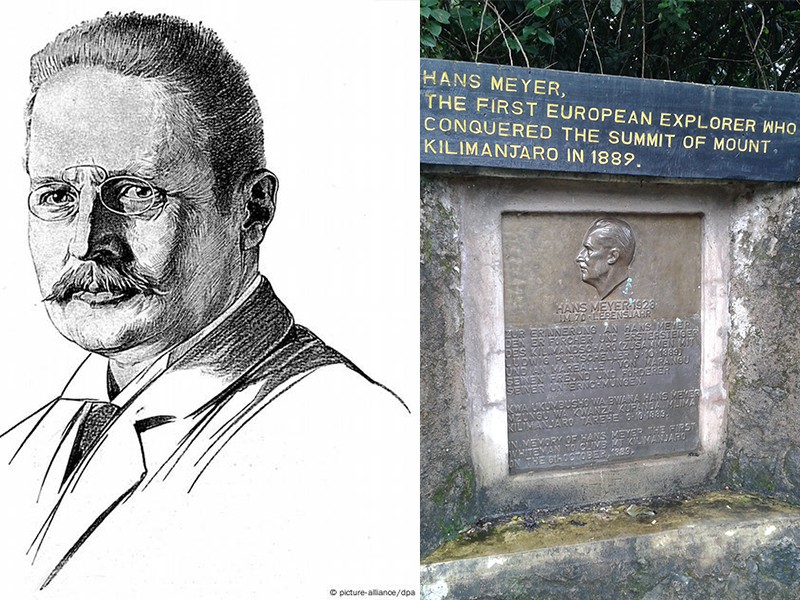
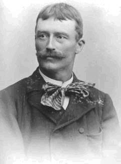
Portrait of Hans Meyer and the memorial plaque at Marangu Gate commemorating his 1889 first ascent of Mount Kilimanjaro.
Hans Meyer was the first European to reach the summit of Kilimanjaro in 1889. This historical plaque at the Marangu Gate Information Center honors his achievement and marks his contribution to the mountain’s climbing history.

Who Was Hans Meyer?

Hans Meyer was a German geographer, mountaineer, and professor at the University of Leipzig. He had a passion for exploring uncharted mountains and became fascinated by Kilimanjaro — then one of the few unconquered peaks in the world.
His ambition led him to organize several expeditions to climb the mountain, each one gaining more ground until he finally succeeded in October 1889.
 
Ever wondered what ‘Kilimanjaro’ actually means? Discover the theories and history behind the name in our Kilimanjaro origin article.
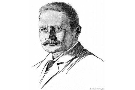
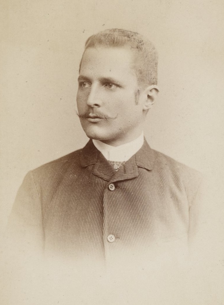
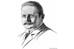
Portrait of Hans Meyer, German geographer and first European to summit Mount Kilimanjaro in 1889 | Kili Quests
Hans Meyer, a German geographer, became the first documented person to reach Uhuru Peak on Mount Kilimanjaro in 1889, accompanied by Austrian climber Ludwig Purtscheller and a Chagga guide named Lauwo.
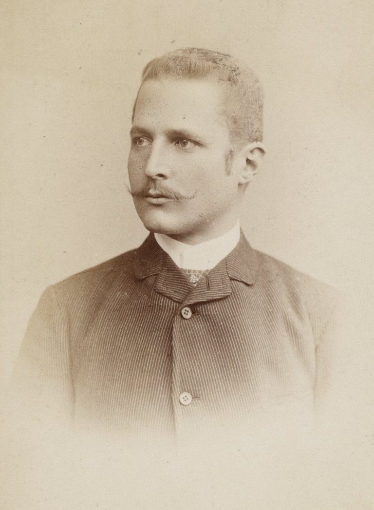
Portrait of Ludwig Purtscheller, Austrian climber who summited Mount Kilimanjaro in 1889 with Hans Meyer | Kili Quests
Ludwig Purtscheller, an experienced Austrian mountaineer, reached the summit of Kilimanjaro with Hans Meyer and local guide Lauwo in 1889.

The First Successful Ascent

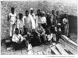
Meyer’s third expedition, which made it to the summit, included:
  • Ludwig Purtscheller, a skilled Austrian alpinist
  • Lauwo, a Chagga tribesman and local guide from Marangu
  • Several porters and support crew
  • On October 6, 1889, the team became the first recorded group to reach the summit of Kibo, the tallest of Kilimanjaro’s three volcanic cones.
  • This historic moment laid the foundation for Kilimanjaro’s future as one of the world’s most iconic trekking destinations.

Discover the untold story of Lauwo, the barefoot teenager who helped lead the first successful Kilimanjaro expedition.

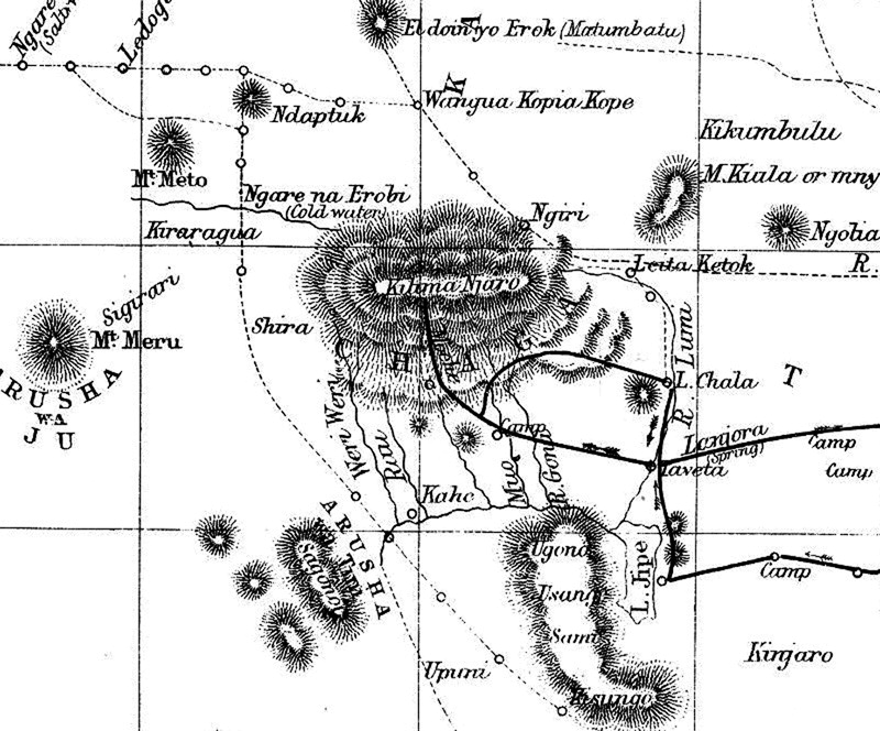
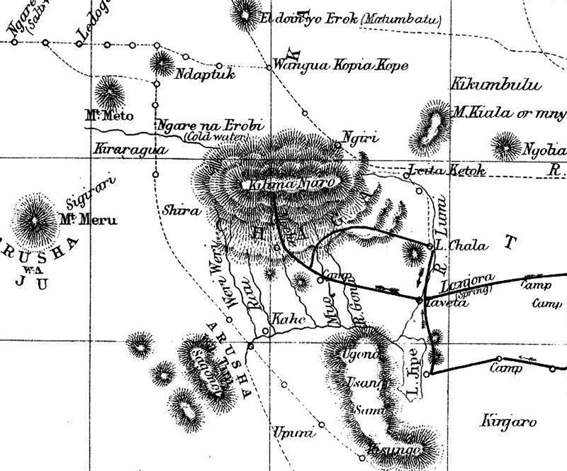
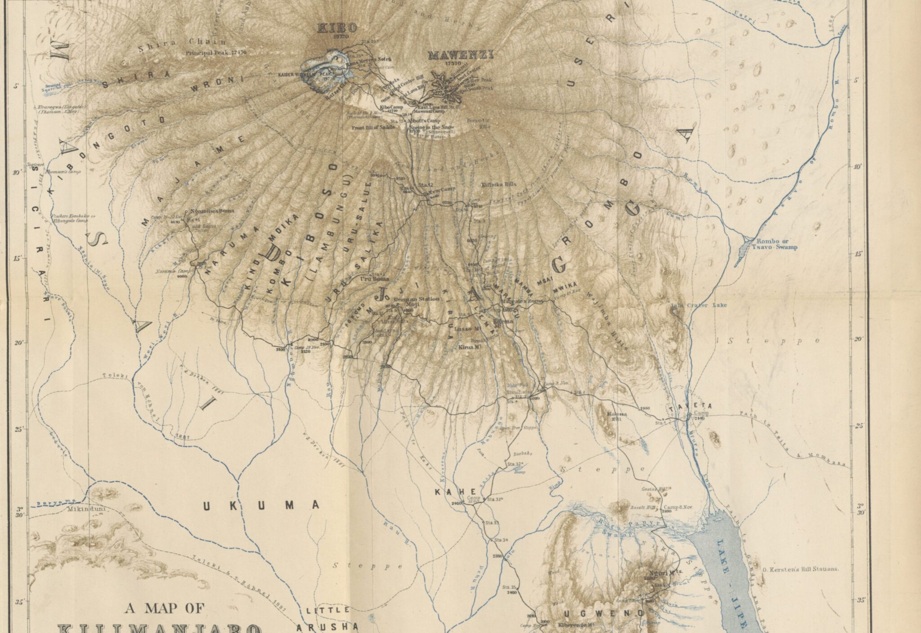
Vintage map of Mount Kilimanjaro showing routes, landmarks, and geography as seen in the 1990s | Kili Quests
A look back in time — this 1990s Kilimanjaro map reflects how the mountain was explored, traveled, and understood decades ago.

What Made the Expedition Historic?

  •  Meyer’s team spent weeks acclimatizing and exploring different routes
  • They were the first to document the mountain’s crater rim
  • The ascent helped map Kilimanjaro’s geography for future climbers
  • They reached the summit long before modern gear or support systems existed
  • Meyer’s expedition was not just a physical feat — it was a scientific and cultural milestone in East African exploration.
Glacial snow and ice covering the crater rim of Mount Kilimanjaro during dry season ascent | Kili Quests
Kilimanjaro’s crater rim wrapped in snow and ancient ice — a glimpse into the mountain’s glacial past.
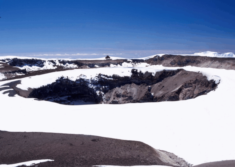
Dry, snowless crater rim of Mount Kilimanjaro showing volcanic rock and summit trail | Kili Quests
The exposed crater rim reveals Kilimanjaro’s raw volcanic structure — dramatic, vast, and wind-carved by time.

Naming the Summit Points

Many of Kilimanjaro’s key landmarks are named after people involved in or inspired by Meyer’s expeditions:
  • Gilman’s Point – named for Clement Gilman, a British cartographer
  • Stella Point – believed to be named after Meyer’s wife
  • Uhuru Peak – renamed in 1961 to honor Tanzania’s independence (originally called “Kaiser Wilhelm Spitze”)
While Meyer originally named the summit after the German emperor, it was later changed to reflect Tanzania’s national identity and independence.
 
Ever wondered why it’s called Stella Point? Here’s the real story

Meyer’s Legacy on Kilimanjaro

  • He published several books and maps about Kilimanjaro
  • His story is taught in East African geography and climbing history
  • His pioneering climb paved the way for over 35,000 people a year to attempt the summit today
  • The role of Lauwo, his Chagga guide, is now also celebrated as a symbol of Tanzanian contribution to the mountain’s history
1889 exploration map of Mount Kilimanjaro drawn by Hans Meyer, highlighting the early summit path and crater area | Kili Quests
A legacy etched in ink — Hans Meyer’s 1889 map captured Kilimanjaro’s summit long before modern routes existed.

Final Thoughts

Hans Meyer’s first successful climb of Mount Kilimanjaro was more than just a mountaineering victory — it was the beginning of the mountain’s modern legacy. His journey combined science, endurance, and intercultural cooperation, with help from locals like Lauwo, whose name deserves equal recognition.
Every climber who follows in Meyer’s footsteps is walking a trail carved by history — one that continues to inspire adventurers from all over the world.
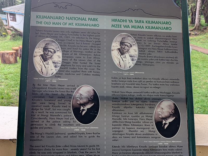
Interpretive sign at Kilimanjaro National Park showing historical profiles of Yohani Kinyala Lauwo, the first local guide of Mount Kilimanjaro, and Hans Meyer, the first recorded European to summit Kilimanjaro in 1889.
Informational sign at Kilimanjaro National Park honoring Yohani Kinyala Lauwo, the first local Kilimanjaro guide, and Hans Meyer, the first European summiteer in 1889. Their partnership marked the beginning of Kilimanjaro’s climbing history.

Plan Your Climb with Kili Quests

At Kili Quests, we honor Kilimanjaro’s history while helping trekkers write their own. Whether you choose the Marangu,Umbwe,Shira,Northern circuit, Machame, or Lemosho Route,Rongai route we guide you to the summit with expert care and deep respect for the mountain’s legacy.
 

Related Articles

Who Was Lauwo? Kilimanjaro’s First Local Guide

Table of Contents

Who Was Lauwo? Tanzania’s First Kilimanjaro Guide | Kili Quests

When talking about the first successful ascent of Mount Kilimanjaro, most people mention the German explorer Hans Meyer. But behind that achievement was a local Chagga man named Lauwo — a name that deserves far more recognition.
In this article, Kili Quests shares the story of Yohani Kinyala Lauwo, the first Tanzanian guide to summit Kilimanjaro. His contribution is a powerful reminder that the mountain’s history is not just written by explorers — but also by the people of the mountain.
 
Mount Kilimanjaro’s exploration began long before tourism — read how Hans Meyer and his Chagga guide Lauwo made the first successful climb
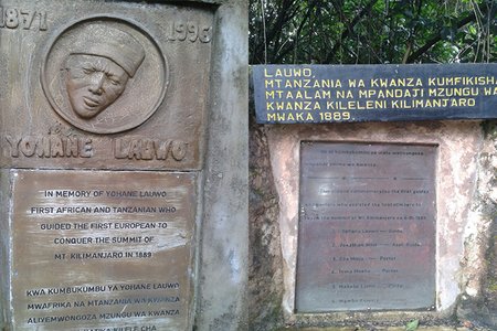
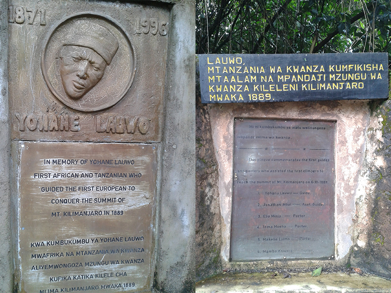
Memorial plaques honoring Yohane Lauwo, the first Tanzanian to guide a European to Kilimanjaro’s summit in 1889.
Yohane Lauwo is remembered as the first African and Tanzanian guide to summit Mount Kilimanjaro, assisting Hans Meyer in the historic 1889 expedition.

Who Was Lauwo?

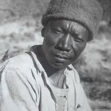
Yohani Kinyala Lauwo was a Chagga tribesman from Marangu, a village on the southeastern slopes of Mount Kilimanjaro.At just 18 years old, Lauwo was recruited to join Hans Meyer’s 1889 expedition — and successfully helped guide the team to the summit of Kibo, the highest of Kilimanjaro’s volcanic cones.He was not just a porter or helper. Lauwo’s local knowledge, strength, and courage were essential to the team’s success in navigating unknown terrain, severe weather, and dangerous altitude.
 
Your Kilimanjaro climb wouldn’t be possible without the help of porters — see what they really do behind the scenes
Portrait of Ludwig Purtscheller, Austrian climber who summited Mount Kilimanjaro in 1889 with Hans Meyer | Kili Quests
Ludwig Purtscheller, an experienced Austrian mountaineer, reached the summit of Kilimanjaro with Hans Meyer and local guide Lauwo in 1889.
Portrait of Hans Meyer, German geographer and first European to summit Mount Kilimanjaro in 1889 | Kili Quests
Hans Meyer led the first successful recorded expedition to the summit of Mount Kilimanjaro in 1889, marking a historic moment in mountaineering.
What Role Did Lauwo Play?

Lauwo:
  • Helped scout and clear a viable route toward the summit Kilimanjaro.
  • Supported both Meyer and Austrian alpinist Ludwig Purtscheller during the climb.
  • Became the first known African to stand on Kilimanjaro’s summit.
His involvement was never just physical — his deep understanding of the mountain’s behavior, weather, and routes made him an invaluable guide.
 
Ever wondered why it’s called Gilmans Point? Here’s the real story.

Why Is Lauwo’s Story Often Overlooked?

For many decades, Lauwo’s role in the historic 1889 ascent was understated or ignored in international records. Hans Meyer and Purtscheller were widely credited as the “first to reach the summit,” while Lauwo remained unnamed.
However, Tanzanian historians and local mountaineering communities have worked hard to reclaim his story — and today, Lauwo is increasingly recognized as the first Tanzanian and the first African to summit Mount Kilimanjaro(Uhuru peak).
Vintage map of Mount Kilimanjaro showing routes, landmarks, and geography as seen in the 1990s | Kili Quests
A look back in time — this 1990s Kilimanjaro map reflects how the mountain was explored, traveled, and understood decades ago.

Lauwo’s Legacy

 He continued to guide climbs into his later years — even into his 70s
  • According to local records, he lived to be over 120 years old, passing away in the early 1990s
  • His descendants still live in Marangu, and the Lauwo family is a respected name in Tanzanian guiding history
  • Many guides today see him as the original role model for Tanzanian mountain professionals
Explore Chagga traditions that are deeply tied to the mountain.At Kili Quests, we believe that honoring pioneers like Lauwo is essential to preserving the true story of Kilimanjaro.

Final Thoughts

Lauwo was not just a footnote in Hans Meyer’s expedition — he was a hero in his own right. As the first Tanzanian to summit Kilimanjaro, he represents the strength, wisdom, and endurance of local mountain people who have supported climbers for over a century.
When you climb Kilimanjaro today, you’re walking in the footsteps of Lauwo — the guide who led the way long before modern gear or recognition.

Climb Kilimanjaro with Local Experts

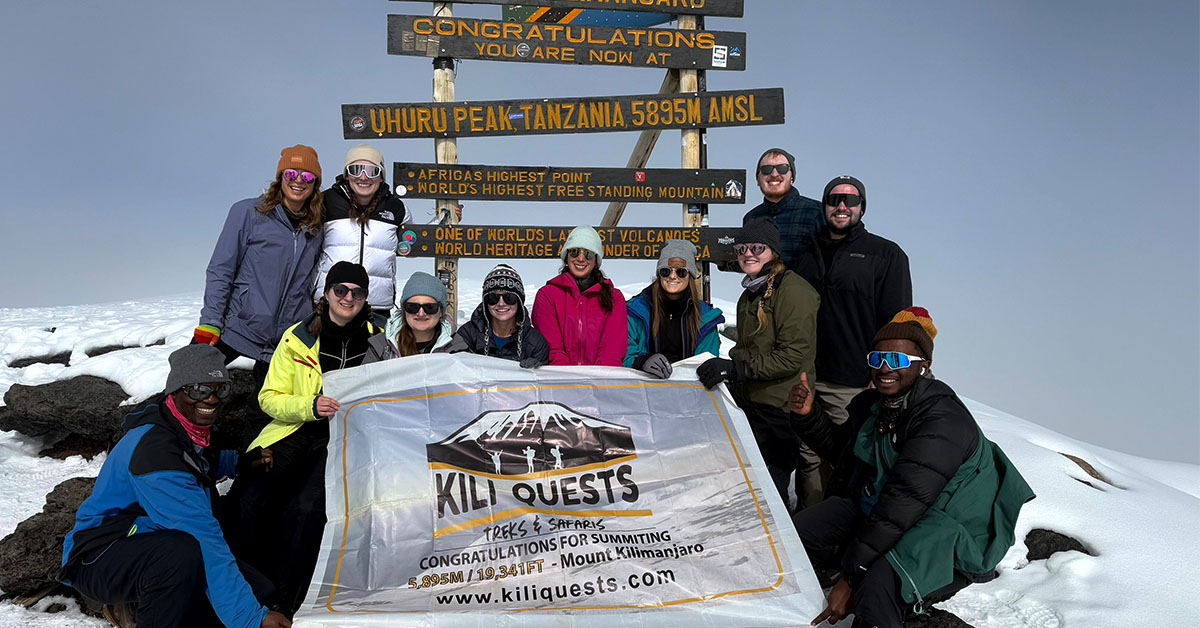
Group of trekkers celebrating together at Uhuru Peak, the summit of Mount Kilimanjaro
Tourists celebrate their successful summit at Uhuru Peak alongside our expert KILI QUESTS guides, proudly raising the flag at Africa’s highest point.
At Kili Quests, our guides continue the legacy of Lauwo — born on the mountain, trained by experience, and driven by passion. Whether you climb the Marangu, Machame, or Lemosho Route, we’ll guide you with the same commitment that Lauwo showed more than a century ago.

Related Articles

How Uhuru Peak Got Its Name After Independence

Table of Contents

From Kaiser Wilhelm Spitze to Uhuru Peak: Kilimanjaro and Tanzania’s Independence | Kili Quests

Mount Kilimanjaro’s summit is known today as Uhuru Peak — a symbol of freedom and pride for the people of Tanzania. But before independence, this same summit carried a very different name: Kaiser Wilhelm Spitze, a colonial-era label honoring the German emperor.
In this article, Kili Quests explores how Kilimanjaro’s highest point was renamed, what “Uhuru” truly means, and how the summit came to represent a new chapter in Tanzania’s history.
 
More than just a mountain name, Uhuru Peak reflects a national milestone. Learn how the summit became a symbol of freedom
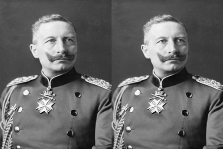
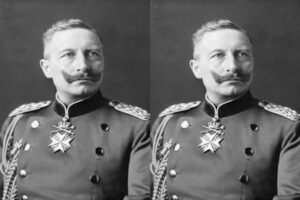
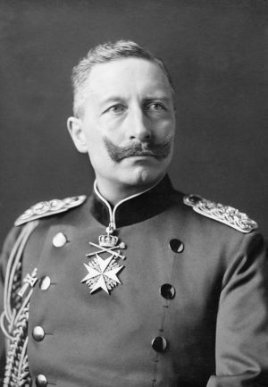
Portrait of Kaiser Wilhelm II, the German emperor after whom Kilimanjaro’s summit was named during colonial rule.
Kaiser Wilhelm II was the namesake of Kilimanjaro’s summit during the German colonial era — formerly called Kaiser Wilhelm Spitze until Tanzania gained independence.

The Colonial Name: Kaiser Wilhelm Spitze

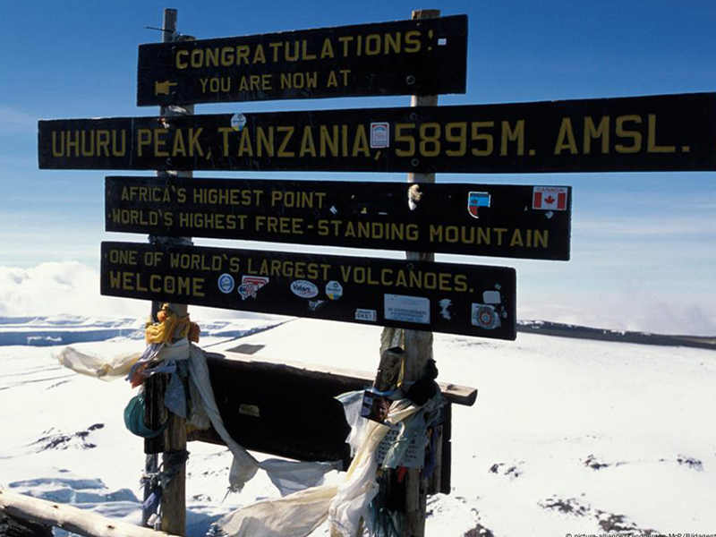
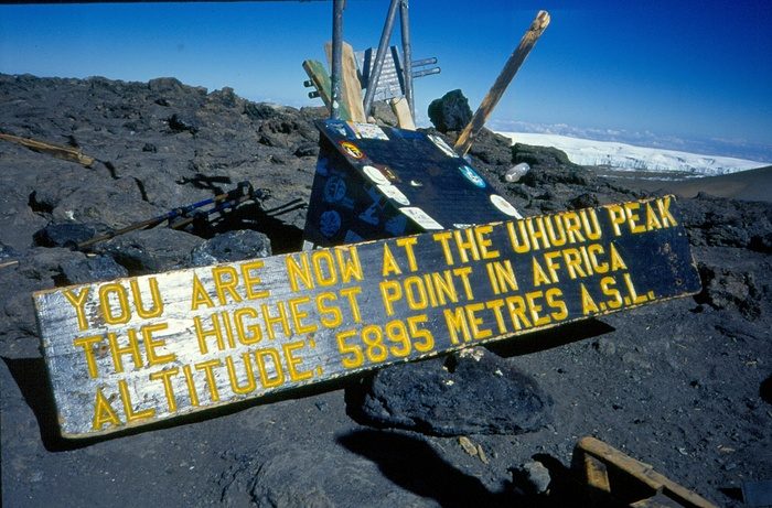
Historic wooden sign at Uhuru Peak on Mount Kilimanjaro displaying the highest point in Africa at 5,895 meters above sea level.
An early sign at Uhuru Peak, renamed in the 1960s after Tanzanian independence. Before this, Europeans knew the summit as Kaiser Wilhelm Spitze during the colonial era.
In 1889, German explorer Hans Meyer became the first recorded person to reach the summit of Mount Kilimanjaro. As part of his achievement, he named the peak Kaiser Wilhelm Spitze, or “Emperor William Peak,” in honor of Kaiser Wilhelm II, the ruler of the German Empire.
At the time, Tanzania (then German East Africa) was a colony under German control, and naming major geographical landmarks after European royalty was a common colonial practice.
Uhuru Peak sign at the summit of Mount Kilimanjaro showing elevation and independence-related messages.
Since 1964, the summit of Kilimanjaro has been officially known as Uhuru Peak — a name symbolizing Tanzanian freedom. During colonial times, it was called Kaiser Wilhelm Spitze by Europeans.

A Mountain Under Many Flags

Throughout the early 20th century, Kilimanjaro — like much of East Africa — changed hands between colonial powers:
  • German control (late 1800s to WWI)
  • British control (after World War I, renamed Tanganyika Territory)
  • Independence movement grows in the 1950s
Despite these political changes, the mountain remained a cultural and geographic icon for local communities — especially the Chagga people, who lived on its slopes.

Tanzania Independence and the Renaming of the Summit

On December 9, 1961, Tanganyika gained independence from British colonial rule and became a sovereign nation.
As part of celebrating this historic milestone, the government officially renamed Kilimanjaro’s summit from Kaiser Wilhelm Spitze to “Uhuru Peak.”
The word “Uhuru” means “freedom” in Swahili — Tanzania’s national language.
This change was more than symbolic. It marked:
  • A rejection of colonial naming and legacy.
  • A celebration of African identity and independence.
  • A reminder that Tanzania’s highest point belongs to its people.

Uhuru Peak Today

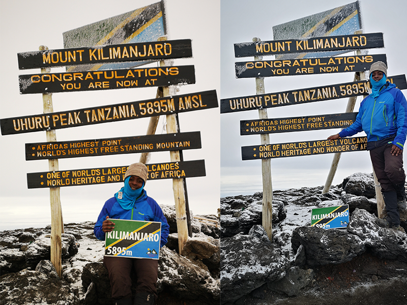
Trekkers posing at the Uhuru Peak summit sign on Mount Kilimanjaro, marking Africa’s highest point at 5,895 meters.
Ones of Kili Quests Member celebrate reaching Uhuru Peak, the highest point in Africa. The sign marks 5,895 meters above sea level — a powerful moment for every Kilimanjaro climber.
Uhuru Peak stands as:
The highest point in Africa (5,895 m / 19,341 ft)
A place where independence meets elevation
A globally recognized name that reflects Tanzania’s values
Today, climbers from all over the world take photos beneath the summit sign that proudly reads:
“Congratulations! You are now at Uhuru Peak, Tanzania, 5,895 m. Africa’s Highest Point. World’s Highest Free-Standing Mountain.”

Did You Know?

The renaming was part of a wider movement in post-colonial Africa to reclaim names, borders, and identities.Uhuru Peak was officially named within months of independence, showing how deeply the name was tied to national pride.Other peaks on Kilimanjaro — such as Stella Point and Gilman’s Point — still retain their explorer-era names
 
Ever wondered why it’s called Stella Point? Here’s the real story
Portrait of Hans Meyer, German geographer and first European to summit Mount Kilimanjaro in 1889 | Kili Quests
Hans Meyer led the first successful recorded expedition to the summit of Mount Kilimanjaro in 1889, marking a historic moment in mountaineering.
Portrait of Ludwig Purtscheller, Austrian climber who summited Mount Kilimanjaro in 1889 with Hans Meyer | Kili Quests
Ludwig Purtscheller, an experienced Austrian mountaineer, reached the summit of Kilimanjaro with Hans Meyer and local guide Lauwo in 1889.
Final Thoughts

Mountains carry meaning — and for Tanzania, Uhuru Peak stands not only as a geographical high point but as a symbol of national freedom.From a colonial name tied to European empire, to a Swahili name that honors independence, the summit of Kilimanjaro tells a powerful story. Every climber who reaches it stands on more than volcanic rock — they stand on the spirit of Uhuru.
Vintage map of Mount Kilimanjaro showing routes, landmarks, and geography as seen in the 1990s | Kili Quests
A look back in time — this 1990s Kilimanjaro map reflects how the mountain was explored, traveled, and understood decades ago.

Climb to Uhuru Peak with Kili Quests

At Kili Quests, we guide you to more than just a summit — we guide you through a journey of culture, history, and self-discovery.Whether it’s your first trek or your return to the mountain, we’ll help you reach Uhuru Peak with expert guidance, preparation, and respect for the land and its story.Explore Chagga traditions that are deeply tied to the mountain
 

Related Articles