Table of Contents
Kilimanjaro Routes Compared: Which Trail Is Right for You? | Kili Quests
Choosing the Best Kilimanjaro Route
Mount Kilimanjaro offers seven main trekking routes to the summit, each with its own unique features. Some are better for first-timers, others for experienced hikers. Some offer scenic plateaus and gentle acclimatization, while others are steep and fast-paced.
In this guide, we break down all seven Kilimanjaro routes and compare them side by side to help you decide which one best suits your fitness level, travel style, and adventure goals.
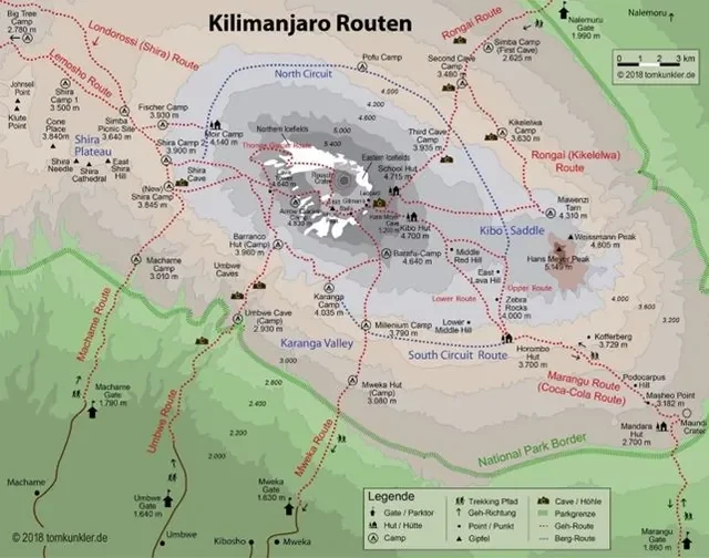
Kilimanjaro Route Comparison Summary
Lemosho Route
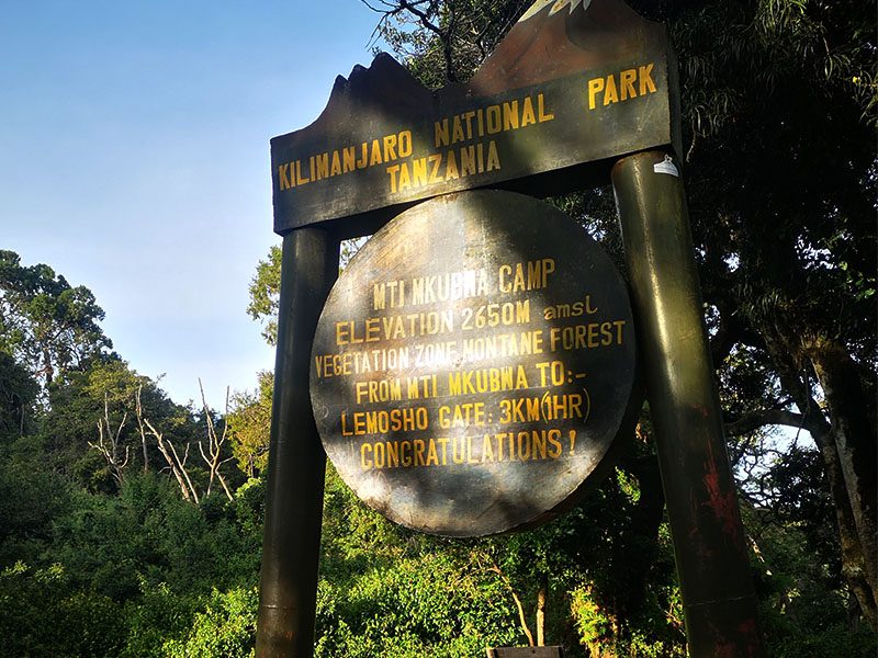
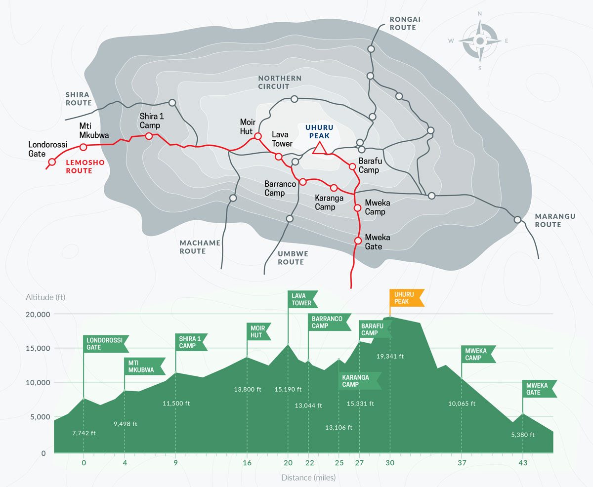
The Lemosho Route is our most scenic trail and has a 98% success rate
Duration: 7–8 days
Distance: ~70 km
Difficulty: Moderate
Success Rate: 98%
Scenery: Excellent
Best For: First-time climbers who want scenic views, fewer crowds, and a high success rate.
Machame Route- "Whiskey"

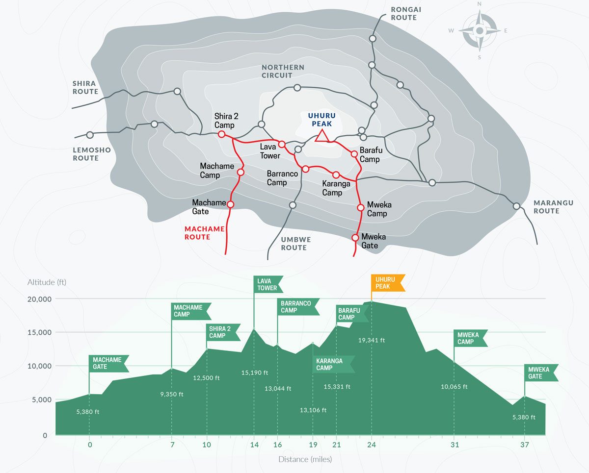
Often called the ‘Whiskey Route,’ Machame offers stunning views and better acclimatization compared to Marangu.
Duration: 6–7 days
Distance: ~62 km
Difficulty: Moderate
Success Rate: 95%
Scenery: Great
Best For: Budget-conscious trekkers who want good acclimatization and a classic Kilimanjaro experience.
Marangu Route-"Coca cola"
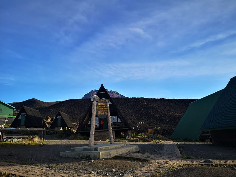

Marangu Route
Duration: 5–6 days
Distance: ~72 km
Difficulty: Moderate
Success Rate: 85%
Scenery: Good
Best For: Climbers who prefer hut accommodation and a faster route, but with higher crowd levels.
Rongai Route
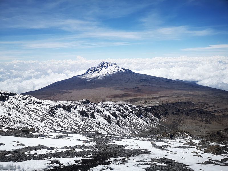
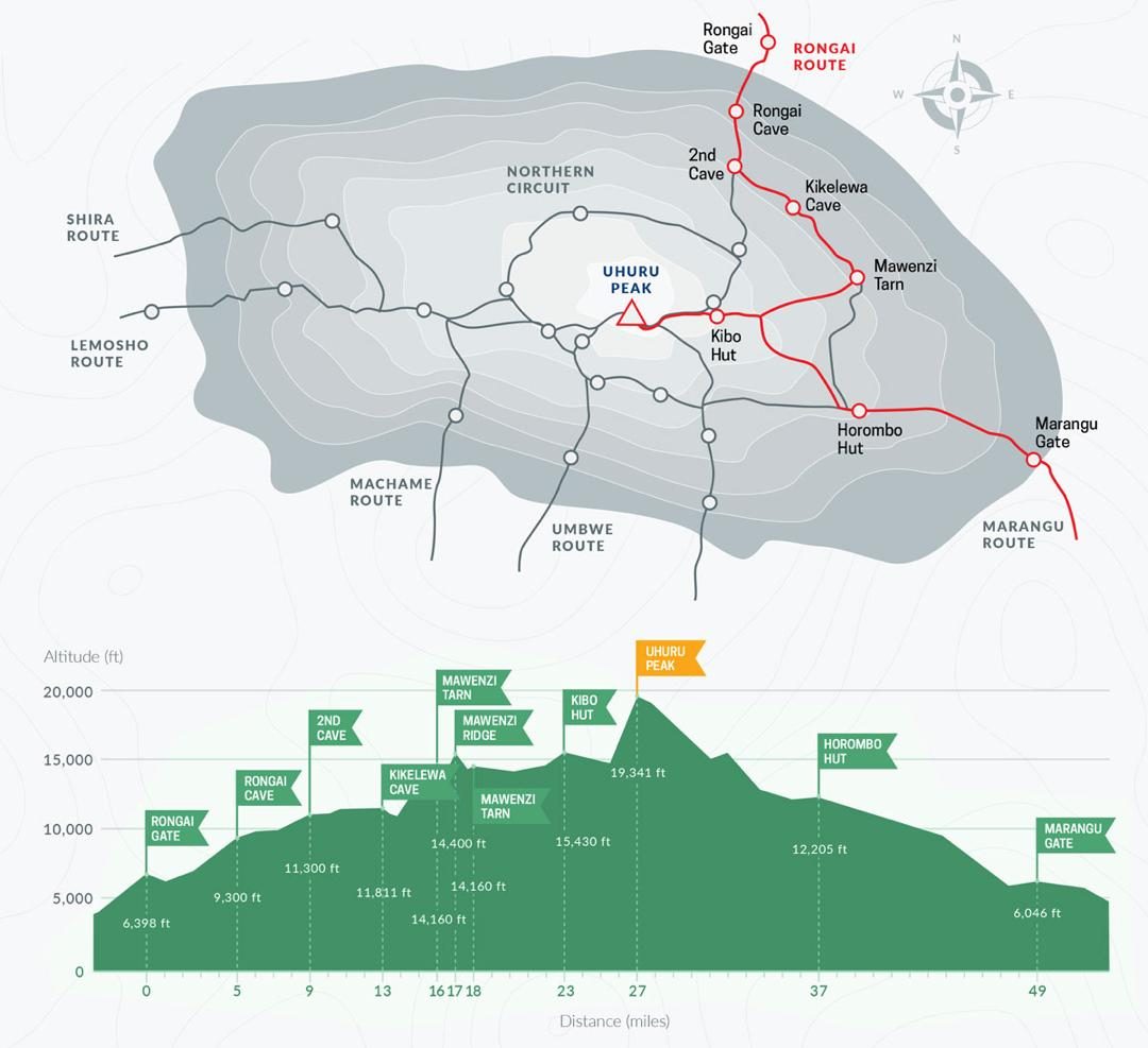
Rongai Route
Duration: 6–7 days
Distance: ~73 km
Difficulty: Moderate
Success Rate: 90%
Scenery: Good
Best For: Those looking for a quiet, dry trail on the northern side of the mountain.
Northern Circuit Route
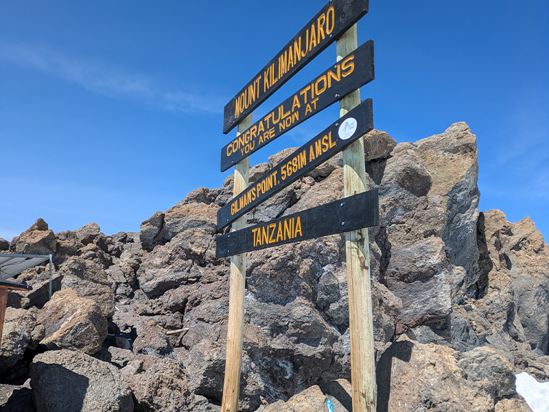
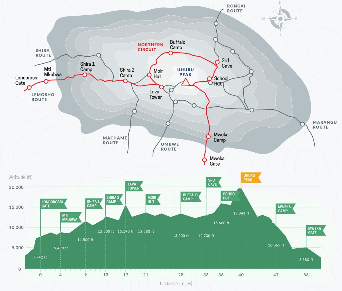
The Northern Circuit offers the best acclimatization if you have extra time.
Duration: 9 days
Distance: ~98 km
Difficulty: Easy–Moderate
Success Rate: 98%
Scenery: Excellent
Best For: Trekkers who want the best acclimatization, low crowds, and panoramic views.
Umbwe Route
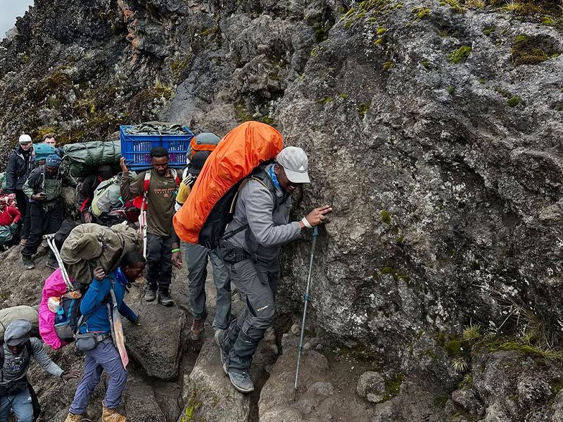
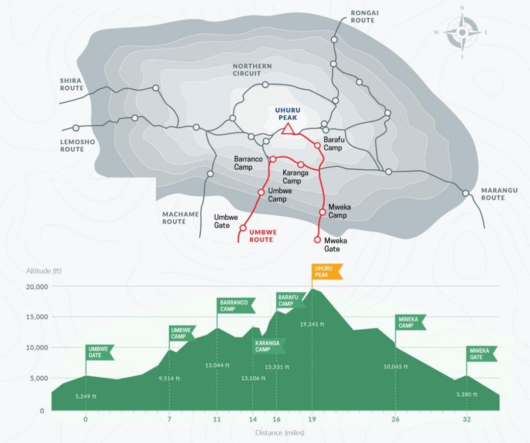
Umbwe Route
Duration: 6 days
Distance: ~53 km
Difficulty: Challenging
Success Rate: 75%
Scenery: Great
Best For: Experienced trekkers looking for a steep, fast, and remote adventure.
Shira Route
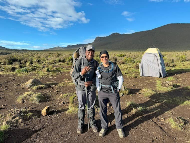
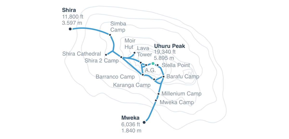
Shira Route
Duration: 7 days
Distance: ~56 km
Difficulty: Challenging
Success Rate: 85%
Scenery: Excellent
Best For: Trekkers already acclimatized who want dramatic landscapes and a peaceful trail.
Which Route Is Best for You?
Still unsure? Here’s how each route matches different trekker types:
- Best for Beginners: Lemosho, Machame, or Northern Circuit
- Best for Scenic Views: Lemosho, Shira, and Northern Circuit
- Best Acclimatization: Northern Circuit and Lemosho ,Machame ,Rongai
- Least Crowded Routes: Rongai, Shira, and Umbwe
- Fastest Routes: Marangu and Umbwe
- Most Comfortable (Huts): Marangu
- Most Adventurous:Northern Circuit , Umbwe and Lemosho, Shira
Scenery and Experience
- If breathtaking views are your top priority, choose a western route like Lemosho, Shira, or Northern Circuit. These start from the Shira Plateau and offer dramatic panoramas with lower foot traffic.
- If you want to feel immersed in Kilimanjaro’s raw terrain, the Umbwe Route provides a more intense, remote adventure — but only for those with altitude experience.
- For comfort and simplicity, Marangu is the only route with hut accommodation, though it tends to be more crowded and has lower success rates due to its shorter duration.

Climb with Kili Quests: Route Support from Experts
At Kili Quests, we help every trekker choose the route that fits them best — based on your health, budget, travel schedule, and goals. We offer:
- Honest route recommendations
- Custom itineraries with your success in mind
- Professionally guided climbs with certified mountain teams
- 24/7 support before, during, and after your trek
Confused by all the trail names? Our [Kilimanjaro routes breakdown] will help you decide based on time, fitness, and scenery
Ready to choose your Kilimanjaro adventure?
[Contact us today] and let Kili Quests guide you to Africa’s highest peak with confidence and care.
Related Articles

Climb Kilimanjaro or Mount Meru? Trekking Guide 2025
April 15, 2025
No Comments
Table of Contents Kilimanjaro vs Mount Meru: Which Trek Should You Choose? If you’re planning a mountain adventure in Tanzania, two peaks often come
Umbwe Route: Kilimanjaro’s Steep Challenge
April 15, 2025
No Comments
Table of Contents Umbwe Route on Kilimanjaro: Steep, Short, and Challenging Why Choose the Umbwe Route? The Umbwe Route is known as the most demanding
Climb Kilimanjaro via Shira Route: Scenic & Remote
April 15, 2025
No Comments
Table of Contents Shira Route on Kilimanjaro: Remote Trail with Open Views Why Choose the Shira Route? Due to this high starting point, it’s best


